April 2006
Monthly Archive
Posted by Glenn
No Comments
May 1 – 2 Â 2006
Air Temperatures – The following maximum temperatures were recorded across Hawaii Sunday:
Lihue, Kauai – 80F
Honolulu, Oahu – 78
Kaneohe, Oahu – 78
Kahului, Maui – 82
Hilo, Hawaii – 80
Kailua-Kona, Hawaii – 83
Temperatures early Sunday morning ranged between these warmest and coolest spots near sea level at the 5 a.m. hour:
Kailua-kona – 73
Hilo airport – 63
Precipitation Totals – The following numbers represent the largest precipitation totals during the last 24 hours (as of Sunday afternoon) on each of the major islands, including:
0.67 KOKEE, KAUAI
1.08 AHUIMANU LOOP, OAHU
0.01 MOLOKAI
0.00 LANAI
0.00 KAHOOLAWE
0.25 WEST WAILUAIKI, MAUI
0.16 PAHOA, BIG ISLAND
Weather Chart – Here’s the latest (automatically updated) weather map…showing high pressure systems far to the north of Hawaii. At the same time we find a weak cold front south of these highs. At the same time, we have a new low pressure system which is forming to the NW of Hawaii. This pressure configuration will cause lighter winds Saturday and Sunday. Here’s a Weather Map Symbol page for clarification about what all those funny weather symbols mean.
Hawaii’s Mountains – Here’s a link to the live webcam on the summit of near 14,000 foot Mauna Kea on the Big Island of Hawaii. The tallest peak on the island of Maui is the Haleakala Crater, which is near 10,000 feet in elevation. These two webcams are available during the daylight hours here in the islands…and when there’s a big moon rising just after sunset for an hour or two! Plus, during the nights and early mornings you will be able to see stars, and the sunrise too…depending upon cloud conditions.
Satellite Images – To view the cloud conditions we have here in Hawaii, please use the following satellite links, starting off with the Infrared Satellite Image of the islands to see all the clouds around the state during the day and night. This next image is one that gives close images of the islands only during the daytime hours, and is referred to as a Close-up visible image. This next image shows a larger view of the Pacific…giving perspective to the wider ranging cloud patterns in the Pacific Ocean…out from the islands. To help you keep track of where any showers may be around the islands, here’s the latest animated radar image.
Aloha Paragraphs
 A nice sunset in Hawaii
A weak low pressure system has developed about 600 miles north of Maui with a dissipating shearline extending down to near the Big Island of Hawaii. The low is forecasted to remain weak and turn into an inverted trough as the work week progresses. This trough will slowly drift south closer to the islands and maintain our light and variable generally weak trade wind pattern. Skies will be partly cloudy with a few showers. These clouds and showers will be favoring mainly the interior sections of the islands and will occur mainly during the afternoon and early evening hours.
The low to the north of the Islands will be centered initially near 30N 155W. It is a cutoff low not tied in directly with the upper westerly jet stream. It will therefore be slow moving and gradually sink southeastward and southward at upper levels as it weakens. Thus the Islands will be on the dry west side of the low underneath the northwesterly flow aloft. Not that we cannot be on the receiving end of a few locally heavy showers during the next few days. As the low opens up into an inverted trough embedded in the trade wind easterlies, it will then likely get carried westward across the Islands. Our wind directions may therefore slowly change from northeast to east to southeast as the week progresses.  For the same spacing of isobars, winds will be somewhat weaker within a trough. Thus light winds should dominate the weather scene pretty much all week. By an inverted trough in the easterlies we mean a trough that will not hold water…excuse the pun…that is, a trough that has its rounded bottom pointing up or toward the north on our usual weather maps. In contrast, a trough in the westerlies will have the usual orientation on our charts. We are of course talking northern hemisphere here. Down under most things, as you know, are somewhat different. Thus for a southern hemisphere weather map to make sense to a northern hemisphere meteorologist, he will take the chart and turn it upside down and inside out and hold it up against the light, and then things look very normal.
We are now getting into the month of May and the sun is very powerful. Be sure to protect yourself against the harmful rays of the sun. At our latitudes near 20N, the sun is already almost vertical overhead at local noon which is about 12:30 pm standard time. The sun beating down on the ocean warms the upper layers of the water from a seasonal low value of about 22C (72F) in February to 27C (80F) in August. The water vapor content of the air goes up exponentially with this modest increase in temperature, and this is what supplies fuel for tropical cyclones which fortunately are a rarity around here but still a force to be reconned with. Our hurricane season here in the central North Pacific starts June 1, but we usually don’t have to worry much till about July 15th. Elsewhere, things are quiet though a disturbed area has developed centered right on the equator to the west of the dateline not far from Tarawa. The progs develop this area into a low pressure system not far from Pohnpei in 4 to 5 days. We will have to wait and see if that happens. This could be bad news for Guam and other areas further down the road. Some people with long memories still remember Pamela in May of 1976. The models have developed a very high degree of skill in predicting tropical cyclogenesis to an extent that it is almost scary that we are getting this close to nature.Â
Much Aloha to you all from Hans substituting for Glenn.
Posted by Glenn
1 Comment
April 30 2006
Air Temperatures – The following maximum temperatures were recorded across Hawaii Saturday:
Lihue, Kauai – 80F
Honolulu, Oahu – 80
Kaneohe, Oahu – 80
Kahului, Maui – 85
Hilo, Hawaii – 80
Kailua-Kona, Hawaii – 84
Temperatures early Saturday morning ranged between these warmest and coolest spots near sea level at the 5 a.m. hour:
Kailua-kona – 74
Hilo airport – 66
Precipitation Totals – The following numbers represent the largest precipitation totals during the last 24 hours (as of Saturday afternoon) on each of the major islands, including:
0.80 HANALEI RIVER, KAUAI
1.38 NUUANU UPPER, OAHU
0.00 MOLOKAI
0.00 LANAI
0.00 KAHOOLAWE
0.97 WEST WAILUAIKI, MAUI
0.79 PIIHONUA, BIG ISLAND
Weather Chart – Here’s the latest (automatically updated) weather map…showing high pressure systems far to the north of Hawaii. At the same time we find a weak cold front south of these highs. At the same time, we have a new low pressure system which is forming to the NW of Hawaii. This pressure configuration will cause lighter winds Saturday and Sunday. Here’s a Weather Map Symbol page for clarification about what all those funny weather symbols mean.
Hawaii’s Mountains – Here’s a link to the live webcam on the summit of near 14,000 foot Mauna Kea on the Big Island of Hawaii. The tallest peak on the island of Maui is the Haleakala Crater, which is near 10,000 feet in elevation. These two webcams are available during the daylight hours here in the islands…and when there’s a big moon rising just after sunset for an hour or two! Plus, during the nights and early mornings you will be able to see stars, and the sunrise too…depending upon cloud conditions.
Satellite Images – To view the cloud conditions we have here in Hawaii, please use the following satellite links, starting off with the Infrared Satellite Image of the islands to see all the clouds around the state during the day and night. This next image is one that gives close images of the islands only during the daytime hours, and is referred to as a Close-up visible image. This next image shows a larger view of the Pacific…giving perspective to the wider ranging cloud patterns in the Pacific Ocean…out from the islands. To help you keep track of where any showers may be around the islands, here’s the latest animated radar image.
Aloha Paragraphs
 Lighter winds in Hawaii now
A low pressure system is developing about 500 miles north of the Islands where normally high pressure resides. This is weakening the trades and causing land and sea breezes to take over in most areas. The type of weather conditions that occur when the trades quit this time of the year is what we often refer to as a convective regime. This manifests itself in mostly clear and cool nights and sunny and warm days but with afternoon interior cloudiness with isolated showers lasting into the early evening hours. This regime will likely last through much of the upcoming week though the trades may return lightly after midweek and from slightly more northerly directions.
The low to the north of the Islands will be centered initially near 30N 155W. It is a cutoff low not tied in directly with the upper westerly jet stream. It will therefore be slow moving, but not act like the similar cutoff low that sat NW of the Islands in late February and all of March. Besides we will be on the dry side of the low underneath the northwesterly flow aloft. Not that we cannot be on the receiving end of a few locally heavy showers during the next few days.
We are now getting into the month of May and the sun is very powerful. Be sure to protect yourself against the harmful rays of the sun. At our latitudes near 20N, the sun is already almost vertical overhead at local noon which is about 12:30 pm standard time. The sun beating down on the ocean warms the upper layers of the water from a seasonal low value of about 22C (72F) in February to 27C (80F) in August. The water vapor content of the air goes up exponentially with this modest increase in temperature, and this is what supplies fuel for tropical cyclones which fortunately are a rarity around here but still a force to be reconned with. Our hurricane season here in the central North Pacific starts June 1, but we usually don’t have to worry much till about July 15th. Elsewhere, we just had a severe hurricane move inland from the Bay of Bengal into western portions of Myanmar between Rangoon and Chittagon. Otherwise, it is the quiet time of the year…the transition months between the southern hemisphere season and the upcoming northern…though the western Pacific is never totally quiet.
Posted by Glenn
1 Comment
April 27-28 2006
Air Temperatures – The following maximum temperatures were recorded across Hawaii Thursday:
Lihue, Kauai – 81F
Honolulu, Oahu – 83
Kaneohe, Oahu – 79
Kahului, Maui – 85
Hilo, Hawaii – 77
Kailua-Kona, Hawaii – 83
Temperatures early Friday morning ranged between these warmest and coolest spots near sea level at the 4 a.m. hour:
Kailua-kona – 74
Hilo airport – 66
Precipitation Totals – The following numbers represent the largest precipitation totals during the last 24 hours (as of Friday morning) on each of the major islands, including:
0.33 MOUNT WAIALEALE, KAUAI
0.38 POAMOHO 2, OAHU
0.00 MOLOKAI
0.25 LANAI
0.00 KAHOOLAWE
0.20 WEST WAILUAIKI, MAUI
0.57 PIIHONUA, BIG ISLAND
Weather Chart – Here’s the latest (automatically updated) weather map…showing high pressure systems far to the NE and NNW of Hawaii. At the same time we find a weak cold front separating the two high pressure cells, whose tail end is located north of the state. This pressure configuration will keep moderately strong trade winds blowing today and Saturday…locally gusty during the afternoons. Here’s a Weather Map Symbol page for clarification about what all those funny weather symbols mean.
Hawaii’s Mountains – Here’s a link to the live webcam on the summit of near 14,000 foot Mauna Kea on the Big Island of Hawaii. The tallest peak on the island of Maui is the Haleakala Crater, which is near 10,000 feet in elevation. These two webcams are available during the daylight hours here in the islands…and when there’s a big moon rising just after sunset for an hour or two! Plus, during the nights and early mornings you will be able to see stars, and the sunrise too…depending upon cloud conditions.
Satellite Images – To view the cloud conditions we have here in Hawaii, please use the following satellite links, starting off with the Infrared Satellite Image of the islands to see all the clouds around the state during the day and night. This next image is one that gives close images of the islands only during the daytime hours, and is referred to as a Close-up visible image. This next image shows a larger view of the Pacific…giving perspective to the wider ranging cloud patterns in the Pacific Ocean…out from the islands. To help you keep track of where any showers may be around the islands, here’s the latest animated radar image.
Aloha Paragraphs

Another nice Hawaiian sunset!
Light easterly trade winds will blow Thursday, with some areas seeing light SE breezes here and there. The main thing is that whatever balmy air is moving around…will be on the light side of the wind spectrum. As a result, there are no marine warnings or advisories for winds across Hawaiian waters. These light east to SE winds will help to moderate the afternoon heat near the coasts, although most areas will still be rising well up into the 80F’s during the days. Overnight low temperatures will drop down to near 70F, give or take a degree or two, near the beaches.
The latest computer models, along with weather chart data, show that the trade winds will strengthen some starting Friday. They often are quite blustery during the spring months, but this time around, they won’t be getting too uppity. We should see light to moderately strong trade winds blowing through the upcoming weekend, into next week. This is all fairly common during the transition period between April and May. Climatologically speaking, the trade winds often remain active through much of the month of May, providing cooling and refreshing relief from the tropical heat during the days…which feels good.
As for showers, there will be a few over the next couple of days, although nothing too heavy is indicated. The trade winds will be able to nudge a few showery clouds towards the north and east windward facing coasts and slopes. At the same time, with the prevailing light winds now, we will likely see cloud buildups over and around the mountains during the afternoon hours. These convective cumulus clouds will drop some showers over those interior upcountry sections today. As the trade winds gain a firmer foothold by Friday, the primary focus for whatever showers that are around, will concentrate their efforts most effectively along the windward sides again.
It’s early Thursday evening here in Kula, Maui…as I start this sunset commentary. Oh what a great sunset it’s going to be! Those high cirrus clouds tried to mute the sunshine today, but it was still pretty hot and sunny anyway. I thought we’d be through the most recent swath of high clouds, coming up from the deep tropics to our SW, but not quite yet obviously. The outside temperature is a warm 67F degrees, while the inside of my weather tower is being bathed by 77F degree warmth, just before the sun sinks behind the West Maui Mountains from my vantage point in Kula. I’ve stayed out of the ocean the last two days, wanting to keep my recent minor skin surgery clean as can be. It’s one more day of work before I fly to California early Saturday morning. It will be a short trip, but I’m really looking forward to seeing my siblings and of course my Mom and Dad. The warm sun is feeling so good on my bare back at the moment…and with just a few more minutes before it goes away, I want to get out there and relish the last few rays of the day on my weather deck. I hope you have a great Thursday night, and that you will join me here again on Friday for the next weather narrative from the paradise land of Hawaii. Aloha for now…Glenn.
p.s. Here’s a link to one of the advertisers on the left hand margin: A Happy Maui Wedding…Maui’s Happy Wedding and Vow Renewal Company “We believe that your Happy Maui Wedding experience begins at the time of your initial contact with us. We define A Happy Maui Wedding, as one that is arranged and performed with heart and sincerity, from the start to beyond the finish.”
Posted by Glenn
[3] Comments
April 26-27 2006
Air Temperatures – The following maximum temperatures were recorded across Hawaii Wednesday:
Lihue, Kauai – 82F
Honolulu, Oahu – 81
Kaneohe, Oahu – 79
Kahului, Maui – 86
Hilo, Hawaii – 79
Kailua-Kona, Hawaii – 83
Temperatures early Thursday morning ranged between these warmest and coolest spots near sea level at the 4 a.m. hour:
Kailua-kona – 73
Hilo airport – 64
Precipitation Totals – The following numbers represent the largest precipitation totals during the last 24 hours (as of Thursday morning) on each of the major islands, including:
1.85 MOUNT WAIALEALE, KAUAI
1.20 WAIHEE PUMP, OAHU
0.00 MOLOKAI
0.25 LANAI
0.00 KAHOOLAWE
0.09 MAHINAHINA, MAUI
0.15 WAIKII, BIG ISLAND
Weather Chart – Here’s the latest (automatically updated) weather map…showing high pressure systems far to the NE and NW of Hawaii. At the same time we find a weak cold front separating the two high pressure cells. This pressure configuration will keep light trade winds blowing today…gradually getting stronger Friday. Here’s a Weather Map Symbol page for clarification about what all those funny weather symbols mean.
Hawaii’s Mountains – Here’s a link to the live webcam on the summit of near 14,000 foot Mauna Kea on the Big Island of Hawaii. The tallest peak on the island of Maui is the Haleakala Crater, which is near 10,000 feet in elevation. These two webcams are available during the daylight hours here in the islands…and when there’s a big moon rising just after sunset for an hour or two! Plus, during the nights and early mornings you will be able to see stars, and the sunrise too…depending upon cloud conditions.
Satellite Images – To view the cloud conditions we have here in Hawaii, please use the following satellite links, starting off with the Infrared Satellite Image of the islands to see all the clouds around the state during the day and night. This next image is one that gives close images of the islands only during the daytime hours, and is referred to as a Close-up visible image. This next image shows a larger view of the Pacific…giving perspective to the wider ranging cloud patterns in the Pacific Ocean…out from the islands. To help you keep track of where any showers may be around the islands, here’s the latest animated radar image.
Aloha Paragraphs
 Rainbow on Kauai
A late season cold front, far to the NW and north of the Hawaiian Islands, is causing a temporary easing of our local trade wind speeds. This frontal boundary has eroded the western end of a high pressure ridge, which extends from a 1032 millibar high pressure system to our NE. Don’t worry about all that meteorological stuff above, all you have to know is that the trade winds will be getting a little softer now through Thursday. They won’t be stopping all together, but just lose a little steam…before they start picking up again some Friday into the weekend.
This cold front won’t be making it far enough south to bring us any rain…although there may be a few showers around from other sources. Those include whatever shower bearing clouds that the lighter trade winds may carry into the windward sides. There’s a chance that the winds may veer to the ESE or even SE now, which could see cloud plumes traveling from one island to the next downstream…which may cause a few showers to. Then, if the winds get light enough, we may see a few afternoon showers falling over the upcountry interior sections.
As Friday rolls around, and the trade winds begin to pick up again, the showers will frequent the usual north and east windward coasts and slopes. As we move into the weekend time frame, it appears that a pretty normal trade wind weather pattern will be back in place, with nice weather prevailing. The latest models continue to show the chance of some enhancement to whatever showers are around early next week…as a front with its associated trough move by to our north then. This possible increase in showers would be focused most directly along the windward sides.
It’s early Wednesday evening here in Kula, Maui, Hawaii, as I begin this sunset commentary. When I got off work today in Kihei, it was quite sunny and warm, with a thin veneer of high cirrus clouds overhead. As I began driving up the Haleakala Highway, I could that there was a dark, very dark shroud of low gray clouds hanging tightly to the slopes of the Haleakala Crater. There were a few small spots where a couple of showers were falling, but in general, the clouds were more threatening looking than anything else. The sun just sank behind a bank of cumulus clouds, which are situated over the West Maui Mountains. The clouds seem to be dissipating quickly just about everywhere, even here on the mountain. I had a short visitation to my Dermatologist this afternoon, like 15 minutes…just enough time to do a quick surgery on a spot of basil cell cancer. Before anyone starts to feel sorry for me, I was the one who has spent most of his life in the sunshine…and pretty much loved every moment of it. It’s payback time now, and fortunately, there hasn’t been any serious business to attend to in terms of skin cancer! At any rate, and as I’ve taken to lately, I’m listening to the internet radio station Groove Salad from south of Market (somaFM) in San Francisco. This particular cut is called Schooled In The Trade – People Under The Stairs. I like the easy going feel of this ambient music when I’m typing away in this Aloha Paragraph section of Glenn’s Weather Narrative. I trust you will have a great Wednesday night. I’ll be back dark and early Thursday morning with your next weather narrative from the Hawaiian Islands. Aloha for now…Glenn.
p.s. Here’s a link to one of the advertisers on the left hand margin: Ululoa Productions …Ulu Loa is situated on the slopes of Haleakala in Haiku, Maui, and embodies the things represented by our logo. In addition to our home and the bounty of its land, it is home to Ulu Loa Studio and Ululoa Productions. Together with the artists, Ulu Loa is a family dedicated to producing quality Hawaiian music that honors tradition and culture and speaks to the heart. online.
Posted by Glenn
No Comments
April 25-26 2006
Air Temperatures – The following maximum temperatures were recorded across Hawaii Tuesday:
Lihue, Kauai – 78F
Honolulu, Oahu – 82
Kaneohe, Oahu – 80
Kahului, Maui – 83
Hilo, Hawaii – 81
Kailua-Kona, Hawaii – 84
Temperatures early Wednesday morning ranged between these warmest and coolest spots near sea level at the 4 a.m. hour:
Kailua-kona – 74
Hilo airport – 66
Precipitation Totals – The following numbers represent the largest precipitation totals during the last 24 hours (as of Wednesday morning) on each of the major islands, including:
1.36 MOUNT WAIALEALE, KAUAI
1.32 POAMOHO 2, OAHU
0.13 MOLOKAI
0.03 LANAI
0.00 KAHOOLAWE
0.81 WEST WAILUAIKI, MAUI
0.67 PIIHONUA, BIG ISLAND
Weather Chart – Here’s the latest (automatically updated) weather map…showing a 1032 millibar high pressure system far to the NE of Hawaii. At the same time we find a cold front to the NW. This pressure configuration will keep light to moderate trade winds blowing today…gradually getting lighter through Thursday. Here’s a Weather Map Symbol page for clarification about what all those funny weather symbols mean.
Hawaii’s Mountains – Here’s a link to the live webcam on the summit of near 14,000 foot Mauna Kea on the Big Island of Hawaii. The tallest peak on the island of Maui is the Haleakala Crater, which is near 10,000 feet in elevation. These two webcams are available during the daylight hours here in the islands…and when there’s a big moon rising just after sunset for an hour or two! Plus, during the nights and early mornings you will be able to see stars, and the sunrise too…depending upon cloud conditions.
Satellite Images – To view the cloud conditions we have here in Hawaii, please use the following satellite links, starting off with the Infrared Satellite Image of the islands to see all the clouds around the state during the day and night. This next image is one that gives close images of the islands only during the daytime hours, and is referred to as a Close-up visible image. This next image shows a larger view of the Pacific…giving perspective to the wider ranging cloud patterns in the Pacific Ocean…out from the islands. To help you keep track of where any showers may be around the islands, here’s the latest animated radar image.
Aloha Paragraphs

Sunset in Lahaina, Maui
High pressure to the NE of the islands will keep the trade winds alive and well today into Wednesday. However, weather maps show a cold front moving by far to the NW of Hawaii. The net result will be light to moderately strong trade winds Tuesday, getting gradually lighter into Wednesday. Tuesday’s winds will still be a little gusty in places, which will keep a localized small craft wind advisory in force around some areas on Maui and the Big Island during the morning hours.
This cold front won’t reach down into the tropics enough to directly influence the Aloha state. It will have at least one effect though, which will be to knock our trade wind speeds down some during the second half of the work week. The trade winds aren’t expected to go away entirely, but they will get softer…and there’s a chance we may see the breezes swinging around to the ESE or even SE with time. This sometimes brings an increase in volcanic haze to the Kona coast of the Big Island, and over Maui County as well.
The trade winds have been blowing steadily through all of the month of April. This is really the first time that they will have faltered much. These moderately strong trade winds have been carrying passing showers to the windward coasts and slopes. As the winds get lighter, we will see an increase in afternoon clouds over and around the mountains through Friday. These clouds may drop some showers where we haven’t seen many lately…although none of the windward or interior showers are expected to be heavy.
The computer forecast models are starting to suggest that we could see some weather changes cropping-up this weekend into early next week. They point out that an upper level trough of low pressure may set up shop to the NE of the state. This may create enough instability in our local atmosphere, that we could see some localized heavier showers then. This isn’t a sure thing yet, but the models have been tending in that direction for the last several days. I suggest that we take a “wait and see†attitude at this point.
It’s early Tuesday evening here in Kula, Maui, Hawaii, as I start writing today’s sunset commentary. It’s rather cloudy as the sun begins to set into the western horizon. This problem, if it can be called a problem, is the intrusion of high level cirrus clouds. These clouds thickened during the day, which filtered and dimmed our Hawaiian sunshine. This type of cloudiness doesn’t drop rain however, so on the other hand, it did help to moderate the afternoon heat, making for actually quite a nice day. The normal afternoon breezes didn’t arrive along the leeward coasts until late, which made for a pleasant beach experience during my lunch time visitation. I’m listening to internet radio again this evening, this time to a station called Groove Salad, with the current song by Allessandro Oliviero…called Gravy. The station plays what is being billed as ambient chill. It’s fun to skip around and try all sorts of music! At any rate, I cooked some Pacific Wild Salmon on the bbq this past weekend, which I’ll plate this evening with a small portion of fresh red sauce pasta that I also made Sunday afternoon. That’s suddenly sounding very enticing, I’d best be getting downstairs out of this weather tower, and having at it. I hope you have a great Tuesday night! I’ll be back before the crack of dawn Wednesday (at least here in the islands) with your next updated weather narrative from the Aloha state. Aloha for now…Glenn.
p.s. Here’s a link to one of the advertisers on the left hand margin: Printsellers.com …Thanks to modern technology and an immense amount of research and development, Printsellers now produce an extensive array of images, prints, maps, and engravings, on fine art paper or canvas for a fraction of the price of the original. These re-creations are produced in-house and are available exclusively from them online.
Posted by Glenn
No Comments
April 24-25 2006
Air Temperatures – The following maximum temperatures were recorded across Hawaii Monday:
Lihue, Kauai – 78F
Honolulu, Oahu – 82
Kaneohe, Oahu – 78
Kahului, Maui – 85
Hilo, Hawaii – 81
Kailua-Kona, Hawaii – 84
Temperatures early Tuesday morning ranged between these warmest and coolest spots near sea level at the 4 a.m. hour:
Kailua-kona – 73
Molokai airport – 69
Precipitation Totals – The following numbers represent the largest precipitation totals during the last 24 hours (as of Tuesday morning) on each of the major islands, including:
1.40 MOUNT WAIALEALE, KAUAI
0.50 KAWAILOA, OAHU
0.00 MOLOKAI
0.00 LANAI
0.00 KAHOOLAWE
0.97 WEST WAILUAIKI, MAUI
0.75 LAUPAHOEHOE, BIG ISLAND
Weather Chart – Here’s the latest (automatically updated) weather map…showing a 1033 millibar high pressure systems far to the NE and NE of Hawaii. At the same time we find a cold front to the NW. This pressure configuration will keep light to moderate trade winds blowing today…gradually getting lighter through Wednesday. Here’s a Weather Map Symbol page for clarification about what all those funny weather symbols mean.
Hawaii’s Mountains – Here’s a link to the live webcam on the summit of near 14,000 foot Mauna Kea on the Big Island of Hawaii. The tallest peak on the island of Maui is the Haleakala Crater, which is near 10,000 feet in elevation. These two webcams are available during the daylight hours here in the islands…and when there’s a big moon rising just after sunset for an hour or two! Plus, during the nights and early mornings you will be able to see stars, and the sunrise too…depending upon cloud conditions.
Satellite Images – To view the cloud conditions we have here in Hawaii, please use the following satellite links, starting off with the Infrared Satellite Image of the islands to see all the clouds around the state during the day and night. This next image is one that gives close images of the islands only during the daytime hours, and is referred to as a Close-up visible image. This next image shows a larger view of the Pacific…giving perspective to the wider ranging cloud patterns in the Pacific Ocean…out from the islands. To help you keep track of where any showers may be around the islands, here’s the latest animated radar image.
Aloha Paragraphs

Napali Coast of Kauai
Photo: Douglas Peebles
The trade winds continue to have a strong hold in the Hawaiian Island weather picture as we begin this new work week. The latest weather maps show high pressure systems located to the NNE and NE of the Aloha state. The strength and location of these trade wind producing high pressure cells will keep light to moderately strong winds blowing across our latitudes of the north central Pacific. There is still a small craft wind advisory in place for those windiest areas around Maui and the Big Island. The computer forecast models show a trough of low pressure moving by to our north later this week, with a lighter version of the trade winds then.
As is common during a trade wind weather pattern, showers will tend to congregate along the windward coasts and slopes. There don’t appear to be any rainfall enhancing weather elements on our horizon at this time though. Thus, just the usual passing showers at times along those north and east facing areas. The night and morning hours will find the most generous shower activity, although a few will arrive during the days at times too. Meanwhile, the south and west facing leeward sections will remain dry and quite sunny. The latest satellite pictures don’t show very much high cloudiness Monday, which means that the resort areas will be mostly sunny to partly cloudy.
I wish you could see what I’m seeing out the window of my weather tower this morning, it’s just wonderful! There’s a crescent moon rising over the summit of the Haleakala Crater, with one of the planets situated just above it…really close! It’s quite a beautiful and unusual configuration. If I crane my neck a little, I can see the very first hint of morning light too. I just was looking at the webcams atop the Haleakala Crater, and Mauna Kea on the Big Island. They are a great way to watch the sunrise happening here in the islands. You can see stars during the night, and the summits during the days. By the way, there’s still snow atop the near 14,000 foot Mauna Kea summit on the Big Island.
It’s early Monday evening here in Kula, Maui, as I start this evening’s sunset commentary. It’s that time of year, when one day looks very similar to the previous day, day after day. There aren’t nearly as many cirrus clouds today, not like yesterday’s incredible display of orange and pink colors. Those same low clouds are still hugging the windward sides, where misty showers are falling…what else is new? The beach was wonderful today, as the ocean is starting warm up a bit, while the air temperatures are going all the way up into the upper 80F’s each afternoon in Kihei and Lahaina. The underwater visibilities, at least where aren’t waves breaking, is very clear. All of those elements coming together, are making for some special days at the coasts. The winds in Kihei this afternoon, at least while I was there during my lunch break, were near calm…which adds to the pleasure of being near the ocean. The sun just went down, and what thin cirrus clouds that are out to the west, are lighting up a bright orange. I will be mentioning for the next several days, that I’m flying to California this Saturday morning, to visit my family for an extended weekend. We are fortunate to have Hans Rosendal stepping in during my absence, who will give expert weather analysis while I’m away. I hope you have a great Monday night! I’ll be back early Tuesday morning with the next weather narrative from here in paradise. Aloha for now…Glenn.
p.s. Here’s a link to one of the advertisers on the left hand margin: Jim Sanders Realty…Maui’s premiere real estate presented by Billy Jalbert, whose website says: “Whether your ideal lifestyle is surfing, kiteboarding or windsurfing on the North Shore near Paia and Haiku, enjoying calm beaches, exclusive golf courses and resorts in Wailea and Kihei, resort style living near Kapalua and Lahaina, or casual Upcountry living in Makawao or Kula, we specialize in finding the ideal real estate that best fits your dreams of a new lifestyle.â€
Posted by Glenn
No Comments
April 23-24 2006
Air Temperatures – The following maximum temperatures were recorded across Hawaii Sunday:
Lihue, Kauai – 77F
Honolulu, Oahu – 81
Kaneohe, Oahu – 79
Kahului, Maui – 80
Hilo, Hawaii – 80
Kailua-Kona, Hawaii – 84
Temperatures early Monday morning ranged between these warmest and coolest spots near sea level at the 4 a.m. hour:
Kailua-kona – 75
Kahului, Maui airport – 61
Precipitation Totals – The following numbers represent the largest precipitation totals during the last 24 hours (as of Monday morning) on each of the major islands, including:
0.56 MOUNT WAIALEALE, KAUAI
0.19 POAMOHO 2, OAHU
0.00 MOLOKAI
0.00 LANAI
0.00 KAHOOLAWE
0.58 ULUPALAKUA, MAUI
0.94 PIIHONUA, BIG ISLAND
Weather Chart – Here’s the latest (automatically updated) weather map…showing high pressure systems far to the NNE and NE of Hawaii. This pressure configuration will keep light to moderate trade winds blowing today through Tuesday…locally gusty during the afternoons. Here’s a Weather Map Symbol page for clarification about what all those funny weather symbols mean.
Hawaii’s Mountains – Here’s a link to the live webcam on the summit of near 14,000 foot Mauna Kea on the Big Island of Hawaii. The tallest peak on the island of Maui is the Haleakala Crater, which is near 10,000 feet in elevation. These two webcams are only available during the daylight hours here in the islands…that is unless there’s a big moon rising just after sunset for an hour or two!
Satellite Images – To view the cloud conditions we have here in Hawaii, please use the following satellite links, starting off with the Infrared Satellite Image of the islands to see all the clouds around the state during the day and night. This next image is one that gives close images of the islands only during the daytime hours, and is referred to as a Close-up visible image. This next image shows a larger view of the Pacific…giving perspective to the wider ranging cloud patterns in the Pacific Ocean…out from the islands. To help you keep track of where any showers may be around the islands, here’s the latest animated radar image.
Aloha Paragraphs

The Hana coast of east Maui
Photo: Douglas Peebles
There’s no end in sight for the trade winds, which are blowing across the Hawaiian Islands now. Wind speeds will vary in strength, increasing some now into Monday. All these trade wind breezes are arriving thanks to moderately strong high pressure systems located far to the NE and NNW of the Aloha state. The winds will be strongest during the days, and lightest during the nights…with the strongest gusts occurring around Maui and the Big Island as is often the case during the spring months. The NWS has issued a new small craft advisory for those windiest areas around the southern islands.
As far as showers go, the windward sides will be where most of whatever few incoming showers fall. These north and east facing windward slopes have seen lots of off and on showers lately. There has been some drying out recently, at least compared to the last couple of weeks…which is good news for those windward locations. As the trade winds slow down during the second half of the new week ahead, the bias for showers will migrate form the windward sides…to over the mountain slopes during the afternoons.
The leeward sides of all the islands will have pleasant weather, with none of those passing showers around. Those south and west facing coasts will find less wind in general too, which will keep the air temperatures 5-10 degrees warmer than the cooler and breezy windward sides. All the recent high cirrus clouds, which was dimming and filtering our sunshine, seems to be thinner now…although there is still a little bit around. This is opening up the way for mostly sunny weather, with fine conditions for all beach activities. The morning hours will be best, as the winds will be lighter as usual.
It’s early Sunday evening here in Kula, Maui, as I start this sunset commentary. It’s about 6pm, with the most beautiful array of low and high level clouds. The high cirrus clouds are catching my eye the most, as they sweep rapidly up over the islands…carried by jet stream winds from the deeper tropics. There’s almost no wind at the moment, my outside chimes are quiet and peaceful. I’m hoping that my neighbor will be coming over soon, as it’s just perfect for ping pong at the moment. The sunset is going to be wonderful, and no better place to see it than from the weather deck. I hope you have a great Sunday night! I’ll be back with the Monday morning edition of this narrative from the islands. Aloha…Glenn
p.s. this is an interesting scientific link
Posted by Glenn
No Comments
April 22-23 2006
Air Temperatures – The following maximum temperatures were recorded across Hawaii Saturday:
Lihue, Kauai – 77F
Honolulu, Oahu – 81
Kaneohe, Oahu – 78
Kahului, Maui – 82
Hilo, Hawaii – 80
Kailua-Kona, Hawaii – 83
Temperatures early Sunday morning ranged between these warmest and coolest spots near sea level at the 5 a.m. hour:
Kailua-kona – 71
Kahului, Maui airport – 67
Precipitation Totals – The following numbers represent the largest precipitation totals during the last 24 hours (as of Sunday morning) on each of the major islands, including:
2.33 MOUNT WAIALEALE, KAUAI
0.29 MANOA LYON ARBORETUM, OAHU
0.08 MOLOKAI
0.00 LANAI
0.00 KAHOOLAWE
0.39 HANA AIRPORT, MAUI
0.70 HONOKAA, BIG ISLAND
Weather Chart – Here’s the latest (automatically updated) weather map…showing high pressure systems far to the NE and NNW of Hawaii. This pressure configuration will keep moderate to locally strong and gusty trade winds blowing today through Monday. Here’s a Weather Map Symbol page for clarification about what all those funny weather symbols mean.
Hawaii’s Mountains – Here’s a link to the live webcam on the summit of near 14,000 foot Mauna Kea on the Big Island of Hawaii. The tallest peak on the island of Maui is the Haleakala Crater, which is near 10,000 feet in elevation. These two webcams are only available during the daylight hours here in the islands…that is unless there’s a big moon rising just after sunset for an hour or two!
Satellite Images – To view the cloud conditions we have here in Hawaii, please use the following satellite links, starting off with the Infrared Satellite Image of the islands to see all the clouds around the state during the day and night. This next image is one that gives close images of the islands only during the daytime hours, and is referred to as a Close-up visible image. This next image shows a larger view of the Pacific…giving perspective to the wider ranging cloud patterns in the Pacific Ocean…out from the islands. To help you keep track of where any showers may be around the islands, here’s the latest animated radar image.
Aloha Paragraphs
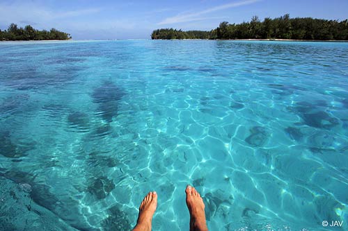

Are those your feet? Or…maybe you just wish they were!
There’s no end in sight for the trade winds, which are blowing across the Hawaiian Islands now….cool ones too in places. Wind speeds will vary in strength, increasing now into Sunday. All these trade wind breezes are arriving thanks to moderately strong high pressure systems located far to the NE and NW of the Aloha state. The winds will be strongest during the days, and lightest during the nights…with the strongest gusts occurring around Maui and the Big Island as is often the case during the spring months.
The reason our trade winds mellowed out briefly, is that a cold front moved by to the north of the state recently. This mid-latitude frontal cloud band won’t bring any clouds or showers to our area however. It will stay a good distance away, although as the front moves away, our local winds will increase in some areas. As this cold front moves away to the east, a new trade wind producing high pressure system will appear…increasing our local trade wind speeds into the new week.
As far as showers go, the windward sides will be where most of whatever few incoming showers fall. These showers won’t have anything to do with the cold front, as noted above…but will just be from clouds carried in on the trade winds. These north and east facing windward slopes have seen lots showers lately. There has been some drying out recently, which is good news for those windward locations. This drier reality will last through the weekend, into the first part of the new week…with a possible increase in showers again around next Wednesday.
The leeward sides of all the islands will have pleasant weather, with none of those passing showers around. Those south and west facing coasts will find less wind in general too, which will keep the air temperatures 5-10 degrees warmer than the cooler and breezy windward sides. All the recent high cirrus clouds, which was dimming and filtering our sunshine, seems to be thinner now. This is opening up the way for mostly sunny weather, with fine conditions for all beach activities. The morning hours will be best, as the winds will be lighter.
It’s early Saturday evening here in Kula, Maui, as I start today’s sunset commentary. I just got back from Haiku, over in the West Kuiaha Rd. area, where I visited some friends, and got a haircut. It was on and off lightly showering over there, but quite warm. Now that I’m back upcountry, I find that it’s pretty breezy at the moment, with my wind chimes singing sweetly…which were clanging together in the stronger winds later in the evening. The drizzly mist is just down the road, although here it’s dry thus far, as are the leeward towns of Lahaina and Kihei. It’s just now a few minutes after sunset, which is about 645pm. There’s a thin bank of high cirrus clouds lighting up nicely, which I’m sure is a nice treat for the folks down on the beaches along the south and west facing beaches. Maybe some of them have a tropical drink in hand, with their feet ankle deep in the warm waters of the Pacific…at least that’s what I might want to be doing if I was on vacation! It’s been a nice day personally, filled with lots of communication with my neighbors and friends. I’m listening to internet radio as I write these words, with Huey Lewis and The News – Stuck With You at the moment, which brings back memories of the past. This particular station is called Club 921, coming out of London, England. I hope you have a great Saturday night! I’ll be back Sunday morning with more weather updates. Aloha for now…Glenn.
p.s. this is an interesting scientific link
Posted by Glenn
[2] Comments
April 21-22 2006
Air Temperatures – The following maximum temperatures were recorded across Hawaii Friday:
Lihue, Kauai – 78F
Honolulu, Oahu – 81
Kaneohe, Oahu – 79
Kahului, Maui – 81
Hilo, Hawaii – 78
Kailua-Kona, Hawaii – 83
Temperatures early Saturday morning ranged between these warmest and coolest spots near sea level at the 5 a.m. hour:
Kailua-kona – 71
Hilo airport – 64
Precipitation Totals – The following numbers represent the largest precipitation totals during the last 24 hours (as of Saturday morning) on each of the major islands, including:
0.16 MOUNT WAIALEALE, KAUAI
0.11 HAKIPUU MAUKA, OAHU
0.02 MOLOKAI
0.10 LANAI
0.00 KAHOOLAWE
0.68 WEST WAILUAIKI, MAUI
0.89 HONAUNAU, BIG ISLAND
Weather Chart – Here’s the latest (automatically updated) weather map…showing high pressure systems far to the NE and NW of Hawaii. This pressure configuration will keep moderate trade winds blowing today, getting a bit stronger on Sunday…locally rather gusty during the afternoon hours both days. Here’s a Weather Map Symbol page for clarification about what all those funny weather symbols mean.
Hawaii’s Mountains – Here’s a link to the live webcam on the summit of near 14,000 foot Mauna Kea on the Big Island of Hawaii. The tallest peak on the island of Maui is the Haleakala Crater, which is near 10,000 feet in elevation. These two webcams are only available during the daylight hours here in the islands…that is unless there’s a big moon rising just after sunset for an hour or two!
Satellite Images – To view the cloud conditions we have here in Hawaii, please use the following satellite links, starting off with the Infrared Satellite Image of the islands to see all the clouds around the state during the day and night. This next image is one that gives close images of the islands only during the daytime hours, and is referred to as a Close-up visible image. This next image shows a larger view of the Pacific…giving perspective to the wider ranging cloud patterns in the Pacific Ocean…out from the islands. To help you keep track of where any showers may be around the islands, here’s the latest animated radar image.
Aloha Paragraphs

Like skateboarding on water…
There’s no end in sight for the trade winds, which are blowing across the Hawaiian Islands now. Wind speeds will vary in strength, getting a little softer over the next couple of days, and then increasing again around Sunday. The NWS office in Honolulu has finally taken down the small craft wind advisory over the marine coastal waters. All these trade wind breezes are arriving thanks to a moderately strong high pressure system located far to the NE of the Aloha state. The winds will be strongest during the days, and lightest during the nights…with the strongest gusts occurring around Maui and the Big Island.
The reason our trade winds will be mellowing out now, is that a cold front is moving by to the north of the state. This mid-latitude frontal cloud band won’t bring any clouds or showers to our area however. It will stay a good distance away, with the only influence being the slightly lighter trade wind flow. As Sunday rolls around, the cold front will have moved away to the east, with a new trade wind producing high pressure system in place… increasing our local trade wind speeds again into next week. Most folks won’t notice these somewhat subtle changes in our local winds.
In the rain department, the windward sides will be where most of the incoming showers will fall. These showers won’t have anything to do with the cold front, as noted above…but will just be from clouds carried in on the trade winds. These north and east facing windward slopes have seen lots showers lately. I’m sure that many folks on those rather wet sides of Maui and the Big Island especially, would say too many showers! As is the case with the persistent trade winds, there doesn’t appear to be any abrupt end to the showery weather along those sections of the islands.
The leeward sides of all the islands will have pleasant weather, with none of those pesky passing showers around. Those south and west facing coasts will find less wind in general too, which will keep the air temperatures 5-10 degrees warmer than the cooler and breezy windward sides. The one problem today will be the high cloudiness that has overspread the entire state. These high cirrus clouds will dim and filter our Hawaiian sunshine quite a bit. Thus, it won’t be a banner day for tanning at our local beaches, until those high clouds depart our area.
It’s early late Friday afternoon here in Kihei, Maui, as I leave work on the way home to Kula. Since I see nothing that looks that good at the local theaters, and the clouds are parting way on the slopes of the Haleakala Crater…I’ve decided to go skateboarding. I want to get on the road, but will come back later to finish off this sunset commentary, see you then. Ok, I’m back down from the 6,000 foot level on the western slope of the Crater. As I was mentioning last Friday evening, the road up there has recently been repaved, so it is as good as it gets for skateboarding! I took about eight runs, and fortunately didn’t fall, although there was one close call, when I had to jump off unexpectedly because a car was coming, and I didn’t see it soon enough. I must admit it’s always with a bit of relief that I find myself driving home without having hit the road! I stayed for the sunset, which lit up nicely pink for a few minutes. I’m listening to Manao radio on my computer, which often plays a fun mix of music…the current song is by Boz Skaggs. I wasn’t expecting to come home after work, so I don’t have much to eat for dinner, although I’ll at least have some avocado and chips, and a steamed zucchini with grated cheese. I hope you have a great Friday night whatever you are doing. There’s a part of me that would like to be in some Big City tonight, like San Francisco or New York, and go out dancing! It would be fun to have a cup of espresso, and hit the dance floor! I’ll be back first thing Saturday morning with the next weather updates. Aloha for now…Glenn.
p.s. Here’s a link to one of the advertisers on the left hand margin: Shot from above, an inspirational website devoted to making available incredible aerial photo’s from New Mexico, and some in Hawaii too.
Posted by Glenn
No Comments
April 20-21 2006
Air Temperatures – The following maximum temperatures were recorded across Hawaii Thursday:
Lihue, Kauai – 77F
Honolulu, Oahu – 79
Kaneohe, Oahu – 77
Kahului, Maui – 80
Hilo, Hawaii – 79
Kailua-Kona, Hawaii – 83
Temperatures early Friday morning ranged between these warmest and coolest spots near sea level at the 4 a.m. hour:
Kailua-kona – 73
Hilo airport – 66
Precipitation Totals – The following numbers represent the largest precipitation totals during the last 24 hours (as of Friday morning) on each of the major islands, including:
0.04 MOUNT WAIALEALE, KAUAI
0.56 MANOA LYON ARBORETUM, OAHU
0.00 MOLOKAI
0.00 LANAI
0.00 KAHOOLAWE
0.78 WEST WAILUAIKI, MAUI
0.47 MOUNTAIN VIEW, BIG ISLAND
Weather Chart – Here’s the latest (automatically updated) weather map…showing a 1030 millibar high pressure system far to the NE of Hawaii. This cell of high pressure will keep moderate trade winds blowing today through Saturday. Here’s a Weather Map Symbol page for clarification about what all those funny weather symbols mean.
Hawaii’s Mountains – Here’s a link to the live webcam on the summit of near 14,000 foot Mauna Kea on the Big Island of Hawaii. The tallest peak on the island of Maui is the Haleakala Crater, which is near 10,000 feet in elevation. These two webcams are only available during the daylight hours here in the islands…that is unless there’s a big moon rising just after sunset for an hour or two!
Satellite Images – To view the cloud conditions we have here in Hawaii, please use the following satellite links, starting off with the Infrared Satellite Image of the islands to see all the clouds around the state during the day and night. This next image is one that gives close images of the islands only during the daytime hours, and is referred to as a Close-up visible image. This next image shows a larger view of the Pacific…giving perspective to the wider ranging cloud patterns in the Pacific Ocean…out from the islands. To help you keep track of where any showers may be around the islands, here’s the latest animated radar image.
Aloha Paragraphs

Tropical Latitudes
Photo: Douglas Peebles
The trade winds, which have been blowing all of April, will continue through Friday. The latest forecast charts suggest that they will continue to blow across the Hawaiian Islands through the end of this month! High pressure systems to the north will be the source of these moderately strong breezes. Wind speeds will vary between 10-25 mph for the most part, although those locally windiest spots will have winds in gusts reaching up over the 30 mph mark. The NWS office in Honolulu will keep the small craft wind advisory going through Friday.
We continue to have a contrast between the windward and leeward sides of the islands. There has been, and will continue to be lots of warm sunshine beaming down on the south and west facing leeward beaches, with air temperatures rising well into the 80F’s. The cooler north and east facing windward sections will have high temperatures restricted to the 70F’s. Overnight low temperatures won’t vary much between the two sides of the islands, ranging between around 68F to the lower 70F’s in general. By the way, those windward areas will continue to see off and on passing showers…which will turn out to be most generous during the night and early morning hours as usual.
It’s early Thursday evening here in Kula, Maui, as I begin this evening’s sunset commentary. Today was quite a nice sunny day, that is during the first half of Thursday. A bank of high cirrus clouds swept in over the Aloha state during the afternoon. Here’s a satellite image showing this canopy of ice crystal clouds streaming northward from the tropics to Hawaii’s south. The leeward sides had good sunshine today, with temperatures once again zooming right up into the upper 80F’s in both Kihei and Lahaina. As I was driving home from work, coming up the Haleakala Highway, there was the most obvious drizzle cloud that had enveloped the windward areas of Paia and Haiku…extending upcountry over Pukalani, Olinda and Piiholo. This mist was stretching over the highway, creating a nice rainbow as I cruised up the mountain listening to NPR on this FM station. As I look out my weather tower window now, there is fog hanging low in the trees a little higher up in Kula. I’m listening to a classical radio station now playing Beethoven, which nicely fits the end of the day here on Maui. Thanks to the many folks who have sent their well wishes on my Fathers health. I’m flying to Long Beach in about a week from now, for a short five day visit…which I’m very much looking forward to! I hope everyone has a great Thursday night, and that if you are so inclined, you will join me here again on Friday morning for the next edition of Glenn’s weather narrative. Aloha for now…Glenn.
p.s. Here’s a link to one of the advertisers on the left hand margin: Spreckelsville beach front lots, whose website says: “Serious buyers may call Henry Spencer at (808) 280-4130 to discuss any issues related to the sale of lots. â€
Next Page »


