











Big Island Weather Forecast
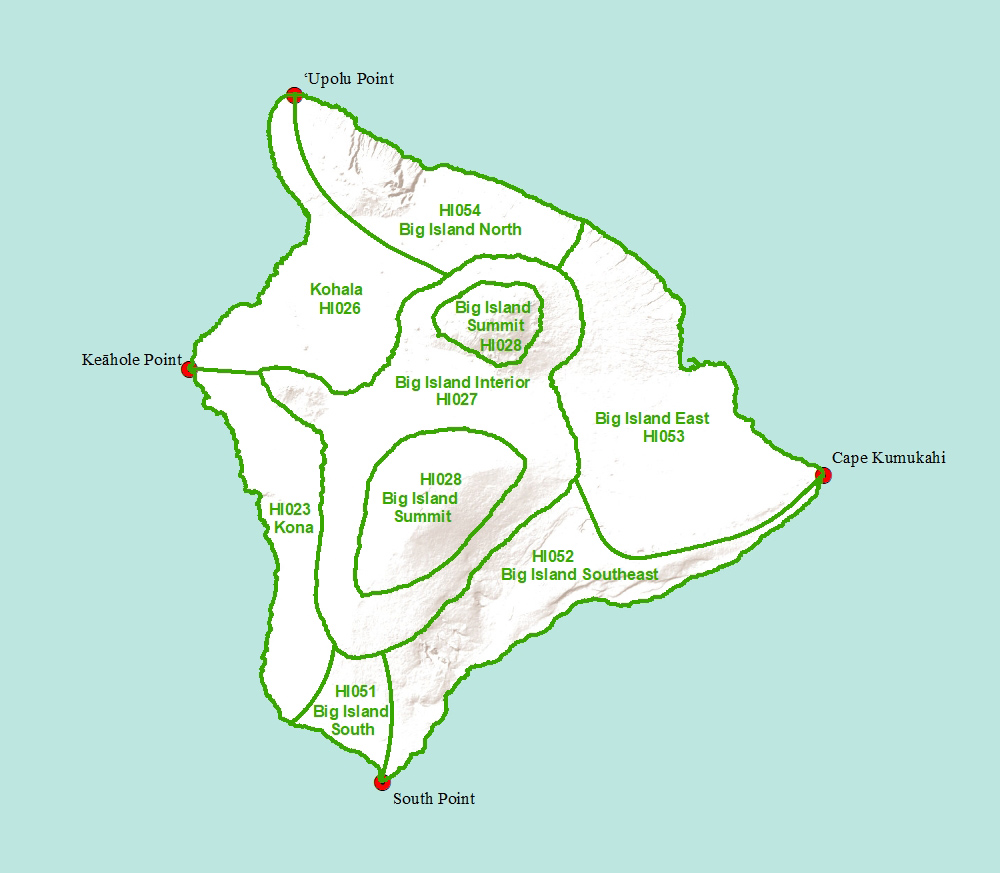
Click on a region of the map above to see weather forecasts for that area
Big Island South-
TODAY
Breezy. Mostly sunny with isolated showers. Highs around 85 near the shore to around 71 near 5000 feet. East winds up to 25 mph. Chance of rain 20 percent.
TONIGHT
Mostly clear. Breezy. Lows around 74 near the shore to around 58 near 5000 feet. East winds up to 25 mph.
SATURDAY
Sunny and breezy. Isolated showers in the afternoon. Highs around 84 near the shore to around 69 near 5000 feet. East winds up to 25 mph. Chance of rain 20 percent.
SATURDAY NIGHT
Mostly clear. Lows 55 to 77. Northeast winds 10 to 15 mph decreasing to up to 10 mph after midnight.
SUNDAY
Sunny. Scattered showers in the afternoon. Highs 68 to 85. East winds up to 10 mph. Chance of rain 40 percent.
SUNDAY NIGHT
Clear. Lows 54 to 77. Light winds.
COLUMBUS DAY
Mostly sunny. Scattered showers in the afternoon. Highs 69 to 86. Light winds becoming south up to 10 mph in the afternoon. Chance of rain 40 percent.
MONDAY NIGHT
Mostly clear with isolated showers. Lows 55 to 77. East winds up to 10 mph in the evening becoming light. Chance of rain 20 percent.
TUESDAY
Mostly sunny. Scattered showers in the afternoon. Highs 69 to 86. East winds up to 10 mph. Chance of rain 40 percent.
TUESDAY NIGHT
Mostly clear. Isolated showers after midnight. Lows 55 to 77. Northeast winds 10 to 15 mph. Chance of rain 20 percent.
WEDNESDAY
Mostly sunny. Scattered showers in the afternoon. Highs 68 to 86. East winds 10 to 15 mph. Chance of rain 40 percent.
WEDNESDAY NIGHT
Mostly clear with isolated showers. Lows 58 to 78. Northeast winds around 10 mph. Chance of rain 20 percent.
THURSDAY
Mostly sunny. Isolated showers in the afternoon. Highs 68 to 86. East winds 10 to 15 mph decreasing to up to 15 mph in the afternoon. Chance of rain 20 percent.
 Email Glenn James: