


Air Temperatures – The following maximum temperatures (F) were recorded across the state of Hawaii Monday:
80 Lihue, Kauai
83 Honolulu, Oahu
82 Molokai
82 Kahului, Maui
83 Kona, Hawaii
85 Hilo, Hawaii
Air Temperatures ranged between these warmest and coolest spots near sea level – and on the highest mountain tops on Maui and the Big Island…as of 743pm Monday evening:
Kailua Kona – 79
Port Allen, Kauai – 73
Haleakala Summit – 48 (near 10,000 feet on Maui)
Mauna Kea Summit – 39 (13,000+ feet on the Big Island)
Hawaii’s Mountains – Here’s a link to the live web cam on the summit of near 13,800 foot Mauna Kea on the Big Island of Hawaii. This web cam is available during the daylight hours here in the islands…and when there’s a big moon shining down during the night at times. Plus, during the nights you will be able to see stars, and the sunrise and sunset too… depending upon weather conditions. Here’s the Haleakala Crater webcam on Maui – if it’s working.
Aloha Paragraphs
Trade winds, a few windward showers…pleasant
A rather dramatic weather change later this week
Small Craft Wind Advisory…windiest coasts and
channels around Maui County and the Big Island
The following numbers represent the most recent top wind gusts (mph), along with directions as of Monday evening:
21 Port Allen, Kauai – ENE
28 Kuaokala, Oahu – NE
24 Molokai – NE
30 Lanai – NE
30 Kahoolawe – NE
28 Kahului, Maui – NE
30 Upolu airport, Big Island – NE
Here are the latest 24-hour precipitation totals (inches) for each of the islands as of Monday evening:
0.02 Mount Waialeale, Kauai
0.01 Moanalua, Oahu
0.01 Molokai
0.00 Lanai
0.00 Kahoolawe
0.03 Puu Kukui, Maui
0.15 Kawainui Stream, Big Island
We can use the following links to see what’s going on in our area of the north central Pacific Ocean. Here’s the latest NOAA satellite picture – the latest looping satellite image… and finally the latest looping radar image for the Hawaiian Islands.
~~~ Hawaii Weather Narrative ~~~
Our local winds will blow from the east-northeast to easterly trade wind direction…prevailing into mid-week. Here’s the latest weather map, showing the Hawaiian Islands, and the rest of the Pacific Ocean. Weather models suggest that the trades will begin to turn back towards the southeast later Wednesday into Thursday. These southeast winds will carry volcanic haze (vog) from the Big Island vents, over the smaller islands on Thanksgiving Day. As we get into Friday and the weekend, our winds will pick up from the south and southwest, as a cold front approaches…and moves into the state.
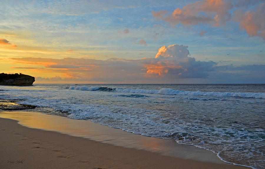
Just a few cloudy periods along our windward sides…and generally clear to partly cloudy in the leeward areas. Satellite imagery shows just a few patches of stable clouds being carried into the windward coasts and slopes, particularly around the Big Island and east Maui…at the time of this writing. Meanwhile, the leeward beaches will remain generally clear to partly cloudy into Tuesday. Here’s the looping radar image, showing just a few showers falling along those windward sides, although certainly not many.
Generally fine weather conditions will prevail through the next day or two, as the overlying atmosphere remains dry and stable. Later this week we’ll see a change in our weather, with increasing showers…as a cold front moves into the state later Friday into the weekend. This cold front is anticipated to be a rather strong one, with a chance of localized flooding, and possible thunderstorms too. I’ll be closely following this potential wet weather situation, keeping you informed about any changes between now and then. I’ll be back early Tuesday morning with your next new weather narrative, I hope you have a great Monday night wherever you’re spending it! Aloha for now…Glenn.
World-wide tropical cyclone activity:
Atlantic Ocean: There are no active tropical cyclones
Here’s a satellite image of the Atlantic Ocean
Caribbean Sea: There are no active tropical cyclones
Gulf of Mexico: There are no active tropical cyclone
Here’s a satellite image of the Caribbean Sea…and the Gulf of Mexico.
Here’s the link to the National Hurricane Center (NHC)
Eastern Pacific: There are no active tropical cyclone
Here’s a wide satellite image that covers the entire area between Mexico, out through the central Pacific…to the International Dateline.
Central Pacific Ocean: There are no active tropical cyclones
Here’s a link to the Central Pacific Hurricane Center (CPHC)
Western Pacific Ocean: There are no active tropical cyclones
South Pacific Ocean: There are no active tropical cyclones
North and South Indian Oceans: Tropical Cyclone 05B (Lehar) remains active in the northern Indian Ocean. Here’s the JTWC graphical track map, along with a satellite image.
Here’s a link to the Joint Typhoon Warning Center (JTWC)
Interesting: Warsaw climate talks end with tepid agreement. Delegates from more than 190 nations at the annual U.N. Framework Convention on Climate Change (UNFCCC) negotiation in Warsaw, Poland today reached agreement on a pathway to Paris in 2015, where they have committed to adopt a new, comprehensive, post-2020 agreement to address the climate crisis. Countries also agreed to pursue limited near-term actions to reduce emissions. Overall, the collective impact of these decisions in reducing emissions is less than what is needed, but some progress was achieved.
“We came to Warsaw hoping to see agreement on a process that will provide the right footholds on the climb to a post-2020 climate agreement in 2015, and we’re leaving with a mixed bag,” said Alden Meyer, director of strategy and policy at the Union of Concerned Scientists (UCS). “Negotiators provided the bare minimum to move forward on the climate deal, but the talks made gains on the international technology mechanism and hit it out of the ballpark with REDD+.”
Through the hours of Friday night and into Saturday evening, exhausted negotiators agreed on the timeframe to put forward their post-2020 plans to cut their carbon pollution and set next year’s climate summit in Lima, Peru as the deadline to agree on the specific information they need to include when they submit these plans. Unfortunately, they failed to agree on what process and criteria to use in evaluating the adequacy and fairness of each others’ proposed actions; they will need to work on this over the coming year.
The negotiations opened in the shadow of Typhoon Haiyan’s destruction in the Philippines. With thousands of victims and graphic images of total devastation as a backdrop, negotiators set about tackling the highly charged issue of loss and damage — how the international community should help vulnerable countries cope with the increasingly unavoidable impacts of climate change. Negotiators created a new body, the Warsaw International Mechanism on Loss and Damage, to address this need. In the final hours, developed countries compromised on language committing to a review of the Mechanism in 2016, where they will reconsider making this a separate body to provide it more authority.
peter mac Says:
Aloha Glenn-
Looks like ‘leaders’ of the developed nations are unable to lead us away from severe climate disruption,
and all that will entail.
Interestingly, global civil society groups and climate activists, including many sincere, educated young people…left the conference a day early in response to the perceived structural futility of the conference, a failure imposed by, ultimately, powerful fossil fuel industries…using the ‘bought’ governments’ leaders.
If they weren’t bought, they would have established policies years ago that would have brought this under control, globally, equitably.
When Corporations rule the world.
Mahalo, Peter Mac, Big Island~~~ Hi Peter, I always enjoy reading your take on situations here in the islands, and our larger perspective too. Thanks for sharing your thoughts, Aloha, Glenn