


Air Temperatures – The following maximum temperatures (F) were recorded across the state of Hawaii Monday:
84 Lihue, Kauai
87 Honolulu, Oahu
86 Molokai
88 Kahului, Maui
86 Kona, Hawaii
84 Hilo, Hawaii
Air Temperatures ranged between these warmest and coolest spots near sea level – and on the highest mountain tops on Maui and the Big Island…as of 743pm Monday evening:
Kailua Kona – 80
Hilo, Hawaii – 73
Haleakala Summit – 46 (near 10,000 feet on Maui)
Mauna Kea Summit – 39 (13,000+ feet on the Big Island)
Hawaii’s Mountains – Here’s a link to the live web cam on the summit of near 13,800 foot Mauna Kea on the Big Island of Hawaii. This web cam is available during the daylight hours here in the islands…and when there’s a big moon shining down during the night at times. Plus, during the nights you will be able to see stars, and the sunrise and sunset too… depending upon weather conditions. Here’s the Haleakala Crater webcam on Maui – if it’s working.
Aloha Paragraphs
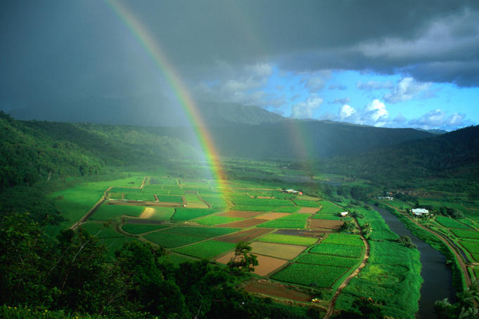
Variable clouds with showers at times, some locally heavy…
with a chance of thunderstorms around Kauai and Oahu
into Wednesday – migrating east over the other
islands later in the week
Small Craft Wind Advisory…Alenuihaha
Channel between Maui and the Big Island
The following numbers represent the most recent top wind gusts (mph), along with directions as of Monday evening:
22 Port Allen, Kauai, Kauai – ESE
30 Kuaokala, Oahu – NE
27 Molokai – ENE
27 Lanai – NE
35 Kahoolawe – ENE
25 Kapalua, Maui – NE
28 South Point, Big Island – NE
Here are the latest 24-hour precipitation totals (inches) for each of the islands as of Monday evening:
1.10 Mount Waialeale, Kauai
0.88 Poamoho RG 1, Oahu
0.15 Molokai
0.00 Lanai
0.47 Puu Kukui, Maui
1.11 Kealakekua, Big Island
We can use the following links to see what’s going on in our area of the north central Pacific Ocean. Here’s the latest NOAA satellite picture – the latest looping satellite image… and finally the latest looping radar image for the Hawaiian Islands.
~~~ Hawaii Weather Narrative ~~~
Our local trade winds will be light to moderately strong…becoming lighter and from the southeast Friday into the weekend. Here’s a weather chart showing a very large near 1035 millibar high pressure center to the north-northeast of our islands. This high pressure system has an elongated ridge of high pressure extending southwest, far offshore to the northwest of Kauai. As the winds veer to the southeast later this week, we’ll see volcanic haze (vog) coming up from the Big Island vents…up over the smaller islands into the weekend.
There will be showers falling at times, locally heavy over Kauai and Oahu, with a possible thunderstorm…less intense showers elsewhere around the state for the time being. Satellite imagery shows patches of lower level clouds over and around the islands. There’s also brighter white, higher level clouds over the eastern end of the state, and an area of thunderstorms offshore to the north of Kauai at the time of this writing. Here’s the looping radar image, showing generally light showers from the Big Island to Maui County, becoming light to moderately heavy mostly over the offshore waters…around Kauai and Oahu.
We find an upper level low pressure system to the north of Lihue, Kauai, which is dropping southward…which will then gradually shift eastward over the other islands later this week. This low pressure system, is edging even closer to Kauai now…which will further destabilize our overlying atmosphere tonight into Tuesday and Wednesday on that side of the state. The cool temperatures this low is bringing aloft, in contrast to the warmer temperatures near the surface…will help to create a lift in the air mass near Kauai and Oahu too. At the same time, any low level clouds and showers that are around will be enhanced…causing heavier showers locally. As this low shifts eastward after mid-week, Maui County and the Big Island may take a turn in receiving these locally heavy showers. As the low moves east, our winds will begin to shift from the trade wind direction as well, around the clock to the southeast direction. This in turn will bring volcanic haze, and muggy conditions to the islands Friday into the weekend. These lighter breezes will prompt showers to grow over the islands during the day, leading to convective buildups, and locally heavy downpours during the afternoon hours. I’ll have more on all of this when I return with your next new weather narrative early Tuesday morning. I hope you have a great Monday night wherever you happen to be spending it! Aloha for now…Glenn.
World-wide tropical cyclone activity:
Atlantic Ocean: There are no active tropical cyclone
DISORGANIZED SHOWERS AND THUNDERSTORMS OVER THE FAR EASTERN TROPICAL
ATLANTIC ARE ASSOCIATED WITH A BROAD AREA OF LOW PRESSURE CENTERED
ABOUT 400 MILES SOUTH-SOUTHWEST OF THE CAPE VERDE ISLANDS.
ENVIRONMENTAL CONDITIONS APPEAR CONDUCIVE FOR GRADUAL DEVELOPMENT
OF THIS DISTURBANCE DURING THE NEXT COUPLE OF DAYS...AND IT HAS A
MEDIUM CHANCE...40 PERCENT...OF BECOMING A TROPICAL CYCLONE DURING
THE NEXT 48 HOURS WHILE MOVING SLOWLY WEST-NORTHWESTWARD AT ABOUT 5
MPH.  UPPER-LEVEL WINDS ARE FORECAST TO BECOME LESS CONDUCIVE FOR
DEVELOPMENT LATE IN THE WEEK...AND THIS SYSTEM HAS A MEDIUM
CHANCE...50 PERCENT...OF BECOMING A TROPICAL CYCLONE DURING THE
NEXT 5 DAYS.

DISORGANIZED CLOUDINESS AND SHOWERS EXTENDING A FEW HUNDRED MILES
SOUTH-SOUTHEAST OF BERMUDA ARE ASSOCIATED WITH A WEAK AND ELONGATED
AREA OF LOW PRESSURE.  ENVIRONMENTAL CONDITIONS ARE EXPECTED TO BE
ONLY MARGINALLY CONDUCIVE FOR DEVELOPMENT DURING THE NEXT SEVERAL
DAYS WHILE THE DISTURBANCE MOVES GENERALLY NORTHWARD AT ABOUT 10
MPH.  THIS SYSTEM HAS A LOW CHANCE...20 PERCENT...OF BECOMING A
TROPICAL OR SUBTROPICAL CYCLONE DURING THE NEXT 48 HOURS AND A LOW
CHANCE...20 PERCENT...OF BECOMING A TROPICAL OR SUBTROPICAL CYCLONE
DURING THE NEXT 5 DAYS.
Here’s a satellite image of the Atlantic Ocean
Caribbean Sea: There are no active tropical cyclones
Gulf of Mexico: There are no active tropical cyclone
Here’s a satellite image of the Caribbean Sea…and the Gulf of Mexico.
Here’s the link to the National Hurricane Center (NHC)
Eastern Pacific: Tropical storm 14E (Narda) is active over the northeast Pacific. Here’s a NHC graphical track map…along with a NOAA satellite image. Here’s what the hurricane models are showing.
A BROAD AREA OF LOW PRESSURE COULD FORM SEVERAL HUNDRED MILES
OFFSHORE OF THE SOUTHWESTERN COAST OF MEXICO IN A FEW DAYS…AND
ENVIRONMENTAL CONDITIONS SHOULD BE CONDUCIVE FOR SOME DEVELOPMENT
OF THIS LOW BY THE END OF THE WEEK. THIS SYSTEM HAS A LOW CHANCE…
NEAR 0 PERCENT…OF BECOMING A TROPICAL CYCLONE DURING THE NEXT 48
HOURS…AND A MEDIUM CHANCE…30 PERCENT…OF BECOMING A TROPICAL
CYCLONE DURING THE NEXT 5 DAYS WHILE IT MOVES WEST-NORTHWESTWARD AT
ABOUT 10 MPH.
Here’s a wide satellite image that covers the entire area between Mexico, out through the central Pacific…to the International Dateline.
Central Pacific Ocean: There are no active tropical cyclones
Here’s a link to the Central Pacific Hurricane Center (CPHC)
Western Pacific Ocean: Typhoon 23W (Danas) remains active in the western Pacific. Here’s a JTWC graphical track map…along with a NOAA satellite image
South Pacific Ocean: There are no active tropical cyclones
North and South Indian Oceans: There are no active tropical cyclones
Here’s a link to the Joint Typhoon Warning Center (JTWC
Interesting: Atmospheric aerosols and how they influence climate – Climate models are evolving, and are getting more accurate, but they are still incomplete. Our atmosphere is very complex, and there are factors that even current models don’t address, or address with an in-complete knowledge of the physical processes involved. This leads to inaccuracies that create uncertainty in the results of climatic projections. Aerosols are an important part of atmospheric dynamics, and their mechanisms of formation are not fully understood.
University of Leeds experts have helped scientists get a step closer to understanding how aerosol particles are formed in the atmosphere and the effect these particles have on our climate.
Working with scientists from the CLOUD experiment at the European Organisation for Nuclear Research (CERN), in Geneva, climate change experts from the University have shown that amines — atmospheric vapours closely related to ammonia, largely derived from activities such as animal husbandry — combine with sulphuric acid to form highly stable aerosol particles at rates similar to those observed in the lower atmosphere.
To conduct the experiment, the research team has access to a special laboratory chamber with unprecedented cleanliness, allowing them to simulate the atmosphere and introduce minute amounts of various atmospheric vapours under carefully controlled conditions — in this case amines and sulphuric acid.
The results of the experiment, published in the journal Nature, are significant because aerosols cause a cooling effect by reflecting sunlight and by seeding cloud droplets, suggesting that both natural and sources of amines caused by man could influence climate.
The team has also shown that ionisation by cosmic rays are unimportant when it comes to generating of these particular aerosol particles in the atmosphere.
The effect of cosmic rays on climate has been a highly controversial topic. It has been suggested that cosmic ray-induced particle formation could affect climate change, but this seems not to be the case for the particles studied at CERN.