


Air Temperatures – The following maximum temperatures (F) were recorded across the state of Hawaii Wednesday:
85 Lihue, Kauai
88 Honolulu, Oahu
86 Molokai
89 Kahului, Maui
87 Kona, Hawaii
86 Hilo, Hawaii
Air Temperatures ranged between these warmest and coolest spots near sea level – and on the highest mountain tops on Maui and the Big Island…as of 510pm Wednesday evening:
Honolulu, Oahu – 86
Hana airport, Maui – 81
Haleakala Summit – 54 (near 10,000 feet on Maui)
Mauna Kea Summit – 55 (13,000+ feet on the Big Island)
Hawaii’s Mountains – Here’s a link to the live web cam on the summit of near 13,800 foot Mauna Kea on the Big Island of Hawaii. This web cam is available during the daylight hours here in the islands…and when there’s a big moon shining down during the night at times. Plus, during the nights you will be able to see stars, and the sunrise and sunset too… depending upon weather conditions. Here’s the Haleakala Crater webcam on Maui – if it’s working.
Aloha Paragraphs
Our trade winds will remain active well into the future…
with passing windward showers at times
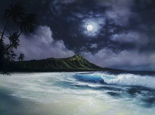
September Full Moon tonight
The following numbers represent the most recent top wind gusts (mph), along with directions as of Wednesday evening:
24 Port Allen, Kauai – NE
30 Kuaokala, Oahu – NNE
27 Molokai – ENE
29 Lanai – NE
35 Kahoolawe – ENE
30 Kahului, Maui – NE
29 Upolu airport, Big Island – NE
Here are the latest 24-hour precipitation totals (inches) for each of the islands as of Wednesday evening:
1.57 Hanalei, Kauai
0.47 Pupukea Road, Oahu
0.24 Molokai
0.00 Kahoolawe
0.00 Lanai
0.12 Kaupo Gap, Maui
0.26 Honaunau, Big Island
We can use the following links to see what’s going on in our area of the north central Pacific Ocean. Here’s the latest NOAA satellite picture – the latest looping satellite image… and finally the latest looping radar image for the Hawaiian Islands.
~~~ Hawaii Weather Narrative ~~~
The trade winds will continue, blowing generally in the moderately strong category…although locally somewhat stronger into next week. Here’s a weather chart showing two near 1025 millibar high pressure centers to the northeast and northwest of the state. The trade winds are forecast to last well into the future…through the rest of this week into next week. There will be day to day variations, although 10-30+ mph should catch the corners generally.
There will be just a few windward showers at times…a couple elsewhere. Satellite imagery shows hardly any clouds, at least in the lower levels…even along our windward sides. At the same time, we see some high cirrus clouds to the west and southwest…extending over the islands locally. We should see nice sunset colors off to the west, and then perhaps again for Thursday’s sunrise. Here’s the looping radar image, showing a few light showers moving by…mostly over the offshore waters.
Mid-week weather words: The gusty late summer trade winds, although still quite strong locally, have eased enough for the NWS forecast office in Honolulu…to cancel the small craft wind advisory around Maui County the the Big Island. These tropical winds were bringing passing showers to our north and east facing coasts and slopes, although they have backed-off completely at the time of this writing. These weather features are all quite common, and will provide pleasant conditions statewide. The leeward beaches will likely be your best bet for laying around on the sand, and taking a dip in our warm ocean now too. All things considered, everything is well and fine, with great outdoor prospects getting a thumbs up into Thursday. By the way, don’t forget to check out the September full moon tonight, it will be beautiful! I’ll be back early Thursday morning with your next new weather narrative from paradise, I hope you have a great Wednesday night wherever you’re spending it! Aloha for now…Glenn.
>>Here’s a great satellite image of the Pacific, with the Hawaiian Islands in the lower left corner, an early season cold front to our north and northeast…and Hurricane Manuel in the Gulf of California to the far right.
World-wide tropical cyclone activity:
Atlantic Ocean: Tropical depression 10L (Humberto) remains active in the central north Atlantic Ocean. Here’s the National Hurricane Center’s graphical track map…along with a NOAA satellite image
CLOUDINESS AND SHOWERS JUST TO THE NORTHEAST OF THE BAHAMAS ARE ASSOCIATED WITH A FRONTAL BOUNDARY AND A SURFACE TROUGH…AND AN AREA OF LOW PRESSURE IS FORECAST TO FORM IN THIS AREA DURING THE NEXT COUPLE OF DAYS. UPPER-LEVEL WINDS DO NOT APPEAR CONDUCIVE FOR SIGNIFICANT TROPICAL DEVELOPMENT…BUT THE LOW COULD STILL ACQUIRE SOME SUBTROPICAL CHARACTERISTICS WHILE IT MOVES GENERALLY NORTHEASTWARD OVER THE WESTERN ATLANTIC THROUGH EARLY NEXT WEEK. THIS SYSTEM HAS A LOW CHANCE…10 PERCENT…OF BECOMING A SUBTROPICAL CYCLONE DURING THE NEXT 48 HOURS AND A LOW CHANCE…20 PERCENT…OF BECOMING A SUBTROPICAL CYCLONE DURING THE NEXT 5 DAYS.
Caribbean Sea: There are no active tropical cyclones
Gulf of Mexico: There are no active tropical cyclones
A LOW PRESSURE SYSTEM LOCATED OVER THE SOUTHWESTERN GULF OF MEXICO
IS PRODUCING DISORGANIZED SHOWER AND THUNDERSTORM ACTIVITY.
CONDITIONS STILL APPEAR CONDUCIVE FOR THE FORMATION OF A TROPICAL
DEPRESSION DURING THE NEXT DAY OR TWO…AND AN AIR FORCE RESERVE
HURRICANE HUNTER PLANE IS SCHEDULED TO INVESTIGATE THE LOW THIS
AFTERNOON…IF NECESSARY. THIS SYSTEM HAS A HIGH CHANCE…70
PERCENT…OF BECOMING A TROPICAL CYCLONE DURING THE NEXT 48 HOURS
WHILE IT MOVES WEST-NORTHWESTWARD AT ABOUT 5 MPH…AND A HIGH
CHANCE…80 PERCENT…OF BECOMING A TROPICAL CYCLONE DURING THE
NEXT 5 DAYS. THIS DISTURBANCE WILL LIKELY SPREAD HEAVY RAIN OVER
PORTIONS OF EASTERN AND SOUTHERN MEXICO AND COULD CAUSE LIFE-
THREATENING FLOODS AND MUDSLIDES OVER AREAS ALREADY IMPACTED BY
TORRENTIAL RAIN DURING THE PAST SEVERAL DAYS.
Here’s a satellite image of the Caribbean Sea…and the Gulf of Mexico.
Here’s the link to the National Hurricane Center (NHC)
Eastern Pacific: Hurricane 13E (Manuel) remains active in the Gulf of California. Here’s the National Hurricane Center’s graphical track map…along with a NOAA satellite image.
Here’s a wide satellite image that covers the entire area between Mexico, out through the central Pacific…to the International Dateline.
Central Pacific Ocean: There are no active tropical cyclones
Here’s a link to the Central Pacific Hurricane Center (CPHC)
Western Pacific Ocean: Typhoon 17W (Usagi) is active in the western Pacific. Here’s a JTWC graphical track map…along with a NOAA satellite image.
South Pacific Ocean: There are no active tropical cyclones
North and South Indian Oceans: There are no active tropical cyclones
Here’s a link to the Joint Typhoon Warning Center (JTWC)
Interesting: Shine on, Shine on, Harvest Moon – The old time song, Shine on Harvest moon is a fall classic. The song was debuted by Bayes and Norworth in the Ziegfeld Follies of 1908 to great acclaim. It became a pop standard, and continues to be performed and recorded into the 21st century.
But what exactly IS a Harvest Moon?
According to folklore, every full Moon has a special name. There’s the Wolf Moon, the Snow Moon, the Worm Moon, the Sprouting Grass Moon, the Flower Moon, the Strawberry Moon, the Thunder Moon, the Sturgeon Moon, the Harvest Moon, the Hunter’s Moon, the Beaver Moon, and the Long Night’s Moon. Each name tells us something about the season or month in which the full Moon appears.
This month’s full Moon is the Harvest Moon.
In 2013 the Moon is full on Sept. 19th (the night of Sept. 18-19 in North America) while the equinox follows close behind on Sept. 22nd. The coincidence sets the stage for a nice display of Harvest moonlight.
In the days before light bulbs, farmers relied on moonlight to help them harvest their crops. Many crops ripen all at once in late summer and early autumn, so farmers found themselves extremely busy at this time of year. They had to work after sundown. Moonlight became an essential part of farming and, so, the Harvest Moon was born.
There’s more to the Harvest Moon, however, than just an old-fashioned name. It really is special.
Throughout the year the Moon rises, on average, about 50 minutes later each day. But near the autumnal equinox, this difference shrinks to only 30 minutes. The reason is, at the beginning of autumn the moon’s orbital path makes a narrow angle with the evening horizon.
To a non-astronomer, that might sound like celestial trivia. But to sky watchers it makes a huge difference. For several nights in a row around the time of the Harvest Moon, the moon rises at about the same time–sunset. And you know what happens when the moon rises at sunset….
Low-hanging moons are reddened by clouds and dust. Not only that, they are swollen to outlandish size by the Moon illusion, a well-known but still mysterious trick of the eye that makes low-hanging Moons seem much larger than they really are.
When you add these effects together the Harvest Moon often looks like a great pumpkin. The experience is repeated for several nights in a row around the equinox.
A great pumpkin-colored Moon rising in the east is a nice way to kick off northern autumn. And it’s a nice way to end the day. At sundown on Sept. 18th, go outside, face east, and enjoy the Harvest Moon.