


Air Temperatures – The following maximum temperatures (F) were recorded across the state of Hawaii Wednesday:
83 Lihue, Kauai
89 Honolulu, Oahu
83 Molokai
88 Kahului, Maui
86 Kona, Hawaii
81 Hilo, Hawaii
Air Temperatures ranged between these warmest and coolest spots near sea level – and on the highest mountain tops on Maui and the Big Island…as of 510pm Wednesday evening:
Kahului, Maui – 86
Hana airport, Maui – 79
Haleakala Summit – 57 (near 10,000 feet on Maui)
Mauna Kea Summit – 46 (13,000+ feet on the Big Island)
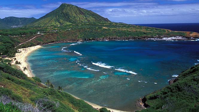
Hawaii’s Mountains – Here’s a link to the live web cam on the summit of near 13,800 foot Mauna Kea on the Big Island of Hawaii. This web cam is available during the daylight hours here in the islands…and when there’s a big moon shining down during the night at times. Plus, during the nights you will be able to see stars, and the sunrise and sunset too… depending upon weather conditions. Here’s the Haleakala Crater webcam on Maui – if it’s working.
Aloha Paragraphs
Small craft wind advisory…windiest coasts and channels
around Maui and the Big Island
Moderately strong trades continuing…a bit stronger at times
A few passing showers windward sides…mostly dry elsewhere
The following numbers represent the most recent top wind gusts (mph), along with directions as of Wednesday evening:
27 Port Allen, Kauai – NE
40 Kuaokala, Oahu – NE
31 Molokai – NE
42 Lanai – NE
36 Kahoolawe – NE
35 Kahului, Maui – NE
31 Waikoloa, Big Island – NE
Here are the latest 24-hour precipitation totals (inches) for each of the islands as of Wednesday evening:
0.57 Mount Waialeale, Kauai
0.27 Oahu Forest NWR, Oahu
0.08 Molokai
0.00 Kahoolawe
0.00 Lanai
0.44 Puu Kukui, Maui
0.45 Kawainui Stream, Big Island
We can use the following links to see what’s going on in our area of the north central Pacific Ocean. Here’s the latest NOAA satellite picture – the latest looping satellite image… and finally the latest looping radar image for the Hawaiian Islands.
~~~ Hawaii Weather Narrative ~~~
Trade winds dominate our Hawaiian Island weather picture. Here’s a weather chart showing high pressure systems located to the northwest and northeast of the islands. At the same time we have an out of season cold front to our north…and a weak tropical system to our southeast. Trade wind speeds will be in the moderately strong category, locally a bit stronger at times. There’s a chance that our trades will drop a notch Sunday into early next week…as a unusual cold front moves by to our north.
Nothing out of the ordinary in the precipitation department. Satellite imagery shows fairly typical low clouds upstream of the islands, which will be carried into the windward sides at times…mostly during the night and early morning hours. Meanwhile, we find an area of high cirrus clouds located offshore to the northeast of Maui County…at the time of this writing. Here’s the looping radar image, showing just a few showers falling along the windward coasts and slopes.
There are several tropical disturbances in our central Pacific, located well southwest, south-southeast and east-southeast of our islands. These areas all have a low chance of developing into tropical cyclones over the next couple of days. Here’s a satellite picture, with these areas circled in yellow. There’s a chance that the northern fringe of one of these disturbances, as it moves westward, may drop some showers near the Big Island Friday into Saturday morning. Otherwise, nothing unusual is in store here in the central Pacific for the time being. I’ll be back early Thursday morning with your next new weather narrative from paradise. I hiked into the Haleakala Crater to see the blooming Silver Swords with friends this afternoon, which was a wonderful experience! I hope you have a great Wednesday night wherever you’re spending it! Aloha for now…Glenn.
World-wide tropical cyclone activity:
Atlantic Ocean: Tropical depression 5 remains active in the far eastern Atlantic Ocean. Here’s the NHC graphical track map…along with a satellite image.
ELSEWHERE…TROPICAL CYCLONE FORMATION IS NOT EXPECTED DURING THE NEXT 48 HOURS
Caribbean Sea: There are no active tropical cyclones
SHOWER AND THUNDERSTORM ACTIVITY ASSOCIATED WITH A LOW PRESSURE
SYSTEM IN THE NORTHWESTERN CARIBBEAN SEA HAS DECREASED DURING THE
PAST SEVERAL HOURS. HOWEVER…CONDITIONS ARE CONDUCIVE FOR
DEVELOPMENT AND A TROPICAL CYCLONE COULD DEVELOP IN THE NEXT FEW
DAYS. THE DISTURBANCE IS MOVING TOWARD THE WEST-NORTHWEST AT 10
MPH AND SHOULD REACH THE YUCATAN PENINSULA LATER TODAY. BY
FRIDAY…THE LOW IS FORECAST TO MOVE OVER THE SOUTHERN GULF OF
MEXICO. THIS SYSTEM HAS A HIGH CHANCE…70 PERCENT…OF BECOMING A
TROPICAL CYCLONE DURING THE NEXT 48 HOURS…AND A HIGH CHANCE…80
PERCENT…OF BECOMING A TROPICAL CYCLONE DURING THE NEXT 5 DAYS.
REGARDLESS OF WHETHER OR NOT A TROPICAL CYCLONE FORMS…HEAVY RAINS
AND GUSTY WINDS ARE FORECAST TO SPREAD OVER WESTERN CUBA…THE
YUCATAN PENINSULA…AND BELIZE DURING THE NEXT DAY OR TWO…AND
INTERESTS IN THESE AREAS SHOULD MONITOR THE PROGRESS OF THIS
DISTURBANCE.
Here’s a satellite image showing the tropical disturbances noted above
TROPICAL CYCLONE FORMATION IS NOT EXPECTED DURING THE NEXT 48 HOURS.
Gulf of Mexico: There are no active tropical cyclones
TROPICAL CYCLONE FORMATION IS NOT EXPECTED DURING THE NEXT 48 HOURS.
Here’s the link to the National Hurricane Center (NHC)
Eastern Pacific: There are no active tropical cyclones
Tropical cyclone formation is not expected during the next 48 hours
Here’s a wide satellite image that covers the entire area between Mexico, out through the central Pacific…to the International Dateline.
Central Pacific Ocean: There are no active tropical cyclones
1. An elongated trough of low pressure about 1125 miles southwest of Kauai is producing disorganized showers and thunderstorms. Further development, if any, will be slow to occur, as this trough moves west at about 15 mph. There is a low chance, near 20 percent, that this disturbance will develop into a tropical cyclone in the next 48 hours.
2. An area of low pressure centered about 475 miles south of the Big Island of Hawaii is moving west at 15 to 20 mph. This system has shown some improvement in organization over the last 6 to 12 hours. Further development, if any, will be slow to occur, and this system has a low chance, near 20 percent, of becoming a tropical cyclone during the next 48 hours.
3. A surface trough about 750 miles southeast of Hilo Hawaii is moving west near 20 mph. This system has become less organized over the past 6 to 12 hours, and environmental conditions are expected to become less conducive for development during the next couple of days. This system has a low chance, near 0 percent, of becoming a tropical cyclone during the next 48 hours.
Here’s a satellite image showing these tropical disturbances
Here’s a link to the Central Pacific Hurricane Center (CPHC)…covering our central Pacific.
Western Pacific Ocean: Typhoon 11W (Utor) remains active, located approximately 157 NM west of Hong Kong. Here’s a JTWC graphical track map…along with a NOAA satellite image. – Final Warning
South Pacific Ocean: There are no active tropical cyclones
North and South Indian Oceans: There are no active tropical cyclones
Here’s a link to the Joint Typhoon Warning Center (JTWC)
Interesting: Non-food crops lock up enough calories to feed 4 billion. Global calorie availability could be increased by as much as 70 per cent — by shifting cropland use to produce food for humans rather than livestock feed and biofuels, according to new research.
Such a shift could free up calories roughly equivalent to the yield increases achieved for maize, wheat and rice between 1965 and 2009, researchers say in the study, published in Environmental Research Letters this month (1 August).
“When talking about the future of food security, people often suggest that we grow our way out of the problem: that if we just keep producing more corn and soybeans we will be able to feed the world.
Our study provides an alternative point of view,” Emily Cassidy, lead author of the study and environmental scientist at the University of Minnesota, United States, tells SciDev.Net.
Researchers looked at the 41 crops that provide more than 90 per cent of world’s calories. They analysed where the crops are grown, the overall production and also how the crops are used: for direct human consumption, animal feed or biofuels.
“Globally, 36 per cent of all calories are fed to animals. We found that decreasing grain-fed meat consumption by 50 per cent would be enough additional calories for two more billion people,” says Cassidy.
Reducing meat consumption, or shifting it away from beef to poultry and pork, has the potential to feed more people per hectare of cropland because beef is not energy efficient, Cassidy adds.
“When we feed 100 calories of average corn and soy to beef cattle we get only three per cent of these calories back, while the efficiency is better for pork and chickens,” she says.
Researchers also looked at crop allocation in terms of proteins.
“Half of the protein that we produce with crops actually goes to animals for feed. We could have the right amount of protein and amino acids if we were to directly consume crops,” says Cassidy. “We are actually losing a lot of protein in the plant-animal conversion process.”
Yet, the authors recognise that the recent global trends are towards more meat consumption and biofuel production.
“Meat is part of the human culture and it’s important for food security in many parts of the world, but when we increase crop yields in affluent nations we are just feeding animals and this is not turning into much food for human consumption,” says Cassidy.