


Air Temperatures – The following maximum temperatures were recorded across the state of Hawaii Tuesday:
Lihue, Kauai – 76
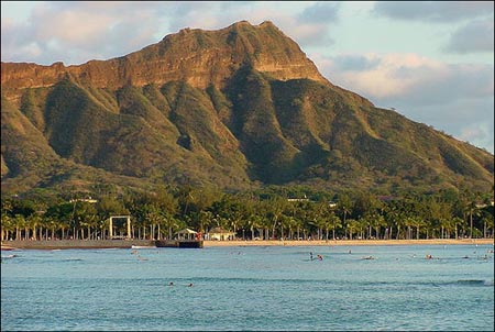
Honolulu airport, Oahu – 81
Molokai airport – 78
Kahului airport, Maui – 81
Kona airport, Hawaii – 82
Hilo airport, Hawaii – 79
Air Temperatures ranged between these warmest and coolest spots near sea level – and on the highest mountain tops around the state…as of 530am Wednesday morning:
Honolulu, Oahu – 70
Hilo, Hawaii – 64
Haleakala Summit – 43 (near 10,000 feet on Maui)
Mauna Kea Summit – 30 (13,000+ feet on the Big Island)
Hawaii’s Mountains – Here’s a link to the live web cam on the summit of near 13,800 foot Mauna Kea on the Big Island of Hawaii. This web cam is available during the daylight hours here in the islands…and when there’s a big moon shining down during the night at times. Plus, during the nights you will be able to see stars, and the sunrise and sunset too…depending upon weather conditions. Here's the Haleakala Crater webcam on Maui – if it's working.
Tropical Cyclone activity in the eastern and central Pacific – Here’s the latest weather information coming out of the National Hurricane Center, covering the eastern north Pacific. You can find the latest tropical cyclone information for the central north Pacific (where Hawaii is located) by clicking on this link to the Central Pacific Hurricane Center. A satellite image, which shows the entire ocean area between Hawaii and the Mexican coast…can be found here. The 2012 hurricane season is over in the eastern and central Pacific…resuming on May 15th and June 1st 2013.
Aloha Paragraphs
A few windward showers, gradually lighter trade winds…
becoming volcanically hazy (voggy) with time
~~~530am HST Wednesday morning: clear, calm
at my upcountry Kula, Maui weather tower, the
air temperature was 49.3F degrees~~~
The following numbers represent the most recent top wind gusts (mph), along with directions as of Tuesday evening:
20 Port Allen, Kauai – E
22 Kahuku Trng, Oahu – NE
23 Molokai – NE
29 Kahoolawe – NE
23 Kapalua, Maui – NE
29 Kealakomo, Big Island – ENE
Here are the latest 24-hour precipitation totals (inches) for each of the islands as of Tuesday evening:
0.05 Mount Waialeale, Kauai
0.01 Hakipuu Mauka, Oahu
0.00 Molokai
0.00 Lanai
0.00 Kahoolawe
0.01 Puu Kukui, Maui
0.22 Island Dairy, Big Island
We can use the following links to see what’s going on in our area of the north central Pacific Ocean. Here's the latest NOAA satellite picture – the latest looping satellite image…and finally the latest looping radar image for the Hawaiian Islands.
~~~ Hawaii Weather Narrative ~~~
Our winds will gradually becoming lighter through the rest of this week. Here's a weather chart showing a large near 1027 millibar high pressure system to the north-northeast of Hawaii. Our trade winds will prevail through mid-week, then taking a turn towards the lighter side of the wind spectrum Thursday and Friday…into the weekend. We will find light and variable winds, veering around to the southeast, as a cold front gets close to Kauai by Friday, then moves down through the state during the weekend. Cooler north to northeast breezes will fill in behind the frontal passage…into early next week.
Satellite imagery shows a few low clouds surrounding the islands…with high clouds getting close to the Big Island. The overlying atmosphere remains dry and stable at the moment, which will limit whatever few showers that happen to fall. The leeward sides will remain generally dry for the time being. This larger satellite picture shows a large area of bright white, high level cloudiness to the south and southeast, which is quickly edging up closer to the Big Island now. The overall picture remains on the dry side, with an increase in afternoon upcountry showers beginning perhaps Wednesday…although more earnestly by Thursday and Friday.
Looking ahead, our winds will become lighter and turn southeast…bringing volcanic haze (vog) back into our weather picture. This change will occur thanks to the approach of a late winter cold front. As this frontal boundary gets closer, it will push a high pressure ridge down over the state, thus the wind shift to southeast…and even the south with time. The models show some pre-frontal showers being carried into the state ahead of the cold front. It appears that this frontal cloud band will drop down through the state over the weekend, bringing showers with it. Thereafter, the winds will turn cooler from the north in the wake of the frontal passage, ending up trade winds from the northeast into the new week. I'll have more information on all of the above early Wednesday morning, when I'll be back with your next new weather narrative. I hope you have a great Tuesday night wherever you happen to be spending it! Aloha for now…Glenn.
World-wide tropical cyclone activity:
Atlantic Ocean/Caribbean Sea: There are no active tropical cyclones
Gulf of Mexico: There are no active tropical cyclones
Eastern Pacific Ocean: There are no active tropical cyclones
Central Pacific Ocean: There are no active tropical cyclones
Western Pacific Ocean: There are no active tropical cyclones
South Pacific Ocean: There are no active tropical cyclones
North and South Indian Oceans: There are no active tropical cyclones
Interesting: Ahead of the 16th meeting of the Convention on the International Trade in Endangered Species that runs from the 3rd to the 15th of March this year, researchers are again warning that sharks are in need of better protection. A new report, published in the journal Marine Policy, estimates the annual number of sharks killed by commercial fishing to be around 100 million, although the actual number could be anywhere between 63 million and 273 million.
The large range in these estimates is due to the poor quality of data available. However, the median estimate of 100 million is by far the most accurate to date. It is extremely difficult to gauge the actual level of shark fishing globally as many sharks are killed at sea and their bodies discarded without being included in official reports.
Commercial shark fishing is driven mainly by high demand for shark fin soup which is considered to be a delicacy in Asia. Sharks are often 'finned', which means their fins are removed, and the dead carcasses discarded at sea. However, they are also killed for sale of their meat, liver oil, cartilage and other body parts.
Although a ban on shark finning is in place in the European Union, Canada and the USA, it has not had the desired effect in terms of protecting vulnerable shark species. Fisheries have responded to the ban by no longer finning sharks at sea, instead keeping the carcasses, other parts of which can also be sold.
The number of sharks killed has barely changed, the root cause of the problem has yet to be solved, and finning is still widely unregulated in many parts of the world. The current rates of exploitation are vastly unsustainable and a number of vulnerable shark species are in decline.
Sharks are slow to grow and reproduce; Boris Worm, one of the report's authors from Dalhousie University in Halifax, says, "Biologically, sharks simply can't keep up with the current rate of exploitation and demand.
Protective measures must be scaled up significantly in order to avoid further depletion and the possible extinction of many shark species in our lifetime." Previous attempts to increase the protection of some species of shark have failed, but scientists are hopeful that this time increased trade controls will be introduced for species such as porbeagle, hammerhead and oceanic white tip sharks.