


June 25-26, 2010
Air Temperatures – The following maximum temperatures were recorded across the state of Hawaii Friday afternoon:
Lihue, Kauai – 84
Honolulu, Oahu – 86
Kaneohe, Oahu – 82
Kaunakakai, Molokai – 83
Kahului, Maui – 86
Hilo, Hawaii – 83
Kailua-kona – 82
Air Temperatures ranged between these warmest and coolest spots near sea level around – and on the highest mountains…as of 5pm Friday evening:
Port Allen, Kauai – 86
Hilo, Hawaii – 77
Haleakala Crater – 57 (near 10,000 feet on Maui)
Mauna Kea summit – 43 (near 14,000 feet on the Big Island)
Precipitation Totals – The following numbers represent the largest precipitation totals (inches) during the last 24 hours on each of the major islands, as of Friday afternoon:
0.76 Mount Waialaele, Kauai
0.92 Moanalua RG, Oahu
0.11 Molokai
0.00 Lanai
0.00 Kahoolawe
0.17 West Wailuaiki, Maui
0.38 Kawainui Stream, Big Island
Marine Winds – Here’s the latest (automatically updated) weather map showing a 1032 millibar high pressure system to the north of the islands….moving west. Trade winds gradually dropping in strength Saturday into Sunday.
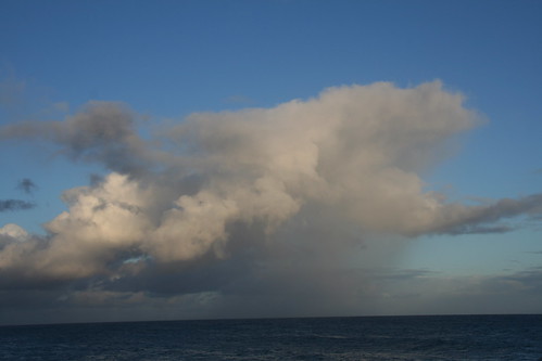
Satellite and Radar Images: To view the cloud conditions we have here in Hawaii, please use the following satellite links, starting off with this Infrared Satellite Image of the islands to see all the clouds around during the day and night. This next image is one that gives close images of the islands only during the daytime hours, and is referred to as a Close-up visible image. This next image shows a larger view of the Pacific…giving perspective to the wider ranging cloud patterns in the Pacific Ocean. Finally, here’s a Looping IR satellite image, making viewable the clouds around the islands 24 hours a day. To help you keep track of where any showers may be around the islands, here’s the latest animated radar image.
Hawaii’s Mountains – Here’s a link to the live webcam on the summit of near 14,000 foot Mauna Kea on the Big Island of Hawaii. The tallest peak on the island of Maui is the Haleakala Crater, which is near 10,000 feet in elevation. These two webcams are available during the daylight hours here in the islands…and when there’s a big moon rising just after sunset for an hour or two! Plus, during the nights and early mornings you will be able to see stars, and the sunrise too…depending upon weather conditions.
Tropical Cyclone activity in the eastern and central Pacific – Here’s the latest weather information coming out of the National Hurricane Center, covering the eastern north Pacific. You can find the latest tropical cyclone information for the central north Pacific (where Hawaii is located) by clicking on this link to the Central Pacific Hurricane Center. Here’s a tracking map covering both the eastern and central Pacific Ocean. A satellite image, which shows the entire ocean area between Hawaii and the Mexican coast…can be found here. Of course, as we know, our hurricane season won’t begin again until June 1st here in the central Pacific.
Aloha Paragraphs
Localized showers into the weekend
As we move into the weekend, our winds will become lighter. Looking at this most recent weather map, we see a moderately strong 1032 millibar high pressure system to the north of the islands…moving towards the west slowly. A part of the weakening of our local trade winds, will be caused by the arrival of an upper level low pressure system. As this colder air aloft arrives, we will see this down shifting of the trade winds. This upper low should also increase the height of the clouds, which would enhance whatever showers that are falling from their bases. As this upper air feature glides away early in the new week ahead, our weather will snap back into what looks to be…yet another week of fairly normal early summer conditions for our islands.
This easing up of the trade winds won’t last long, as the trade winds are expected to increase again right after the weekend. This is the time of year when light winds aren’t common, so that it will be a brief period. The best chance of showers between now and Sunday, would be in two parts for the state, with
Here’s an IR satellite image to check out the clouds around the islands.
Here’s an IR satellite image of the whole central Pacific.
Here’s the looping satellite image of the Hawaiian Islands.
The eastern
It’s Friday evening as I begin writing this last section of today’s narrative update. As noted above, our trade winds will be weaker this weekend. At the same time, we’ll see an area of moisture riding in from the northeast. This moisture source will come under the influence of an upper level low pressure system, which will enhance it somewhat…providing some localized rainfall to the state into the weekend. ~~~ Since its Friday, and the weekend starts for this Maui weatherman, I headed over to see a new film in Kahului. I thought I was going to see Jonah Hex (2010) starring James Brolin and Megan Fox…among others. The synopsis reads like this: A scarred bounty hunter is charged with tracking down his oldest enemy, who is preparing to unleash hell. I’m not all that sure what that means exactly, but I’ll take it as an action film for sure! Oops, I just checked the ratings this film is getting, and they don’t look that good, with a C grade from both the critics and the viewers.
~~~ As it turned out, I changed my mind, and saw instead the new film called Knight and Day (2010), starring Tom Cruise and Cameron Diaz…among others. It’s now almost 11pm, and I just got home from seeing it. I actually liked it lots, and not just because it was another of those numerous action flicks that I so regularly see. I happen to like Tom and Cameron, they are both good actors, and they were well suited to play together. It was a fast paced film, which I enjoyed of course. There were all the usual stunts, and shootings, and other special effects, which held my attention closely. The synopsis: Tom Cruise stars as an international super spy who accidentally gets involved with Cameron Diaz, an ordinary, everyday woman.
I would give it a good solid B grade, and would recommend it to those of you who like this sort of thing. Here’s the trailer for this film if you have any interest…I think most of you would enjoy seeing it.
~~~ I’ll be back early Saturday morning with your next new weather narrative. I hope you have a great Friday night until then! Aloha for now…Glenn.
Extra: Friday night is the June full moon, and a partial lunar eclipse, which begins at 12:16am Saturday morning, peaking at 1:38am…ending at 3am!
James Says:
Hi Glenn,
Can we expect to see the Lunar eclipse?~~~Hi James, here’s a link to find about this partial lunar eclipse, Aloha, Glenn
http://en.wikipedia.org/wiki/June_2010_lunar_eclipse