


August 10-11 2008
Air Temperatures – The following maximum temperatures were recorded across the state of Hawaii Sunday afternoon:
Lihue, Kauai – 87
Honolulu, Oahu – 89
Kaneohe, Oahu – 84
Kahului, Maui – 87
Hilo, Hawaii – 84
Kailua-kona – 86
Air Temperatures ranged between these warmest and coolest spots near sea level, and on the taller mountains…at 4 p.m. Sunday afternoon:
Lihue, Kauai – 86F
Hilo, Hawaii – 79
Haleakala Crater- 52 (near 10,000 feet on Maui)
Mauna Kea summit – 43 (near 14,000 feet on the Big Island)
Precipitation Totals – The following numbers represent the largest precipitation totals (inches) during the last 24 hours on each of the major islands, as of Sunday afternoon:
1.65 Mount Waialaele, Kauai
0.43 Poamoho 2, Oahu
0.01 Molokai
0.00 Lanai
0.02 Kahoolawe
0.93 West Wailuaiki, Maui
0.47 Pahoa, Big Island
Weather Chart – Here’s the latest (automatically updated) weather map showing high pressure systems located to the north through northeast of Hawaii. Our local winds be moderately strong, although stronger and gusty in the channels and those windiest places around the state.
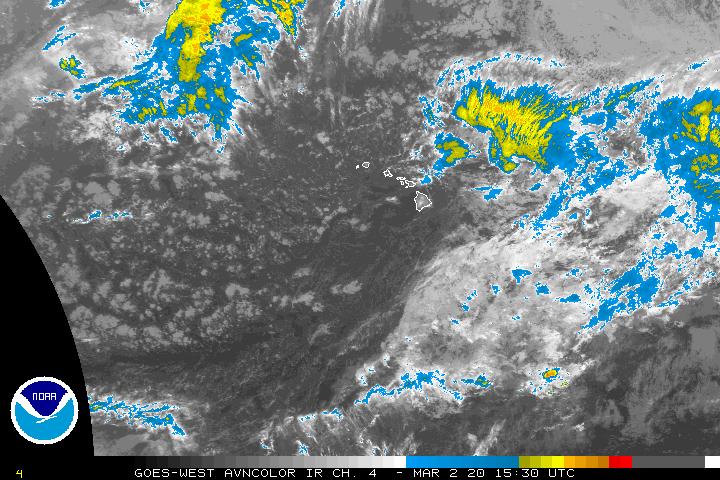
Satellite and Radar Images: To view the cloud conditions we have here in Hawaii, please use the following satellite links, starting off with the Infrared Satellite Image of the islands to see all the clouds around the state during the day and night. This next image is one that gives close images of the islands only during the daytime hours, and is referred to as a Close-up visible image. This next image shows a larger view of the Pacific…giving perspective to the wider ranging cloud patterns in the Pacific Ocean. To help you keep track of where any showers may be around the islands, here’s the latest animated radar image.
Hawaii’s Mountains – Here’s a link to the live webcam on the summit of near 14,000 foot Mauna Kea on the Big Island of Hawaii. The tallest peak on the island of Maui is the Haleakala Crater, which is near 10,000 feet in elevation. These two webcams are available during the daylight hours here in the islands…and when there’s a big moon rising just after sunset for an hour or two! Plus, during the nights and early mornings you will be able to see stars, and the sunrise too…depending upon weather conditions.
Aloha Paragraphs

Hilo Bay, with rainbow and showers…not all that unusual
Photo Credit: flickr.com
The Central Pacific Hurricane Center (CPHC) continues tracking tropical depression Kika, our first cyclone of the 2008 hurricane season…located to the southwest of the islands Sunday evening. Here’s a looping satellite picture of this tropical cyclone. Here’s a storm tracking map to show this tropical system in relation to the Hawaiian Islands – please note that we have a hurricane in the eastern Pacific, named Hernan. Hernan is a gradually weakening hurricane, which has peaked out in strength, and is destined for the tropical cyclone graveyard, as it moves over cooler water over the next 4-5 days. Despite all this tropical activity, neither of these storms will have any influence on our local weather here in the Hawaiian Islands. There is a chance that whatever leftover moisture that may be involved with what will then be former hurricane Hernan…may bring some showers to the southern part of the state eventually.
~~~ This satellite image shows the three main areas of interest around the Hawaiian Islands. The area north-northeast of Hawaii is rapidly thinning high cirrus clouds, too far away to dim our daytime sunshine. The area to the southwest, below the islands, is tropical depression Kika…no problem there as this system remains on course towards the west. The large area to the east-southeast, is a region of tropical moisture, which may move northwest over our area later in the new week ahead? If it were to move into our islands, or near by, there’s a chance it could deposit rainfall, perhaps even heavy preciptiation, which would be a positive step in pushing back the drought conditions that exist in many parts of the Hawaiian Islands at the moment. We’ll have to wait and see if this area develops into a tropical cyclone, in which case it could bring rains to the Big Island and Maui around Thursday or Friday…that’s still a question however.
It’s early Sunday evening here in Kula, Maui, as I begin writing this last section of today’s narrative. Sunday was a hot day, even in the upcountry areas, with elevations between 2,000 and 4,000 feet. All that heat, caused clouds to gather along the slopes of the mountains…which dropped late afternoon showers locally, which is fairly common here in the tropics. The winds remained rather blustery down hear the coasts, with the ocean chalked-up with white caps, and the coconut palm trees swaying to and fro. The strongest gusts late Sunday afternoon occurred here on Maui, where Maalaea Bay had winds topping out at 38 mph, while the Kahului airport saw winds reaching 40 mph! Here in Kula, at the 3,100 foot elevation, my wind chimes are sounding off, although faintly under the influence of only light breezes. Monday will continue the long number of days with at least moderately strong trade winds blowing, with the trade winds tempering some starting Tuesday, as a low pressure system in the Gulf of Alaska erodes the high pressure cell and ridges to our north then. I’ll be back very early Monday morning with your next new weather narrative from paradise. I hope you have a great Sunday night wherever you happen to be reading from! Aloha for now…Glenn.
Unbelievably large waves…in Tahiti!!