


June 22-23, 2010
Air Temperatures – The following maximum temperatures were recorded across the state of Hawaii Tuesday afternoon:
Lihue, Kauai – 84
Honolulu, Oahu – 87
Kaneohe, Oahu – 83
Kaunakakai, Molokai – 85
Kahului, Maui – 88
Hilo, Hawaii – 81
Kailua-kona – 82
Air Temperatures ranged between these warmest and coolest spots near sea level around – and on the highest mountains…as of 5pm Tuesday evening:
Barking Sands, Kauai – 85
Hilo, Hawaii – 76
Haleakala Crater – 52 (near 10,000 feet on Maui)
Mauna Kea summit – 45 (near 14,000 feet on the Big Island)
Precipitation Totals – The following numbers represent the largest precipitation totals (inches) during the last 24 hours on each of the major islands, as of Tuesday afternoon:
0.43 Mount Waialaele, Kauai
0.08 Manoa Valley, Oahu
0.03 Molokai
0.00 Lanai
0.01 Kahoolawe
0.26 West Wailuaiki, Maui
0.45 Kawainui Stream, Big Island
Marine Winds – Here’s the latest (automatically updated) weather map showing high pressure systems to the northeast of the islands. This will keep strong trade winds blowing through Thursday…locally strong and gusty at times.
Satellite and Radar Images: To view the cloud conditions we have here in Hawaii, please use the following satellite links, starting off with this Infrared Satellite Image of the islands to see all the clouds around during the day and night. This next image is one that gives close images of the islands only during the daytime hours, and is referred to as a Close-up visible image. This next image shows a larger view of the Pacific…giving perspective to the wider ranging cloud patterns in the Pacific Ocean. Finally, here’s a Looping IR satellite image, making viewable the clouds around the islands 24 hours a day. To help you keep track of where any showers may be around the islands, here’s the latest animated radar image.
Hawaii’s Mountains – Here’s a link to the live webcam on the summit of near 14,000 foot Mauna Kea on the Big Island of Hawaii. The tallest peak on the island of Maui is the Haleakala Crater, which is near 10,000 feet in elevation. These two webcams are available during the daylight hours here in the islands…and when there’s a big moon rising just after sunset for an hour or two! Plus, during the nights and early mornings you will be able to see stars, and the sunrise too…depending upon weather conditions.
Tropical Cyclone activity in the eastern and central Pacific – Here’s the latest weather information coming out of the National Hurricane Center, covering the eastern north Pacific. You can find the latest tropical cyclone information for the central north Pacific (where Hawaii is located) by clicking on this link to the Central Pacific Hurricane Center. Here’s a tracking map covering both the eastern and central Pacific Ocean. A satellite image, which shows the entire ocean area between Hawaii and the Mexican coast…can be found here. Of course, as we know, our hurricane season won’t begin again until June 1st here in the central Pacific.
Aloha Paragraphs
Trade wind weather conditions Wednesday
Trade winds will continue, strengthening some Wednesday into Thursday, before backing off some Friday into the weekend…remaining somewhat lighter than normal into early next week. Small craft wind advisories are active in all our major channels, and in all coastal waters too Tuesday night…and will likely remain over those areas through Thursday. The winds have become strong enough over the Haleakala Crater on Maui, and the summits on the
The windward sides will see a few showers…most notably during the night and early morning hours. As this IR satellite image shows, there are scattered clouds around the islands…although most of which are offshore from the windward sides of the islands. This looping radar image shows scattered showers moving through the state…the majority of which are upstream of the windward sides as we push through the night. This larger view of the central Pacific shows an increase in thunderstorm activity far to the southwest of the islands, which may eventually send us high cirrus clouds on the upper wind flow out of the southwest. Otherwise, we’ll find lots of daytime sunshine, and good weather at our local beaches for the time being. The next chance of some more substantial precipitation would have to wait until perhaps late Friday into the weekend…especially over the Kauai and
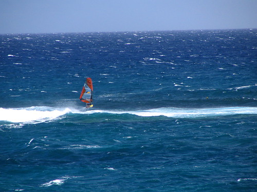
It’s Tuesday evening as I begin writing this last section of today’s narrative update. We’ll find fairly normal weather conditions here in the islands this week, at least through Thursday. As far as rainfall goes, there will be some showers, although not all that many most of the time. There could be an increase in windward showers perhaps around Friday night into the weekend…as a trough of low pressure makes our overlying atmosphere more shower prone then. This increase in showers will depend, as always…on whether there will be a corresponding increase in clouds for the trough to work on. Other than that, the main thing through the next several days will be the stronger and gusty trade winds. The surf will become rougher and choppy along our east facing beaches, and rise from the south along our leeward beaches again by Thursday.
~~~ The eastern
~~~ Here in Kihei, Maui early this evening it’s mostly clear, and a little breezy. The big news here on Maui this afternoon was the two brush fires that broke out near Kahului. The roads around the airport were closed in places, which I understand snarled traffic considerably. I’m holding off on leaving Kihei for the drive back home to Kula, to let some of the traffic jam ease up. I’ll be back early Wednesday morning with your next new weather narrative, I hope you have a great Tuesday night until then! Aloha for now…Glenn.
Interesting: It’s not just the crude that is causing problems in the gulf oil spill: Another petroleum byproduct, natural gas, is reported to be leaking in much greater concentrations than previously thought. And not only could the gas be suffocating sea life, but a new analysis warns that a giant, 1,000-year-old methane bubble could soon explode, taking out miles and miles of the ocean floor and causing a violent oil spill tsunami that would threaten the entire gulf coastline. How credible is this new threat?
The Trouble Methane Has Already Caused
Natural gas, primarily known for its role as a home heating agent, contains between 75 and 90 percent methane by volume. A heat-trapping greenhouse gas, it results as a byproduct in most deep-ocean drilling operations and is highly combustible, although drillers attempt to mitigate its dangerous potential by releasing it in controlled spurts, or "kicks," from a well. Tragically, one particularly strong, uncontrolled kick caused the April 20 explosion that sank BP’s Deepwater Horizon platform.
Since then, the oil that has leaked from the Macondo Prospect into the Gulf of Mexico (now pegged at a rate as high as 100,000 barrels per day) has contained about 40 percent methane, according to The Associated Press. The agency notes that this is far greater the 5 percent typically found in oil deposits, and has the potential to create dreaded oxygen-depleted "dead zones" throughout the ocean, wherein no sea life can survive for years. Already, scientists have observed methane concentrations up to 10,000 times higher than normal and corresponding oxygen depletion levels.
As environmentalists have pointed out, the methane released by the BP oil spill is also thought to be adding to global warming, as methane is a greenhouse gas 20 times more potent than carbon dioxide. BP says it’s burning much of the natural gas that bubbles up from the source of the leak, but does not account for the portion that has already escaped into the water. Other science writers have noted that methane does eventually dissolve uniformly in seawater and is consumed by microbes.
The Worst-Case Scenario
The frightening "low-probability" scenario described today by entrepreneur and philanthropist DK Matai at The Huffington Post includes the possibility of a "massive bubble trapped for thousands of years under the Gulf of Mexico sea floor" exploding and setting off a "tsunami [traveling] at a high speed of hundreds of miles per hour."
Matai continues: Florida might be most exposed to the fury of a tsunami wave. The entire Gulf coastline would be vulnerable, if the tsunami is manifest. Texas, Louisiana, Mississippi, Alabama and southern region of Georgia might experience the effects of the tsunami according to some sources.
He also warns of a "second tsunami via vaporization." This could result after the initial explosion displaced all the oil, gas and water around it, producing a gigantic, extremely hot (300-degree Fahrenheit) cavity, which would vaporize all the incoming water, turning it into steam and causing another rupture in the gulf floor. He notes that as time goes on and the gulf well remains unplugged, the "risk increases."
BP’s View
BP America spokesman Robert Wine told Surge Desk that Matai’s claims were unfounded, saying: "Of course there’s natural gas down there. That’s what’s coming up, that’s what we’ve been burning this whole time. It’s what caused the explosion in the first place, after all, so where does this idea of another bubble or explosion come from? It is a bit difficult to comment on the claims of unspecified geologists." No matter how unlikely a tsunami might be, we’ve already entered hurricane season, which has a much greater chance of ruining the gulf oil spill response effort.