


Air Temperatures – The following maximum temperatures were recorded across the state of Hawaii Friday:
Lihue, Kauai – 85
Honolulu airport, Oahu – 89 (record for Friday – 92 in 1988)
Kaneohe, Oahu – 84
Molokai airport – 83
Kahului airport, Maui – 85
Kona airport 86
Hilo airport, Hawaii – 82
Air Temperatures ranged between these warmest and coolest spots near sea level – and on the highest mountain tops…as of 5pm Friday evening:
Barking Sands, Kauai – 84
Hilo, Hawaii – 78
Haleakala Crater – missing (near 10,000 feet on Maui)
Mauna Kea Summit – 45 (over 13,500 feet on the Big Island)
Here are the 24-hour precipitation totals (inches) for each of the islands as of Friday evening:
0.94 Kilohana, Kauai
0.10 Kahuku training area, Oahu
0.03 Molokai
0.00 Lanai
0.42 Kahoolawe
0.68 Ulupalakua, Maui
1.11 Kawainui Stream, Big Island
Satellite and Radar Images: To view the cloud conditions we have here in Hawaii, please use the following satellite links, starting off with this Infrared Satellite Image of the islands to see all the clouds around during the day and night. This next image is one that gives close images of the islands only during the daytime hours, and is referred to as a Close-up visible image. Finally, here's a Looping IR satellite image, making viewable the clouds around the islands 24 hours a day. To help you keep track of where any showers may be around the islands, here’s the latest animated radar image.
Hawaii’s Mountains – Here’s a link to the live web cam on the summit of near 13,500 foot Mauna Kea on the Big Island of Hawaii. This web cam is available during the daylight hours here in the islands…and when there’s a big moon shining down during the night at times. Plus, during the nights you will be able to see stars, and the sunrise and sunset too…depending upon weather conditions. The Haleakala Crater webcam on Maui just came back online, after being on the blink for several weeks.
Tropical Cyclone activity in the eastern and central Pacific – Here’s the latest weather information coming out of the National Hurricane Center, covering the eastern north Pacific. You can find the latest tropical cyclone information for the central north Pacific (where Hawaii is located) by clicking on this link to the Central Pacific Hurricane Center. A satellite image, which shows the entire ocean area between Hawaii and the Mexican coast…can be found here. Here's a tropical cyclone tracking map for the eastern and central Pacific.
Aloha Paragraphs
Light to moderate trade winds, strongest near Maui
County and the Big Island…showers along
the windward sides and leeward slopes at times
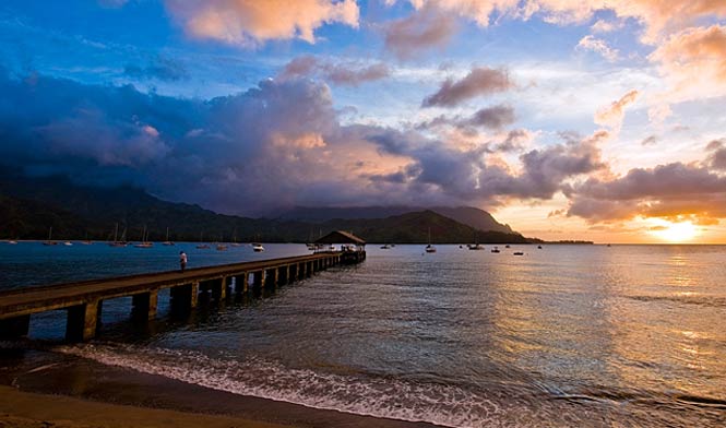
North shore of Kauai
Our trade winds will be light to locally moderate through Monday. Glancing at this weather map, showing high pressure systems to the northwest and northeast of the islands. Our local winds will remain light to moderately strong into Sunday…locally a bit stronger during the afternoons.
Trade winds continue…the following numbers represent the strongest gusts (mph), along with directions Friday evening:
13 Lihue, Kauai – NE
16 Kahuku, Oahu – NE
20 Molokai – NNE
17 Kahoolawe – NE
22 Kapalua, Maui – NE
15 Lanai – NE
20 Upolu Point, Big Island – NE
We can use the following links to see what’s going on in our area of the north central Pacific Ocean Friday evening. Looking at this NOAA satellite picture we find scattered low clouds generally offshore of the islands, heading towards the Big Island and Maui and Kauai at the time of this writing. We can use this looping satellite image to see the low clouds moving along in the trade wind flow. There look to be more high level clouds coming our way from the southwest, although they were still over the ocean at the time of this writing. Checking out this looping radar image we see showers over the ocean, moving along in the northeast breezes, which will reach the islands tonight at times.
Sunset Commentary: A solid light to moderately strong trade wind weather pattern will continue over the state through the weekend into Monday. As we push into Tuesday onwards, high pressure will strengthen to our north, prompting an increase in our local trade wind flow. As the trade winds increase, there’s a good chance of finding small craft wind advisory flags going up over those windiest coasts and channels…particularly around Maui County and the Big Island.
Rainfall will continue to fall along our windward sides at times, although there’s no rainfall enhancing upper level low pressure systems in our area at the moment. This suggests that there will be nothing out of the ordinary in terms of precipitation. Meanwhile, the leeward sides will remain generally dry through the weekend, with perhaps a few showers being carried over that way…once the trade winds show their expected increase. The upcountry leeward slopes on both Maui and the Big Island may continue to see afternoon showers breaking out again Saturday and Sunday.
The surf will continue to be generally on the small side this weekend, although the north shores have pretty good surf breaking, associated with a north-northwest swell. This should be in the dropping through Sunday however. The surf will begin to rise Sunday night along our leeward beaches into Monday. This larger than normal south swell was generated last weekend down near New Zealand. It will have taken about a week to travel that 3500+ miles from the southern hemisphere to our shores. It is expected to be large enough to trigger a high surf advisory by Monday and Tuesday.
Here in Kihei, Maui at around 615pm HST Friday evening, skies were partly cloudy to mostly cloudy, with some minor clear spots as sunset too. This afternoon there was some impressive cloud buildups over the southwest slopes of the Haleakala Crater. These clouds let loose with some good showers from the Ulupalakua pastures, all the way down through Maui Meadows into Makena. ~~~ Rather than going to the movies tonight, some friends invited me to join them over on the north shore. There's a social function at the Spreckelsville Country Club, with live jazz, food and drinks. This should be fun, and so I'll report back to you in the morning about how it turned out to be. I'd like to go see the new film with Brad Pitt tomorrow night, called Moneyball. More about that tomorrow, as I finally finish my work week now. I hope you have a great Friday night! Aloha for now…Glenn.
Interesting: With climate change, the world is generally getting warmer —- but not in a slow and straight line. Instead, many models show that weather is simply becoming more unpredictable and possibly more volatile, with more severe storms, more severe droughts and more peaks in all kinds of weather extremes. All of that volatility raises its own fears. With more extreme weather events, are we getting set up for a rise in related injuries and deaths?
A new study offers some comforting news. Researchers from the Reason Foundation, a public policy think tank, took a decade-by-decade look at the number of deaths caused worldwide by extreme weather events from 1900 to 2010. Over time, the study found, weather has been growing increasingly extreme.
In the last decade, there were 350 reported severe weather events each year, compared with just 2.5 per year in the 1920s and close to 46 per year in the 1960s. When it comes to death by weather, the worst decade was from 1920 to 1929, when environmental conditions killed 241 out of every million people.
Since then, the rate has steadily dropped by 98 percent. In the 1960s, 50 out of every million people around the world died because of floods, fires, storms, extreme heat or cold, and related causes. By the 2000s, the rate was down to about five out of a million.
During the study period, the researchers also found that droughts were responsible for close to 60 percent of extreme weather deaths, while floods caused almost 35 percent. Deaths from both causes have dropped precipitously in recent decades. Even hurricanes, tornadoes and other storms, which claimed 7 percent of extreme weather deaths from 1900 to 2008, kill 55 percent fewer people now than they did in the '70s.
Butch Says:
Aloha Glen, Thanks for all your great weather reporting!!! The "Interesting" article is just that–reminds me of a book I read some years ago titled "Not by fire but by Ice" by Robert Felix. Very good read and very ahead of its' time, if you don't know about it, check it out–right up your alley. He is a scientist or climatologist or something –has a good outlook. Take care, Butch~~~Hi Butch, thanks for your comment, and I will check out that book you mention. You’re very welcome, enjoy doing the daily weather reporting. Aloha, Glenn
Michael Says:
oh you just can't beat, a social function at the Spreckelsville Country Club!!!Hi Michael, yes it was fun! Aloha, Glenn