


April 23-24, 2010
Air Temperatures – The following maximum temperatures were recorded across the state of Hawaii Friday afternoon:
Lihue, Kauai – 80
Honolulu, Oahu – 83
Kaneohe, Oahu – 80
Kaunakakai, Molokai – 79
Kahului, Maui – 84
Hilo, Hawaii – 80
Kailua-kona – 80
Air Temperatures ranged between these warmest and coolest spots near sea level around the state – and on the highest mountains…at 4pm Friday afternoon:
Honolulu, Oahu – 82F
Molokai airport – 74
Haleakala Crater – 46 (near 10,000 feet on Maui)
Mauna Kea summit – 37 (near 14,000 feet on the Big Island)
Precipitation Totals – The following numbers represent the largest precipitation totals (inches) during the last 24 hours on each of the major islands, as of Friday afternoon:
1.86 Mount Waialaele, Kauai
1.79 Manoa Valley, Oahu
0.14 Molokai
0.00 Lanai
0.10 Kahoolawe
0.78 West Wailuaiki, Maui
1.70 Kawainui Stream, Big Island
Marine Winds – Here’s the latest (automatically updated) weather map showing a 1030 millibar high pressure system far to the northeast of the islands, with a 1023 millibar high pressure system to the west-northwest. This pressure configuration will keep our trade winds blowing into Sunday...becoming somewhat lighter.
Satellite and Radar Images: To view the cloud conditions we have here in Hawaii, please use the following satellite links, starting off with this Infrared Satellite Image of the islands to see all the clouds around the state during the day and night. This next image is one that gives close images of the islands only during the daytime hours, and is referred to as a Close-up visible image. This next image shows a larger view of the Pacific…giving perspective to the wider ranging cloud patterns in the Pacific Ocean. Finally, here’s a Looping IR satellite image, making viewable the clouds around the islands 24 hours a day. To help you keep track of where any showers may be around the islands, here’s the latest animated radar image.
Hawaii’s Mountains – Here’s a link to the live webcam on the summit of near 14,000 foot Mauna Kea on the Big Island of Hawaii. The tallest peak on the island of Maui is the Haleakala Crater, which is near 10,000 feet in elevation. These two webcams are available during the daylight hours here in the islands…and when there’s a big moon rising just after sunset for an hour or two! Plus, during the nights and early mornings you will be able to see stars, and the sunrise too…depending upon weather conditions.
Tropical Cyclone activity in the eastern and central Pacific – Here’s the latest weather information coming out of the National Hurricane Center, covering the eastern north Pacific. You can find the latest tropical cyclone information for the central north Pacific (where Hawaii is located) by clicking on this link to the Central Pacific Hurricane Center. Here’s a tracking map covering both the eastern and central Pacific Ocean. A satellite image, which shows the entire ocean area between Hawaii and the Mexican coast…can be found here. Of course, as we know, our hurricane season won’t begin again until June 1st here in the central Pacific.
Aloha Paragraphs
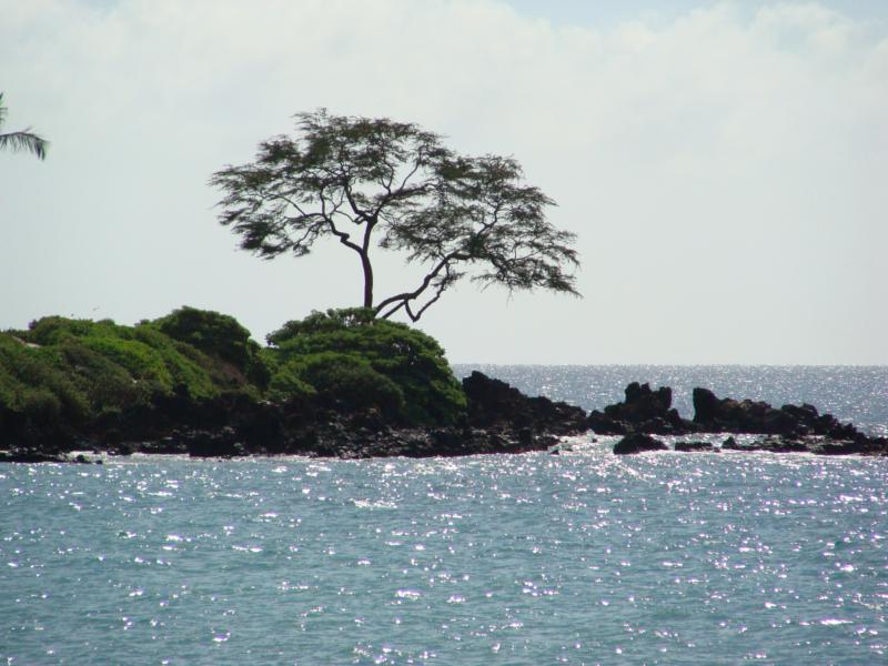
Wailea, Maui
The trade winds remain the most dominant weather feature as we move into the weekend. They have peaked out in strength now, actually over the last few days, and are now on a gentle downward trend in speed. We could pretty easily call them in general, light to moderately strong here and there. The winds are light enough now in fact, that the NWS forecast office has discontinued all of its small craft wind advisories statewide. This lighter version of the trade winds is expected to last through the weekend.
The computer models suggest that a new high pressure system will migrate eastward, into the north and northeast of
The cold air associated with a trough of low pressure, which has been over us recently…is moving away. This trough is expected to be replaced by an upper level ridge of high pressure. This ensures a nice weekend, at least that’s the thought. The only thing that would likely knock this idea for loop, would be to see a slug of showery clouds come moving our way, from off the warm
This all translates into what has become a drought condition, especially over the leeward sides of Molokai, Maui, and the
It’s Friday evening as I begin writing this last section of today’s narrative. As noted above, our weather was nice Friday, with little interruption expected this weekend. As the trade winds become lighter, it may begin to feel a bit warmer, especially along those leeward beaches during the afternoon hours. All in all, things are looking good, and I’m looking forward to enjoying this favorably inclined springtime weather pattern myself! ~~~ Since this is Friday, I’m going to take in a new film this evening. This one is called Clash of the Titans (2010), starring Sam Worthington and Gemma Artereton…among others. The shortest possible synopsis for this film is: The warrior Perseus finds himself in the ultimate struggle for power between gods, kings, and men. My Mom is always asking me "why do you see these types of films Glenn"? The truth is that I’d like to see other types of films too, like Indy films in particular, although we only get so many films here on Maui, so it’s not easy to be all that picky. Here’s a trailer for this film, just in case you were curious, and I know my Mom won’t be! I’ve had several friends who have said that they liked it a lot, so I’m taking my chance. It’s playing in Dolby Digital 3D, so that should be fun. I’ll catch up with you again Saturday morning, with a new weather narrative, and my take on this film too. I hope you have a great Friday night until then! Aloha for now…Glenn.
Interesting: Indo-Pacific lionfish, an invasive carnivore equipped with venomous spines, are spreading—and eating their way—through the fishes of the Caribbean Sea. In an effort to stop, or at least slow down, these fearless invaders, the National Science Foundation has awarded a 3-year, $700,000 grant to scientists at Oregon State University (OSU), Corvallis. The lionfish are normally found in Pacific Ocean waters.
But since the 1990s, they’ve been spotted from Florida to Rhode Island, and as far south as Colombia, and are now wreaking havoc among the fishes of Caribbean coral reefs—adding yet another woe to those already facing the reefs.
"We want to understand why lionfish are so successful," in their new habitats, says Mark Hixon, a marine biologist at OSU and leader of the newly funded research effort. Rare in their native waters, the lavishly striped and decorated fish (Pterois volitans) are booming on the reefs around the Bahama Islands, Hixon’s previous work shows.
In a controlled experiment in 2005, his team recorded the lionfish’s voracious appetite. A single one can reduce the number of other fishes by 79% in as few as 5 weeks. The researchers witnessed colorful cardinal fish, parrotfish, damselfish all going down the lionfish’s gullet.
One consumed 20 small fish in 30 minutes. "It seems that the native fish don’t perceive lionfish as fish," perhaps because of the predator’s markings, Hixon says. "They swim right up to it," only to end up being swallowed whole.
Many of the small reef fish are herbivores and help keep seaweed in check; without them, Hixon and others predict that seaweed may grow rampantly, overwhelming the reefs’ ecosystem. Hixon’s new study will compare lionfish populations in the Pacific and Atlantic oceans to try to sort out why they are rare at home, but thriving in foreign seas.
"Something, a parasite, predator, or disease," is limiting them in the Pacific, says Hixon. If the researchers can discover what that is, they hope to find—and foster—a similar lionfish attacker in the Atlantic. Native groupers in the Bahamas might prey on lionfish, but because groupers have been overfished, they are unlikely to significantly reduce the invaders.
Plus, in experiments, Hixon has found that neither groupers nor sharks are particularly keen to eat the lionfish. "They don’t look like their conventional prey," and the groupers and shark don’t seem to enjoy the venomous spike that comes with the meal. Hixon has larger hopes for humans as consumers of lionfish.
The fish are fairly easy to catch, are tasty, and could even carry a green label. "They could be advertised as a conservation dish," he says, noting that there is a lionfish cookbook in the works.
Interesting2: Eyjafjallajökull and its massive cloud of volcanic ash clearly have had an enormous impact on Europe and its airports, disrupting the mobility of millions and costing airlines more than a billion euros. But what about the volcano’s effect globally? While much more difficult to determine, Northwestern University professor Dirk Brockmann and his research group jumped at the chance to examine the global impact.
Mobility patterns in places far from Europe — including the United States, India and southeast Asia — were significantly affected by the European disruption, to the surprise of Brockmann. The team compared the entire worldwide air transportation network before and after the 27 major European airports were closed and used complex network theory to compute and list the most affected airports still operating.
"We were surprised to discover that at the top of the list were airports outside of Europe, not airports in Europe," Brockmann said. "Singapore, Hong Kong and Beijing are some of the high-traffic airports most affected, despite being geographically distant from Europe and separated from Iceland by continents."
He and his graduate students Daniel Grady, Christian Thiemann and Olivia Woolley also found that airports like Madrid and Dubai have become more central in the entire air transportation network, taking over the role of the closed airports. Brockmann and his group have expertise in running simulations and computational models of human transportation networks and pandemic diseases.
He is associate professor of engineering sciences and applied mathematics at Northwestern’s McCormick School of Engineering and Applied Science. "European airports are bridges to the world — the majority of global air traffic goes through Europe," Brockmann said.
"The distances to places have increased globally as a result of the volcanic ash disruption. Mumbai, for example, has become more disconnected than we expected from the U.S. and Africa. Flights from the U.S. to Mumbai normally go through Europe, but now Mumbai is a more distant city to us."
A trip that may have required two flights before the volcano’s eruption might have taken four or five trips when the situation was at its worst, which translates into more time, says Brockmann. At the peak of the disruption, with the 27 major European airports closed, 10 percent of the entire global air traffic system was removed.
The slowdown in air traffic affected not only the mobility of people but that of fresh vegetables and fruit, grains and other food, medicine, machinery parts and more. "The removal of those 27 nodes dramatically affects the entire complex system," said Brockmann. "We can quantify Eyjafjallajökull’s effect and illustrate it, which is not a simple thing to do."
"In this case, the entire air transportation system was slowed but still works," said Brockmann, who most recently studied the spread of swine flu. "Our calculations show that an actual system breakdown requires the removal of 80 percent of the airports from the system. This shows how robust the system is.
Interesting3: Ice-covered volcanoes like the one in Iceland that brought European air traffic to a standstill are the center of an emerging branch of volcano science that seeks to answer important questions about climate change. Scientists believe the rocks created when volcanoes erupt beneath glaciers contain distinct chemical signatures that indicate the thickness of the ice that was above the volcanoes when they blew.
By correlating the thickness with the age of the rocks, researchers can estimate the degree to which Earth was covered by glaciers thousands — or even millions — of years ago. That information is crucial to climatologists who want to understand how ice and temperature conspire to make the globe cool down or heat up.
"In the big global climate models that they run on supercomputers, ice cover on the Earth is very important," said Ian Skilling, a volcanologist at the University of Pittsburgh. Paleoclimatologists already have a good idea about temperatures in the planet’s distant past, thanks to sediment samples from the ocean floor.
But ocean temperatures, though an important factor in understanding the history of the planet’s climate, are only part of the story. Scientists don’t understand very well how changes in ocean temperature are linked with ice conditions on land, said Ben Edwards, a volcanologist at Dickinson College in Carlisle, Pa.
Combining the ocean data with information from volcanic rocks "will give us a much better feel for how global climate changes in the course of time," he said. The rocks formed by volcanoes covered by glaciers have some distinctive features. They have relatively smooth edges, on account of banging into ice on their way out of the crater.
Those edges also have a glassy rind that forms because ice causes magma to cool extremely quickly. The glass contains water, carbon dioxide and sulfur dioxide. The concentration of water is determined in part by the pressure above the volcano before it erupts — an indication of the thickness of the ancient ice layer that covered it.
"Higher water content means higher pressure on that glass when it was forming," Skilling said. "It gives you some idea of just how far beneath the surface it was." Ice thickness is important because it helps scientists figure out how long a glacier lasted in a particular place.
It also gives scientists clues about how warm the air was, how much sunlight was reflected back into space, and how high sea levels were, Skilling said. Edwards recently collected rocks from about 40 volcanoes in British Columbia that were covered by glaciers when they erupted. "We want to correlate when there were big ice sheets on land with the cold spells recorded in the ocean," he said.
But North American volcanoes erupt somewhat sporadically. To get a more continuous record of glacial conditions, the neighbors of the erupting Eyjafjallajokull volcano could be particularly helpful, he said. Volcanologists have calculated glacier thickness for several times and places, and so far they match up with ocean temperatures from the same periods. Edwards said he expects to find many more matches.
Interesting4: A strong 6.1-magnitude quake has rocked the central region of Chile which was hit by the massive February 27 tremor, the US Geological Service says. The epicenter of the quake, which struck at 10.03am GMT on Friday (8.03pm AEST) was 65km south of Concepcion, Chile, the USGS said. The 8.8-magnitude February 27 quake – one of the largest on record – struck off Concepcion, triggering a local tsunami. At least 452 people were killed and the disaster caused some $US30 billion in damage.
Interesting5: There’s a "good possibility” than a volcano will burst through the streets of Auckland in the next few hundred years. New Zealand’s most populous city is already studded with at least 50 volcanoes – the last, Rangitoto Island, emerged in the Haraki Gulf about 700 years ago. Auckland University geologist Phil Shane says "a new little one pops up” in Auckland every 1000 years, "so you could have an eruption in our lifetime” Auckland is built on a "volcanic field”, Dr Shane said.
"Rather than a new (volcano) bursting through the old eroded remains of an ancient one, often they pop up in a new place.” Auckland’s bustling main strip, Queen Street, would be a "candidate”, he said. "A place like Queen Street wouldn’t be out of the question. "Equally, it could happen out in the harbor or somewhere else. "Unfortunately, it’s very hard to forecast (when) something like this is going to happen unless we’re only … like weeks or months away from it happening,” Dr Shane said.
Miriam Says:
My brother works on these oil platforms in the Gulf of Mexico. He has known many people who have died doing their jobs. It is dangerous, challenging work. The helicopters that ferry the men out and back are also a dangerous commute. Our fuel depends on these brave men risking their lives and their family’s futures. This kind of news makes me humble and grateful. Thank you Glenn for sharing. M~~~Hi Mariam, thanks for your thoughtful note, there is so much danger out there everyday, in so many areas of our life. I’d like to wish everyone reading this note the best luck, and good fortune. Yes, I can see how you feel humble and grateful…I sure do too! Aloha, Glenn