


Weather Details & Aloha Paragraphs
Posted by GlennSeptember 23-24 2007
Air Temperatures – The following maximum temperatures were recorded across the state of Hawaii Sunday:
Lihue, Kauai – 85F
Honolulu, Oahu – 88
Kaneohe, Oahu – 84
Kahului, Maui – 88
Hilo, Hawaii – 82
Kailua-Kona, Hawaii – 89
Temperatures early Monday morning ranged between these warmest and coolest spots near sea level at the 4 a.m. hour:
Kailua-kona – 77F
Hilo, Hawaii – 70
Precipitation Totals – The following numbers represent the largest precipitation totals (inches) during the last 24 hours on each of the major islands, as of Monday morning:
0.24 WAILUA, KAUAI
0.22 MANOA LYON ARBORETUM, OAHU
0.00 MOLOKAI
0.05 LANAI
0.01 KAHOOLAWE
0.45 OHEO GULCH, MAUI
1.61 HONAUNAU, BIG ISLAND
Weather Chart – Here’s the latest (automatically updated) weather map…showing high pressure systems located far to the NNW and NE of Hawaii. These high pressure cells will merge to our northest later Monday or Tuesday. This pressure configuration will keep moderate trade winds blowing across our Hawaiian islands…locally stronger and gusty in those locally windiest areas. Here’s a Weather Map Symbol page for clarification about what all those weather symbols mean on the map.
Hawaii’s Mountains – Here’s a link to the live webcam on the summit of near 14,000 foot Mauna Kea on the Big Island of Hawaii. The tallest peak on the island of Maui is the Haleakala Crater, which is near 10,000 feet in elevation. These two webcams are available during the daylight hours here in the islands…and when there’s a big moon rising just after sunset for an hour or two! Plus, during the nights and early mornings you will be able to see stars, and the sunrise too…depending upon cloud conditions.
Tropical Cyclone activity in the eastern and central Pacific – Here’s the latest information coming out of the National Hurricane Center, covering the eastern north Pacific. You can find the latest tropical cyclone information for the central north Pacific (where Hawaii is located) by clicking on this link to the Central Pacific Hurricane Center. Here’s a tracking map covering both the eastern and central Pacific Ocean.
Satellite and Radar Images: To view the cloud conditions we have here in Hawaii, please use the following satellite links, starting off with the Infrared Satellite Image of the islands to see all the clouds around the state during the day and night. This next image is one that gives close images of the islands only during the daytime hours, and is referred to as a Close-up visible image. This next image shows a larger view of the Pacific…giving perspective to the wider ranging cloud patterns in the Pacific Ocean…out from the islands. To help you keep track of where any showers may be around the islands, here’s the latest animated radar image.
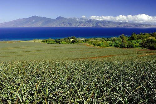
Pineapple fields on Maui…Molokai in the background
photo credit: flickr.com
Moderately strong trade winds will continue to blow across our tropical latitudes here in the islands. Weather maps show high pressure systems located far to the NE and NW of the islands Sunday evening. Wind speeds will range between light to moderately strong, all the way up to strong and gusty, depending upon your location. As usual, these breezes will be strongest during the days, and lightest in general during the nights. The latest model output indicates that the trade winds will continue well into the new week ahead. There are no advisories for winds in major channels, or the coastal waters at this time.
There will still be a few showers around, primarily along the windward sides through Monday here in the Aloha state. A high pressure ridge exists aloft now over Hawaii, which in combination with little upstream moisture to the east…will keep island skies quite sunny and dry in most areas. The windward sides will see the usual few showers, otherwise most all leeward areas will remain dry. An upper level trough of low pressure will take over duty aloft starting Tuesday, bringing back somewhat more showers to the forecast…especially along the windward sides for several days thereafter.
It’s Sunday evening as I start writing this last paragraph of todays weather narrative. This first full day of autumn will see nice weather in the Hawaiian Islands. We should see lots of warm sunshine beaming down, with whatever clouds that gather, dropping just a few showers. As the trade winds are blowing however, there’s always that chance of a few raindrops falling along those windward coasts and slopes. Then too, the daytime heating of the volcanic slopes will cause clouds to form during the afternoons around the mountains on the bigger islands. These clouds will be dry for the most part, although we might see a few sprinkles falling along the upslope areas of Kona, on the Big Island. All things considered, the next several days will have pleasant weather conditions. As noted in the paragraph above, the appearance of an upper level low pressure starting Tuesday, may trigger an increase in showers along the windward sides of the islands. ~~~ I’ll be back early Monday morning with more weather updates, I hope you have a great Sunday night wherever you may be reading from! Aloha for now…Glenn.