


September 18-19, 2010
Air Temperatures – The following maximum temperatures were recorded across the state of Hawaii Saturday afternoon:
Lihue airport, Kauai – 84
Honolulu airport, Oahu – 87
Kaneohe MCAS, Oahu – 85
Molokai airport – 85
Kahului airport, Maui – 87
Ke-ahole airport (Kona) – 85
Hilo airport, Hawaii – 84
Air Temperatures ranged between these warmest and coolest spots near sea level – and on the highest mountain tops…as of 4pm Saturday afternoon:
Barking Sands, Kauai – 86
Kaneohe, Oahu – 79
Haleakala Crater – 55 (near 10,000 feet on Maui)
Mauna Kea summit – 45 (near 14,000 feet on the Big Island)
Precipitation Totals – The following numbers represent the largest precipitation totals (inches) during the last 24 hours on each of the major islands, as of Saturday afternoon:
1.02 Mount Waialeale, Kauai
0.32 Manoa Valley, Oahu
0.05 Molokai
0.00 Lanai
0.00 Kahoolawe
0.18 Puu Kukui, Maui
0.09 Kealakekua, Big Island
Marine Winds – Here’s the latest (automatically updated) weather map showing a 1021 millibar high pressure system located just to the northwest of the islands. Our local trade winds will remain light to moderately strong through Monday…locally stronger and gusty.
Satellite and Radar Images: To view the cloud conditions we have here in Hawaii, please use the following satellite links, starting off with this Infrared Satellite Image of the islands to see all the clouds around during the day and night. This next image is one that gives close images of the islands only during the daytime hours, and is referred to as a Close-up visible image. This next image shows a larger view of the Pacific…giving perspective to the wider ranging cloud patterns in the Pacific Ocean. Finally, here’s a Looping IR satellite image, making viewable the clouds around the islands 24 hours a day. To help you keep track of where any showers may be around the islands, here’s the latest animated radar image.
Hawaii’s Mountains – Here’s a link to the live webcam on the summit of near 14,000 foot Mauna Kea on the Big Island of Hawaii. The tallest peak on the island of Maui is the Haleakala Crater, which is near 10,000 feet in elevation. These two webcams are available during the daylight hours here in the islands…and when there’s a big moon rising just after sunset for an hour or two! Plus, during the nights and early mornings you will be able to see stars, and the sunrise too…depending upon weather conditions.
Tropical Cyclone activity in the eastern and central Pacific – Here’s the latest weather information coming out of the National Hurricane Center, covering the eastern north Pacific. You can find the latest tropical cyclone information for the central north Pacific (where Hawaii is located) by clicking on this link to the Central Pacific Hurricane Center. Here’s a tracking map covering both the eastern and central Pacific Ocean. A satellite image, which shows the entire ocean area between Hawaii and the Mexican coast…can be found here. Of course, as we know, our hurricane season won’t begin again until June 1st here in the central Pacific.
Aloha Paragraphs
Windward showers will increase some into Sunday
It looks like our trade winds will remain active through the weekend, although begin to lose some strength…going into the new week ahead. This weather map shows a weak 1021 millibar high pressure system located just to the northwest of our islands. This high pressure cell, and its associated high pressure ridge, is the source of our trade wind flow Saturday night. The trade winds remain strong enough now, that the NWS office in Honolulu is keeping small craft wind advisories up, for those windiest coastal and channels around Maui and the Big Island. The winds have strengthened enough atop the two high mountain peaks on the Big Island, Mauna Kea – Mauna Loa…that there is a wind advisory in effect until Sunday evening.
As the trade winds continue to blow, incoming showers will be focused along the windward sides. An early season cold front, which is weak, and is the very tail-end of a more active frontal boundary far to the northeast, is being carried our way on the trade winds. This satellite image shows this weather feature best, although it won’t amount to all that much precipitation on Sunday along our windward sides. Glancing south of the islands, using this satellite picture, we see that typical line of thunderstorms to the southwest, south and southeast. There’s one particular area of disturbed weather that continues to pulse, resulting in the NWS forecast office in Honolulu, giving it a 10% chance of developing into a tropical cyclone. Here’s a satellite image showing that area far to our southeast.
It’s Saturday as I begin writing this last section of today’s narrative update. The weather here in the islands remains nice, which isn’t unusual for these last few days of the summer season. A new sign of the upcoming early autumn season will arrive soon, when our first northwest swell arrives along our north and west shores, generated from an early season storm far to our northwest…up in the Aleutian Islands of Alaska. I see that increase in windward biased showers arriving early Sunday, brought our way by the seasons first cold front.
~~~ I went to see a new film after work Friday night after work, called The American (2010) starring George Clooney, Thekla Reuten, Irina Bjorklund …among others. The synopsis: a skilled assassin lets his guard down when he retreats to the Italian countryside for one final assignment. I was nervous after reading online that the reviews were very low, with over 2900 reviews gave the film a D+ grade. This film was SO slow, and rather depressing actually, although I’ll give it a C+ grade myself. It was unusual, and I did appreciate the big country views, and the photography in general was well done. It certainly wasn’t an uplifting film in any way, with George Clooney never cracking one smile. There were the usual beautiful women of course, who fell in love the handsome Mr. Clooney. Here’s a trailer, so you take a quick look at the nature of this 1 hour and 35 minute film.
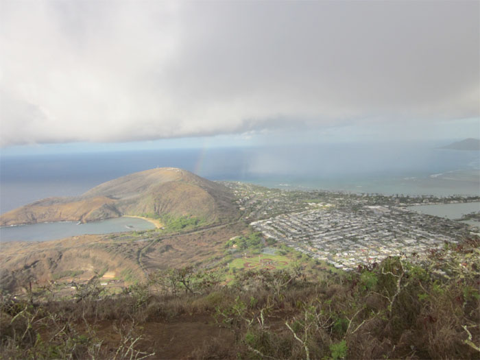
~~~ Saturday was one of those spectacularly sunny days, with hardly any clouds around…even along our windward coasts and slopes. The trade winds blew light to moderately strong, although late in the day, there were still a couple of 35 mph gusts, being reported on both Maui and the Big Island. The two most interesting things perhaps happening now, is the arrival of a very early season cold front, and the soon to be rise in an early season northwest swell train of waves. The cold front is much more active up along the west coast, with just the very tail-end of the frontal cloud band being carried our way on the trade winds. This means that it won’t be pushing in our direction on its own steam, from the northwest, like it would in the autumn or winter season. It will be carried into our windward sides, on the decreasingly strong trade wind flow. It will bring some showers, although a fairly modest amount I believe. Here’s a satellite image to view its approach to the northeast. Here’s a looping radar image, to see whatever showers that begin arriving too. Then, yet another sign of the season, is the new northwest swell, which again won’t be like during our winter season, when it would be much larger. It will however bring larger surf to our north and west shores, than we’ve seen for quite a while.
~~~ I’ll be back perhaps later this evening, with some Saturday night music video’s, like I did last weekend. You may want to check back in around 8 or 9pm this evening, to see if I’ve added some of my favorite music. Or, if then that, I’ll be back Sunday morning with your next new weather narrative. I hope you have a great Saturday night until then! Aloha for now…Glenn.
Interesting: A new volcano eruption on Iceland could happen again soon, but will likely wreak less havoc than the one that caused massive airspace shutdowns earlier this year, experts said Thursday. The Eyjafjoell eruption, which began on April 14 and spewed enough ash to cause the biggest European airspace shutdown since World War II, "was very unusual," Armann Hoskuldsson, a geologist at the University of Iceland, told an international conference in Keflavik, southwest of the capital.
"Most volcano eruptions in Iceland are basaltic," with lava flows and spewing only coarse-grained and heavy particles, he explained. "That is what we would expect would happen in Katla," a much larger, neighboring volcano that historically erupts within a year or so of Eyjafjoell, he said. The smaller Eyjafjoell volcano, whose ash cloud affected more than 100,000 flights and eight million passengers in April and May, was different, Hoskuldsson insisted.
"The particles were so fine that they did not settle. They were absolutely not coming down, determined to go to Europe and bother your airspace," he pointed out. "For us in Iceland … we don’t deal with this kind of eruption except maybe once a century," he added. Other experts gathered at the Keflavik conference agreed that Iceland’s next eruption would likely not have the same repercussions as Eyjafjoell.
"No two volcanoes are the same and no two eruptions are the same," said William Aspinall, a geophysicist at Britain’s University of Bristol. For European airspace to suffer similar dire consequences as last time, the next eruption would need to be as explosive as the Eyjafjoell blast and meteorological conditions would need to be similar, he said.
"The conditions have to be right. The volcano has to erupt at the right time, the wind has to blow in the right direction, stay in the right direction for a right amount of time to get the conditions we had" with Eyjafjoell, he told the Keflavik conference. While it is unlikely that so many factors would fall into place, Aspinall cautioned that the global response needed to be improved quickly.
"For the UK, if we had a repeat of this it would be an absolute disaster if it happened in the next two years," he said, pointing out that another massive airspace shutdown could seriously disrupt the 2012 Olympics in Britain.
Interesting2: Last week at the Nordic Exceptional Trendshop 2010, held in Denmark, one presentation took urban agriculture to the next level. A collaboration with NASA, you might even say it launched urban agriculture out of this world, and into the future. The idea is called Agropolis, a combination grocery store, restaurant, and farm all in one building, employing the most advanced technologies in hydroponic, aeroponic, and aquaponic farming.
As it stands, Agropolis is still just a mere idea, with little more than some cool graphics to back it up. But regardless, Agropolis ushers forth a new wave of thinking about urban food systems.The team behind the Agropolis concept proposes that this new generation of store would be an ecosystem unto itself, a finely tuned orchestra of parts in balance, that would not only be totally envrionmentally sustainably and friendly, but also just plain producing the freshest food around.
But what would all these innovative, NASA-inspired state of the art hydroponics and other high-tech solutions look like in practice? According to the vision of Agropolis, a customer would walk into a store that is covered in green. Vegetables growing on the walls as far as the eye can see. And below the floors one would see tilapia swimming, working in tandem with vegetables in an aquaponic system.
You would buy a tomato that was literally just picked, from a plant that you can see in front of you. The store would bring a whole new meaning to local, and one-up the notion of hyper local, since all the food available to eat or buy would have traveled zero miles from the farm to the store.
At most, just a few steps. It all sounds grand, and more than a little space-age. But the challenge given to the team that came up with Agropolis wasn’t entirely outside reality: Create a farm without relying on arable land. As the Earth’s healthy soil and other resources dwindle, it may not be out of the realm of possibility that a system like Agropolis be needed, particularly in urban areas.
And while urban agriculture has come a long way, incorporating all kinds of creative and innovative ideas and technologies, in order to make it work on a large and global scale it may be time for something as futuristic and high-tech as Agropolis.
Interesting3: Animal flocks, be it honeybees, fish, ants or birds, often move in surprising synchronicity and seemingly make unanimous decisions at a moment’s notice, a phenomenon which has remained puzzling to many researchers. New research published September 15, in New Journal of Physics, uses a particle model to explain the collective decision making process of flocks of birds landing on foraging flights.
Using a simple self-propelled particle (SPP) system, which sees the birds represented by particles with such parameters as position and velocity, the researchers from Budapest, Hungary, find that the collective switching from the flying to the landing state overrides the individual landing intentions of each bird.
In the absence of a decision making leader, the collective shift to land is heavily influenced by perturbations the individual birds are subject to, such as the birds’ flying position within the flock. This can be compared to an avalanche of piled up sand, which would occur even for perfectly symmetric and cautiously placed grains, but in reality happens much sooner because of increasing, non-linear fluctuations.
As the researchers explain, "Our main motivation was to better understand something which is puzzling and out there in nature, especially in cases involving the stopping or starting of a collective behavioral pattern in a group of people or animals. "We propose a simple model for a system whose members have the tendency to follow the others both in space and in their state of mind concerning a decision about stopping an activity.
This is a very general model, which can be applied to similar situations." Possible applications include collectively flying, unmanned aerial vehicles, initiating a desired motion pattern in crowds or groups of animals and even finance, where the results could be used to interpret collective effects on selling or buying shares on the stock market.
Interesting4: The Arctic sea ice cover appears to have reached its minimum extent for the year, the third-lowest recorded since satellites began measuring sea ice extent in 1979, according to the University of Colorado at Boulder’s National Snow and Ice Data Center. While this year’s September minimum extent was greater than 2007 and 2008, the two record-setting and near-record-setting low years, it is still significantly below the long-term average and well outside the range of natural climate variability, according to CU-Boulder’s NSIDC scientists.
Most researchers believe the shrinking Arctic sea ice is tied to warming temperatures caused by an increase in human-produced greenhouse gases being pumped into Earth’s atmosphere. On Sept. 10 the sea ice extent dropped to 1.84 million square miles, or 4.76 million square kilometers, and is likely the lowest ice extent of the year as sea ice appears to have begun its annual cycle of growth.
The 2010 minimum ice extent is 93,000 square miles, or 240,000 square kilometers, above the 2008 numbers and 240,000 square miles, or 630,000 square kilometers, above the record low in 2007. The 2010 sea ice extent is 130,000 square miles, or 340,000 square kilometers, below 2009, according to Serreze. "We are still looking at summers with an ice-free Arctic Ocean in perhaps 20 to 30 years," said Serreze, also a professor in CU-Boulder’s geography department.
The 2010 minimum is 753,000 square miles, or 1.95 million square kilometers, below the 1879-2000 average minimum and 625,000 square miles, or 1.62 million square kilometers, below the 1979 to 2010 average minimum. Since NSIDC researchers determine the minimum sea ice extent using a five-day running average, there is still a small chance the sea ice extent could fall slightly, said Serreze.
CU-Boulder’s NSIDC will provide more detailed information in early October with a full analysis of the 2010 Arctic ice conditions, including aspects of the melt season and conditions heading into the winter ice-growth season.
Interesting5: You’ve been tossing and turning all night. Rolling over, the clock says 2:00 am. Instead of reaching for the bottle of Nyquil, or something even stronger, researchers from Northwestern University (NWU) have a much healthier alternative to falling asleep — aerobic exercise. Regular cardiovascular exercise can improve the quality of sleep, overall mood and vitality of insomniacs.
The study, from Northwestern Medicine (of NWU) in Chicago, analyzed the effects of aerobic exercise on middle-aged and older adults, half of which suffer from chronic insomnia. Compared to all other non-pharmacological methods, exercise proved to be incredibly effective at both putting people to sleep and keeping them asleep. "This is relevant to a huge portion of the population," said Phyllis Zee, M.D., director of the Sleep Disorders Center at NWU.
"Insomnia increases with age. Around middle age, sleep begins to change dramatically. It is essential that we identify behavioral ways to improve sleep. Now we have promising results showing aerobic exercise is a simple strategy to help people sleep better and feel more vigorous." We have all heard the phrase, "get a good night sleep, you have a big day tomorrow," meaning you should sleep well in order to have the energy for the next day. This study from NWU turns this old saying on its head.
Now it’s, "get a good night sleep, have a big day today," meaning you should spend a lot of energy in order to sleep well. Sleep and exercise are linked; humans need both if they want to have a healthy lifestyle. The two can create a virtuous cycle. Sleeping better will allow you to spend more energy which will allow you to sleep better, and so on. Good sleep can also improve mental health. People who suffer from anxiety, depression, and attention deficit disorder often have sleeping problems.
Neuro-imaging studies suggest that a good night sleep can help foster mental and emotional resilience. A bad night sleep can bring about negative thinking and emotional vulnerability. The NWU study included 23 sedentary adult women over 55 who have had sleeping problems. They used women because women have the highest rates of insomnia. The group was split in two — workout group and non-workout group.
Exercise was shown to improve the workout groups’ sleep quality, alleviated depressive symptoms , and decreased their daytime drowsiness. It is amazing how exercise is a natural cure-all for so many things, now that many people are living more sedentary lifestyles. It is good for a faster metabolism, keeping body weight down, strengthening the heart and lungs. Now, according to the NWU study, it is good for sleep too. The study is to be published in the October issue of Sleep Medicine.
Eliza Says:
Aloha Glenn ~
Can smell the rain here in the upper edges of Pukalani; it just doesn’t make it over here to the house. Trust it is flowing well into the reservoirs. Happy Sunday ! Eliza~~~Hi Eliza, that rain must be right on the edge of reaching you, I can sure see it from here in Kula…although its clear up here. Happy Sunday to you too! Aloha, Glenn