Air Temperatures – The following high temperatures (F) were recorded across the state of Hawaii Sunday…along with the low temperatures Sunday:
81 – 71 Lihue, Kauai
83 – 74 Honolulu, Oahu
82 – 72 Kahului AP, Maui
82 – 69 Kailua Kona AP
79 – 66 Hilo AP, Hawaii
Here are the latest 24-hour precipitation totals (in inches) for each of the islands as of Sunday evening:
1.87 Kalaheo, Kauai
0.24 Kawailoa, Oahu
0.12 Molokai
0.00 Lanai
0.00 Kahoolawe
0.77 West Wailuaiki, Maui
2.48 Saddle Quarry, Big Island
The following numbers represent the strongest wind gusts (mph) as of Sunday evening:
26 Port Allen, Kauai
44 Oahu Forest NWR, Oahu
31 Molokai
32 Lanai
37 Kahoolawe
33 Maalaea Bay, Maui
36 Pali 2, Big Island
Here’s a wind profile of the Pacific Ocean – Closer view of the islands
Hawaii’s Mountains – Here’s a link to the live webcam on the summit of our tallest mountain Mauna Kea (nearly 13,800 feet high) on the Big Island of Hawaii. This webcam is available during the daylight hours here in the islands, and at night whenever there’s a big moon shining down. Also, at night you will be able to see the stars — and the sunrise and sunset too — depending upon weather conditions.
Aloha Paragraphs

Winter storms remain well north and northeast of Hawaii

Thunderstorms well south and southwest…with high cirrus clouds now over us

Partly to mostly cloudy, with those Cirrus lighting up for sunset…a colorful Christmas present from weather

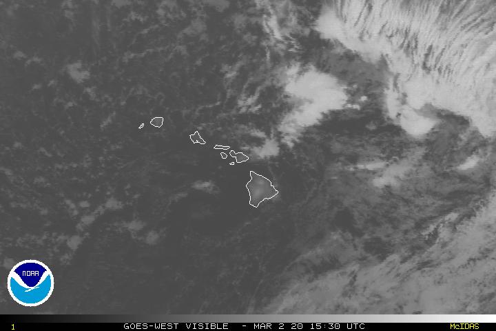
Showers locally – Looping radar image
Small Craft Advisory…coasts and channels statewide
Gale Warning…Pailolo and Alenuihaha Channels, Big Island leeward and southeast waters
High Surf Advisory…North and west shores of Kauai, Oahu, Molokai, and north shores of Maui and the
Big Island, and east shores of Kauai, Oahu, Molokai, Maui and the Big Island
Wind Advisory…Maui County and the Big Island / 25-35 with gusts over 50 mph
~~~ Hawaii Weather Narrative ~~~
Trade winds remain active over the state…which will continue through this work week. Here’s the latest weather map, showing a moderately strong high pressure system northeast of Hawaii, with an associated ridge of high pressure running westward from its center…crossing the International Dateline. As a result, the trade winds will be our primary weather influence this week, which are expected to remain blustery into Tuesday. This windy episode will finally ease around the middle of the week, although the trade winds are expected to continue unabated through the remainder of 2016. Looking ahead, this would help to ventilate the New Year’s Eve fireworks smoke away.
Our Hawaii weather will remain rather placid…except for the locally gusty winds. The outlook calls for the current trade wind weather pattern to continue, along with the normal windward showers through Tuesday. This prolonged trade wind weather pattern will likely last through the end of the year, with a cold frontal cloud band or two…knocking on our front door along the way. As far as any organized cloud bands on the horizon, the best bet seems to be showers increasing from a weak band around Wednesday, and then increased windward showers again during the New Years holiday weekend.
Marine environment details: The large northwest swell is expected to slowly decline tonight and Monday. A High Surf Warning remains active for north facing shores of most of the smaller islands, along with some west facing shores. A High Surf Advisory is in effect for a couple more west shores and north facing shores of the Big Island. Finally, a High Surf Advisory is in effect for exposed east facing shores due to the strong trade winds across the state. Shores under the warning tonight will likely fall to advisory levels by Monday morning.
As mentioned, strong trade winds persist across the state, due to a strong high pressure system passing north of the area. These winds will likely maintain through Tuesday, with a possible slight decline Tuesday night. However, the trades are likely to strengthen again during the second half of the work week. For now, a Gale Warning is in effect for the Pailolo and Alenuihaha Channels and waters south of the Big Island. A Small Craft Advisory (SCA) is in effect for the remaining waters.
Looking ahead, a moderate northwest swell will arrive Monday night, and continue into Wednesday morning. Another large north swell may impact the state around Thursday night.
Headline weather issue…blustery trade winds
World-wide tropical cyclone activity…with storms showing up when active
![]()
>>> Atlantic Ocean: The 2016 hurricane season has ended
Here’s a satellite image of the Atlantic Ocean
>>> Caribbean: The 2016 hurricane season has ended
>>> Gulf of Mexico: The 2016 hurricane season has ended
Here’s a satellite image of the Caribbean Sea…and the Gulf of Mexico
Here’s the link to the National Hurricane Center (NHC)
>>> Eastern Pacific: The 2016 hurricane season has ended
Here’s a wide satellite image that covers the entire area between Mexico, out through the central Pacific…to the International Dateline.
Here’s the link to the National Hurricane Center (NHC)
>>> Central Pacific: The 2016 hurricane season has ended
Here’s the NOAA 2016 Hurricane Season Summary for the Central Pacific Basin
Here’s a link to the Central Pacific Hurricane Center (CPHC)
Typhoon 30W (Nock-ten) is in the South China Sea. Here’s the JTWC graphical track map, with a satellite image…and what the computer models are showing.
>>> South Pacific Ocean: No active tropical cyclones
>>> North and South Indian Oceans / Arabian Sea: No active tropical cyclones
Here’s a link to the Joint Typhoon Warning Center (JTWC)
Interesting Researchers Found Local Experiences and Temperatures Drive Belief or Non-Belief in Climate Change – A new study finds local weather may play an important role in Americans’ belief in climate change. The study, published on Monday, found that Americans’ belief that the earth is warming is related to the frequency of weather-related events they experience, suggesting that local changes in their climate influence their acceptance of this worldwide phenomenon.
The researchers found that Americans who experience more record highs than lows in temperature are more likely to believe the earth is warming. Conversely, Americans who live in areas that have experienced record low temperatures, such as southern portions of Ohio and the Mississippi River basins, are more skeptical that the earth is warming.
The study notes that part of this dichotomy may be because of the early terminology used to describe climate change that suggested the earth was simply warming – not changing in innumerable but measurable ways. This might have led residents living in areas that experienced an unusually cold winter to doubt that climate change is occurring.
“Who do Americans trust about climate change; scientists or themselves?” said Robert Kaufmann, professor in the department of geography and the Center for Energy & Environmental Studies at Boston University and lead author of the paper. “For many Americans, the answer seems to be themselves.”
The researchers also found that a recent period of lower-than-average temperatures offset the effect of a long warming period, further supporting their findings that people’s belief in climate change is local and experiential.
The scientists note the importance of differentiating between weather, the temperatures of a relatively short period of time such as a season, and climate, the average temperatures over a period of 25 or 30 years. Emphasizing the difference between weather and climate may help scientists more effectively communicate about climate change.
The paper, “The Spatial Heterogeneity of Climate Change: An Experiential Basis for Skepticism,” was published in Proceedings National Academy of Sciences.


 Email Glenn James:
Nancy Says:
Mele Kalikimaka, and mahalo nui for the gift of this narrative all year long!
Nancy
~~~ Hi Nancy, thank you so much for your well wishes, all the way from Sebastopol, Sonoma County, California. This Narrative gift is yours for the taking…just the way it should be.
Aloha, Glenn
Eleanor Schofield Says:
Merry Christmas, Happy Hannukah, and best wishes to all!
Thank you so much, Glenn, for all your work and keeping us informed. Love those van Gogh-like wind patterns over the Pacific!
Eleanor in Hilo
~~~ Hi Eleanor, and season’s greetings back to you!
You are so welcome, I love doing the work it takes to keep this website up-to-date. I suppose that might be clear, as I’ve been doing it since 1996…which amazes me! No, it doesn’t seem like just yesterday that I began, and as a matter of fact, it seems like a very long time ago in actuality!
Ah yes, the wind profile, it’s such a great tool/art piece!
Aloha, Glenn
Sandra J Says:
Merry Christmas Glenn!! Wishing a day of joy and merriment, and hope 2017 is full of love and laughter. Thank you for all that you do. You are my “go to” for all my weather interests, or concerns. Thank you for kick starting my interest in all things weather related. I am able to get a picture of what is coming our way, on Vancouver Island, B.C., Canada, from your website. Again, thank you for all your hard work. It is very much appreciated. Merry Christmas!!
~~~ Hi Sandra, what a nice comment to read on this Christmas morning…thank you for your heartfelt words!
Looking at the webcam picture of Vancouver right now, I see clear skies, with just those mild mannered gray clouds out to the west (http://www.katkam.ca/pic.aspx). Looks like a nice Christmas Day to me. The temperature was 34F degrees at around 9am HST…which I think is around 11am up your way.
I love keeping this website updated, for you certainly, and for all the rest of my wonderful readers too!
Aloha, Glenn
woody adamz Says:
Hoe, Hoe, Hoe..If you have a garden…At any rate…MeleKalikiMaka….and, Much Gratitude for The Best Weather Site in Havai’i Nei…and say hi to that Sand Santa ???? and helpers for me k?….ALOHA!
~~~ Hi Woody, good hearing from you on this Christmas morning! Thanks very much for your Merry Christmas wishes, and for your good humor too!
I’ll give a shaka to those sand Santa’s…and his helpers too.
Have ah good day Woody!
Aloha, Glenn
Mary Says:
Merry Christmas to you and to your family! Thank you for this website. I really appreciate the work that you do to create and update the site. Merry Christmas to your Mom too.
~~~ Hi Mary, how nice of you, thanks for your Merry Christmas wishes! My Mom will appreciate you mentioning her as well, I know she will! Let me thank you for her right now.
As for the weather work I do, thank you for that too, it’s such a pleasure…and gives my life meaning as well.
Aloha, Glenn