


Air Temperatures – The following maximum temperatures (F) were recorded across the state of Hawaii Thursday…along with the low temperatures Thursday:
80 – 71 Lihue, Kauai
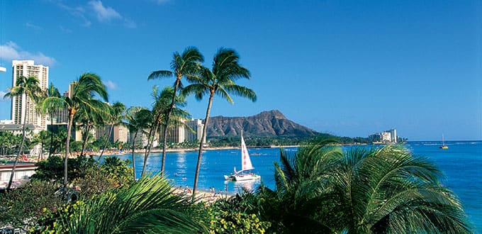
80 – 70 Honolulu, Oahu
82 – 66 Kahului AP, Maui
82 – 70 Kailua Kona AP
77 – 68 Hilo AP, Hawaii
Here are the latest 24-hour precipitation totals (in inches) for each of the islands as of Thursday evening:
2.92 Mount Waialeale, Kauai
1.55 Manoa Lyon Arboretum, Oahu
0.48 Molokai
0.06 Lanai
0.03 Kahoolawe
1.43 West Wailuaiki, Maui
2.08 Saddle Quarry, Big Island
The following numbers represent the strongest wind gusts (mph) as of Thursday evening:
15 Port Allen, Kauai
31 Oahu Forest NWR, Oahu
23 Molokai
22 Lanai
35 Kahoolawe
22 Kahului AP, Maui
28 South Point, Big Island
Here’s a wind profile of the Pacific Ocean – Closer view of the islands
Hawaii’s Mountains – Here’s a link to the live webcam on the summit of our tallest mountain Mauna Kea (nearly 13,800 feet high) on the Big Island of Hawaii. This webcam is available during the daylight hours here in the islands, and at night whenever there’s a big moon shining down. Also, at night you will be able to see the stars — and the sunrise and sunset too — depending upon weather conditions.
Aloha Paragraphs

High pressure to our northeast will dominate our local weather, with a cold front northwest…which will approach us, although won’t reach the islands

The cold front northwest…with thunderstorms far south

Partly cloudy in general…windward showers locally

Showers locally…nothing unusual – Looping radar image
Small Craft Advisory…windiest coasts and channels around Maui County and the Big Island
~~~ Hawaii Weather Narrative ~~~
Trade winds remain active over the state…which will continue into the Christmas Holiday weekend and beyond. Here’s the latest weather map, showing moderately strong high pressure systems located to our northeast and north. At the same time, we have a storm low pressure system far offshore to the northwest of the state. This low will push a cold front closer to the state, prompting our winds to falter a little, shifting to the east-southeast or even southeast. If the winds veer all the way around to the southeast, we could have a brief bout of volcanic haze over the smaller islands into Saturday. Otherwise, the trade winds will be the primary weather influence well into the future, and are expected to become locally strong and gusty Christmas Eve into next week.
We’re involved with a typical, very early winter trade wind weather pattern…which will likely hold firm through the end of the year. Satellite imagery shows that we have some windward showers falling locally, which will continue to be the case. The outlook for the Christmas Holiday weekend shows that this trade wind weather pattern will remain in charge, along with somewhat less than normal periods of windward showers…continuing into next week. The one slight interruption will be a cold front approaching the state, although other than knocking our trade winds down a notch Friday into Saturday, won’t have much of an influence. This prolonged trade wind weather pattern will likely last through the end of the year, or at least well into next week.
Marine environment details: The north-northwest swell will gradually diminish today. A new northwest swell, generated by a powerful low pressure system northwest of the islands, is expected by the weekend, although model guidance has been inconsistent in predicting the swell…which will arrive in Hawaiian waters Saturday night through Sunday night. Surf heights will certainly be large enough to warrant a high surf advisory for exposed north and west facing shores, and peak surf heights could reach warning levels along north facing shores. Increasing trade winds late this weekend and early next week will bring high surf to our windward shores.
A new high pressure system building northwest and north of the islands, will bring increasing trade winds over the weekend that will last into early next week…with gale force winds possible in some zones. This could continue into Tuesday before winds ease slightly.
Our weather will remain favorably inclined…leading to a windy although relatively dry Christmas Day
World-wide tropical cyclone activity…with storms showing up when active
![]()
>>> Atlantic Ocean: The 2016 hurricane season has ended
Here’s a satellite image of the Atlantic Ocean
>>> Caribbean: The 2016 hurricane season has ended
>>> Gulf of Mexico: The 2016 hurricane season has ended
Here’s a satellite image of the Caribbean Sea…and the Gulf of Mexico
Here’s the link to the National Hurricane Center (NHC)
>>> Eastern Pacific: The 2016 hurricane season has ended
Here’s a wide satellite image that covers the entire area between Mexico, out through the central Pacific…to the International Dateline.
Here’s the link to the National Hurricane Center (NHC)
>>> Central Pacific: The 2016 hurricane season has ended
Here’s the NOAA 2016 Hurricane Season Summary for the Central Pacific Basin
Here’s a link to the Central Pacific Hurricane Center (CPHC)
Typhoon 30W (Nock-ten) remains active over the Philippine Sea headed towards the Philippines and Manila. Here’s the JTWC graphical track map, with a satellite image…and what the computer models are showing.
>>> South Pacific Ocean: No active tropical cyclones
>>> North and South Indian Oceans / Arabian Sea:
Tropical Cyclone 02S (Yvette) remains active in the South Indian Ocean, headed towards the NW coast of Australia. Here’s the JTWC graphical track map, with a satellite image…and what the computer models are showing.
Here’s a link to the Joint Typhoon Warning Center (JTWC)
Interesting Researchers Found Local Experiences and Temperatures Drive Belief or Non-Belief in Climate Change – A new study finds local weather may play an important role in Americans’ belief in climate change. The study, published on Monday, found that Americans’ belief that the earth is warming is related to the frequency of weather-related events they experience, suggesting that local changes in their climate influence their acceptance of this worldwide phenomenon.
The researchers found that Americans who experience more record highs than lows in temperature are more likely to believe the earth is warming. Conversely, Americans who live in areas that have experienced record low temperatures, such as southern portions of Ohio and the Mississippi River basins, are more skeptical that the earth is warming.
The study notes that part of this dichotomy may be because of the early terminology used to describe climate change that suggested the earth was simply warming – not changing in innumerable but measurable ways. This might have led residents living in areas that experienced an unusually cold winter to doubt that climate change is occurring.
“Who do Americans trust about climate change; scientists or themselves?” said Robert Kaufmann, professor in the department of geography and the Center for Energy & Environmental Studies at Boston University and lead author of the paper. “For many Americans, the answer seems to be themselves.”
The researchers also found that a recent period of lower-than-average temperatures offset the effect of a long warming period, further supporting their findings that people’s belief in climate change is local and experiential.
The scientists note the importance of differentiating between weather, the temperatures of a relatively short period of time such as a season, and climate, the average temperatures over a period of 25 or 30 years. Emphasizing the difference between weather and climate may help scientists more effectively communicate about climate change.
The paper, “The Spatial Heterogeneity of Climate Change: An Experiential Basis for Skepticism,” was published in Proceedings National Academy of Sciences.
GARY MORSE Says:
Hi Glenn
My wife found your site a few years back. We are winter residents (Kihei) we start each day with a check of your weather
site I find the wind profile fascinating. Its also a great tool for us to get accurate info when we are off island in the summer(Colorado Rockies) also like the articles You put up.
Thanks for you hard work!
Gary & Lynne
~~~ Hi Gary and Lynne, from down there in warm and dry Kihei. I’m glad Lynne found my website, and you put it to good use while you’re here.
Indeed, the near real time wind profile is a fun tool, no matter where you are in the world.
Glad too that you find the articles that I post, interesting.
Hard work, I’m not sure about how hard it is, although I appreciate your acknowledging the time and effort that it takes to keep this site updated.
Enjoy your long vacation here, and also the fascinating weather you have there in the mountains of Colorado too.
Happy Holiday’s
Aloha, Glenn