


Air Temperatures – The following maximum temperatures (F) were recorded across the state of Hawaii Thursday…along with the minimums Thursday:
79 – 61 Lihue, Kauai
81 – 67 Honolulu, Oahu
84 – 63 Molokai AP
85 – 63 Kahului AP, Maui
84 – 67 Kailua Kona
84 – 68 Hilo AP, Hawaii
Here are the latest 24-hour precipitation totals (inches) for each of the islands, as of Thursday evening:
0.01 N Wailua Ditch, Kauai
0.02 Poamoho RG 1, Oahu
0.00 Molokai
0.00 Lanai
0.00 Kahoolawe
0.00 Maui
0.17 Saddle Quarry, Big Island
The following numbers represent the strongest wind gusts (mph)…as of Thursday evening:
12 Puu Opae, Kauai – SSW
14 Waianae Valley, Oahu – SSW
16 Molokai – ENE
18 Lanai – NE
25 Kahoolawe – NE
12 Kaupo Gap, Maui – SE
20 Upolu AP, Big Island – NE
Hawaii’s Mountains – Here’s a link to the live web cam on the summit of near 13,800 foot Mauna Kea on the Big Island of Hawaii. This web cam is available during the daylight hours here in the islands…and when there’s a big moon shining down during the night at times. Plus, during the nights you will be able to see stars, and the sunrise and sunset too…depending upon weather conditions.
Aloha Paragraphs

A gale low pressure over the ocean to the northeast…
with a trailing cold front

Scattered clouds…with high cirrus to the southwest –
and yet another cold front north and northwest

Clear…with partly to mostly cloudy areas

Just a few showers falling…mostly around the eastern islands
looping radar image
There was a 4.2 magnitude earthquake 70 miles north of Hilo, Hawaii
Thursday night…which I definitely felt here on Maui – no tsunami
~~~ Hawaii Weather Narrative ~~~
Light breezes into Friday morning, along with localized volcanic haze…then returning trade winds later Friday into the weekend. Here’s the latest weather map, showing the Hawaiian Islands, and the rest of the North Pacific Ocean. We find high pressure systems far to the northeast and just to the west of Hawaii…with an associated ridge over the central islands. Finally, we see a low pressure system not far to our north, which is moving eastward…along with a trailing cold front. Our local winds will remain light, as this ridge of high pressure is draped across the state for the time being. We’ll end up with light to moderately strong trade winds later Friday, becoming moderately strong through the weekend. An approaching cold front early next week will likely cause our winds to veer to the southeast Monday…which in turn may bring volcanic haze back over us again then. The models go on to suggest gusty trade winds arriving around next Tuesday, in the wake of the frontal passage.
Here’s a wind profile…of the offshore waters around the islands – with a closer view
Here’s the Hawaiian Islands Sulfate Aerosol…animated graphic – showing vog forecast
Generally fair weather…continuing through the rest of this week. The outlook shows mostly dry weather during this second half of the week, with fairly routine windward showers at times through the weekend, as the trade winds return then. The leeward sides should have nice weather during this extended forecast period, with few showers if any…and lots of daytime sunshine. The longer range models show the chance of another spring time cold front approaching the islands early next week. This looks to be yet another of our many weak cold fronts this year so far, and there’s a chance that it may stall just to the northwest of Kauai…although it may have enough push to reach into the state later Tuesday into Wednesday. Either way, the gusty trade winds will carry some windward showers our way for a couple days thereafter.
Marine environment details: The current large west-northwest swell impacting Hawaii will decline. Surf heights generated by this swell will be large enough to keep the high surf advisory going through 6am Friday…for most of the north and west facing shores. The surf is expected to fall below advisory conditions fro all shores by morning.
Strengthening trade winds are expected to reach advisory criteria in the windiest marine zones around Maui County and the Big Island beginning as early as Friday evening…continuing through the weekend. Trade winds are then expected to diminish below advisory speeds on Monday. After the current swell declines, no major swells are expected through the middle of next week.
Lowering surf along all coasts of Hawaii
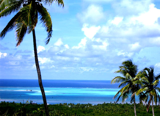
Here in Maui County…It’s clear and calm in upcountry Kula early this Thursday morning…with an air temperature 45.6F degrees. Meanwhile, the volcanic haze is still with us today. The temperature at nearly the same time was 65 degrees down in Kahului under cloudy skies, 68 out in Hana, 66 at Maalaea Bay, and 43 atop the Haleakala summit. Meanwhile, Kahoolawe was 64 degrees, 64 at Lanai City, with 66 at the Molokai airport. According to satellite imagery, there are cloudy areas, with a few showers falling along our windward coasts and slopes before sunrise. / Late morning, clear to partly cloudy, although the clouds around the mountains are definitely adding up…and the volcanic haze is increasing.
– Early afternoon, with clouds stacking up over and around the mountains, and stretching down towards the beaches locally. The vog is thick, and becoming thicker at each glance I take down into the central valley.
– Early evening, as the clouds of the afternoon are already beginning to evaporate. As has been the case all day, the volcanic haze is still definitely with us. I anticipate that these thinning clouds will give way to mostly clear skies as we head into the early morning hours Friday. As the winds remain on the light side, we’ll have another relatively chilly morning Friday as well.
World-wide tropical cyclone activity:
>>> Atlantic Ocean: The last regularly scheduled Tropical Weather Outlook of the 2015 Atlantic hurricane season…has occurred. Routine issuance of the Tropical Weather Outlook will resume on June 1, 2016. During the off-season, Special Tropical Weather Outlooks will be issued if conditions warrant. Here’s the 2015 hurricane season summary
Here’s a satellite image of the Atlantic Ocean
>>> Caribbean Sea: The last regularly scheduled Tropical Weather Outlook of the 2015 Atlantic hurricane season…has occurred. Routine issuance of the Tropical Weather Outlook will resume on June 1, 2016. During the off-season, Special Tropical Weather Outlooks will be issued if conditions warrant.
>>> Gulf of Mexico: The last regularly scheduled Tropical Weather Outlook of the 2015 Atlantic hurricane season…has occurred. Routine issuance of the Tropical Weather Outlook will resume on June 1, 2016. During the off-season, Special Tropical Weather Outlooks will be issued if conditions warrant.
Here’s a satellite image of the Caribbean Sea…and the Gulf of Mexico
Here’s the link to the National Hurricane Center (NHC)
>>> Eastern Pacific: The last regularly scheduled Tropical Weather Outlook of the 2015 North Pacific hurricane season…has occurred. Routine issuance of the Tropical Weather Outlook will resume on May 15, 2016. During the off-season, Special Tropical Weather Outlooks will be issued if conditions warrant. Here’s the 2015 hurricane season summary
Here’s a wide satellite image that covers the entire area between Mexico, out through the central Pacific…to the International Dateline.
Here’s the link to the National Hurricane Center (NHC)
>>> Central Pacific: The central north Pacific hurricane season has officially ended. Routine issuance of the tropical weather outlook will resume on June 1, 2016. During the off-season, special tropical weather outlooks will be issued if conditions warrant. Here’s the 2015 hurricane season summary
Here’s a link to the Central Pacific Hurricane Center (CPHC)
>>> South Pacific Ocean: No active tropical cyclones
>>> North and South Indian Oceans / Arabian Sea: No active tropical cyclones
Here’s a link to the Joint Typhoon Warning Center (JTWC)
Interesting: Severe water stress likely in Asia by 2050 – Economic and population growth on top of climate change could lead to serious water shortages across a broad swath of Asia by the year 2050, a newly published study by MIT scientists has found.
The study deploys detailed modeling to produce what the researchers believe is a full range of scenarios involving water availability and use in the future. In the paper, the scientists conclude there is a “high risk of severe water stress” in much of an area that is home to roughly half the world’s population.
Having run a large number of simulations of future scenarios, the researchers find that the median amounts of projected growth and climate change in the next 35 years in Asia would lead to about 1 billion more people becoming “water-stressed” compared to today.
And while climate change is expected to have serious effects on the water supply in many parts of the world, the study underscores the extent to which industrial expansion and population growth may by themselves exacerbate water-access problems.
“It’s not just a climate change issue,” says Adam Schlosser, a senior research scientist and deputy director at MIT’s Joint Program on the Science and Policy of Global Change and a co-author of the study. “We simply cannot ignore that economic and population growth in society can have a very strong influence on our demand for resources and how we manage them. And climate, on top of that, can lead to substantial magnifications to those stresses.”
The paper, “Projections of Water Stress Based on an Ensemble of Socioeconomic Growth and Climate Change Scenarios: A Case Study in Asia,” is being published in the journal PLOS One. The lead author is Charles Fant, a researcher at the Joint Program. The other co-authors are Schlosser; Xiang Gao and Kenneth Strzepek, who are also researchers at the Joint Program; and John Reilly, a co-director of the Joint Program who is a senior lecturer at the MIT Sloan School of Management.
Teasing out human and environmental factors
To conduct the study, the scientists built upon an existing model developed previously at MIT, the Integrated Global Systems Model (IGSM), which contains probabilistic projections of population growth, economic expansion, climate, and carbon emissions from human activity. They then linked the IGSM model to detailed models of water use for a large portion of Asia encompassing China, India, and many smaller nations.
The scientists then ran an extensive series of repeated projections using varying conditions. In what they call the “Just Growth” scenario, they held climate conditions constant and evaluated the effects of economic and population growth on the water supply. In an alternate “Just Climate” scenario, the scientists held growth constant and evaluated climate-change effects alone. And in a “Climate and Growth” scenario, they studied the impact of rising economic activity, growing populations, and climate change.
Approaching it this way gave the researchers a “unique ability to tease out the human [economic] and environmental” factors leading to water shortages and to assess their relative significance, Schlosser says.
This kind of modeling also allowed the group to assess some of the particular factors that affect the different countries in the region to varying extents.
“For China, it looks like industrial growth [has the greatest impact] as people get wealthier,” says Fant. “In India, population growth has a huge effect. It varies by region.”
The researchers also emphasize that evaluating the future of any area’s water supply is not as simple as adding the effects of economic growth and climate change, and it depends on the networked water supply into and out of that area. The model uses a network of water basins, and as Schlosser notes, “What happens upstream affects downstream basins.” If climate change lowers the amount of rainfall near upstream basins while the population grows everywhere, then basins farther away from the initial water shortage would be affected more acutely.
Future research directions
Other scholars who have examined the work say it makes a valuable contribution to the field.
“They’re looking at a really important issue for the world,” says Channing Arndt, an agricultural economist at the United Nations’ World Institute for Development Economics Research, who thinks that the basic finding of the study “makes sense.”
Arndt also believes that the ambitious scope of the study, and the way it evaluates the effects of climate change as well as economic and population growth, is a worthwhile approach. “Doing it in this integrated way is the right way to go about it,” he adds.
The research team is continuing to work on related projects, including one on the effects of mitigation on water shortages. While those studies are not finished, the researchers say that changing water-use practices can have significant effects.
“We are assessing the extent to which climate mitigation and adaptation practices — such as more efficient irrigation technologies — can reduce the future risk of nations under high water stress,” Schlosser says. “Our preliminary findings indicate strong cases for effective actions and measures to reduce risk.”
The researchers say they will continue to look at ways of fine-tuning their modeling in order to refine their likelihood estimates of significant water shortages in the future.
“The emphasis in this work was to consider the whole range of plausible outcomes,” Schlosser says. “We consider this an important step in our ability to identify the sources of changing risk and large-scale solutions to risk reduction.”