


Air Temperatures – The following maximum temperatures (F) were recorded across the state of Hawaii Sunday…along with the minimum temperatures Sunday:
79 – 67 Lihue, Kauai
82 – 65 Honolulu, Oahu
81 – 54 Molokai AP
82 – 59 Kahului, Maui
82 – 67 Kailua Kona
81 – 65 Hilo, Hawaii
Here are the latest 24-hour precipitation totals (inches) for each of the islands, as of Sunday evening:
0.18 Anahola, Kauai
0.01 Ahuimanu Loop, Oahu
0.01 Molokai
0.00 Lanai
0.00 Kahoolawe
0.00 Maui
0.24 Pahala, Big Island
The following numbers represent the strongest wind gusts (mph)…as of Sunday evening:
14 Port Allen, Kauai – SE
14 Kahuku, Oahu – ENE
18 Molokai – ESE
18 Lanai – NE
23 Kahoolawe – ENE
18 Kapalua, Maui – NE
20 South Point, Big Island – NE
Hawaii’s Mountains – Here’s a link to the live web cam on the summit of near 13,800 foot Mauna Kea on the Big Island of Hawaii. This web cam is available during the daylight hours here in the islands…and when there’s a big moon shining down during the night at times. Plus, during the nights you will be able to see stars, and the sunrise and sunset too… depending upon weather conditions.
Aloha Paragraphs

Clear to partly cloudy across the state…higher clouds
to the northeast and northwest

Clear conditions over Kauai and Oahu…some
clouds over the Big Island and Maui

A few showers around the eastern islands…although
mostly dry elsewhere
~~~ Hawaii Weather Narrative ~~~
High Surf Advisory…most north and west shores
Light trade winds, becoming light and variable again later Monday onwards…with more volcanic haze. Here’s the latest weather map, showing the Hawaiian Islands, and the rest of the North Pacific Ocean, along with a real-time wind profiler of the central Pacific. We find high pressure systems to the northeast…with ridges stretched back towards the southwest. At the same time, we have low pressure systems far to the north and northwest, with the tail-end of a dissipating cold front to the northeast of the state. The volcanic haze (vog) continues, even with the light trade winds blowing. Light and variable winds again soon through mid-week. This will keep volcanic haze around in many parts of the state. Thereafter, a strong cold front will approach the state, bringing gusty southwest winds later Thursday into Saturday. Typically, these kinds of cold fronts can usher in chilly weather for a day or two in their wake, followed by strong and gusty trade winds…stay tuned.
Rainfall will be generally absent over most of Kauai, Oahu and Maui County…with a few light showers along the windward side of the Big Island. Here’s the looping radar image showing very few showers across our area…with most areas remain bone dry. Light winds and dry weather should prevail through the first half of the new week. There will be clear to partly cloudy mornings, giving way to cloudy conditions along the slopes during the afternoons. These upcountry clouds won’t be doing much shower producing however, and likely remain dry through the first half of the week. Showers will likely begin arriving along our leeward sides, brought by strengthening southwest kona winds beginning later Thursday or early Friday. The stronger cold front anticipated to arrive Friday and Saturday, will bring potentially heavy showers, with some possible localized flooding…stay tuned. I’ll be back with more updates on all of the above, I hope you have a great Sunday night wherever you’re spending it! Aloha for now…Glenn.
Here in Kula, Maui: It’s clear here on Maui Sunday morning. The air still has a little bit of leftover volcanic haze, although I would rate it light to very light at the time of this writing. The light trade winds are helping to ventilate it away, which is a relief. The air temperature bottomed-out at 47 degrees this morning. ~~~ A late Sunday morning observation still shows mostly clear and blue skies, with some shallow clouds topping the West Maui Mountains, and a couple of cumulus puffs towards the north shores. The air temperature now at 1120am was 64.4 degrees, heading up towards the 70 degree level later today. ~~~ Now it’s late in the afternoon, under partly cloudy skies, a light breeze, with an air temperature of 70.3 degrees, and yes…there’s still vog in our atmosphere. ~~~ It’s already early evening, just before sunset, with mostly clear skies prevailing. I can see that orange color in the sky, which means the last rays of the day are lighting up the volcanic haze. Speaking of the air, the temperature at 605pm was cooling off quickly…reading 62.4 degrees. ~~~ It’s now dark at 835pm, under clear skies, with lots of stars, with our temperature taking a nose dive to 53.8 degrees…which will dip into the 40’s again tonight.
~~~ Here’s an interesting youtube video…called How Whales Change Climate
Friday Evening Film: Once again there were many new films that I was interested in seeing, so I’ll let them slide by, and pick off one of the older ones I hadn’t seen yet. The one that I saw was called The Imitation Game, which several of my friends have given high marks. The stars in this film include Benedict Cumberbatch, Keira Knightley, Rory Kinnear, Matthew Beard, Allen Leech, and Tuppence Middleton…among many others. The synopsis: during the winter of 1952, British authorities entered the home of mathematician, cryptanalyst and war hero Alan Turing (Benedict Cumberbatch) to investigate a reported burglary. They instead ended up arresting Turing himself on charges of ‘gross indecency’, an accusation that would lead to his devastating conviction for the criminal offense of homosexuality – little did officials know, they were actually incriminating the pioneer of modern-day computing. Famously leading a motley group of scholars, linguists, chess champions and intelligence officers, he was credited with cracking the so-called unbreakable codes of Germany’s World War II Enigma machine. An intense and haunting portrayal of a brilliant, complicated man, THE IMITATION GAME follows a genius who under nail-biting pressure helped to shorten the war and, in turn, save thousands of lives.
This film was astonishingly well done, deep and heavy, with such character, it was brilliant in my opinion. The film excelled, thanks to the quality of the acting, entertaining script, and a true story ta boot. Cumberbatch and Knightley were superb, they delivered rich performances. In the end, a machine was created to help win a war, and in the process…set the stage for the modern computers. Simply put, I am thoroughly comfortable giving it a solid A grade. I suggest you at least take a peek at what I was lucky enough to see…here’s the trailer.
World-wide tropical cyclone activity:
>>> Atlantic Ocean: The last regularly scheduled Tropical Weather Outlook of the 2014 Atlantic hurricane season…has occurred. Routine issuance of the Tropical Weather Outlook will resume on June 1, 2015. During the off-season, Special Tropical Weather Outlooks will be issued as conditions warrant.
Here’s a satellite image of the Atlantic Ocean
>>> Caribbean Sea: The last regularly scheduled Tropical Weather Outlook of the 2014 Atlantic hurricane season…has occurred. Routine issuance of the Tropical Weather Outlook will resume on June 1, 2015. During the off-season, Special Tropical Weather Outlooks will be issued as conditions warrant.
>>> Gulf of Mexico: The last regularly scheduled Tropical Weather Outlook of the 2014 Atlantic hurricane season…has occurred. Routine issuance of the Tropical Weather Outlook will resume on June 1, 2015. During the off-season, Special Tropical Weather Outlooks will be issued as conditions warrant.
Here’s a satellite image of the Caribbean Sea…and the Gulf of Mexico.
>>> Eastern Pacific: The last regularly scheduled Tropical Weather Outlook of the 2014 North Pacific hurricane season…has occurred. Routine issuance of the Tropical Weather Outlook will resume on May 15, 2015. During the off-season, Special Tropical Weather Outlooks will be issued as conditions warrant.
Here’s a wide satellite image that covers the entire area between Mexico, out through the central Pacific…to the International Dateline.
Here’s the link to the National Hurricane Center (NHC)
>>> Central Pacific: The central north Pacific hurricane season has officially ended. Routine issuance of the tropical weather outlook will resume on June 1, 2015. During the off-season, special tropical weather outlooks will be issued as conditions warrant.
Here’s a link to the Central Pacific Hurricane Center (CPHC)
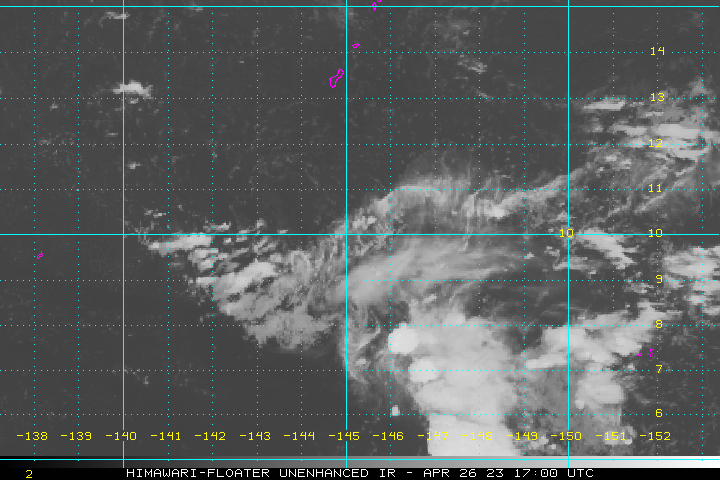
>>> Northwest Pacific Ocean: Tropical depression 01W (Mekkhala) remains active as it moves over the ocean to the east of Luzon Island. Here’s the JTWC graphical track map for this weakening tropical system. Here’s the NOAA satellite image of this system.
>>> South Pacific Ocean: There are no active tropical cyclones
>>> North and South Indian Oceans: Tropical cyclone 05S (Bansi) is now dissipating in the south Indian Ocean. Here’s the JTWC graphical track map for this weakening tropical cyclone. Here’s the NOAA satellite image of this system…over the open ocean away from any islands – Final Warning
Here’s a link to the Joint Typhoon Warning Center (JTWC)
Interesting: How does rain cause that earthy odor? – Ever notice an earthy smell in the air after a light rain? Now scientists at MIT believe they may have identified the mechanism that releases this aroma, as well as other aerosols, into the environment.
Using high-speed cameras, the researchers observed that when a raindrop hits a porous surface, it traps tiny air bubbles at the point of contact. As in a glass of champagne, the bubbles then shoot upward, ultimately bursting from the drop in a fizz of aerosols.
The team was also able to predict the amount of aerosols released, based on the velocity of the raindrop and the permeability of the contact surface.
The researchers suspect that in natural environments, aerosols may carry aromatic elements, along with bacteria and viruses stored in soil. These aerosols may be released during light or moderate rainfall, and then spread via gusts of wind.
“Rain happens every day — it’s raining now, somewhere in the world,” says Cullen R. Buie, an assistant professor of mechanical engineering at MIT. “It’s a very common phenomenon, and it was intriguing to us that no one had observed this mechanism before.”
Youngsoo Joung, a postdoc in Buie’s lab, adds that now that the group has identified a mechanism for raindrop-induced aerosol generation, the results may help to explain how certain soil-based diseases spread.
“Until now, people didn’t know that aerosols could be generated from raindrops on soil,” Joung says. “This finding should be a good reference for future work, illuminating microbes and chemicals existing inside soil and other natural materials, and how they can be delivered in the environment, and possibly to humans.”