


Air Temperatures – The following maximum temperatures were recorded across the state of Hawaii Friday afternoon:
Lihue, Kauai – 78
Honolulu airport, Oahu – 81
Molokai airport – 80
Kahului airport, Maui – 80
Kona airport – 81
Hilo airport, Hawaii – 79
Air Temperatures ranged between these warmest and coolest spots near sea level – and on the highest mountain tops around the state…as of 110pm Saturday afternoon:
Honolulu, Oahu – 81
Hana, Maui- 77
Haleakala Summit – 48 (near 10,000 feet on Maui)
Mauna Kea Summit – 36 (near 13,800 feet on the Big Island)
Hawaii’s Mountains – Here’s a link to the live web cam on the summit of near 13,800 foot Mauna Kea on the Big Island of Hawaii. This web cam is available during the daylight hours here in the islands…and when there’s a big moon shining down during the night at times. Plus, during the nights you will be able to see stars, and the sunrise and sunset too…depending upon weather conditions. Here's the Haleakala Crater webcam on Maui.
Tropical Cyclone activity in the eastern and central Pacific – Here’s the latest weather information coming out of the National Hurricane Center, covering the eastern north Pacific. You can find the latest tropical cyclone information for the central north Pacific (where Hawaii is located) by clicking on this link to the Central Pacific Hurricane Center. A satellite image, which shows the entire ocean area between Hawaii and the Mexican coast…can be found here. The 2012 hurricane season is over in the eastern and central Pacific…resuming on May 15th and June 1st 2013.
Aloha Paragraphs
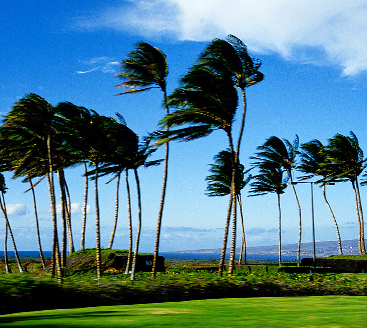
Blustery trade winds…well into the future
Clear to partly cloudy, cloudy periods, some
passing showers at times windward sides…
a few along the leeward sides here and there
Small craft wind advisory all marine zones
High surf advisory for east shores of all islands
Wind advisory for strong easterly winds atop
the Haleakala summit on Maui
The following numbers represent the most recent top wind gusts (mph), along with directions as of Saturday afternoon:
30 Lihue, Kauai – ENE
43 Kahuku Trng, Oahu – E
35 Molokai – ENE
47 Kahoolawe – NE
36 Kahului, Maui – NE
32 Lanai – NE
45 South Point, Big Island – NE
Here are the latest 24-hour precipitation totals (inches) for each of the islands as of Saturday morning:
0.87 Mount Waialeale, Kauai
0.39 Tunnel RG, Oahu
0.20 Molokai
0.00 Kahoolawe
0.50 Puu Kukui, Maui
0.73 Kawainui Stream, Big Island
We can use the following links to see what’s going on in our area of the north central Pacific Ocean. Here's the latest NOAA satellite picture – the latest looping satellite image…and finally the latest looping radar image for the Hawaiian Islands.
~~ Hawaii weather commentary ~~
Strong and gusty trade winds will continue to blow this weekend…continuing on into the new week ahead. We currently have a near 1031 millibar high pressure system (weather map), located to the north-northeast of Hawaii this afternoon. We find strong and gusty winds starting off our day today. As has been the case during the last week, winds in gusts, will reach up above the 40 mph mark on many of the islands. Already this morning before sunrise, there was a gust all the way up to 48 mph on the small, windy island of Kahoolawe, with the small island of Lanai not far behind…at 42 mph. This afternoon, the winds have remained uppity, with gusts up into the middle to upper 40 mph range.
The high pressure system, again running about 1031 millibars, will be pumped-up to 1040 millibars right after the weekend…boosting trade wind speeds a notch in the process. The wind advisory today has been pared back, now covering only the Haleakala summit here on Maui. If the trades accelerate again after this weekend as expected, we'll likely see this rather unusual advisory covering more ground then. This unseasonably strong spell of blustery trade winds, really doesn't have an end point yet. So, look for more windy to very windy weather circumstances holding on well into the future. This means more of those 40 to near 50 mph gusts…running rampant across our typically windiest places in the state.
As for precipitation, there will be some, primarily along our windward sides, and over the lower mountains on the smaller islands…with a few stretching over into the leeward sides through Sunday. Further ahead, the models show some increase in showers for our windward sides generally in the Monday through Wednesday time frame. This will be the result of an old cold front bringing moisture into the state on the gusty trade wind flow. Here's a satellite image, showing quite a steady stream of low clouds arriving along our windward coasts and slopes, although with nice gaps at times too. Our overriding atmosphere remains quite dry and stable however, so not all that much precipitation is expected.
We'll see lots of sunshine along our leeward beaches today, with good weather continuing there…albeit on the windy side. We'll find those occasional showers arriving along our windward coast at times, although with clear periods too. At this point, the weekend looks good from a weather perspective, with no major changes in our current trade wind weather pattern, well into the new work week ahead. The main thing, as I've been talking/writing about over the last week, of course is the exceptionally windy weather conditions we've been dealing with. The islands are used to the trade winds, its just their strong and gusty nature of late, reaching up into the 40+ mph range for so long.
Tis the season: this past Thursday evening I attended the Pacific Disaster Center's Christmas holiday get together…my part time day job, where I've worked for the last 17 years. Then last evening I had dinner with a friend in Kahului, and went to the see the film I wrote about below. This evening I have a friend's birthday party to go to in Haiku, which is being billed as a dance party. ~~~ The general mood here in Hawaii, and across the whole country, and even the world…is rather dire now! This has happened despite the holiday season, what with the terrible shooting there in Connecticut. There's so much being reported about this very sad and senseless situation, more than enough it seems. So, I'll just add that I feel a deep sadness too, for not only all those innocent kids, their parents, the friends and families, and actually…all of us have taken this news on the chin so to speak! I'll catch up with you again on Sunday morning. Aloha for now…Glenn.
Extra: cute youtube video…of an active cat -2
Friday evening film: I decided to see the new film called Lincoln, starring Daniel Day-Lewis, Sally Field, Tommy Lee Jones, Joseph Gordon-Levitt, Gloria Reuben…among many many others. The synopsis: In a nation divided by war and the strong winds of change, Lincoln pursues a course of action designed to end the war, unite the country and abolish slavery. With the moral courage and fierce determination to succeed, his choices during this critical moment will change the fate of generations to come. This film has received good reviews from the critics, and is being billed as a drama, biopic, adaptation. ~~~ It was a long film, running 2 hours and 30 minutes. I found it be a bit slow during the first half, and then it picked up some thereafter. I must admit that I wasn't planning on seeing this film, and at the last minute decided to give it a chance. I'm glad I did see it, although it wasn't my favorite film of the year by any means. I appreciated the great acting, which was the best part for me. As for a grade, I think it deserved a solid B, although short of a B+ in my opinion. It may just be that it wasn't my cup of tea in terms of films. At any rate, here's the trailer…so you can take a peek yourself.
World-wide tropical cyclone activity:
Atlantic Ocean/Caribbean Sea: There are no active tropical cyclones
Gulf of Mexico: There are no active tropical cyclones
Eastern Pacific Ocean: There are no active tropical cyclones
Central Pacific Ocean: There are no active tropical cyclones
Western Pacific Ocean: There are no active tropical cyclones
South Pacific Ocean: Tropical cyclone Evan (04P) remains active in the south Pacific Ocean…located approximately 385 NM northeast of Nadi, Fiji. Sustained winds are near 100 knots, with gusts to near 125 knots. Tropical cyclone Evan will increase in strength…through the next 24 hours. Here's the JTWC graphical track map, along with a satellite image.
North and South Indian Oceans: There are no active tropical cyclones
Interesting: Some Amazon rainforest tree species are more than eight million years old found a genetic study published in the December 2012 edition of Ecology and Evolution. Christopher Dick of the University of Michigan and the Smithsonian Tropical Research Institute (STRI), Simon Lewis of the University of Leeds, Mark Maslin of University College London, and Eldredge Bermingham of STRI analyzed the age of 12 widely distributed Amazon tree species. T
hey found that nine of the species emerged prior to the Pliocene Epoch some 2.6 million years ago, seven dated to the Miocene Epoch (5.6 million years ago), and three were more than eight million years old. The findings indicate that many Amazon tree species have survived warm periods in the past and are therefore likely to survive climate change projected for the year 2100.
Air temperatures in the Amazon during the early Pliocene were similar to Intergovernmental Panel on Climate Change projections for the region in 2100 under a moderate carbon emissions scenario, while temperatures in the late Miocene (5.3-11.5 million years ago) are roughly what the IPCC forecasts under a highest carbon emissions scenario.
The study seems to be at odds with other research suggesting that many Amazon trees would face extinction from higher temperatures alone. For example a 2008 study published in the Proceedings of the National Academy of Sciences (PNAS) projected up to 50 percent of "rare" species across the Amazon could disappear.
However the authors caution that the results do not indicate that Amazon trees are out of the woods yet — other environmental and ecological changes still leave the region highly vulnerable. "The past cannot be compared directly with the future.
While tree species seem likely to tolerate higher air temperatures than today, the Amazon forest is being converted for agriculture and mining, and what remains is being degraded by logging, and increasingly fragmented by fields and roads," said Lewis in a statement. "
Species will not move as freely in today's Amazon as they did in previous warm periods, when there was no human influence. Similarly, today's climate change is extremely fast, making comparisons with slower changes in the past difficult." The authors therefore suggest conservation policies focused on preventing deforestation.
They also recommend cuts to global greenhouse gas emissions. "With a clearer understanding of the relative risks to the Amazon forest, we conclude that direct human impacts – such as forest clearances for agriculture or mining – should remain a focus of conservation policy," said Lewis.
"We also need more aggressive action to reduce greenhouse gas emissions in order to minimize the risk of drought and fire impacts to secure the future of most Amazon tree species."
The Amazon is Earth's largest rainforest. Nearly two-thirds of the Amazon lies within the borders of Brazil, which has made great progress in reducing deforestation since 2004. However deforestation in Amazon countries outside Brazil is holding relatively steady.
Eliza Says:
Here's Maru's website, Glenn –
http://sisinmaru.blog17.fc2.com/
Updated M-F and sometimes Saturday.
Enjoy ~ Eliza~~~Thanks Eliza, I like that cat Maru! Aloha, Glenn