


Air Temperatures – The following maximum temperatures were recorded across the state of Hawaii Monday afternoon:
Lihue, Kauai – 84
Honolulu airport, Oahu – 84
Molokai airport – 81
Kahului airport, Maui – 89
Kona airport – 84
Hilo airport, Hawaii – 82
Air Temperatures ranged between these warmest and coolest spots near sea level – and on the highest mountain tops around the state…as of 710pm Monday evening:
Kahului, Maui – 79
Hilo, Hawaii – 72
Haleakala Summit – 50 (near 10,000 feet on Maui)
Mauna Kea Summit – 41 (near 13,800 feet on the Big Island)
Hawaii’s Mountains – Here’s a link to the live web cam on the summit of near 13,800 foot Mauna Kea on the Big Island of Hawaii. This web cam is available during the daylight hours here in the islands…and when there’s a big moon shining down during the night at times. Plus, during the nights you will be able to see stars, and the sunrise and sunset too…depending upon weather conditions. Here's the Haleakala Crater webcam on Maui…although this webcam is not always working correctly.
Tropical Cyclone activity in the eastern and central Pacific – Here’s the latest weather information coming out of the National Hurricane Center, covering the eastern north Pacific. You can find the latest tropical cyclone information for the central north Pacific (where Hawaii is located) by clicking on this link to the Central Pacific Hurricane Center. A satellite image, which shows the entire ocean area between Hawaii and the Mexican coast…can be found here.
Aloha Paragraphs
Light south to southeast winds through
Tuesday…then light trades again for a day or
two…back to southeast with vog by the weekend
Afternoon interior showers locally…some elsewhere
Volcanic haze into Wednesday morning
Good sunrise Tuesday morning
As this weather map shows, we have a moderately strong near 1030 high pressure system located far to the northeast of the islands. At the same time, we have a near 1000 millibar gale low pressure system to our north, with its associated cold front moving southeast towards Hawaii. Our local winds will be generally light from the southeast today through Tuesday.
The following numbers represent the most recent top wind gusts (mph), along with directions as of Monday evening:
12 Waimea Heights, Kauai – SSW
23 Kahuku Trng, Oahu – SE
20 Molokai – ESE
27 Kahoolawe – E
12 Hana, Maui – ESE
12 Lanai – NE
27 PTA West, Big Island – NW
We can use the following links to see what’s going on in our area of the north central Pacific Ocean. Here's the latest NOAA satellite picture – the latest looping satellite image…and finally the latest looping radar image for the Hawaiian Islands.
Here are the latest 24-hour precipitation totals (inches) for each of the islands as of Monday evening:
0.20 Poipu, Kauai
0.59 Hakipuu Mauka, Oahu
0.00 Molokai
0.01 Lanai
0.00 Kahoolawe
1.05 Kepuni, Maui
0.69 Pahala, Big Island
~~ Hawaii Sunset Commentary ~~
Our local winds will be from the east to south and southeast through Wednesday morning…then returning light trades for a couple of days. We find a moderately strong high pressure system (weather map), located far to the northeast of the islands this evening. At the same time we find a gale low pressure system to our north…with its associated cold front migrating southeastward towards Hawaii. It's presence will keep our winds on the light side from the south to southeast through Tuesday…although the Big Island will remain in a light trade wind flow perhaps. We'll see these south to southeast breezes carrying volcanic haze over parts of the island chain for a couple of days. At the same time, aided by daytime heating of the islands, and the associated sea breezes…we'll see afternoon clouds and a few localized showers in the interior upcountry areas Tuesday as well. The trade winds will rebound a little around the middle of the week, although the forecast keeps them light. The models show another early season cold approaching the state this coming weekend, which will tamp down our trade winds, and turning them southeast…with more vog again then too.
As we look at this satellite image, it shows scattered clouds around the state…both at the surface and at higher levels too. If we shift to this looping satellite image, we see that the clouds, at least the lower level ones, are moving up from the south to southeast…on the islands from Maui up through Kauai. The clouds are still coming into the Big Island from the east-southeast. At the same time, there's an area of high cirrus clouds coming up from the west-southwest. Then, if we turn to this even larger satellite image, we see the brighter white area of clouds associated with the cold front to the north and northwest of Kauai…not too far away offshore.
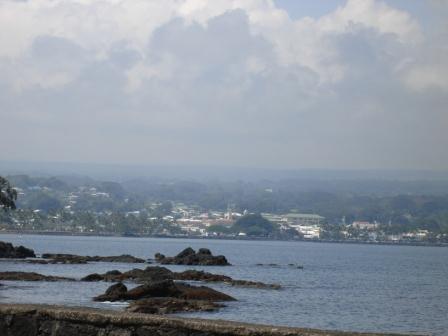
Here in Kula, Maui at 5pm Monday evening, it was partly to mostly cloudy, with volcanic haze…and an air temperature of 70.2F degrees. Our winds are lighter now, coming up from the south to southeast in most areas. This is occurring in response to an area of low pressure to our north. This low pressure system has an associated cold front, just to the northwest of Kauai, which has pushed a ridge of high pressure down over Oahu now. We'll find localized sea breezes, and the daytime heating of the islands, combining to prompt afternoon clouds and a few showers over the interior sections. Volcanic haze is spreading up from the Big Island vents, to other parts of the state into mid-week. This lighter wind regime, with locally hazy skies and afternoon upcountry clouds with a few showers…will prevail through Tuesday night. Thereafter, the ridge will move northward again as the cold front dissipates, allowing light trade winds to return, along with those common few windward biased showers Wednesday through Thursday or Friday. Looking even further ahead, the next early season cold front will approach the state this coming weekend. We may see similar conditions then, as we're seeing now, with the trade winds giving way to light winds from the south and southeast. This will prompt more voggy weather, with some afternoon convective showers over the interiors. I'll be back again early Tuesday morning with your next new weather narrative, I hope you have a great Monday night wherever you're spending it! Aloha for now…Glenn.
By the way: I want to let you know that I'll be flying out of the Kahului airport this Thursday, on a flight to San Francisco. The normal daily weather forecasts will remain available in my absence, located in the upper left hand corner of all pages on this website. Just go to that area, and click on the island you want a forecast for…as shown below. I'll write more about my vacation before I leave…and will provide reports along the way as usual.

Extra: Youtube music video, Olomana…Seabird – one of my favorites
World-wide tropical cyclone activity:
Atlantic Ocean/Caribbean Sea: Tropical storm Nadine remains active, located about 640 miles west-southwest of the Azores….in the Atlantic Ocean. Sustained winds were 65 mph, moving east-southeast at 7 mph. Here's the NHC graphical track map, along with the satellite image showing long lasting Nadine's position.
A tropical disturbance is remains active about 900 miles west-southwest of the Cape Verde Islands…in the Atlantic Ocean. It has a high 70% chance of developing into a tropical depression within the next 48 hours or so. Here's a satellite image showing this area, along with Nadine far to its north.
Gulf of Mexico: There are no active tropical cyclones
Eastern Pacific Ocean: There are no active tropical cyclones
Central Pacific Ocean: There are no active tropical cyclones
Western Pacific Ocean: Tropical storm Maliksi (20W) remains active about 200 NM south-southeast of Iwo-To, Japan. This tropical cyclone has 40 knot sustained winds, with gusts to near 50. Here's a JTWC graphical track map, along with a satellite image of this storm.
Tropical storm Gaemi (21W) is active about 515 NM east of Hue, Vietnam. This tropical cyclone has 40 knot sustained winds, with gusts to near 50 knots. Here's a JTWC graphical track map, along with a satellite image of this storm.
South Pacific Ocean: There are no active tropical cyclones
North and South Indian Oceans: There are no active tropical cyclones
Interesting: Summer temperatures on the Norwegian archipelago of Svalbard in the High Arctic are now higher than during any time over the last 1,800 years, including a period of higher temperatures in the northern hemisphere known as the Medieval Warm Period, according to a new study. In an analysis of algae buried in deep lake sediments, a team of scientists calculated that summer temperatures in Svalbard since 1987 have been 3.6 to 4.5 degrees F warmer than during the Medieval Warm Period, which lasted from roughly 950 to 1250 AD.
Scientists say this year's record declines in Arctic sea ice extent and volume are powerful evidence that the giant cap of ice at the top of the planet is on a trajectory to largely disappear in summer within a decade or two, with profound global consequences.
The Medieval Warm Period is often cited by climate change skeptics as proof that the planet has experienced periods of high temperatures in recent centuries unrelated to the burning of fossil fuels. "Our record indicates that recent summer temperatures on Svalbard are greater than even the warmest periods at that time," said William D'Andrea, a climate scientist at Columbia University.
The algae, which make more unsaturated fats in colder periods and more saturated fats in warmer periods, reveal critical clues about past climates. Scientists were able to date the lake specimens by analyzing grains of glass emitted by a series of well-known Icelandic volcanoes that left unique chemical time markers. The study is published in the journal Geology.
Steve Says:
We'll be missing u, leaving us in the haze, eh! Have a really great time on the coast, and don't forget to write! Steve ~~~ Hi Steve, thanks for your note, I appreciate your sentiment. I will remember to write reports along the way, while I’m in California and Colorado. Aloha, Glenn