


Air Temperatures – The following maximum temperatures were recorded across the state of Hawaii Thursday afternoon:
Lihue, Kauai – 83
Honolulu airport, Oahu – 83
Molokai airport – 84
Kahului airport, Maui – 85
Kona airport – 86
Hilo airport, Hawaii – 85
Air Temperatures ranged between these warmest and coolest spots near sea level – and on the highest mountain tops around the state…as of 810pm Thursday evening:
Barking Sands, Kauai – 79
Hilo, Hawaii – 75
Haleakala Summit – 41 (near 10,000 feet on Maui)
Mauna Kea Summit – 36 (near 13,800 feet on the Big Island)
Hawaii’s Mountains – Here’s a link to the live web cam on the summit of near 13,800 foot Mauna Kea on the Big Island of Hawaii. This web cam is available during the daylight hours here in the islands…and when there’s a big moon shining down during the night at times. Plus, during the nights you will be able to see stars, and the sunrise and sunset too…depending upon weather conditions. Here's the Haleakala Crater webcam on Maui…although this webcam is not always working correctly.
Tropical Cyclone activity in the eastern and central Pacific – Here’s the latest weather information coming out of the National Hurricane Center, covering the eastern north Pacific. You can find the latest tropical cyclone information for the central north Pacific (where Hawaii is located) by clicking on this link to the Central Pacific Hurricane Center. A satellite image, which shows the entire ocean area between Hawaii and the Mexican coast…can be found here.
Aloha Paragraphs
Light winds giving way to strengthening trades
this weekend…showers at times, increasing
on the windward sides Sunday
Rising northwest swell later this weekend…
high surf advisory north and west shores
As this weather map shows, we have a near 1025 millibar high pressure system located far to the east-northeast of the islands. At the same time, we find an early season cold front to the northwest of the islands, which is pushing a high pressure ridge closer to us. A trough of low pressure is draped over the Kauai end of the chain as well. Our local winds will be quite light through Friday…with rebounding trade winds this weekend.
The following numbers represent the most recent top wind gusts (mph), along with directions as of Thursday evening:
25 Mana, Kauai – NNW
16 Kuaokala, Oahu – NNE
12 Molokai – SE
14 Kahoolawe – SSW
16 Hana, Maui – SE
18 Lanai – SW
20 Kaupulehu, Big Island – SW
We can use the following links to see what’s going on in our area of the north central Pacific Ocean. Here's the latest NOAA satellite picture – the latest looping satellite image…and finally the latest looping radar image for the Hawaiian Islands.
Here are the latest 24-hour precipitation totals (inches) for each of the islands as of Thursday evening:
1.08 Mount Waialeale, Kauai
1.17 Pupukea Road, Oahu
0.19 Molokai
0.30 Lanai
0.00 Kahoolawe
0.59 Wailuku, Maui
1.44 Piihonua, Big Island
~~ Hawaii Sunset Commentary ~~
Our local winds will be quite light through Friday…then increasing again this weekend into the first part of next week. We find a near 1025 millibar high pressure system (weather map), located to the northeast of the islands Thursday evening. As the associated high pressure ridge, from this high is quite close to Kauai, our winds will remain on the light side, arriving from the southeast in many areas. The overlying atmosphere will become more stable by Friday, as a surface trough of low pressure moves away to the west. There will continue to be some showers around, although gradually fewer…and certainly less intense than over the last few days.
As we look at this satellite image, it shows low level clouds over and around the state this this evening. We'll see these cumulus and stratocumulus clouds being carried over the islands, leading to showers falling at times. At the same time, there's high and middle level clouds to the north, northeast and southeast of the state as well. As the air mass gradually becomes more stable, showers will still fall, although not in such a widespread manner…and not as generous either. Here's the radar image, so we can keep track of any leftover heavy showers that decide to fall here and there.
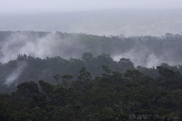
Here in Kula, Maui at 515pm Thursday evening, it was cloudy and very foggy with off and on showers…and an air temperature of 65.8F degrees. The winds will remain lighter than usual again through most of Friday. Looking at this weather map again, we see an early season cold front moving east and southeast…to the northwest and north of our islands. This frontal boundary is pushing a high pressure ridge down closer to us in the process. At the same time we see a trough of low pressure moving westward, and will be west of Kauai by Friday morning. This closer proximity of the ridge, and the trough near us, is why our local winds are softer now…and have shifted to the southeast in places as well.
As the winds remain relaxed into Friday, we'll see daytime onshore sea breezes developing along our leeward beaches. These will carry moisture from the ocean over the islands, into the upcountry areas. This moisture laden air will cool and condense as it rises upslope…during the later morning through afternoon hours, leading to cloudy skies again Friday in most areas. These afternoon clouds will drop showers, although the recent downpours will back off in most cases. Saturday will turn quite a bit drier, while early Sunday may see an increase in windward biased showers, coming in on a surge of the trade winds.
If all of this is sounding like the first signs of the fall season, coupled with what you're seeing outside the last couple of days (almost like winter in some places)…you're absolutely right. By the way, the autumnal equinox arrives Saturday, September 22nd. Looking ahead, our trade winds will rebound this weekend, and become quite strong and gusty by Sunday into Monday. There will likely be small craft wind advisory flags being raised over those windiest areas in Maui County, and the Big Island. As these strong trade winds arrive, they will blow an increasing amount of clouds and showers our way, which will focus their efforts most effectively along our windward coasts and slopes by Sunday morning. These gusty trades will back off again around the middle of next week, when another cold front may approach the state then. I'll be back again early Friday morning with your next new narrative, I hope you have a great Thursday night wherever you're spending it! Aloha for now…Glenn.
Extra: youtube music video, Anoushka Shankar playing…Pancham Se Gara
World-wide tropical cyclone activity:
Atlantic Ocean/Caribbean Sea: Tropical storm Nadine (14L) is active about 270 miles south of the Azores…and moving away. Sustained winds are 60 mph, moving south at 10 mph. Here's the NHC graphical track map for this tropical storm. Here's a satellite image showing Nadine.
At the same time, we find a tropical disturbance active to the west-southwest of Nadine, located 450 miles east of Bermuda. It has a medium 50% chance of developing into a tropical cyclone within the next 48 hours. Here's a satellite image showing both Nadine and this area of disturbed weather in the central Atlantic.
Gulf of Mexico: There are no active tropical cyclones
Eastern Pacific Ocean: There are no active tropical cyclones
There's a broad area of disturbed weather south of southern Mexico, located about 400 miles south of Manzanillo, Mexico. It has a high 70% chance of developing into a tropical cyclone within the next 48 hours. Here's a satellite image of this area.
Central Pacific Ocean: There are no active tropical cyclones
Western Pacific Ocean: Tropical storm Jelawat (19W) is active in the Philippine Sea, located about 535 NM east-southeast of Manila. This storm currently has sustained winds of 45 knots, and is forecast by the JTWC to strengthen into a typhoon within 36 hours. Here's a graphical track map, along with a satellite image.
South Pacific Ocean: There are no active tropical cyclones
North and South Indian Oceans: There are no active tropical cyclones
Interesting: The Arctic is especially vulnerable to the effects of global warming, as has become apparent in the melting sea ice in recent years. Climate models predict much greater warming in the Arctic than the global average, resulting in significant attention to the region. In particular, there are concerns that Arctic shrinkage, a consequence of melting glaciers and other ice in Greenland, could contribute to a substantial rise in sea levels worldwide.
Arctic sea ice cover likely melted to its minimum extent for the year on September 16, according to scientists at the National Snow and Ice Data Center (NSIDC). Sea ice extent fell to 1.32 million square miles, which is now the new lowest summer minimum extent. "We are now in uncharted territory," said NSIDC Director Mark Serreze.
"While we’ve long known that as the planet warms up, changes would be seen first and be most pronounced in the Arctic, few of us were prepared for how rapidly the changes would actually occur." In September 2008, the extent of the summer Arctic ice cap was at a near-record low, only 9.01 percent greater than the record low in 2007, and 33.6 percent below the average extent of sea ice from 1979 to 2000.
According to the University of Bremen, in September 2011 the Arctic ice cap was smaller than ever before recorded since the satellite measurements started in the 1970s. Arctic ice is declining in area and thinning. Arctic temperatures have risen more than twice as fast as the global average over the past half century. Arctic sea ice cover grows each winter as the sun sets for several months, and shrinks each summer as the sun rises higher in the northern sky.
Each year, the Arctic sea ice reaches its minimum extent in September. This year’s minimum follows a record-breaking summer of low sea ice extents in the Arctic. Sea ice extent fell to 1.58 million square miles on August 26, breaking the lowest extent on record set on September 18, 2007 of 1.61 million square miles. On September 4, it fell below 1.54 million square miles, another first in the 33-year satellite record.
"The strong late season decline is indicative of how thin the ice cover is," said NSIDC scientist Walt Meier. "Ice has to be quite thin to continue melting away as the sun goes down and fall approaches." NSIDC scientists have observed fundamental changes in the Arctic’s sea ice cover.
The Arctic used to be dominated by mult-iyear ice, or ice that survived through several years. Lately, the Arctic is increasingly characterized by seasonal ice cover and large areas are now prone to completely melt away in summer. Arctic sea ice has long been recognized as a sensitive climate indicator.
The region’s sea ice extent–defined by NSIDC as the total area covered by at least 15 percent of ice—varies from year to year because of changeable weather conditions. However, ice extent has shown a dramatic overall decline over the past thirty years. This year’s minimum will be nearly 50 percent lower than the 1979 to 2000 average. NSIDC lead scientist Ted Scambos said that thinning ice, along with early loss of snow, are rapidly warming the Arctic.
"But a wider impact may come from the increased heat and moisture the warmer Arctic is adding to the climate system," he said. NSIDC scientist Julienne Stroeve said, "Recent climate models suggest that ice-free conditions may happen before 2050, though the observed rate of decline remains faster than many of the models are able to capture." Serreze said, "While lots of people talk about opening of the Northwest Passage through the Canadian Arctic islands and the Northern Sea Route along the Russian coast, twenty years from now from now in August you might be able to take a ship right across the Arctic Ocean."
Eliza Says:
Aloha Glenn –
Had a lovely overnight rain here in upper Pukalani. Just sweet to hear it. Heard that parts of Kihei got a rinse, too. Still overcast and cloudy here at 10am. Kinda feels like Haiku is visiting over here. haha
Happy day ~ Peace to you ~ Eliza ~~~ Hi Eliza, peace to you as well, on this very tail-end of summer day! Rinse is a good way of putting it, it is healthy and vital. Haiku visiting Pukulani…it visited Kula too, although all the fog made it feel more like northern California somehow. Take care my friend! Aloha, Glenn