


Air Temperatures – The following maximum temperatures were recorded across the state of Hawaii Tuesday afternoon:
Lihue, Kauai – 85
Honolulu airport, Oahu – 88
Kaneohe, Oahu – M
Molokai airport – 84
Kahului airport, Maui – 86
Kona airport – 86
Hilo airport, Hawaii – 83
Air Temperatures ranged between these warmest and coolest spots near sea level – and on the highest mountain tops around the state…as of 6pm Tuesday evening:
Barking Sands, Kauai – 83
Hilo, Hawaii – 78
Haleakala Summit – 50 (near 10,000 feet on Maui)
Mauna Kea Summit – M (near 13,800 feet on the Big Island)
Hawaii’s Mountains – Here’s a link to the live web cam on the summit of near 13,800 foot Mauna Kea on the Big Island of Hawaii. This web cam is available during the daylight hours here in the islands…and when there’s a big moon shining down during the night at times. Plus, during the nights you will be able to see stars, and the sunrise and sunset too…depending upon weather conditions. Here's the Haleakala Crater webcam on Maui…although this webcam is not always working correctly.
Tropical Cyclone activity in the eastern and central Pacific – Here’s the latest weather information coming out of the National Hurricane Center, covering the eastern north Pacific. You can find the latest tropical cyclone information for the central north Pacific (where Hawaii is located) by clicking on this link to the Central Pacific Hurricane Center. A satellite image, which shows the entire ocean area between Hawaii and the Mexican coast…can be found here.
Aloha Paragraphs
Trade winds continuing well into the
future…windward showers at times
As this weather map shows, we have a moderately strong high pressure systems aligned to the northwest and northeast of the islands. Our local trade winds will remain light to moderately strong in general through Friday…then pick up a bit Saturday and Sunday into early next week.
The following numbers represent the most recent top wind gusts (mph), along with directions as of Tuesday evening:
18 Poipu, Kauai – NE
29 Kuaokala, Oahu – NE
20 Molokai – NE
27 Kahoolawe – NE
30 Kahului, Maui – NE
28 Lanai – NE
25 PTA Keamuku, Big Island – NE
We can use the following links to see what’s going on in our area of the north central Pacific Ocean. Here's the latest NOAA satellite picture – the latest looping satellite image…and finally the latest looping radar image for the Hawaiian Islands.
Here are the latest 24-hour precipitation totals (inches) for each of the islands as of Tuesday evening:
0.06 Mount Waialeale, Kauai
0.47 Oahu Forest NWR, Oahu
0.05 Molokai
0.00 Lanai
0.00 Kahoolawe
1.52 Puu Kukui, Maui
0.90 Glenwood, Big Island
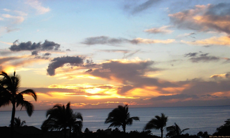
~~ Sunset Commentary ~~
Light to moderately strong trade winds prevail…probably picking up a notch this coming weekend. We find several moderately strong high pressure systems (weather map) located to the northwest through northeast of the islands Tuesday evening. These trades will carry windward showers our way at times. The leeward sides will remain relatively dry, although a few showers could fall here and there, especially along the Kona slopes on the Big Island during the afternoon and evening hours.
Here in Kula, Maui at 520pm Tuesday evening, it was clear to partly cloudy…with an especially warm air temperature of 82.2F degrees. The trade winds will continue across our islands through the next week and more. These trade winds will blow generally in the light to moderately strong realms through Friday…picking up a bit this weekend into early next week. If we look at this satellite image, it shows generally clear to partly cloudy skies immediately upstream of the windward sides of the islands at the moment. There are more clouds of course upstream, which will bring just a few windward biased showers our way tonight into Wednesday morning. Further to the east, we can see the signs of a trough of low pressure, which will arrive later Wednesday, then move slowly across our island chain through Thursday. Its presence, and cooler air aloft, will prompt some increase in windward showers into Thursday. As we move into Friday and the weekend, our atmosphere will dry out some, with generally good weather prevailing. I'll be back again early Wednesday morning with your next new weather narrative from paradise. I hope you have a great Tuesday night wherever you happen to be spending it! Aloha for now…Glenn.
World-wide tropical cyclone activity:
Central Pacific Ocean: There are no active tropical cyclones
Eastern Pacific Ocean: There are no active tropical cyclones
Atlantic Ocean/Gulf of Mexico/Caribbean: Tropical storm Isaac (9L) is active in the far western Atlantic…located about 140 miles east of Guadeloupe…moving westward at 21 mph. This tropical cyclone will be gradually strengthening, becoming a hurricane within two days…as it moves through the Caribbean Sea. Here's the long radar loop from Martinique…as the storm moves towards the Lesser Antilles.
Tropical depression (10L) is active in the eastern Atlantic…located about 860 miles west-southwest of the Cape Verde Islands…moving west-northwest at 16 mph. This new tropical cyclone will be gradually strengthening, becoming a tropical storm named Joyce later today…as it remains away from land through the next five days.
Showers and thunderstorms are located over the southwestern Gulf of Mexico, with a low 0% chance of developing into a tropical depression over the next day or two.
Here's a satellite image showing tropical storm Isaac (9L), tropical depression 10L, and the area of disturbed weather in the southwest Gulf.
Western Pacific Ocean: Typhoon Tembin (15W) remains active…located about 210 NM southeast of Taipei, Taiwan. Sustained winds are 85 knots, with gusts to near 105 knots. The JTWC keeps Tembin over the ocean for awhile longer, although then brings it over the south central part of Taiwan, and then into the Taiwan Strait…curving southward. Here's the JTWC graphical track map…which shows it having peaked in strength, with a gradual stepping down in strength going forward.
Newly formed Typhoon Bolaven (16W) is active in the western Pacific…located about 655 NM southeast of Kadena AB, Okinawa, Japan. Sustained winds are 90 knots, with gusts to near 110 knots.The JTWC keeps Bolaven over the ocean, moving by close to Kadena AB in about three days. Here's the JTWC graphical track map…which shows it continuing to strengthen as a stronger typhoon.
South Pacific Ocean: There are no active tropical cyclones
North and South Indian Oceans: There are no active tropical cyclones
Interesting: A $425 million lander that would drill a few meters into Mars in order to probe its crust, mantle, and core will be NASA's next major planetary science mission. In a teleconference late Monday, NASA's associate administrator for the Science Mission Directorate, John Grunsfeld, announced that he has selected the InSight mission to Mars as NASA's next cost-capped mission to explore the solar system.
The craft will set a seismometer on the surface and send a temperature sensor down a drill hole to better understand how that rocky planet evolved from a nascent ball of magma. InSight (Interior Exploration Using Seismic Investigations, Geodesy, and Heat Transport) beat out two other finalists for NASA's Discovery Program award.
One would have splashed a craft onto a lake of liquefied natural gas on Titan, and another would have touched down on an active comet. InSight team members, led by planetary scientist W. Bruce Banerdt of NASA's Jet Propulsion Laboratory in Pasadena, California, had made a strong pitch for their mission quickly returning the maximum science for the buck.
InSight is based on the lander and spacecraft design that successfully delivered the Phoenix lander to Mars, they noted, which reduces both cost and risk. And while seismological studies have detailed Earth's interior, the interiors of the three other rocky planets—Mercury, Venus, and Mars—have remained largely unknown.
Mars, they argued, is large enough to have separated into crust, rocky mantle, and metallic core, but it has not been so tectonically active that it erased the record of that evolution. Although NASA Administrator Charles Bolden associated InSight with NASA’s ongoing Mars exploration program, the selection falls far short of rescuing the cash-strapped Mars program.
It suffered deep cuts in President Barack Obama’s fiscal year 2013 budget request, necessitating NASA’s withdrawal from a joint rover mission with the European Space Agency. A study committee is due to report to NASA management later this month on how the NASA science program might team up with NASA’s human exploration program to explore Mars together.
Interesting2: Over the last 50 million years, tectonic shifts in the Earth's crust caused by forces deep within the mantle have caused the Caribbean island chain to be pushed Eastward. Staring at a map will reveal the bulging shape of the lesser Antilles way out into the Atlantic. A new study by researchers from the University of Southern California has found the reason for this movement to be the South American plate.
The South America is far larger and more heavily rooted in its location. The Caribbean movement to the east is caused by the underlying mantle pushing against the southern continent. The study was conducted in order to better understand how the continents resist movement and how their land masses affect the reshaping of the Earth's surface.
"Studying the deep earth interior provides insights into how the Earth has evolved into its present form," said Meghan S. Miller, assistant professor of earth sciences in the USC Dornsife College of Letters, Arts and Sciences, and lead author of the paper.
"We're interested in plate tectonics, and the southeastern Caribbean is interesting because it's right near a complex plate boundary." Miller, together with associate professor Thorsten W. Becker, looked at the margin between the Caribbean and South American plate.
However, to build their tectonic model, they had to incorporate the entire globe because everything is connected. They used earthquake data which provides insight into the Earth's deep interior. The seismic waves produced can be tracked all over the world.
The waves can move slowly or quickly depending on the rock composition and underlying temperature. The speed of the waves is also determined by how the crystals align within the rocks after eons of being pushed around by the mantle convection.
Multiple models were created, reconstructing the Earth to a depth of almost 3,000 kilometers. They found that the South American Plate was a "cratonic keel", or a landmass that is roughly three times thicker than normal lithosphere and stronger than typical mantle. The keel deflects and channels mantle flow.
"Oceanic plates are relatively simple, but if we want to understand how the Earth works as a system — and how faults evolved and where the flow is going over millions of years — we also have to understand continental plates," Becker said. The sturdy South American plate is going nowhere fast, so the Caribbean have nowhere to go but further out to sea, away from the hulking landmasses that surround it. Who knows where they will be in another 50 million years.
This study has been published in the journal Nature Geoscience