


Air Temperatures – The following maximum temperatures were recorded across the state of Hawaii Friday:
Lihue, Kauai – 83
Honolulu airport, Oahu – 88 (Record high temperature for Friday / 91 -1987)
Kaneohe, Oahu – 82
Molokai airport – 84
Kahului airport, Maui – 85
Kona airport – 87
Hilo airport, Hawaii – 82
Air Temperatures ranged between these warmest and coolest spots near sea level – and on the highest mountain top around the state…as of 5pm Friday evening:
Honolulu, Oahu – 82
Port Allen, Kauai – 75
Haleakala Summit – M (near 10,000 feet on Maui)
Mauna Kea Summit – 45 (near 13,800 feet on the Big Island)
Hawaii’s Mountains – Here’s a link to the live web cam on the summit of near 13,800 foot Mauna Kea on the Big Island of Hawaii. This web cam is available during the daylight hours here in the islands…and when there’s a big moon shining down during the night at times. Plus, during the nights you will be able to see stars, and the sunrise and sunset too…depending upon weather conditions. Here's the Haleakala Crater webcam on Maui…although this webcam is not always working correctly.
Tropical Cyclone activity in the eastern and central Pacific – Here’s the latest weather information coming out of the National Hurricane Center, covering the eastern north Pacific. You can find the latest tropical cyclone information for the central north Pacific (where Hawaii is located) by clicking on this link to the Central Pacific Hurricane Center. A satellite image, which shows the entire ocean area between Hawaii and the Mexican coast…can be found here.
Aloha Paragraphs
Light-moderate trade winds,
localized upcountry showers,
fine weather at the beaches
As this weather map shows, we have a near 1030 millibar high pressure system located far to the north of the islands. Our local winds will remain active from the trade wind direction, becoming slightly lighter into Saturday. Speaking of lighter trade winds, the NWS forecast office in Honolulu has canceled the long lasting small craft wind advisory…in all marine zones around the state.
The following numbers represent the most recent top wind gusts (mph), along with directions as of Friday evening:
17 Port Allen, Kauai – WNW
33 Kuaokala, Oahu – NNE
14 Molokai – ENE
23 Kahoolawe – NE
18 Lipoa, Maui – NE
22 Lanai – NE
31 Keahole airport, Big Island – SW
We can use the following links to see what’s going on in our area of the north central Pacific Ocean. Here's the latest NOAA satellite picture – the latest looping satellite image…and finally the latest looping radar image for the Hawaiian Islands.
Here are the latest 24-hour precipitation totals (inches) for each of the islands as of Friday afternoon:
0.64 Mount Waialeale, Kauai
0.29 Waianae Valley, Oahu
0.27 Molokai
0.00 Lanai
0.00 Kahoolawe
0.08 Hana airport, Maui
0.61 Kainaliu, Big Island
Sunset Commentary:
Some afternoon upcountry showers, with just a few along our windward sides at night…otherwise just fine. A near 1030 millibar high pressure to the north of Hawaii, will continue the light to moderately strong trade wind flow across our islands. These trades will carry a few windward showers our way, with generally dry conditions prevailing along our leeward beaches. The trades will remain on the lighter side of the wind spectrum through the weekend…then pick up a notch again early next week. As our trade winds are lighter now, daytime sea breezes will occur, carrying moisture up the leeward slopes during the later morning through afternoon hours. The overlying atmosphere remains rather dry and stable however, so that no serious showers will fall from these afternoon upcountry clouds…with clear and slightly cool early mornings both Saturday and Sunday. The trade winds will rebound after the weekend, putting an end to the afternoon clouds over the smaller islands…lasting through all of the new week ahead.
It's Friday evening, and so you know the routine…I'll be driving down to Kahului to see a new film. This one is called Safety not Guaranteed, starring Aubrey Plaza, Mark Duplass, Jake Johnson and Karan Soni…among many others. The synopsis: when an unusual classified ad inspires three cynical Seattle magazine employees to look for the story behind it, they discover a mysterious eccentric named Kenneth, a likable but paranoid supermarket clerk, who believes he's solved the riddle of time travel and intends to depart again soon. The critics are giving this new film high grades. According to the trailer, it looks good, and full of fun to me. I'll be seeing it with one of my neighbors, and his daughter. As usual, I'll let you know what we thought in my narrative Saturday morning.
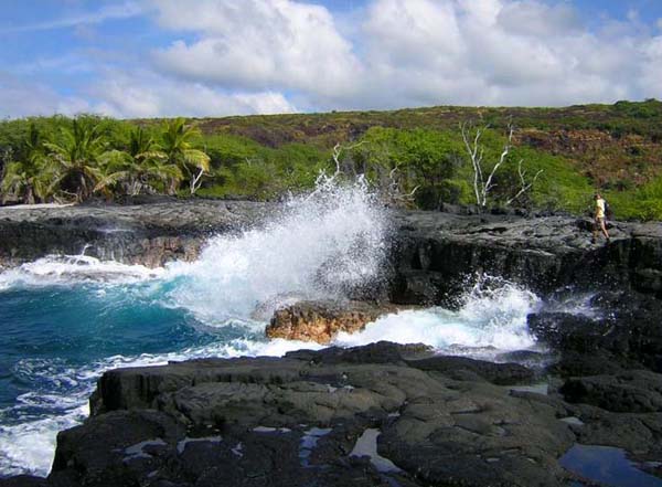
Here in Kula, Maui at 515pm, it was partly cloudy with off and on light passing showers…an air temperature of 68.7F degrees. As mentioned above, our trade winds are lighter now than they have been in quite some time. This is due to less strong high pressure to our north, and a trough of low pressure just to our north as well. This combination will lead to daytime sea breezes developing along the leeward beaches. These breezes will carry moisture upslope into the interior regions, which will cool and condense on its journey upwards. This in turn will prompt lots of clouds, and even showers here and there during the afternoon hours through Sunday. Our early morning hours will be slightly cooler than normal, a sure sign of these somewhat lighter trades. As the trade winds rebound after the weekend, windward showers will increase again some, with a normal summery trade wind weather pattern returning. ~~~ I'll be back early Saturday morning with your next new weather narrative, I hope you have a great Friday night wherever you happen to be spending it! Aloha for now…Glenn.
[World-wide tropical cyclone activity:
Central Pacific Ocean: There are no active tropical cyclones
Eastern Pacific Ocean: There are no active tropical cyclones
Atlantic Ocean/Gulf of Mexico/Caribbean: There are no active tropical cyclones
Western Pacific Ocean: Newly formed tropical depression 9W is now active just to the north-northwest of Luzon Island in the Philippines…located approximately 220 NM north of Manila. Sustained winds are 25 knots, with gusts to near 35 knots. It's expected increase to a tropical storm as it crosses the warm waters of the South China Sea. It will impact the southern China coast in about two days, and then move further west to strike the Vietnamese coast…moving inland just south of Hanoi. Here's the JTWC graphical track map for this strengthening tropical cyclone.
South Pacific Ocean: There are no active tropical cyclones
South and North Indian Oceans: There are no active tropical cyclones
Interesting: As the Earth's surface warms, climate models predict that the amount of fresh water for human consumption will likely decrease in parts of the globe. While that prospect looms for many cities around the world, a new study finds a more imminent threat to water supplies of cities in the tropical Andes, such as Lima, Peru and Quito, Ecuador. "Despite all the uncertainty of the future impact of climate change, the impact of population growth is much bigger," said Wouter Buytaert of Imperial College London, an environmental engineer and lead author of the study.
This could mean harsher times ahead for millions including the 7.6 and 2.2 million inhabitants of the fast growing cities of Lima and Quito. Some parts of the tropical Andes, a region along the northwestern coast of South America, already lack sufficient water to meet demand. To help policy makers combat this water scarcity, Buytaert and his colleague, Bert De Bièvre of the Consortium for the Sustainable Development of the Andean Eco-region in Quito, Ecuador, compared the two main drivers of water depletion in that region — climate change and population growth.
The scientists used 19 climate models to project how climate change may affect urban water resources of the tropical Andes over the next 60 years. While the most pessimistic findings from models projected an average water depletion of up to 10 percent of current values, some optimistic outlooks estimated a 10 percent increase in water availability.
When the researchers separately modeled the impact of population growth, they found a drop of 38 to 62 percent in the amount of water available for each person. In their projections, the demand for more water as populations increase surpasses the amount of water lost through evaporation from warmer temperatures due to climate change.
Combining the two effects into a more realistic scenario of climate change and population growth happening simultaneously, the team saw the downward trend take over. “Under whatever climate scenario, if you combine it with the impact of population growth it’s nearly certain that the impact will be negative,” Buytaert said. “So, it’s very, very unlikely that there will be more water available in the future [for this region].”
The study has been accepted for publication in Water Resources Research, a journal of the American Geophysical Union. Buytaert and De Bièvre, a civil engineer with specialization in irrigation, focused their models on four cities in the tropical Andes: Lima; Quito; Bogotá, Colombia; and La Paz, Bolivia. These four cities are all increasing in population at a faster rate than the average population growth rate of South America as a whole.
While the scientists’ methods and models could be applied to different regions worldwide, Buytaert said, their results don’t necessarily translate to other highly populated cities around the world. This is because the extent to which population growth and climate change impact a city’s water resources depends significantly on each city’s location and surrounding environment.
Cities at different elevations obtain their water from different sources, which are variably affected by climate change. For instance, cities at low elevations such as Lima obtain their water from streams flowing down the Andes. But cities at high elevations, such as Bogotá, Quito, and La Paz, are more restricted in how they obtain water and often collect it from nearby lakes or ponds, since it would be too costly to pump up from lower sources.
“The way you look at the issue of water scarcity in the future is very different for a city like Lima than for a city like Quito, and that is a main point we want to highlight,” Buytaert said. Further, Lima ranks as the second largest desert city in the world while Quito, for instance, has a relatively humid climate.
These differences in elevation and climate make it difficult to generalize future water availability for a broad region, he said. Previous studies have approached issues of future water scarcity, but on global scales. To really inform policy-making on a national level, Buytaert said, researchers should include the specific geography and environment of individual cities.
“A lot of policy actions are being taken, but we have to be aware about what the future holds in order to make sure that those actions are sustainable and future proof,” he said. The region could work to keep future water scarcity at bay by using several tactics, Buytaert explained. First, he said, would be to educate citizens about the issues of water scarcity and how to consume less water.
Quito, for instance, uses approximately 66 gallons of water per person per day while the United Kingdom uses about 26.5 gallons per person per day – less than half of Quito’s consumption. Second, officials could safeguard current crucial water supplies, such as wetlands, through conservation efforts.
These approaches are just a few of many that could combat the problem of future water scarcity. “The solution will be complex and will really be a combination of many small things that can be done,” Buytaert said. To probe the regional situation more deeply, Buytaert said, the next step will be to look at additional influences on water resources, such as vegetation changes and land degradation.
Integrating those stressers into models would give an increasingly accurate picture and timeline for when, where, and how water scarcity will impact the tropical Andes.