


Air Temperatures – The following maximum temperatures were recorded across the state of Hawaii Wednesday:
Lihue, Kauai – 82
Honolulu airport, Oahu – 84 (Record high for Wednesday / 90 – 1981)
Kaneohe, Oahu – 83
Molokai airport – 79
Kahului airport, Maui – 83
Kona airport – 82
Hilo airport, Hawaii – 79
Air Temperatures ranged between these warmest and coolest spots near sea level – and on the highest mountain top around the state…as of 5pm Wednesday evening:
Barking Sands, Kauai – 86
Kapalua, Maui – 73
Mauna Kea – 39 (near 13,800 feet on the Big Island)
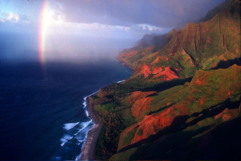
Hawaii’s Mountains – Here’s a link to the live web cam on the summit of near 13,800 foot Mauna Kea on the Big Island of Hawaii. This web cam is available during the daylight hours here in the islands…and when there’s a big moon shining down during the night at times. Plus, during the nights you will be able to see stars, and the sunrise and sunset too…depending upon weather conditions. Here's the Haleakala Crater webcam on Maui…although this webcam is not always working correctly.
Tropical Cyclone activity in the eastern and central Pacific – Here’s the latest weather information coming out of the National Hurricane Center, covering the eastern north Pacific. You can find the latest tropical cyclone information for the central north Pacific (where Hawaii is located) by clicking on this link to the Central Pacific Hurricane Center. A satellite image, which shows the entire ocean area between Hawaii and the Mexican coast…can be found here. Here's a tropical cyclone tracking map for the eastern and central Pacific.
Aloha Paragraphs
Trade winds gradually becoming somewhat lighter
Passing windward showers…a few leeward sections
As this weather map shows, we have a large near 1030 millibar high pressure system to the north-northwest of the islands. Our local winds will remain active from the trade wind direction…a little lighter Thursday and Friday through the weekend.
The following numbers represent the most recent top wind gusts (mph), along with directions as of Wednesday evening:
33 Lihue, Kauai – NE
56 Makua Range, Oahu – NE
35 Molokai – NE
32 Kahoolawe – NE
31 Kahului, Maui – NE
37 Lanai – NE
42 Puu Waawaa, Big Island – NNE
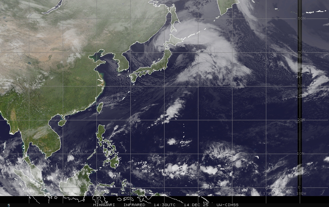
We can use the following links to see what’s going on in our area of the north central Pacific Ocean. Here's the latest NOAA satellite picture – the latest looping satellite image…and finally the latest looping radar image for the Hawaiian Islands.
Here are the latest 24-hour precipitation totals (inches) for each of the islands as of Wednesday evening:
1.92 Mount Waialeale, Kauai
0.96 Oahu Forest NWR, Oahu
0.27 Molokai
0.00 Lanai
0.00 Kahoolawe
0.61 Puu Kukui, Maui
2.55 Kawainui Stream, Big Island
Sunset Commentary: Our trade winds remained strong and gusty today…which will become a bit softer Thursday into the weekend. There will continue to be showers, falling generally in the light to moderately heavy range along our windward sides, although locally a bit heavier at times…especially along the Big Island and Maui County coasts and slopes tonight. These showers will stretch over into leeward sides at times too, at least on some of the smaller islands. There will be off and on passing showers along those north and east windward coasts and slopes periodically through the rest of this work week…although tapering off some by Saturday and Sunday.
As this large view satellite image shows, we continue to have a rather steady supply of low clouds being transported in our direction by the strong and gusty trades…taking aim on the eastern islands tonight. Meanwhile, there continues to be those few brighter white, high and middle level clouds to our west and south. At the same time, we see a bit of thunderstorm activity far to the southwest and southeast, down in the inter-tropical convergence zone (ITCZ) close to the Equator. Finally, here's a closer look at our islands using this satellite picture…so we can keep track of all those low level showery clouds…as they approach the windward sides quite regularly during the next 24-48 hours.
Here in Kula, Maui at 535pm, it was mostly cloudy and calm…with an air temperature of 71.1F degrees. Our trade winds will continue blowing, with passing showers falling along our windward coasts and slopes. These showers will be somewhat enhanced in frequency and intensity over the next few couple of days, as an upper level trough of low pressure passes over the state through Friday. As we push into the Friday and the weekend time frame, our trade winds will become moderately strong, a downward trend from here. At the same time, showers, which will be pretty active now through at least some of Friday…will back off in time for the weekend too. ~~~ I'll be back early Thursday morning, I hope you have a great Wednesday night wherever you're spending it! Aloha for now…Glenn.
[World-wide tropical cyclone activity:
Central Pacific Ocean: There are no active tropical cyclones expected through the next 48 hours.
Eastern Pacific Ocean: There are no active tropical cyclones expected through the next 48 hours.
Atlantic Ocean/Gulf of Mexico/Caribbean: There are no active tropical cyclones expected through the next 48 hours.
SHOWER AND THUNDERSTORM ACTIVITY ASSOCIATED WITH POST-TROPICAL CYCLONE DEBBY…LOCATED ABOUT 175 MILES WEST-NORTHWEST OF BERMUDA…HAS INCREASED THIS MORNING. THIS SYSTEM IS PRODUCING WINDS TO NEAR GALE FORCE AS IT MOVES NORTHEASTWARD AT 15 TO 20 MPH. ENVIRONMENTAL CONDITIONS ARE MARGINALLY FAVORABLE FOR REGENERATION…AND THIS SYSTEM HAS A LOW CHANCE…10 PERCENT…OF BECOMING A TROPICAL CYCLONE AGAIN DURING THE NEXT 48 HOURS.
SHOWERS AND THUNDERSTORMS ASSOCIATED WITH A TROPICAL WAVE LOCATED ABOUT 1350 MILES EAST OF THE WINDWARD ISLANDS HAVE BECOME A LITTLE MORE CONCENTRATED THIS MORNING. ANY DEVELOPMENT SHOULD BE SLOW TO OCCUR AS IT MOVES GENERALLY WESTWARD AT 10 TO 15 MPH. THIS SYSTEM HAS A LOW CHANCE…10 PERCENT…OF BECOMING A TROPICAL CYCLONE DURING THE NEXT 48 HOURS.
ELSEWHERE…TROPICAL CYCLONE FORMATION IS NOT EXPECTED DURING THE NEXT 48 HOURS.
Here is a graphical tropical weather outlook…showing these tropical disturbances in the Atlantic Ocean
Western Pacific Ocean: The Joint Typhoon Warning Center (JTWC) is continuing warnings on tropical storm Doksuri (07W). It is located approximately 335 NM north of Manila. Doksuri has 40 mph sustained winds, with gusts to near 52 mph. It has become a tropical storm again as it moved by offshore between Luzon Island and Taiwan. It will move towards the mainland China coast just to the north of Hong Kong…as a tropical storm as it makes landfall. Here is a JTWC graphical map showing where this tropical storm is located. Here's a satellite image of Doksuri.
South Indian Ocean: There are no active tropical cyclones
Interesting: Predicting the long-term future is inherently difficult. In the words of Donald Rumsfeld, there are the known-knowns the known-unknowns, and the unknown-unknowns, events that we cannot even think of that will affect future decisions. In the field of energy production and consumption, things are in a great state of flux, and there are many factors, from geopolitics, market forces, technological advances, and various in initiatives in efficiency.
To cover the various outcomes of future energy in America, the US Energy Information Administration (EIA) has released the Annual Energy Outlook 2012 in which it includes 29 alternative cases projected out to the year 2035. Through the examination of the many cases, the EIA has come to the following predictions:
The Rate of Growth in Energy Slows over the Projected Period
In our lifetimes, we have seen booms in population, industry, and the use of electricity as new gadgets and devices continually drain the grid. Energy use will continue to grow, but only at a modest 0.3 percent per year. The US would not return to its pre-recession level of energy consumption. Reasons for this include moderate population growth, an extended economic recovery, and increasing energy efficiency.
Domestic Production of Crude Oil and Natural Gas Increase
Due to advancing technology, oil in hard-to-reach places has become economically viable, including the offshore reserves in the Gulf of Mexico. Natural gas production will also continue to increase as shale reserves are exploited. The EIA predicts that shale gas production will jump from 5 trillion cubic feet per year in 2010 to 13.6 trillion cubic feet per year, and shale gas will account for nearly half of all dry gas production. The US will become a net exporter of natural gas.
Petroleum Imports will Decline
One of the energy consumption in America is its dependence on imports, often from volatile places like Venezuela and the Middle East. As a result of future spikes in energy prices and increased domestic production, imports will make up a smaller share of total energy consumption. Another major factor will be the stricter fuel economy standards for new vehicles.
Energy from Renewables Increase
Today, renewable energy makes up 10 percent, but that number will grow to 15 percent in 2035. This will coincide with the decline of coal-fired power generation.
Carbon Dioxide Emissions Remain Below their 2005 Level
The prediction of CO2 emissions are very difficult because they can be subject to regulatory decisions which are dependent on politics in Washington D.C. and the state capitals. However, the EIA predicts CO2 emissions will grow slowly due to modest economic growth, renewable technologies, increase in natural gas usage, and efficiency improvements.