


Air Temperatures – The following maximum temperatures were recorded across the state of Hawaii Thursday:
Lihue, Kauai – 83
Honolulu airport, Oahu – 84
Kaneohe, Oahu – 75
Molokai airport – 79
Kahului airport, Maui – 82
Kona airport – 85
Hilo airport, Hawaii – 79
Air Temperatures ranged between these warmest and coolest spots near sea level – and on the highest mountain top around the state…as of 8pm Thursday evening:
Barking Sands, Kauai – 79
Hilo, Hawaii – 70
Haleakala Summit – M (near 10,000 feet on Maui)
Mauna Kea Summit – 32 (near 13,800 feet on the Big Island)
Hawaii’s Mountains – Here’s a link to the live web cam on the summit of near 13,800 foot Mauna Kea on the Big Island of Hawaii. This web cam is available during the daylight hours here in the islands…and when there’s a big moon shining down during the night at times. Plus, during the nights you will be able to see stars, and the sunrise and sunset too…depending upon weather conditions. Here's the Haleakala Crater webcam on Maui…although this webcam is not always working correctly.
Tropical Cyclone activity in the eastern and central Pacific – Here’s the latest weather information coming out of the National Hurricane Center, covering the eastern north Pacific. You can find the latest tropical cyclone information for the central north Pacific (where Hawaii is located) by clicking on this link to the Central Pacific Hurricane Center. A satellite image, which shows the entire ocean area between Hawaii and the Mexican coast…can be found here. Here's a tropical cyclone tracking map for the eastern and central Pacific.
Aloha Paragraphs

Trade winds gradually becoming somewhat
lighter as we get into the weekend
Passing windward showers, leeward sections in
places too…diminishing Friday into the weekend
As this weather map shows, we have a large near 1032 millibar high pressure system to the north-northwest of the islands. Our local winds will remain active from the trade wind direction…a little lighter Thursday and Friday through the weekend.
The following numbers represent the most recent top wind gusts (mph), along with directions as of Thursday evening:
32 Port Allen, Kauai – NE
38 Kuaokala, Oahu – NE
31 Molokai – NE
35 Kahoolawe – NE
30 Kahului, Maui – NE
39 Lanai – NE
31 South Point, Big Island – NE
We can use the following links to see what’s going on in our area of the north central Pacific Ocean. Here's the latest NOAA satellite picture – the latest looping satellite image…and finally the latest looping radar image for the Hawaiian Islands.
Here are the latest 24-hour precipitation totals (inches) for each of the islands as of Thursday afternoon:
0.26 Mount Waialeale, Kauai
0.71 Oahu Forest NWR, Oahu
0.80 Molokai
0.01 Lanai
0.01 Kahoolawe
3.79 Puu Kukui, Maui
2.23 Island Dairy, Big Island
Sunset Commentary: Our trade winds will become gradually lighter into the weekend…although remaining active through the next week at least. There will continue to be more than the normal amount of showers falling along our windward sides tonight, some of which will become quite generous at times. These showers will stretch over into leeward sides at times too, at least on the smaller islands. There will be off and on passing showers along those north and east facing windward coasts and slopes early Friday, although tapering off rather quickly thereafter…with a favorably inclined weather outlook this weekend and beyond.
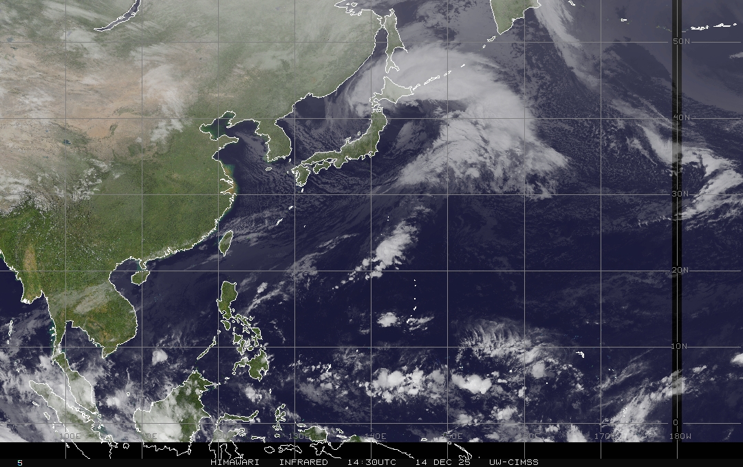
As this large view satellite image shows, we continue to have low clouds hung-up along the island chain. Meanwhile, there continues to be those brighter white, high and middle level clouds far to the west of our islands. At the same time, we see increased thunderstorm activity far to the southwest, south and southeast, down in the inter-tropical convergence zone (ITCZ) close to the Equator. Finally, here's a closer look at our islands using this satellite picture…so we can keep track of all those low level showery clouds…as they gradually move further west away from the islands by Friday.
Here in Kula, Maui at 545pm, it was cloudy and calm, with on and off showers, and an air temperature of 69.6F degrees. Kula had cloudy skies all day, with light showers falling in a regular manner…the next of which is just about to begin now! All of the islands, that is except Kauai, saw way more showers than usual, and not just on the windward sides! These showers have been enhanced in frequency and intensity, as an upper level trough of low pressure passed over the state. The cold air associated with this trough added depth to the clouds under it, thus the greatly increased showers we saw today! As was the case not long ago, Thursday was much more like a winter day, than any typical summer day…that's for sure! As we push into Friday and the weekend, our trade winds will be moderately strong, and at the same time showers, which have been active…will ease up too. Looking even further ahead, our summer weather outlook for next week looks like it will match the climatological norm quite well. Last update of the evening here in Kula, it's still very foggy, and still showering lightly at 850pm. ~~~ I'll be back early Friday morning with your next new weather narrative, I hope you have a great Thursday night wherever you're spending it! Aloha for now…Glenn.
[World-wide tropical cyclone activity:
Central Pacific Ocean: There are no active tropical cyclones expected through the next 48 hours.
Eastern Pacific Ocean: There are no active tropical cyclones expected through the next 48 hours.
Atlantic Ocean/Gulf of Mexico/Caribbean: There are no active tropical cyclones expected through the next 48 hours.
A LOW PRESSURE AREA…THE POST-TROPICAL REMNANTS OF DEBBY…IS LOCATED ABOUT 150 MILES WEST-NORTHWEST OF BERMUDA AND MOVING EAST- NORTHEASTWARD AT 20 TO 25 MPH. THE LOW IS PRODUCING GALE-FORCE WINDS NEAR THE CENTER. HOWEVER…THE ASSOCIATED SHOWER ACTIVITY REMAINS MINIMAL…AND ABUNDANT DRY AIR NEAR THE LOW IS EXPECTED TO PREVENT RE-DEVELOPMENT. THIS SYSTEM HAS A LOW CHANCE…10 PERCENT…OF BECOMING A TROPICAL CYCLONE AGAIN DURING THE NEXT 48 HOURS.
SHOWERS AND THUNDERSTORMS ASSOCIATED WITH A TROPICAL WAVE LOCATED ABOUT 1150 MILES EAST OF THE WINDWARD ISLANDS REMAIN DISORGANIZED. DEVELOPMENT…IF ANY…SHOULD BE SLOW TO OCCUR AS THE WAVE MOVES GENERALLY WESTWARD AT 10 TO 15 MPH. THIS SYSTEM HAS A LOW CHANCE…10 PERCENT…OF BECOMING A TROPICAL CYCLONE DURING THE NEXT 48 HOURS.
ELSEWHERE…TROPICAL CYCLONE FORMATION IS NOT EXPECTED DURING THE NEXT 48 HOURS.
Here is a graphical tropical weather outlook…showing these tropical disturbances in the Atlantic Ocean
Western Pacific Ocean: The Joint Typhoon Warning Center (JTWC) is continuing warnings on tropical storm Doksuri (07W). It is located approximately 212 NM southeast of Hong Kong. Doksuri has 58 mph sustained winds, with gusts to near 63 mph. It is a tropical storm in the South China Sea. It will continue moving towards the mainland China coast, making landfall well south of Hong Kong…as a tropical storm. Here is a JTWC graphical map showing where this tropical storm is located. Here's a satellite image of Doksuri.
Meanwhile, a new tropical disturbance has formed in the southwest Pacific. There's a high chance that a tropical cyclone will form within the next 12-24 hours. Here's a JTWC graphical map showing the area under investigation, which is being called 91P.
South and North Indian Oceans: There are no active tropical cyclones
Interesting: A new study published today in Nature by authors from the Biodiversity and Climate Research Centre and the Goethe University Frankfurt suggests that large parts of Africa’s savannas may well be forests by 2100. The study suggests that fertilization by atmospheric carbon dioxide is forcing increases in tree cover throughout Africa. A switch from savanna to forest occurs once a critical threshold of CO2 concentration is exceeded, yet each site has its own critical threshold.
The implication is that each savanna will switch at different points in time, thereby reducing the risk that a synchronous shock to the earth system will emanate from savannas. Tropical grasslands, savannas and forests, areas the authors call the savanna complex, are expected to respond sensitively to climate and atmospheric changes.
This is because the main players, grasses and trees, differ fundamentally in their response to temperature, carbon dioxide supply and fire and are in an unrelenting struggle for the dominance of the savanna complex. The outcome of this struggle determines whether vast portions of the globe’s tropical and sub-tropical regions are covered with grasslands, savannas or forests.
In the past such shifts in dominance have played out in slow motion, but the current wave of atmospheric changes has accelerated the potential rate of change. Experimental studies have generally shown that plants do not show a large response to CO2 fertilization.
“However, most of these studies were conducted in northern ecosystems or on commercially important species” explains Steven Higgins, lead author of the study from the Biodiodversity and Climate Reseach Centre and Goethe-University.
“In fact, only one experimental study has investigated how savanna plants will respond to changing CO2 concentrations and this study showed that savanna trees were essentially CO2 starved under pre-industrial CO2 concentrations, and that their growth really starts taking off at the CO2 concentrations we are currently experiencing.“
The vegetation shifts that the Higgins and Scheiter study projects are an example of what some theorists call catastrophic regime shifts. Such catastrophic regime shifts can be triggered by small changes in the factors that regulate the system. These small changes set up a cascade of events that reinforce each other causing the system to change more and more rapidly.
The study demonstrated that the savanna complex showed symptoms of catastrophic regime shifts. “The potential for regime shifts in a vegetation formation that covers such vast areas is what is making earth system scientists turn their attention to savannas” comments Higgins. Knowing when such regime shifts will occur is critical for anticipating change.
This study discovered that locations where the temperature rise associated with climate change occurs rapidly, for example in the center of southern Africa, are projected to switch later to forest as the high rate of temperature increase allows the savanna grasses to remain competitive for longer in the face of rising atmospheric CO2 concentration.
This means that even though a single location may experience its catastrophic regime shift, the vegetation change when averaged over a region will be smoother. Such gradual transitions in regional vegetation patterns will reduce the potential for shocks to the earth system. “While this may seem reassuring, we have to bear in mind that these changes are still rapid when viewed on geological time scales”, says Higgins.
The practical implications of the study are far reaching. For example, the study identified a belt that spans northern central Africa where fire suppression would encourage savannas to transition to forests. “So if you wanted to sequester carbon as part of a carbon mitigation action, this is where you should do it” explained Higgins “with the caveat that where this will work is shifting as atmospheric conditions change.”
A worrying implication is that the grasslands and open savannas of Africa, areas with unique floras and faunas, are set to be replaced by closed savannas or forests. Hence it appears that atmospheric change represents a major threat to systems that are already threatened by over-grazing, plantation forestry and crop production.
Doug Warne Says:
Aloha Glen,
Just to let you know, I got back from Hana after sunset last night after picking up some guests in the late afternoon. It was raining quite heavily from MM0 thru MM23 and off and on past that. All waterfalls were fully formed including Upper Waikamoi, Waikani, Wailua Iki , Kopili ula, and Upper Hanawi, Most streams were running though not flooding (clear water). Just thought you would like to know. Felt like winter out there not the dry month of June! —— Regards, — DW.~~~Hi Doug, thanks so much for the report of all those waterfalls going off! I can see that its still raining over on the windward side, with even light showers today here in Kula. I know, right….feels more like winter than summer, I agree! Aloha, Glenn