


Air Temperatures – The following maximum temperatures were recorded across the state of Hawaii Friday:
Lihue, Kauai – 82
Honolulu airport, Oahu – 85 (Record high for Friday / 90 – 1988 )
Kaneohe, Oahu – 82
Molokai airport – 84
Kahului airport, Maui – 84
Kona airport – 83
Hilo airport, Hawaii – 81
Air Temperatures ranged between these warmest and coolest spots near sea level – and on the highest mountain tops…as of 5pm Friday evening:
Barking Sands, Kauai – 82
Molokai airport – 76
Haleakala Crater – 50 (near 10,000 feet on Maui)
Mauna Kea – 41 (near 13,800 feet on the Big Island)
Hawaii’s Mountains – Here’s a link to the live web cam on the summit of near 13,800 foot Mauna Kea on the Big Island of Hawaii. This web cam is available during the daylight hours here in the islands…and when there’s a big moon shining down during the night at times. Plus, during the nights you will be able to see stars, and the sunrise and sunset too…depending upon weather conditions. Here's the Haleakala Crater webcam on Maui…although this webcam is not always working correctly.
Tropical Cyclone activity in the eastern and central Pacific – Here’s the latest weather information coming out of the National Hurricane Center, covering the eastern north Pacific. You can find the latest tropical cyclone information (once the season begins June 1) for the central north Pacific (where Hawaii is located) by clicking on this link to the Central Pacific Hurricane Center. A satellite image, which shows the entire ocean area between Hawaii and the Mexican coast…can be found here. Here's a tropical cyclone tracking map for the eastern and central Pacific.
Aloha Paragraphs
Lighter trade wind speeds, passing windward
showers at times…although generally light
As this weather map shows, we have high pressure systems located to the northeast and far northwest of the Hawaiian Islands. At the same time, we find the tail-end of a cold front far to our northwest of the islands. Our local winds will continue to be from the trade wind direction, and then become somewhat lighter this weekend into early next week.
The following numbers represent the most recent top wind gusts (mph), along with directions as of Friday evening:
27 Port Allen, Kauai – E
33 Kuaokala, Oahu – ENE
21 Molokai – NE
33 Kahoolawe – ESE
32 Kahului, Maui – NE
33 Lanai – NE
27 PTA Keamuku, Big Island – NE
We can use the following links to see what’s going on in our area of the north central Pacific Ocean. Here's the latest NOAA satellite picture – the latest looping satellite image…and finally the latest looping radar image for the Hawaiian Islands.
Here are the latest 24-hour precipitation totals (inches) for each of the islands as of Friday afternoon:
1.47 Mount Waialeale, Kauai
0.36 Waiawa, Oahu
0.00 Molokai
0.19 Lanai
0.00 Kahoolawe
1.11 Puu Kukui, Maui
0.92 Keahole aiport, Big Island
Sunset Commentary: The trade winds will continue to blow briskly into the evening, although are beginning to show more signs of the anticipated weakening trend ahead. We'll see this brief reduction in wind speeds, as the trades drop to the light to moderately strong range through Saturday and Sunday. The reason for this minor faltering of our trade wind speeds, is that a cold front will slide by far to our north, weakening a high pressure ridge…north of the Hawaiian islands. The NWS forecast office in Honolulu has now cancelled the small craft wind advisories for those windiest parts of Maui County and the Big Island. The forecast models then suggest that these winds will pick back up again right after the weekend.
Here in Kula, Maui at 515pm, skies were clear to partly cloudy, along with light winds, and an air temperature of 76.3F degrees. As far as precipitation goes, there will be more of those incoming showers tonight into early Saturday morning. We can use this satellite image to see those somewhat showery clouds to the east of the state, at the time of this writing…that will move through the island chain into Saturday morning. As for the weekend, it looks to be favorably inclined for the most part. As the lighter winds arrive, we'll likely see some sea breeze activity along those more trade wind sheltered beaches Saturday. This in turn will carry moisture up the leeward slopes, triggering more afternoon clouds, along with a few light showers. Sunday should be similar, before Monday rolls around, when the trade winds will pick up in strength.
This evening I'm going to finally see the new film called The Avengers, starring Robert Downey Jr., Chris Evans, Mark Ruffalo, Chris Hemsworth, Scarlett Johansson, Samuel L. Jackson, Gwyneth Paltrow…among many others. The synopsis: Iron Man, The Incredible Hulk, Thor, Captain America, Hawkeye and Black Widow answer the call to action when Nick Fury, director of the international peacekeeping agency known as S.H.I.E.L.D., initiates a daring, globe-spanning recruitment effort to assemble The Avengers team to defeat an unexpected enemy threatening global safety and security. Despite pulling together the ultimate dream team, Nick Fury and longtime confidant Agent Coulson must find a way to convince the Super Heroes to work with, not against each other, when the powerful and dangerous Loki gains access to the Cosmic Cube and its unlimited power. I've been really looking forward to this one, and will let you know what I thought Saturday morning. Here's a trailer for you to see what I'll be watching at the theater in Kahului this evening. ~~~ I'll be back Saturday morning with your next new weather narrative, I hope you have a great Friday night until then! Aloha for now…Glenn.
Tropical cyclone activity: The first tropical cyclone of the 2012 hurricane season…has now weakened into what's called a remnant low pressure system. It's located approximately 620 miles south-southwest of the southern tip of Baja California. Here's the NHC graphical track map for former Aletta (1E), along with this satellite image. There is absolutely no threat to the Hawaiian Islands, as this dissipated system meanders offshore from the Mexican coast. Meanwhile, there's still that area of disturbed weather (92E) further to the east, several hundred miles south of Acapulco, Mexico. It has dropped from the medium 40% earlier in the day Friday…to the low 20% chance of developing into a tropical cyclone during the next 48 hours. Here's a satellite image showing this area circled in yellow.
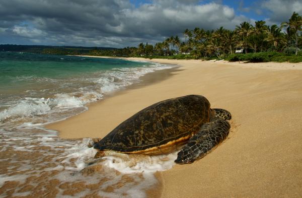
Interesting: A turtle the size of a small car once roamed what is now South America 60 million years ago, suggests its fossilized remains. Discovered in a coal mine in Colombia in 2005, the turtle was given the name Carbonemys cofrinii, which means "coal turtle." It wasn't until now that the turtle was examined and described in a scientific journal; the findings are detailed online Thursday in the Journal of Systematic Paleontology.
The researchers say C. cofrinii belongs to a group of side-necked turtles known as pelomedusoides. The turtle's skull, roughly the size of an NFL football, was the most complete of the fossil remains. In addition to its colossal size, the turtle would have been equipped with massive, powerful jaws, meaning it could've eaten just about anything in its range, from mollusks (a group that includes snails) to smaller turtles and even crocodiles, the researchers noted.
Its all-encompassing appetite as well as its need for a large range to satiate its food requirements may explain why no other turtle of this size has been found at the site. [ Gallery: The World's Biggest Beasts ] "It's like having one big snapping turtle living in the middle of a lake," study researcher Dan Ksepka of North Carolina State University said in a statement.
"That turtle survives because it has eaten all of the major competitors for resources." While the researchers have found bite marks on the remains of other side-necked turtles in the area, suggesting they were preyed upon by crocodilians, such predators would not have messed with this coal mine turtle.
"In fact, smaller crocs would have been easy prey for this behemoth," Ksepka said. The researchers also discovered a turtle shell nearby that they believe belonged to the same species; the shell would've been large enough to double as a kiddy swimming pool, they noted, as it measured some 5 feet 7 inches across.
"We had recovered smaller turtle specimens from the site. But after spending about four days working on uncovering the shell, I realized that this particular turtle was the biggest anyone had found in this area for this time period — and it gave us the first evidence of gigantism in freshwater turtles," Edwin Cadena, also of North Carolina State, said in a statement.
In fact, this big turtle appeared 5 million years after the dinosaurs vanished, at a time when gigantism was relatively common in this part of South America. For instance, the largest snake ever discovered, measuring 45 feet (14 meters) long and called Titanoboa cerrejonensis , lived there, also about 60 million years ago.
A combination of factors, including abundant food, fewer predators, vast habitat and climate change, would have worked together to allow turtles and other animals to balloon to such relatively gargantuan sizes, the researchers suggest. For instance, the warm weather would've been beneficial for such ectotherms that rely on their surroundings to regulate their body temperature.
"The environment seems to have been tropical based on fossil plants found at the site," Ksepka said. "And the turtle appears to have been adapted to spending most of its time in the water, though coming ashore to lay eggs would be part of its life cycle."
Another turtle discovered in this coal mine may have evolved an adaptation to protect itself from these giants; the turtle, called Cerrejonemys wayuunaiki, sported an extra-thick shell, about the thickness of a high-school textbook. The research, funded by the Smithsonian Institute and the National Science Foundation, will be detailed in the June 2012 print issue of the Journal of Systematic Paleontology.