


Air Temperatures – The following maximum temperatures were recorded across the state of Hawaii Saturday:
Lihue, Kauai – 81
Honolulu airport, Oahu – 84 (Record high temperature for Friday / 90 – 2005)
Kaneohe, Oahu – 82
Molokai airport – 81
Kahului airport, Maui – 84 (Record high temperature for Friday / 91 – 1953)
Kona airport – 83
Hilo airport, Hawaii – 79
Air Temperatures ranged between these warmest and coolest spots near sea level – and on the highest mountain tops…as of 5pm Saturday evening:
Honolulu, Oahu – 80
Hilo, Hawaii – 73
Haleakala Crater – 45 (near 10,000 feet on Maui)
Mauna Kea – 46 (near 13,800 feet on the Big Island)
Hawaii’s Mountains – Here’s a link to the live web cam on the summit of near 13,800 foot Mauna Kea on the Big Island of Hawaii. This web cam is available during the daylight hours here in the islands…and when there’s a big moon shining down during the night at times. Plus, during the nights you will be able to see stars, and the sunrise and sunset too…depending upon weather conditions. Here's the Haleakala Crater webcam on Maui…although this webcam is not always working correctly.
Aloha Paragraphs
Trade winds gradually fading away, most showers will
occur in the upcountry areas during the afternoons
Somewhat muggy conditions Sunday/Monday –
returning trades slated for later Tuesday
onwards…with refreshing breezes returning
Happy Mothers Day!
As this weather map shows, we have high pressure systems located to the west-northwest, and far to the northeast of the Hawaiian Islands…with a small low pressure system east-northeast of the state too. At the same time, we find an approaching cold front to our north, heading towards Kauai this weekend. Our local winds will continue to gradually become lighter through Monday…then begin increasing again later Tuesday onwards.
The following numbers represent the most recent wind gusts (mph), along with directions as of Saturday afternoon:
17 Princeville, Kauai – NE
22 Kalaeloa airport, Oahu – NE
20 Molokai – NE
28 Kahoolawe – NE
27 Kahului, Maui – NE
04 Lanai – NE
18 South Point, Big Island – NE
We can use the following links to see what’s going on in our area of the north central Pacific Ocean. Here's the latest NOAA satellite picture – the latest looping satellite image…and finally the latest looping radar image for the Hawaiian Islands.
Here are the latest 24-hour precipitation totals (inches) for each of the islands as of Saturday afternoon:
0.67 Kilohana, Kauai
0.24 Hakipuu Mauka, Oahu
0.00 Molokai
0.00 Lanai
0.00 Kahoolawe
0.01 Kahului airport, Maui
2.24 Honaunau, Big Island
Sunset Commentary: A late season cold front, approaching from the north, will prompt somewhat unusual conditions for our Hawaiian Islands through the next several days. Looking at this weather map, we see a small area of low pressure to our east-northeast, along with high pressure centers stretched out towards our west-northwest and far northeast…with an associated ridge of high pressure between the two. The keynote weather feature however, is that cold front that's dipping southward to the north of the islands…which has recently breaking the hold between the high pressure systems. The latest forecast continues to show the cold front pushing close to Kauai Monday.
There's still some question as to how close the frontal cloud band will get, although it's expected to get close enough to perhaps bring an increase in clouds and showers near Kauai by Monday morning. The island chain between now and then will find good weather, with some afternoon cloud buildup activity over the mountains leading to localized showers…especially over Maui and the Big Island. Then, say around Tuesday or so, the trade winds will rebound, bringing more typical late spring weather conditions to the Aloha state through the rest of the week at least.
There are several new films that I'd like to see, although I thought they might still be too crowded this weekend. Therefore, I went to see one that wasn't my first choice last evening. It was called The Raven, starring John Cusack and Alice Eve…among many others. The synopsis, Edgar Allen Poe joins forces with a young Baltimore detective to hunt down a mad serial killer who's using Poe's own works as the basis in a string of brutal murders. When a mother and daughter are found brutally murdered in 19th century Baltimore, Detective Emmett Fields makes a startling discovery: the crime resembles a fictional murder described in gory detail in the local newspaper – part of a collection of stories penned by struggling writer and social pariah Edgar Allan Poe. But even as Poe is questioned by police, another grisly murder occurs, also inspired by a popular Poe story. Realizing a serial killer is on the loose using Poe's writings as the backdrop for his bloody rampage, Fields enlists the author's help in stopping the attacks. But when it appears someone close to Poe may become the murderer's next victim, the stakes become even higher and the inventor of the detective story calls on his own powers of deduction to try to solve the case before it's too late. ~~~ The Yahoo user reviews give it a 4 out of 5 star rating, which was good enough to get me into the theater. As is almost always the case, I ended up liking this film well enough, although not greatly. It was a bit too dark for my mood, and didn't really hit the mark that closely for me personally. It was my own fault of course, as I knew what I was getting into. There was only a few folks in the theater, which typically isn't a good sign eiither. I can give this film a B- grade, and here's a trailer in case you're interested in a little peek.
As noted above, a late season cold front will slide southward towards us over the next several days. This in turn will help to ease our trade winds, which should drop to their lightest levels Sunday through Tuesday morning. We'll see the current trade wind weather pattern shift to a convective pattern, with the characteristic cool clear mornings giving way to cloudy afternoons over the islands locally, with a few showers over the interior sections. It will be interesting to see just how close the frontal band gets to Kauai, although as the trade winds return later Tuesday…what's left of it will be pushed away to the west. As we get into the middle of the new week, we will see the start of a long lasting trade wind weather pattern.
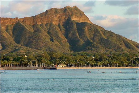
Here in Kula, Maui at 430pm, skies clear to partly cloudy with light breezes, and a warm air temperature of 75.4F degrees. As this satellite image shows, we have cloud patches around the islands, most of which are offshore from the islands…with the exception of the Big Island. One area of higher level clouds, that are showing up brighter white in color, is approaching the state from the north. As the trade winds are still blowing generally from the northeast to east-northeast, we could expect a few windward biased showers tonight. As the winds calm down further, and the cold front gets closer, pushing the high pressure ridge down over or near our islands, we'll shift into a convective weather pattern. This will bring light and variable breezes to the state Sunday into Tuesday morning. At the same time, we'll find cool early mornings, with those clouds increasing over and around the mountains…with a few showers falling there locally.
I had a great time at the Seabury Crafts Fair in lower Olinda, staying several hours in the perfectly sunny and warm weather. I met up with a friend, whose a doctor in Makawao and Kihei, and his girlfriend. He has invited me over to his place for a bbq this evening, where there will be about 9-10 other folks attending. He sent out an email saying he had venison, elk, buffalo, and chicken that he was going to be grilling, which is very unusual…at least for me to taste! I'll let you know about what I thought of this game, which was all grown here here on Maui, except for the buffalo I'll be back. ~~~ I'll be back Sunday morning with your next new weather narrative from paradise, I hope you have a great Saturday night until then! Aloha for now…Glenn.
Extra: The 2012 hurricane season in the eastern Pacific begins May 15th. It's interesting to note that there's an area clouds that are under investigation, some 500+ miles south-southwest of Acapulco, Mexico. It's being called 90E Invest, and can be seen by viewing this satellite image. The National Hurricane Center (NHC) in Miami is giving this area a 40% chance of developing into a tropical cyclone during the next 48 hours. Just for the record, there is absolutely no threat to the Hawaiian Islands, and I'm sharing this just as information.
Interesting: How can NASA physicist and climatologist James E. Hansen, writing in the New York Times today, “say with high confidence” that recent heat waves in Texas and Russia “were not natural events” but actually “caused by human-induced climate change”? It wasn’t all that long ago that respected MIT atmospheric scientist Kerry Emanuel flatly refuted the notion that you can pinpoint global warming as the cause of an extreme weather event. “It’s statistical nonsense,” he told PBS.
In 2005, Emanuel reported that hurricane intensity, which is fed by warmth, had increased some 80 percent during the previous 50 years, a period during which temperatures had increased more dramatically than any time in at least 500 years. Nonetheless, he asserted, that didn’t mean Hurricane Katrina, the sixth strongest Atlantic storm on record, had been brought on by climate change.
Even with a multitude of extreme weather events in recent years — tornadoes in New York City, blizzards in Washington, D.C., 15,000 warm-temperature records shattered across the U.S. in March — each consistent with computer models of a warming world, Emanuel and many other noted scientists have been unwilling to attribute any one event to global warming.
There’s just too much variability in the weather, these experts say, and their dedication to data has helped prop open the door for “denialists” to sow doubt about the reality of our warming world. But Hansen’s shot across the bow this morning indicates that the unwillingness to point fingers may be changing. According to a peer-reviewed paper Hansen has submitted to a leading scientific journal and made available prior to publication, scientists can now state “with a high degree of confidence” that some extremely high temperatures are in fact caused by global warming, simply because they occur much more frequently than they used to.
Hansen’s reasoning has to do with math. Statisticians employ standard deviation to measure variability; it’s the calculation pollsters use to determine margin of error, and it’s especially valuable when looking at the weather. Perfect distribution of standard deviation is graphed as the familiar bell curve; about two-thirds of the time, data points fall in the middle of the bell — or within one standard deviation of the mean.
Hansen, with co-authors Reto Ruedy, also of NASA, and Makiko Sato, of Columbia University, has crunched decades’ worth of readings from more than 1,000 weather stations around the world as well as satellite observations and measurements from Antarctic research stations. The aim: to figure out how often temperatures varied from the mean — and how far they varied — during two periods.
In the paper, the authors show that extreme outliers of more than three standard deviations above the mean temperature covered between six and thirteen percent of the globe during the years 2003 to 2008. If they were normally distributed and similar to the climactic record, that should have been just a 0.1-to-0.2 percent frequency of an extreme heat event. (That’s about exactly as often as a perfect bell curve predicts they would occur.)
Hansen dubs this difference a “three-sigma anomaly,” for the Greek-letter symbol for standard deviation. And in the world of statistics, these anomalies represent a stunning 10-fold increase in extreme weather events. Hansen says the heat wave that struck Texas and Oklahoma last summer and the Moscow heat wave of 2010 (which caused 11,000 deaths in the city) are examples of three-sigma anomalies.
In a paper published last year in the Proceedings of the National Academy of Sciences, Stefan Rahmstorf and Dim Coumou of the Potsdam Institute for Climate Impact Research, in Germany, wrote that it was 80 percent probable that the Moscow heat wave had been caused by global warming. “These three-sigma anomalies,” Hansen says, “we can now say are due to global warming.” But what about the extreme cold snaps climate-change deniers keep pointing to?
Even with global warming, Hansen told Time.com in an email, there “is still a broad bell curve. In fact, it has become broader, which means there will still be times when a season is colder than average. When that happens [people] should not say, ‘What happened to global warming?’ It will still be there — they are just looking at natural variability.” Back in 1988, when Hansen was among the first and most credible scientists to sound the alarm about global warming, he, Ruedy and several co-authors came up with the concept of “climate dice.”
Imagine dice with two sides red (for hot), two sides blue (for cold) and two sides white (average temperatures). If you roll the dice, you’re equally likely to get any result. With continued emissions of greenhouse gas, however, the authors predicted that by the early 21st century, four of the sides would be red. “The climate dice are loaded now, just as we said back in the 1980s that they would be,” Hansen wrote. “People should be able to recognize the change, especially the increasingly extreme events. Don’t be surprised if there are more examples this summer.”