


Air Temperatures – The following maximum temperatures were recorded across the state of Hawaii Sunday:
Lihue, Kauai – 73
Honolulu airport, Oahu – 79
Kaneohe, Oahu – 77
Molokai airport – 82
Kahului airport, Maui – 84 (record high for the date – 89 – 1961)
Kona airport – 81
Hilo airport, Hawaii – 74
Air Temperatures ranged between these warmest and coolest spots near sea level – and on the highest mountain tops…as of 5pm Sunday evening:
Kailua-kona – 78
Honolulu, Oahu – 66
Haleakala Crater – 46 (near 10,000 feet on Maui)
Mauna Kea – 32 (near 13,800 feet on the Big Island)
Hawaii’s Mountains – Here’s a link to the live web cam on the summit of near 13,800 foot Mauna Kea on the Big Island of Hawaii. This web cam is available during the daylight hours here in the islands…and when there’s a big moon shining down during the night at times. Plus, during the nights you will be able to see stars, and the sunrise and sunset too…depending upon weather conditions. Here's the Haleakala Crater webcam on Maui.
Aloha Paragraphs
Locally strong and gusty winds – showers,
especially on Kauai and Oahu…some
of which will be heavy – high
cirrus clouds – volcanic haze (vog) –
rising rough high surf east shores
As this weather map shows, we have high pressure systems to the north and northeast of the islands. At the same time we have a weak low pressure system, with its associated trough of low pressure to the north and west of Kauai. Our winds will be generally light and variable in direction, locally stronger…coming in from the southeast over the open ocean this weekend.
The following numbers represent the strongest wind gusts (mph), along with directions Sunday evening:
17 Barking Sands, Kauai – SE
25 Bellows, Oahu – NE
18 Molokai – NE
42 Kahoolawe – E
33 Lipoa, Maui – SE
17 Lanai – NE
31 Upolu Point, Big Island – NE
We can use the following links to see what’s going on in our area of the north central Pacific Ocean Sunday evening. Looking at this NOAA satellite picture we see a large area of considerable clouds over the ocean to the southwest through northwest of Kauai and Oahu…with some embedded heavy showers and thunderstorms. We can use this looping satellite image to see the counterclockwise rotating low pressure system to the northwest of Kauai, and those brighter white clouds associated with a trough of low pressure to our west and northwest. Checking out this looping radar image we see light to moderate showers, some of which are locally heavy…focusing on Oahu at the time of this writing.
Here are the 24-hour precipitation totals (inches) for each of the islands as of Sunday evening:
8.27 Anahola, Kauai
0.82 Waihee Pump, Oahu
0.10 Molokai
0.00 Kahoolawe
0.21 Puu Kukui, Maui
1.38 Mountain View, Big Island
Sunset Commentary: The latest forecast continues to suggest that locally strong and gusty winds will continue Sunday night…in response to low pressure to our northwest and west. Meanwhile, these winds will carry showers our way at times, some of which will be locally heavy…with thunderstorms near Kauai and Oahu. We continue to find an atmospheric destabilizing cold pool of air aloft, associated with an area of low pressure offshore from Kauai. Its presence is helping to keep our atmosphere more shower prone than usual…especially near Kauai. A flood watch remains in effect on the islands of Kauai and Oahu tonight. As we move into the new work week ahead, our weather will gradually improve, along with strengthening trade winds. Looking further ahead, our trade winds will then once again give way to southeast to perhaps even south winds, ahead of a cold front approaching, or even arriving towards the weekend.
This past Friday evening I drove into Kahului to see a new film called Act of Valor, starring Alex Veadov and Roselyn Sanchez…among many others. The synopsis: an unprecedented blend of real-life heroism and original filmmaking, Act of Valor stars a group of active-duty U.S. Navy SEALs in a film like no other in Hollywood's history. A fictionalized account of real life Navy SEAL operations, Act of Valor features a gripping story that takes audiences on an adrenaline-fueled, edge-of-their-seat journey. When a mission to recover a kidnapped CIA operative unexpectedly results in the discovery of an imminent, terrifying global threat, an elite team of highly trained Navy SEALs must immediately embark on a heart-stopping secret operation, the outcome of which will determine the fate of us all. Act of Valor combines stunning combat sequences, up-to-the-minute battlefield technology, and heart-pumping emotion for the ultimate action adventure film-showcasing the skills, training and tenacity of the greatest action heroes of them all: real Navy SEALs. ~~~ The rotten tomatoes website is giving a low grade of 26 out of 100. I appreciated it much more than that, and would personally lift that low grade to a solid B rating. It was full of suspense and action, with all kinds of shooting and all the rest of that kind of rough stuff. It was the opening night here on Maui, and the theater was about two thirds full. If you like war films, this would be right down your alley. If on the other hand you can't take this kind of shoot em up kind of film, give it a pass. If you are on the fence line about whether or not you'd enjoy this, check out this trailer, as it will likely move you one way or the other.
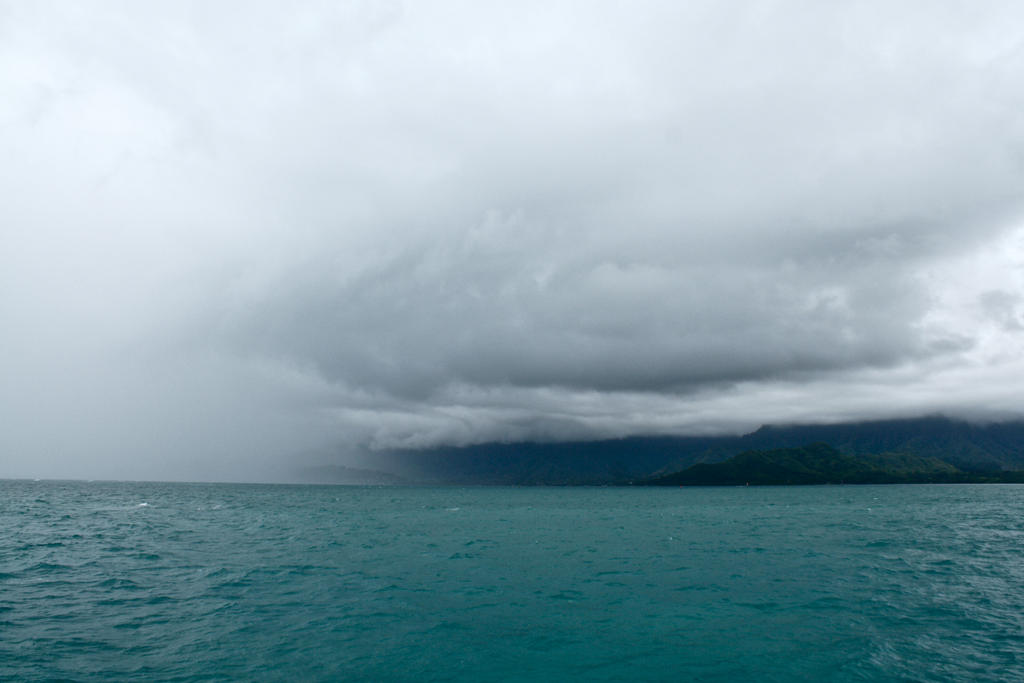
Here in Kula, Maui at 6pm HST, we had calm winds, mostly cloudy skies with volcanic haze…and an air temperature of 64.9F degrees. As noted above, the bulk of our shower activity will be concentrated near Kauai and Oahu overnight, with considerably less showers elsewhere. Our local winds will remain in the light to moderately strong category, although locally strong. Meanwhile, we find that a low pressure system present to the northwest of the state. The placement of this low and its associated trough of low pressure to our west…has prompting considerable showers over, which are now stretching over Oahu. These rains are rather intense, with flash flooding a definite threat. Winds will be from the southeast over the open ocean for the most part, more variable and lighter in closer to the islands themselves.
The flash flood watch over Kauai and Oahu has now been cancelled. Here's a looping radar image so we can keep track of where those heavy showers are. Looking at the rainfall totals on Kauai during the past 24 hours, shows that island has been deluged with precipitation. Every rain gauge on the island has seen lots of water, ranging between 3.04" on the low side, with 8.27 inches on the high side! I'll be back early Monday morning with your next new weather narrative. I hope you have a great Sunday night, although be careful on Kauai and Oahu with all that heavy rainfall! Aloha for now…Glenn.
Interesting: The collapse of the ancient Mayan civilization may have been linked to relatively modest dry spells, researchers now say. The ancient Mayan empire once stretched across an area about the size of Texas, with cities and fields occupying what is now southern Mexico and northern Central America, including the countries of Guatemala, Belize, El Salvador and Honduras.
The height of the Mayan empire, known as the Classic period, reached from approximately A.D. 250 to at least A.D. 900. The ancient Maya had what was arguably the most advanced civilization in the Americas. For instance, they made dramatic breakthroughs in astronomy that helped them very accurately predict where the moon and other planets would be in the sky centuries in the future.
They also left behind many books and stone inscriptions regarding the stories of their gods and the history of their divine kings and queens. For unknown reasons, the ancient Mayan civilization then disintegrated more than a millennium ago. The number of people declined catastrophically to a fraction of the empire's former size, and the ruins of its great cities are now largely overgrown by jungle.
Scientists have long drawn connections between the slow decline of the ancient Maya, which took about two centuries, "to climate change, and especially to drought," said researcher Martín Medina-Elizalde at the Yucatan Center for Scientific Research in Mexico. "No sound estimates had been made about the severity of this drought, but some have suggested extreme scenarios."
To see how much rainfall the ancient Maya saw before the demise of their civilization, the researchers combined the four most detailed records of past climate changes known regarding the civilization's collapse — three from nearby lakes and one from a stalagmite, a mineral formation that grows upward from a cave floor. This helped develop a model of "the region's balance between evaporation and rainfall," Medina-Elizalde said.
The scientists found that rainfall in the region decreased episodically for periods as long as a decade at a time. "Our results show rather modest rainfall reductions between times when the Classic Maya civilization flourished and its collapse between 800 to 950," said researcher Eelco Rohling, a paleoclimatologist at the University of Southampton in England.
"These reductions amount to only 25 to 40 percent in annual rainfall, but they were large enough for evaporation to become dominant over rainfall, and open water availability was rapidly reduced. The data suggest that the main cause was a decrease in summer storm activity."
The timing of these dry spells might help explain why modest reductions in rainfall still may have helped cause the demise of a well-established civilization. "Summer was the main season for cultivation and replenishment of Maya freshwater storage systems and there are no rivers in the Yucatan lowlands," Rohling said.
It appeared to Rohling that the ancient Maya had become reliant on continuous rainfall supplies, and had stretched the capacity of their farmlands to a fine limit based on normal levels of rain. "Then, even a rather subtle climatic change was enough to create serious problems," he told LiveScience.
"Societal disruptions and abandonment of cities are likely consequences of critical water shortages, especially because there seems to have been a rapid repetition of multiyear droughts." Rohling emphasized they are not saying that climate ended the ancient Mayan civilization. "We are documenting that there was a reduction in rainfall, and that reservoirs of water were evaporating," he said.
This may in turn have led to societal unrest or diseases or both, "which are more likely to explain the actual collapse of society." The scientists noted that the droughts they saw during the demise of the ancient Mayan civilization were similar in severity to those projected by the Intergovernmental Panel on Climate Change (IPCC) for the near future in the same region.
"There are differences too, but the warning is clear — what seems like a minor reduction in water availability may lead to important, long-lasting problems," Medina-Elizalde said. "This problem is not unique to the Yucatan Peninsula, but applies to all regions in similar settings where evaporation is high. Today, we have the benefit of awareness, and we should act accordingly."
The scientists detailed their findings in the Feb. 24 issue of the journal Science.
tim Says:
Good evening Glen, I've been keeping an eye on the radar this afternoon and have noticed that the rain mass is slowly making its way south east. Is there any chance of that energy reaching Maui in a few hours, or will the cooling evening temps dissipate our chances for more much needed rain? ~~~ Hi Tim, good eye, as you point out, that rain shield is getting closer to Molokai. I think that there is a chance of seeing some of the edge of this rain edging into parts of Maui County, although don’t anticipate it will lead to flooding…as always though, time will tell. We sure could use that moisture however, as you suggest. Aloha, Glenn