


Air Temperatures – The following maximum temperatures were recorded across the state of Hawaii Tuesday:
Lihue, Kauai – 78
Honolulu airport, Oahu – 84 (record high temperature for the date…89F degrees – 1977)
Kaneohe, Oahu – 75
Molokai airport – 81
Kahului airport, Maui 82
Kona airport 80
Hilo airport, Hawaii – 72
Air Temperatures ranged between these warmest and coolest spots near sea level – and on the highest mountain tops…as of 5pm Tuesday evening:
Barking Sands, Kauai – 80
Hilo, Hawaii – 70
Haleakala Crater – 39 (near 10,000 feet on Maui)
Mauna Kea – 32 (near 13,800 feet on the Big Island)
Hawaii’s Mountains – Here’s a link to the live web cam on the summit of near 13,800 foot Mauna Kea on the Big Island of Hawaii. This web cam is available during the daylight hours here in the islands…and when there’s a big moon shining down during the night at times. Plus, during the nights you will be able to see stars, and the sunrise and sunset too…depending upon weather conditions. Here's the Haleakala Crater webcam on Maui…which is working only sometimes lately.
Aloha Paragraphs
Windward showers…sunny leeward
As this weather map shows, we find a 1027 millibar high pressure system located to the northeast of the Hawaiian Islands Tuesday evening. This high pressure cell has an elongated ridge that runs from the center west-southwest across the International Dateline…into the western Pacific. This ridge is positioned to the north of the state, which will keep our winds blowing, although will be subdued to some extend by a trough of low pressure draped over the state now. Easterly trade winds will return through Friday…then strengthening from the trade wind direction this weekend into early next week.
The following numbers represent the strongest wind gusts (mph), along with directions Tuesday evening:
22 Port Allen, Kauai – E
23 Kahuku, Oahu – E
27 Molokai – E
36 Kahoolawe – ESE
21 Lipoa, Maui – SE
13 Lanai – SE
32 Upolu Point, Big Island – NE
We can use the following links to see what’s going on in our area of the north central Pacific Ocean early Tuesday evening. Looking at this NOAA satellite picture we find that high and middle level cloudiness stretches across parts of Maui County and the Big Island, leaving Oahu and Kauai under just lower level clouds. We can use this looping satellite image to see this high level moisture streaming up from the southwest, over the eastern islands…although it continues to shift slowly eastward. This cloudiness masks the lower level showers that are being carried our way on the lower level wind flow…over the eastern islands. Checking out this looping radar image we see showers over the ocean, most of which are in the light to moderately heavy category, although some are locally heavier, the most active areas are coming over Oahu and southeast of the Big Island at the time of this writing.
Here are the 24-hour precipitation totals (inches) for each of the islands as of Tuesday evening:
3.72 Mount Waialeale, Kauai
7.12 Moanalua RG, Oahu
2.04 Molokai
0.00 Lanai
0.00 Kahoolawe
1.43 Puu Kukui, Maui
0.47 Ahumoa, Big Island
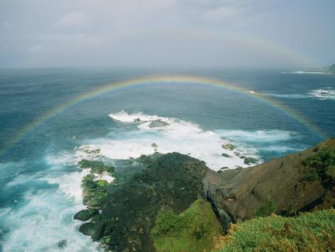
Sunset Commentary: The off and on wet weather continues here in the islands, with localized flooding on several of the islands during the day. The largest precipitation amounts have reached up over 7.00″ on at least two our islands in the chain during the last 24 hours. The area from Oahu down through Maui County to the Big Island continue to have a flash flood watch in effect at the time of this writing. An unstable atmosphere, along with abundant low level moisture is leading to this inclement weather pattern. The thick high and middle level clouds are adding to this Seattle-like reality, which has been shifting around at times, although is currently over just parts of Maui County and the Big Island…as seen on this satellite image.
The computer models continue to suggest that we’ll dig ourselves out from under this overcast cloud layer(s) pretty soon. Already Kauai, Oahu and Molokai are seeing clearing skies, at least the high stuff, while there are small blue patches starting to appear over Maui in places too. Wednesday should continue this gradually improving weather, especially along our leeward sides. As our easterly trade winds fill back into the area, the windward sides will continue to find passing showers at times into Friday. Then, as we push into the upcoming weekend, the trade winds are expected to increase in strength, becoming rather strong and gusty again. This wind flow will continue to bring more showers to our already soggy windward coasts and slopes.
Here in Kihei, Maui at around 530Pm Tuesday evening, it was partly to mostly cloudy If you look at the looping radar, it shows the extent of the rainfall that's still around now, some of which is heavy. There is still the chance of some heavy showers tonight from Oahu down to the Big Island. As I was mentioning above, tomorrow looks like it will be quite a bit improved, with more of that into Thursday and Friday. This is especially true along our leeward beaches, where we should finally see more sunshine. The windward sides may not be quite so lucky, as they aren't done with the off and on passing showers, which will continue to be the case right into the upcoming weekend. ~~~ I'll be back early Wednesday morning with your next new weather narrative, I hope you have a great Tuesday night until then! Aloha for now…Glenn.
Interesting: Government officials have this afternoon issued a warning as one of the stormiest periods the UK has seen for several years is set to worsen. Weather experts warn the strength of an incoming low-pressure system can already be compared to the Great Storm of 1703.
According to the advisory released by the Central Office of Information this afternoon, the end of the week in particular could see dramatic stormy conditions across England and Wales. Experts are already warning that Friday's storm could be likened to the Great Storm of 1703 with a forecast of record low pressures as hurricane-force winds crash in from the west.
Weather records show the pressure at the centre of the 1703 Great Storm was 973 millibars but current forecast data shows the pressure at the centre of Friday's storm will be around 972 millibars and could even drop as low as 920 millibars. According to the latest severe weather warning, Scotland is unlikely to be as badly affected by Friday's storm as England and Wales.
Jonathan Powell of Positive Weather Solutions told ClickGreen tonight that Friday's storm is likely to be destructive as well as disruptive. "There is every expectation that the storm later in the week will deliver an extraordinary punch," he said. "Winds are forecast to reach 80mph and there is every possibility the storm will wind itself up even further as it crosses the Atlantic."
The Met Office said an Atlantic storm passing over the UK later today will bring wet and windy weather to the whole country, with some particularly heavy rain for parts of Wales and South West England.
Interesting2: An unusually hot melting season in 2010 accelerated ice loss in southern Greenland by 100 billion tons — and large portions of the island’s bedrock rose an additional quarter of an inch in response. That’s the finding from a network of nearly 50 GPS stations planted along the Greenland coast to measure the bedrock’s natural response to the ever-diminishing weight of ice above it.
The Greenland ice sheet is a vast body of ice covering 660,235 square miles, roughly 80% of the surface of Greenland. It is the second largest ice body in the world, after the Antarctic Ice Sheet. The ice sheet is almost 1,500 miles long in a north-south direction, and its greatest width is 680 miles at a latitude of 77°N, near its northern margin. The mean altitude of the ice is 7,005 feet.
Every year as the Greenland Ice Sheet melts, the rocky coast rises, explained Michael Bevis, Ohio Eminent Scholar in Geodynamics and professor in the School of Earth Sciences at Ohio State University. Some GPS stations around Greenland routinely detect uplift of 0.59 inches or more, year after year.
But a temperature spike in 2010 lifted the bedrock a detectably higher amount over a short five-month period — as high as 0.79 inches in some locations. “Pulses of extra melting and uplift imply that we’ll experience pulses of extra sea level rise,” he said.
"The process is not really a steady process." Because the solid earth is elastic, Bevis and his team can use the natural flexing of the Greenland bedrock to measure the weight of the ice sheet, just like the compression of a spring in a bathroom scale measures the weight of the person standing on it.
Bevis is the principal investigator for the Greenland GPS Network (GNET), and he’s confident that the anomalous 2010 uplift that GNET detected is due to anomalous ice loss during 2010: "Really, there is no other explanation. The uplift anomaly correlates with maps of the 2010 melting day anomaly.
In locations where there were many extra days of melting in 2010, the uplift anomaly is highest." In scientific parlance, a melting day anomaly refers to the number of extra melting days — that is, days that were warm enough to melt ice — relative to the average number of melting days per year over several decades.
In 2010, the southern half of Greenland lost an extra 100 billion tons of ice under conditions that scientists would consider anomalously warm. GNET measurements indicate that as that ice melted away, the bedrock beneath it rose. The amount of uplift differed from station to station, depending on how close the station was to regions where ice loss was greatest.
Southern Greenland stations that were very close to zones of heavy ice loss rose as much as 0.79 inches over the five months. Even stations that were located far away typically rose at least 0.2 inches during the course of the 2010 melting season.
But stations in the North of Greenland barely moved at all. There have been several recent major Greenland ice loss events: A major ice loss to northern Greenland's Petermann glacier occurred when the glacier lost 33 square miles (85 of floating ice between 2000 and 2001.
Between 2001 and 2005, a breakup of Sermeq Kujalleq erased 36 square miles from the ice field and raised awareness worldwide of glacial response to global climate change. In July 2008, researchers monitoring daily satellite images discovered that a 11-square-mile piece of Petermann broke away.
Interesting3: Imagine visiting San Diego in December hoping to escape the doldrums of winter to relax in warmth and sunshine, but instead finding the very thing you wished to avoid…snow! It happened 44 years ago on Dec. 13, 1967, as a powerful storm dropped temperatures low enough so that snowflakes were flying in one of America's most snow-resistant cities.
Some local children could even play in the snow that day, according to one resident who experienced the unusual event firsthand. "There were some places around the city where kids managed to sled," a resident told VoiceofSanDiego.org.
Saying this was a rare occurrence might be an understatement larger than the city of San Diego itself. Only five times over the last 130 years of record-keeping has snow fallen in the city itself. The last time any flakes stuck was during the 1967 event.
The warming influence of the Pacific Ocean keeps the weather of San Diego relatively consistent throughout the year, with temperatures rarely dropping low enough to even support the white stuff. Snow is even unusual in the hills outside of the city, which were turned white that day in 1967, including in El Cajon.
The mountains east of San Diego, which typically get snow every year, had more than 8 feet over the course of that week. While the official observing station at San Diego International Airport itself reported a trace, enough snow was available to build snowmen in parts of the city.
Nearby Carlsbad, along the coast, recorded 2 inches. For those who experienced it first hand, the sight of snow falling in San Diego is something they will never forget. To commemorate the 40th anniversary in 2007, the San Diego Union-Tribune uncovered stories from the day that "America's Finest City" turned white.
The surreal experience of snow falling on surfers sent them rushing into a nearby surf shop, stoked about an encounter with something other than the perfect wave. A schoolchild used the opportunity to make snowballs to his advantage that day, hurling one at his "no-nonsense" typing teacher.
The powerful storm left an indelible mark on other Southwestern cities more acclimated to heavy snow, including Flagstaff, Ariz., where 27.3 inches fell in one day setting a new 24-hour record for the city.
Bill Says:
Hi Glenn–
We're headed to Lanai for 2 weeks beginning next Wednesday. Although I realize forecasts this far out are unreliable, it seems next week into Christmas look cloudy / rainy. This is our 4th Holiday trip to the islands in a row , and the weather has been gorgeous for the entire trip each time. Of course, even a rainy day in Hawaii beats any December day on the mainland, but what does your instinct tell you about our chances for an ongoing rainy pattern? Interestingly, the weather here in the Great Lakes, as opposed to the past few years, has been very mild to date–wonder if there is any correlation?
Mahalo ~~~Hello Bill, it won’t be cloudy and rainy for your entire trip, no way. I’d say come ahead, and expect more or less the same as you have been getting during your last trips. There are bound to be some showers during the two week period, as it will be winter, and we do have winter weather here in the tropics too. You’ll be fine, and by the way…happy holidays! Aloha, Glenn
Mike Says:
I was going to college in Flagstaff in 1967. It started snowing on the 12th of December and stopped snowing on December 23rd. By the time it finished there was about 8 feet of snow in Flagstaff from that one storm, which was probably a series of storms stacked over the eastern Pacific. Funny, it's snowing in Flagstaff right now with more than a foot having fallen in the last 24 hours with more to come into the next weekend.~~~Hi Mike, wow, snow bound in Flagstaff! I’ve been there once, and liked it, although I still remember it being 8 degrees, and I think it was the coldest I’ve ever been one night! Looks like you’ll have a nice white Christmas, that seems pretty certain. Happy Holiday’s, thanks for your note. Aloha, Glenn