


Air Temperatures – The following maximum temperatures were recorded across the state of Hawaii Thursday:
Lihue, Kauai – 86
Honolulu airport, Oahu – 90 (record for Thursday – 93 in 1984)
Kaneohe, Oahu – 83
Molokai airport – 87
Kahului airport, Maui – 87
Kona airport 85
Hilo airport, Hawaii – 81
Air Temperatures ranged between these warmest and coolest spots near sea level – and on the highest mountain tops…as of 5pm Thursday evening:
Port Allen, Oahu – 88
Kaneohe, Oahu – 81
Haleakala Crater – 52 (near 10,000 feet on Maui)
Mauna Kea Summit – 36 (over 13,500 feet on the Big Island)
Here are the 24-hour precipitation totals (inches) for each of the islands as of Thursday evening:
0.98 Mount Waialeale, Kauai
0.20 Moanalua RG, Oahu
0.00 Molokai
0.00 Lanai
0.00 Kahoolawe
0.22 West Wailuaiki, Maui
1.00 Kawainui Stream, Big Island
Marine Winds – Here’s the latest (automatically updated) weather map showing a near 1032 millibar high pressure system far to the north-northeast of our islands. Our local trade winds will remain moderately strong through Friday, lighter Saturday…strongest around Maui and the Big Island.
Satellite and Radar Images: To view the cloud conditions we have here in Hawaii, please use the following satellite links, starting off with this Infrared Satellite Image of the islands to see all the clouds around during the day and night. This next image is one that gives close images of the islands only during the daytime hours, and is referred to as a Close-up visible image. Finally, here's a Looping IR satellite image, making viewable the clouds around the islands 24 hours a day. To help you keep track of where any showers may be around the islands, here’s the latest animated radar image.
Hawaii’s Mountains – Here’s a link to the live web cam on the summit of near 13,500 foot Mauna Kea on the Big Island of Hawaii. The tallest peak on the island of Maui is the Haleakala Crater, which is near 10,000 feet in elevation. These two web cams are available during the daylight hours here in the islands…and when there’s a big moon shining down during the night at times. Plus, during the nights you will be able to see stars, and the sunrise and sunset too…depending upon weather conditions.
Tropical Cyclone activity in the eastern and central Pacific – Here’s the latest weather information coming out of the National Hurricane Center, covering the eastern north Pacific. You can find the latest tropical cyclone information for the central north Pacific (where Hawaii is located) by clicking on this link to the Central Pacific Hurricane Center. A satellite image, which shows the entire ocean area between Hawaii and the Mexican coast…can be found here. Here's a tropical cyclone tracking map for the eastern and central Pacific.
Aloha Paragraphs

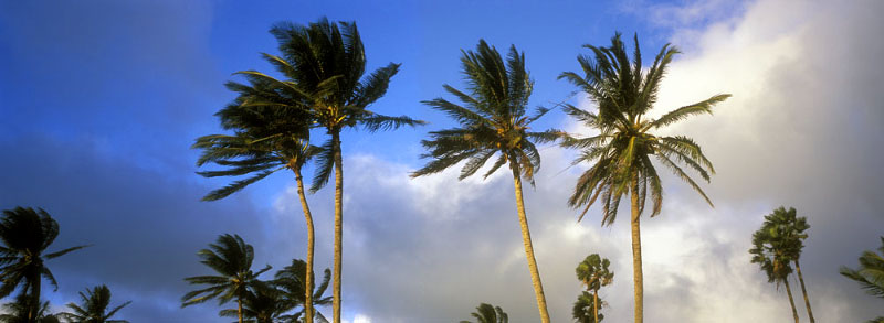
Trade wind weather pattern continues
The trade winds will continue, light to moderately strong…locally stronger around Maui County and the Big Island into Saturday. Glancing at this weather map, we find a near 1032 millibar high pressure system far to the north-northeast of our islands. Our local trade winds will remain active…strongest around Maui County and the Big Island. The computer forecast models continue to suggest that our trade winds will start to become lighter this weekend into next week.
Our trade winds will remain active…the following numbers represent the strongest gusts (mph), along with directions Thursday evening:
13 Princeville, Kauai – NE
22 Kahuku, Oahu – NE
27 Molokai – NE
28 Kahoolawe – ESE
32 Kahului, Maui – NE
07 Lanai – ESE
24 Upolu Point, Big Island – NE
We can use the following links to see what’s going on in our area of the north central Pacific Ocean Thursday night. Looking at this NOAA satellite picture we find low level clouds to the east, moving into and through our island area. There are a few higher level cirrus spreading over of our islands as well. We can use this looping satellite image to see areas of thunderstorms over the ocean, far to the southeast through southwest…and high cirrus approaching from the southwest of the islands. Checking out this looping radar image we see that there are a few showers being carried along in the trade wind flow…hardly any though at the time of this writing.
Sunset Commentary: Starting off, the large area of stable clouds which were poised to the east of our islands yesterday, have moved about half way through our islands. This hasn’t amounted to much precipitation though, as these relatively thin clouds haven’t given up much water. This was expected, although as usual, Kauai’s Mount Waialeale has collected over an inch of rainfall during the last 24 hours. This mountain could probably get .01” from a totally clear sky!
As we move into the weekend, and on into the early part of next week, we may see some changes in our rainfall pattern. The reason for this is that an early season storm in the north Pacific, will send an unusually early cold front southward towards the equator. This frontal boundary, as it moves through the mid-latitudes, into the subtropics…will shove our trade wind producing high pressure system eastward. This high’s associated ridge will get pushed southward towards our islands in the process. This in turn will knock our trade winds down in strength. All of this suggests that our current trade wind weather pattern will give way to a convective pattern. This typically brings the emphasis for showers over to the leeward slopes during the afternoon hours.
Meanwhile, the surf is still somewhat larger than normal, but is dropping in size. The high surf warning is long gone, and even now the high surf advisory has been ended as well. The leeward sides, those south and west facing shores have had lots of waves breaking the last several days. The reefs on those sides of the islands got aerated, the sand got eroded in places, and the surfing community got stoked! This surf, having been generated in the southern hemisphere, will continue to diminish in size Friday into the weekend. There will be generally small to very small surf most of next week. A storm down that way, near New Zealand now, is in the process of generating a new south swell however, which will arrive along our south and west facing beaches in about a week…lasting into next weekend.
Here in Kihei, Maui at 530pm HST Thursday evening, skies were clear to partly cloudy, with still a pretty stiff trade wind breeze blowing for this time of day. There are so many tropical cyclones in the world now! One is moving into Japan right now, called Talas. Soon to be tropical storm Lee will be moving into the Gulf of Mexico coast. Meanwhile, Katia, will be strengthening in the Atlantic…becoming a major category 3 hurricane with time. I'll have more to say about tropical storm Lee in the Gulf of Mexico, and certainly soon to be (again) hurricane Katia, which briefly dropped back down to a tropical storm today. Right now though, I'll be taking the drive back upcountry to Kula. I'll be back early Friday morning with your next new weather narrative. I hope you have a great Thursday night until then! Aloha for now…Glenn.
Interesting: In an attempt to hedge against future rising energy prices, Volkswagen announced last week that it will invest up to $1.45 billion in renewable energy. The announcement follows the company's decisions earlier this year to invest in other clean energy projects as well as to launch new electric vehicles. According to the German language edition of the Financial Times, Volkswagen will become a large investor in two offshore wind parks in the North Sea. The investment accomplishes two objectives: to help the car manufacturer meet its renewable energy goals for 2020 as well as give a boost to Germany's flagging wind power sector.
While Germany has been a leader in solar energy the past decade, wind power has been a different story. Ambitious projects to build wind power farms in the North Sea have suffered from the lack of investors who saw the proposed projects as too risky. Volkswagen had been in talks with wind power developers for several years but had hesitated to commit to the industry.
But the moves of other companies, including the American private equity firm Blackstone, helped open the door to increased investment. Blackstone closed a deal on one wind farm last month. Now WV is set to invest in two wind power farms, including one 60 miles north , an island off of Germany's northwestern coast. For Volkswagen, the investment goes beyond scoring a few corporate social responsibility (CSR) points.
True, VW has pledged to reduce its carbon dioxide emissions 40 percent by 2020. But energy security is a concern for European countries, and companies, who have been rattled by volatility in the Middle East and North Africa as well as Russia's shutdown of its gas supplies to Europe two years ago. And with Angela Merkel's promise to phase out nuclear energy by 2022, the time for energy intensive firms like Volkswagen to find different sources of power is now.
Interesting2: Warming streams could spell the end of spring-run Chinook salmon in California by the end of the century, according to a study by scientists at UC Davis, the Stockholm Environment Institute and the National Center for Atmospheric Research. There are options for managing water resources to protect the salmon runs, although they would impact hydroelectric power generation, said Lisa Thompson, director of the Center for Aquatic Biology and Aquaculture at UC Davis.
A paper describing the study is published online by the Journal of Water Resources Planning and Management. "There are things that we can do so that we have the water we need and also have something left for the fish," Thompson said.
Working with Marisa Escobar and David Purkey at SEI's Davis office, Thompson and colleagues at UC Davis used a model of the Butte Creek watershed, taking into account the dams and hydropower installations along the river, combined with a model of the salmon population, to test the effect of different water management strategies on the fish.
They fed in scenarios for climate change out to 2099 from models developed by David Yates at NCAR in Boulder, Colo. In almost all scenarios, the fish died out because streams became too warm for adults to survive the summer to spawn in the fall.
The only option that preserved salmon populations, at least for a few decades, was to reduce diversions for hydropower generation at the warmest time of the year. "If we leave the water in the stream at key times of the year, the stream stays cooler and fish can make it through to the fall," Thompson said.
Summer, of course, is also peak season for energy demand in California. But Thompson noted that it might be possible to generate more power upstream while holding water for salmon at other locations.
Hydropower is often part of renewable energy portfolios designed to reduce greenhouse gas emissions, Purkey said, but it can complicate efforts to adapt water management regimes to a warming world. Yet it need not be all-or-nothing, he said.
"The goal should be to identify regulatory regimes which meet ecosystem objectives with minimal impact on hydropower production," he said. "The kind of work we did in Butte Creek is essential to seeking these outcomes." There are also other options that are yet to be fully tested, Thompson said, such as storing cold water upstream and dumping it into the river during a heat wave. That would both help fish and create a surge of hydropower.
Salmon are already under stress from multiple causes, including pollution, and introduced predators and competitors, Thompson said. Even if those problems were solved, temperature alone would finish off the salmon — but that problem can be fixed, she said. "I swim with these fish, they're magnificent," Thompson said. "We don't want to give up on them."