


Air Temperatures – The following maximum temperatures were recorded across the state of Hawaii Friday:
Lihue, Kauai – 85
Honolulu airport, Oahu – 88 (record for Friday – 92 in 1986)
Kaneohe, Oahu – 83
Molokai airport – 85
Kahului airport, Maui – 85
Kona airport 85
Hilo airport, Hawaii – 81
Air Temperatures ranged between these warmest and coolest spots near sea level – and on the highest mountain tops…as of 5pm Friday evening:
Barking Sands, Kauai – 85
Hilo, Hawaii – 80
Haleakala Crater – 48 (near 10,000 feet on Maui)
Mauna Kea Summit – 41 (over 13,500 feet on the Big Island)
Here are the 24-hour precipitation totals (inches) for each of the islands as of Friday evening:
2.02 Mount Waialeale, Kauai
0.48 Manoa Lyon Arboretum, Oahu
0.38 Molokai
0.00 Lanai
0.00 Kahoolawe
1.09 West Wailuaiki, Maui
0.75 Kawainui Stream, Big Island
Marine Winds – Here’s the latest (automatically updated) weather map showing a 1035 millibar high pressure system to the north-northeast of our islands Friday night. Our local trade winds will remain active through Sunday…locally strong and gusty.
Satellite and Radar Images: To view the cloud conditions we have here in Hawaii, please use the following satellite links, starting off with this Infrared Satellite Image of the islands to see all the clouds around during the day and night. This next image is one that gives close images of the islands only during the daytime hours, and is referred to as a Close-up visible image. Finally, here's a Looping IR satellite image, making viewable the clouds around the islands 24 hours a day. To help you keep track of where any showers may be around the islands, here’s the latest animated radar image.
Hawaii’s Mountains – Here’s a link to the live web cam on the summit of near 13,500 foot Mauna Kea on the Big Island of Hawaii. The tallest peak on the island of Maui is the Haleakala Crater, which is near 10,000 feet in elevation. These two web cams are available during the daylight hours here in the islands…and when there’s a big moon shining down during the night at times. Plus, during the nights you will be able to see stars, and the sunrise and sunset too…depending upon weather conditions.
Tropical Cyclone activity in the eastern and central Pacific – Here’s the latest weather information coming out of the National Hurricane Center, covering the eastern north Pacific. You can find the latest tropical cyclone information for the central north Pacific (where Hawaii is located) by clicking on this link to the Central Pacific Hurricane Center. A satellite image, which shows the entire ocean area between Hawaii and the Mexican coast…can be found here. Here's a tropical cyclone tracking map for the eastern and central Pacific.
Aloha Paragraphs
Strong trade winds through the next couple of days…
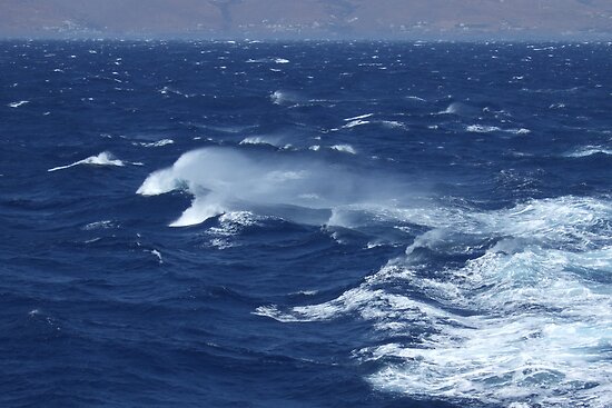
High surf advisory east facing shores
The trade winds will continue to blow strongly through this weekend..gradually easing up some Sunday into next week. Glancing at this weather map, we find a very large 1035 millibar high pressure system to the north-northeast of the islands Friday night. This high pressure cell and its associated ridges will provide our trade winds over the islands well into the future. Our local winds will remain stronger and gusty than usual into the weekend. The current small craft wind advisories cover all marine zones across the state now. As the high pressure system to our north begins to weaken some Sunday into early next week, along with having an upper level low pressure system edge near us…our local winds will step down a little in strength.
Our trade winds will remain active…the following numbers represent the strongest gusts (mph), along with directions Friday evening:
33 Port Allen, Kauai – NE
32 Waianae, Oahu – NE
32 Molokai – NNE
33 Kahoolawe – ESE
40 Kapalua, Maui – NE
42 Lanai – NE
39 Upolu Point, Big Island – NE
We can use the following links to see what’s going on in our area of the north central Pacific Ocean Friday night. Looking at this NOAA satellite picture we find just a few low level cumulus and stratocumulus clouds coming into our windward sides. There's more clouds however just upwind from our windward sides…so we'll more showers arriving. We can use this looping satellite image to see lower level clouds being carried along in the low level wind flow. There are considerable high clouds coming up towards us from the south and southwest of the islands too…associated with thunderstorms in the deeper tropics. Checking out this looping radar image we see showers being carried along in the wind flow…which will likely bring a modest increase during the night.
Sunset Commentary: The trade winds maxed-out today, as evidenced by gusts up towards 50 mph early this afternoon. That may be pushing it a little, as the highest gust at the time of this writing was 45 mph. The winds will remain extra strong into Saturday, with gusts sending anemometer needles past 40 mph once again Saturday. The expectation is for slightly lighter winds on Sunday, with a further easing-up going into the new work week ahead….although not dropping below the moderately strong levels. There still isn’t any sign of the trade winds faltering more than that, well into the future. We’re into the heart of our summer trade wind season, which is totally normal for our area of the north Pacific.
As far as rainfall is concerned, there will continue to be some showers falling. These will be most generous along our windward coasts and slopes…and especially during the cool and moist night time hours. The computer forecast models continue to suggest that an upper level low pressure system will edge closer by Monday, perhaps by later in the day Sunday. This relatively cold air aloft may enhance our shower activity then, although it will depend up how much available moisture that the trade winds drag our way.
This will be a rather short window of opportunity however, as the low aloft shifts away shortly thereafter. It’s probably a long shot, although there’s always a chance of some of the remnant moisture from tropical cyclone Eugene, now way off to our east, being carried our way on the trade winds. If this stuff was to arrive here late next week, it would probably just blend into whatever showery clouds that might be around then.
Speaking of tropical cyclones for another minute, we may see some modestly rising surf along our windward sides later this weekend, coming in from Eugene, mentioned above…generated when it was a very strong category 4 hurricane a couple of days ago. Typhoon Muifa way over in the western Pacific, actually the east China Sea now, was too far away to send us any surf. There’s another tropical cyclone that’s spinning closer to us, whose name is Merbok, also in the western Pacific. This storm is going to strengthen into a typhoon, as it hooks back up to the northeast, which is far northwest of Hawaii. This system might be able to send us some surf from the northwest direction with time.
Here in Kihei, Maui at around 530pm Friday evening, skies were mostly clear with just a few clouds around here and there. I'm leaving soon to see a new film in Kahului. This one is called Crazy, Stupid, Love, starring Steve Carell, Ryan Gosling, Julianne Moore, Emma Stone, Marisa Tomei, Kevin Bacon…among many others. Hello, how could this film be bad with all these heavy hitters on board!? The synopsis: a hapless forty-something finds himself suddenly single when his seemingly "perfect" life unravels. I don't usually fall for comedy films, but this one looks pretty good, and a friend at work saw it and recommended it. So, I'll go see it, and will report back to you in the morning. Here's a trailer just in case you have an interest in getting a taste of what I'll be seeing. I hope you have a great Friday night, see you in the morning! Aloha for now…Glenn.
Interesting: Dog-sized dinosaurs that lived near the South Pole, sometimes in the dark for months at a time, had bone tissue very similar to dinosaurs that lived everywhere on the planet, according to a doctoral candidate at Montana State University. That surprising fact falsifies a 13-year-old study and may help explain why dinosaurs were able to dominate the planet for 160 million years, said Holly Woodward, MSU graduate student in the Department of Earth Sciences and co-author of a paper published Aug. 3 in the journal PLoS ONE.
"If we were trying to find evidence of dinosaurs doing something much different physiologically, we would expect it to be found in dinosaurs from an extreme environment such as the South Pole," Woodward said. "But based on bone tissues, dinosaurs living within the Antarctic Circle were physiologically similar to dinosaurs living everywhere else.
"This tells us something very interesting; that basically from the very start, early dinosaurs, or even the ancestors of dinosaurs, evolved a physiology that allowed an entire group of animals to successfully exploit a multitude of environmental conditions for millions of years," Woodward said.
Jack Horner, Woodward's adviser and Regents Professor of Paleontology/Curator of Paleontology at MSU's Museum of the Rockies, said Woodward's findings are consistent with other results from the museum's histology lab. "I think the most important finding is that polar dinosaurs don't seem to be any different than any other dinosaurs in respect to how their bones grew," Horner said.
"Dinosaurs have annual growth lines and those that don't have them are simply not yet a year old." Woodward said she conducted her research after reading a 1998 study about polar dinosaurs. Intrigued by the study, she decided to review the findings and received a National Science Foundation grant that allowed her to travel to Australia last summer, set up a histology laboratory and analyze bones in a rare collection in Australia's Melbourne Museum.
Woodward analyzed the bone tissue of 17 dinosaurs that lived 112 to 100 million years ago during the latter part of the Early Cretaceous Period. All but one of the dinosaurs in her study were plant eaters. All lived in the Antarctic Circle in what is now known as the Australian state of Victoria.
Also participating in the study were the authors of the original study: Anusuya Chinsamy at the University of Cape Town in South Africa, Tom Rich at the Melbourne Museum and Patricia Vickers-Rich at Monash University in Australia. The three scientists who conducted the original study welcomed her analysis and didn't mind that she falsified their hypothesis, Woodward said.
She added that the new study looked at more dinosaur bones than the original study because more bones from the polar dinosaurs were available. Paleontologists have been adding to the collection over the past 25 to 30 years. The original study looked at the bone microstructure of the polar dinosaurs and concluded that the differences they saw indicated that some dinosaurs survived harsh polar conditions by hibernating, while others evolved in a way that allowed them to be active year-round, Woodward said.
The new study showed that all but the youngest dinosaurs had "Lines of Arrested Growth" or LAGs, Woodward said. Since the hibernation hypothesis was based on the presence or absence of LAGs, the new study falsified the hypothesis. LAGSs, in a bone cross section, look like tree rings, Woodward said. Like tree rings, they are formed when growth temporarily stops.
"Research on animals living today suggests that LAGs form annually, regardless of latitude or climate," Woodward said. "Like tree rings, LAGs can be counted to age an animal, so that the absence of these marks likely indicates a dinosaur was less than a year old. These marks have also been found in dinosaurs that lived at much lower latitudes having no need to hibernate."
The new study doesn't mean there was nothing unique about polar dinosaurs, but those qualities aren't apparent in bone tissue, Woodward said. "It is very likely that dinosaurs living in different environments evolved specific adaptations — either physical or behavioral — to cope with environmental conditions," she said. "Analysis of bone microstructure can tell us a great deal about growth, but some things just aren't recorded in bone tissue."