


Air Temperatures – The following maximum temperatures were recorded across the state of Hawaii Wednesday:
Lihue, Kauai – 85
Honolulu airport, Oahu – 88 (record for Wednesday – 91 in 1984, 1994, 1995, 2003)
Kaneohe, Oahu – 82
Molokai airport – 87
Kahului airport, Maui – 88 (record for Wednesday – 94 in 1952)
Kona airport 85
Hilo airport, Hawaii – 85
Air Temperatures ranged between these warmest and coolest spots near sea level – and on the highest mountain tops…as of 5pm Wednesday evening:
Barking Sands, Kauai – 84
Kaneohe, Oahu – 80
Haleakala Crater – 55 (near 10,000 feet on Maui)
Mauna Kea Summit – 48 (over 13,500 feet on the Big Island)
Here are the 24-hour precipitation totals (inches) for each of the islands as of Wednesday evening:
0.90 Mount Waialeale, Kauai
0.21 Oahu Forest NWR, Oahu
0.04 Molokai
0.00 Lanai
0.00 Kahoolawe
0.16 Puu Kukui, Maui
0.18 Glenwood, Big Island
Marine Winds – Here’s the latest (automatically updated) weather map showing a 1027 millibar high pressure system to the northeast of our islands. Our local trade winds will remain active through Friday…strengthening.
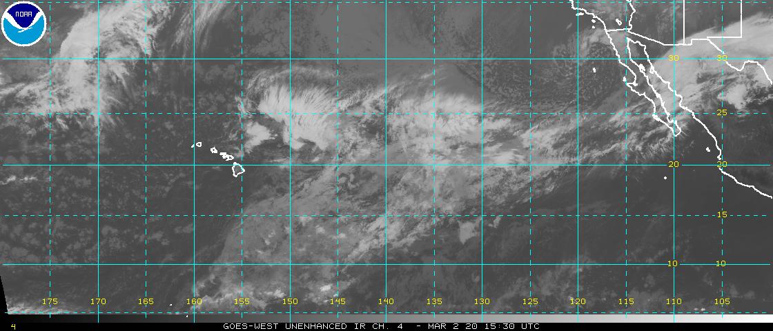
Satellite and Radar Images: To view the cloud conditions we have here in Hawaii, please use the following satellite links, starting off with this Infrared Satellite Image of the islands to see all the clouds around during the day and night. This next image is one that gives close images of the islands only during the daytime hours, and is referred to as a Close-up visible image. Finally, here's a Looping IR satellite image, making viewable the clouds around the islands 24 hours a day. To help you keep track of where any showers may be around the islands, here’s the latest animated radar image.
Hawaii’s Mountains – Here’s a link to the live web cam on the summit of near 13,500 foot Mauna Kea on the Big Island of Hawaii. The tallest peak on the island of Maui is the Haleakala Crater, which is near 10,000 feet in elevation. These two web cams are available during the daylight hours here in the islands…and when there’s a big moon shining down during the night at times. Plus, during the nights you will be able to see stars, and the sunrise and sunset too…depending upon weather conditions.
Tropical Cyclone activity in the eastern and central Pacific – Here’s the latest weather information coming out of the National Hurricane Center, covering the eastern north Pacific. You can find the latest tropical cyclone information for the central north Pacific (where Hawaii is located) by clicking on this link to the Central Pacific Hurricane Center. A satellite image, which shows the entire ocean area between Hawaii and the Mexican coast…can be found here. Here's a tropical cyclone tracking map for the eastern and central Pacific.
Aloha Paragraphs

Increasingly strong trades over the next couple of days
Artist Credit: Wishard
The trade winds will continue to blow through this week and beyond. Glancing at this weather map, we find a 1027 millibar high pressure cell to the north-northeast of the islands. This high pressure cell and its associated ridges will provide a continuous flow of trade wind breezes over the islands. The computer models continue to suggest that our local winds will accelerate into Thursday and Friday, and remain quite strong and gusty into the weekend. the current small craft wind advisories remain up over those windiest coasts and channels across the island chain.
Our trade winds will remain active…the following numbers represent the strongest gusts (mph), along with directions Wednesday evening:
25 Port Allen, Kauai – ENE
27 Waianae, Oahu – NE
29 Molokai – NE
35 Kahoolawe – ESE
35 Kahului, Maui – NE
12 Lanai – SE
37 South Point, Big Island – NE
We can use the following links to see what’s going on in our area of the north central Pacific Ocean Wednesday night. Looking at this NOAA satellite picture we find modest bands of low level clouds impacting the windward sides of the Islands. We can use this looping satellite image to see lower level clouds being carried along in the low level wind flow. There are considerable high clouds not far offshore to our west and northwest, as well as just south of the islands. Checking out this looping radar image we see just a few light showers being carried along in the wind flow…with showers impacting the windward sides locally.
Sunset Commentary: The stronger winds now have made small craft wind advisories necessary in many of the coastal and channel waters now. This flow of air may be deep enough to cause a wind advisory over the summit of the Haleakala Crater on Maui soon too. It appears that the strongest winds will occur in the Friday through Saturday time frame. There is no end in sight to these mid-summer trade winds, so that they will continue right on into next week.
Precipitation will continue this week a little on the drier side of normal. Moisture content measuring tools are sensing even somewhat drier air upstream of the islands, to the northeast and east now. This suggests that showers will be somewhat limited, although not not absent altogether. As the trade wind speeds pick up soon, we should see a normal corresponding increase in windward biased showers…and even a few leeward ones too.
Other than those fairly normal showers, there are no organized rainmakers on our horizon at this time. There’s always the chance that we might see some increase in showers arriving later next week, from what will then be retired hurricane Eugene. This moisture source, if it holds together on the trade winds, may bring some tropical rainfall our way. Here's where major category 3 hurricane Eugene is now, and where the forecast points are…which by the way isn't going to impact our Hawaiian Islands. This track map shows where it is in relation to Hawaii…and a satellite image showing Hawaii and Eugene.
Here in Kihei, Maui at around 530pm HST Wednesday evening, skies were clear to partly cloudy. Wednesday was a nice day, with lots of sunshine beaming down, and only a few generally windward biased showers around. As usual, as night falls, and temperatures cool a little more, we see our relative humidity levels rise some. This combination often helps those overnight showers fall, depending of course on what moisture sources the trade winds can drag our way. The satellite images now show a rather modest band of clouds just upstream, which could help to bring some of that moisture our way tonight. I'll be leaving soon for my drive back upcountry to Kula, which I'm looking forward to. It's been another very big day of weather work, as this senior weather specialist at the Pacific Disaster Center. I'll be back dark and early Thursday, if I have internet connectivity that is (which has been an off and on issue lately), so I'll catch up with you in the morning hopefully. I trust you will have a great Wednesday night until then! Aloha for now…Glenn.
Interesting: The mountainous region on the far side of the moon, known as the lunar farside highlands, may be the solid remains of a collision with a smaller companion moon, according to a new study by planetary scientists at the University of California, Santa Cruz. The striking differences between the near and far sides of the moon have been a longstanding puzzle. The near side is relatively low and flat, while the topography of the far side is high and mountainous, with a much thicker crust.
The new study, published in the August 4 issue of Nature, builds on the "giant impact" model for the origin of the moon, in which a Mars-sized object collided with Earth early in the history of the solar system and ejected debris that coalesced to form the moon.
The study suggests that this giant impact also created another, smaller body, initially sharing an orbit with the moon…that eventually fell back onto the moon and coated one side with an extra layer of solid crust tens of kilometers thick.
Interesting2: If this summer's record-breaking heat has you gulping iced tea while bemoaning the evils of climate change, you're probably not alone. But climate communications experts suggest that any extra interest in global warming triggered by the heat wave will be gone by the first winter snow.
July brought oppressive heat to much of the country, with all 50 states setting high temperature records. Climate scientists say that such heat waves will be the norm in the future if climate change continues unabated, but experts say it will take more summers as hot as this one to shift the climate change policy debate.
"It's record-setting temperatures, and people are thinking, 'This is global warming, maybe we should think about this,'" said Ye Li, a postdoctoral researcher at the Center for Decision Sciences at Columbia Business School, who has studied the influence of temperature on climate-change beliefs. "But will it have a long-term impact? Part of that depends on whether people remember these temperatures. I know every winter I'm not remembering what the hottest days of summer were like."
Weather versus climate
No one weather event, including this heat wave, can be attributed directly to climate change, since climate is the sum of weather over time. Rather, climate change loads the dice, making it more likely that with any roll, you'll come up with extreme weather, including heat waves and heavy precipitation.
This tendency toward weather extremes is why a warming planet can expect more heat waves in summer, and at the same time, heavy snowfalls in winter.
Heating up: public opinion
The inability to directly pin a single weather event on climate change makes it tough for scientists to communicate the realities of climate change, Li told LiveScience. Public opinion is split on global warming, a split that tends to fall along party lines.
The Democrat-Republican divide has been growing in recent years. A 2008 Gallup analysis found that in 1998, just under half of both Democrats and Republicans said the effects of global warming had already begun. In 2008, 76 percent of Democrats agreed with that statement, while only 41 percent of Republicans did.
Media and social networks also influence people's opinions, said Anthony Leiserowitz, the director of the Yale Project on Climate Change Communication. News coverage is how most people learn about climate, Leiserowitz told LiveScience, so quantity and quality of coverage matters. Similarly, people's friends, family and colleagues may influence their beliefs.
But perhaps one of the most unexpected factors that influences people's opinions on climate change is what the weather looks like outside. Columbia's Li surveyed Americans and Australians and found that when it's hotter outside, people are more likely to be worried about global warming. When it's cooler, that worry dissipates.
"This temperature effect is actually quite large," Li said. "It's possible that if you give people enough hot days, it might even overcome a staunch Republican's belief against climate change."
Cherry-picked data
On the other hand, people tend to cherry-pick information based on their pre-existing beliefs about climate, Leiserowitz said. In May 2011, he and his colleagues released a report on people's assessments of global warming. They included questions about whether the winter's snowstorms and the previous summer's record-heat influenced people's beliefs about warming.
People who don't hold strong opinions about global warming tended to be swayed by the weather, Leiserowitz said. Snow made them doubt warming, while heat prompted them to accept it.
But the people at the extremes — the ones whose minds were made up either way — only gave credence to the weather event that fit their preferred narrative. About 77 percent of people who were dismissive of climate change said heat waves did not make them consider the idea that global warming might be real. Likewise, 53 percent of people who are highly alarmed about global warming said snowstorms did not soothe their minds.
Bigger snowstorms are an effect of global warming, and some of the alarmed group may have known this, Leiserowitz said. However, he said, other studies show that a significant portion of this group do not understand that climate change can result in more snow, so an informed population cannot explain the entire effect.
Getting the word out
Misinformation about climate change is rampant, said Edward Maibach, the director of the Center for Climate Change Communication at George Mason University in Virginia. Almost 6 out of 10 Americans don't know that the percent of climate scientists who are convinced that the climate is changing is in the high 90s. The myth that there is scientific disagreement on the topic "turns out to be a very important determinative factor in undermining people's belief that the climate is changing," Maibach said.
Exacerbating the issue is the fact that besides environmental groups, there is little public education on climate change, Maibach said. Unfortunately, he said, environmental groups are viewed with skepticism and not trusted.
This summer's temperatures are unlikely to change the equation, Maibach said.
"I don't think it's going to shift public opinion dramatically," he said.
Interesting3: Construction will soon go forward of Kingdom Tower, a giant skyscraper planned for the Saudi Arabian city of Jeddah. When complete, the sleek, kilometer-tall building will be the world's tallest.
An investment firm headed by Saudi Prince Alwaleed bin Talal will pay the Binladen Group, a construction firm, 4.6 billion riyals ($1.2 billion) to erect the tower over the next five years. Housing offices, a hotel, luxury condos and the world's highest observation tower, it will stand as the centerpiece of a 100-billion-riyal development planned for the area called "Kingdom City."
If it adheres to its construction timeline and does indeed reach unprecedented heights in 2016, the Kingdom Tower will continue a modern trend: Recently, the height record has changed hands every six years.
At 3,280 feet, Kingdom will dwarf the current tallest building in the world, Burj Khalifa in Dubai, United Arab Emirates, which stands at 2,717 ft. Burj Khalifa swiped the record in 2010 from Taipei 101 in Taipei, Taiwan. That 101-story skyscraper became the tallest in 2004, surpassing the Petronas Towers, dual skyscrapers in Kuala Lumpur, Malaysia, that overtook Chicago's Willis Tower in 1998.
The Willis Tower (formerly the Sears Tower) was the last building to hold the world record long enough to settle in and get comfortable — it was tallest for 25 years. It was also the last member of an American dynasty of reigning buildings, having overtaken the World Trade Center towers in New York City in 1973, which themselves overtook the Empire State Building in 1971. That structure held the record for 40 years, topping the Chrysler Building a few blocks away in 1931.