


Air Temperatures – The following maximum temperatures were recorded across the state of Hawaii Thursday:
Lihue, Kauai – 86
Honolulu airport, Oahu – 89 (record for Thursday – 93 in 1987, 1996)
Kaneohe, Oahu – 83
Molokai airport – 85
Kahului airport, Maui – 88
Kona airport 87
Hilo airport, Hawaii – 85
Air Temperatures ranged between these warmest and coolest spots near sea level – and on the highest mountain tops…as of 5pm Thursday evening:
Barking Sands, Oahu – 86
Kaneohe, Oahu – 81
Haleakala Crater – M (near 10,000 feet on Maui)
Mauna Kea Summit – 41 (over 13,500 feet on the Big Island)
Here are the 24-hour precipitation totals (inches) for each of the islands as of Thursday evening:
0.14 Kilohana, Kauai
0.38 Manoa Lyon Arboretum, Oahu
0.00 Molokai
0.00 Lanai
0.00 Kahoolawe
0.12 West Wailuaiki, Maui
0.37 Kealakekau, Big Island
Marine Winds – Here’s the latest (automatically updated) weather map showing high pressure systems to the northeast and north of our islands. Our local trade winds will remain light to moderately strong through Saturday, gradually increasing a little…strongest around Maui and the Big Island.
Satellite and Radar Images: To view the cloud conditions we have here in Hawaii, please use the following satellite links, starting off with this Infrared Satellite Image of the islands to see all the clouds around during the day and night. This next image is one that gives close images of the islands only during the daytime hours, and is referred to as a Close-up visible image. Finally, here's a Looping IR satellite image, making viewable the clouds around the islands 24 hours a day. To help you keep track of where any showers may be around the islands, here’s the latest animated radar image.
Hawaii’s Mountains – Here’s a link to the live web cam on the summit of near 13,500 foot Mauna Kea on the Big Island of Hawaii. The tallest peak on the island of Maui is the Haleakala Crater, which is near 10,000 feet in elevation. These two web cams are available during the daylight hours here in the islands…and when there’s a big moon shining down during the night at times. Plus, during the nights you will be able to see stars, and the sunrise and sunset too…depending upon weather conditions.
Tropical Cyclone activity in the eastern and central Pacific – Here’s the latest weather information coming out of the National Hurricane Center, covering the eastern north Pacific. You can find the latest tropical cyclone information for the central north Pacific (where Hawaii is located) by clicking on this link to the Central Pacific Hurricane Center. A satellite image, which shows the entire ocean area between Hawaii and the Mexican coast…can be found here. Here's a tropical cyclone tracking map for the eastern and central Pacific.
Aloha Paragraphs
Summer trade wind weather pattern
The trade winds will continue, light to moderately strong through the remainder of this week. Glancing at this weather map, showing high pressure systems to the north and northeast of our islands. Our local trade winds will remain light to moderately strong…gradually increasing in strength through the weekend. As we move into early next week, our trade winds may increase another notch.
Our trade winds will remain active…the following numbers represent the strongest gusts (mph), along with directions Thursday evening:
28 Port Allen, Kauai – E
33 Bellows, Oahu – NE
29 Molokai – NE
22 Kahoolawe – ESE
31 Kapalua, Maui – NE
22 Lanai – NE
23 Upolu Point, Big Island – NE
We can use the following links to see what’s going on in our area of the north central Pacific Ocean Thursday night. Looking at this NOAA satellite picture we find low level clouds around the edges, although most island areas were generally clear at the time of this writing. We can use this looping satellite image to see a rather limited amount of lower level clouds moving into the state from the east. There are areas of thunderstorms over the ocean…far to the southwest and west of the islands. Checking out this looping radar image we see just a few showers falling, most of which are over the ocean to the south and southeast of the Big Island at the time of this writing.
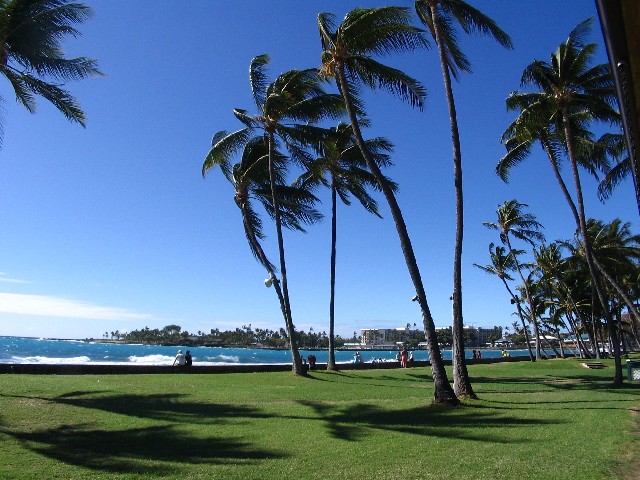
Sunset Commentary: Since we have less an a month left of our summer season, we could probably begin to refer to this period as late summer. As such, and in comparison to many other areas in the world, we are about as peaceful as can be. The light to moderately strong trade wind flow continues to gently sway our local coconut palm trees, and giving a ruffle to our surrounding ocean surface. Actually, with localized stronger trade wind gusts here and there, the ocean is choppy there…with white caps chalking up the surface.
Meanwhile, as far as rainfall goes, there just isn’t much…with most of our rain gauges empty, with just a bit of dust at the bottom. As usual, and it probably goes without saying, or writing in this case…most of our showers will spill along the windward sides, during the night and early morning hours. If this all sounds very typical, it is…and is actually somewhat less windy and drier than even normal. There don’t appear to be any major, or hardly any minor changes in store through the rest of this week, into next week for that matter.
Here in Kula, Maui at 530pm HST Thursday evening, skies were quite clear, with partly cloudy conditions around the edges in places. In the world of weather, all eyes are now on strengthening category 3 hurricane Irene in the far western Atlantic Ocean. This hurricane is now through running through the Bahamas, as it moves over open ocean to the north. It will head towards the eastern seaboard of the United States now, and needs to be monitored very closely for all those folks who live in the mid-Atlantic states…all the way up the coast through New York to New England. This is a very dangerous tropical cyclone, and you folks who live along its expect path, need to be making preparations, and following the orders of the emergency management! Then, in the opposite direction, again in relation to the Hawaiian Islands, we have strengthening super typhoon 14W in the Philippine Sea. This particular storm, named Nanmadol, is even stronger than Irene, with soon to be wind gusts of almost 200 mph! Neither of these will come anywhere near our islands of course. Here's a picture of Nanmadol, with the impressive central eye, with a second tropical cyclone to its right. ~~~ Turning our attention back here to Hawaii, once again we remain in a pleasant trade wind weather pattern, with no indications otherwise well into the future. I'll be back early Friday morning with your next new weather narrative from paradise, I hope you have a great Thursday night until then! Aloha for now…Glenn.
Extra: Scary video of the Japanese Earthquake/Tsunami!
Interesting: Tropical cyclones like Irene are predicted to be more powerful this year, thanks to natural conditions, but researchers disagree on how to rate that intensity. Atmospheric researchers tend to agree that tropical cyclones of unusual ferocity are coming this century, but the strange fact is that there is no consensus to date on the five-point scale used to classify the power of these anticipated storms. In what may sound like a page from the script of the rock-band spoof Spinal Tap with its reference to a beyond-loud electric guitar amplifier volume 11, there is actually talk of adding a sixth level to the current Saffir-Simpson hurricane scale, on which category 5 intensity means sustained winds higher than 155 miles per hour (250 kilometers per hour) for at least one minute, with no speed cap.
The lack of an upper limit on the scale results in all of the most intense tropical cyclones getting lumped together, despite their wide range of power. Category 5 becomes less descriptive when it includes 2005's Emily, which reached peak wind speeds of 257.5 kph (160 mph) and six hours in category 5; the same year's Katrina which held peak wind velocity of 280 kph (175 mph) for 18 hours in the category; and 1980's Allen, churning with peak winds at 305 kph (190 mph) maintained for 72 hours in the highest category.
And now the ferocity forecast for the century adds to this classification problem. "The severe hurricanes might actually become worse. We may have to invent a category 6," says David Enfield, a senior scientist at the University of Miami and former physical oceanographer at the U.S. National Oceanic and Atmospheric Administration (NOAA). This new level wouldn't be an arbitrary relabeling. Global satellite data from the past 40 years indicate that the net destructive potential of hurricanes has increased, and the strongest hurricanes are becoming more common—especially in the Atlantic. This trend could be related to warmer seas or it could simply be history repeating itself. Data gathered earlier than the 1970s, although unreliable, show cycles of quiet decades followed by active ones. The quiet '60s, '70s and '80s ended in 1995, the year that brought Felix and Opal, among others, and resulted in $13 billion in damages and more than 100 deaths in the U.S.
The pros and cons of categories: Five or six?
The average difference between the current categories equals nearly 20 mph, so a category 6 label would likely be applied to hurricanes with sustained winds over (280 kph) 175 mph. The speed and destruction of hypothetical "category 6" storms is speculative, despite the hurricanes with winds at that level.
After all, meteorologists and climate researchers may not even choose a category 5 storm from the record books if asked to identify the most powerful tropical cyclone in history, because the Saffir–Simpson scale fixates on maximum wind speed lasting for at least one minute and disregards the many other large-scale components that factor into a storm's level of devastation. The whole index should be thrown out the hurricane-proof window, some say.
"If I could do it, I would do away with categories," says Bill Read?, director of NOAA's National Hurricane Center (NHC). "The whole indexing [of hurricanes] was done back in the '60s and '70s when we had no way to convey the variables of damage that the storm did. We didn't measure it that carefully; we didn't have the tools."
Even nowadays, instruments to measure actual wind speed are often destroyed during extreme storms, so estimates have to be extrapolated from satellite images and other data. Actual observations can also be suspect. It took 14 years for the World Meteorological Organization to acknowledge that an anemometer in Australia recorded a world record wind speed of 407 kph (253 mph) during Tropical Cyclone Olivia in 1996. Wind speed science has improved over the years. Since the 1990s direct wind measurements from hurricane-hunter aircraft have replaced central pressure measurements, which were often a proxy for wind speeds.
Variables used by meteorologists and climatologists to assess damage can go beyond wind speeds to include duration over land and the extent of deadly storm surges. Read sums it up this way: "Size matters: Katrina, Rita, Ike—all of them made landfall at a 2 or 3 level, but look at the damage they caused. Obviously a category did not accurately describe the impact."
A transition to "impact forecasting" began last year when NOAA's National Hurricane Center simplified the Saffir–Simpson hurricane scale and renamed it the Saffir–Simpson hurricane wind scale. This change involved stripping away the scale's former central pressure, flooding and storm surge estimates. These factors among others are now forecast separately. In 2009 the National Weather Service began using new probability models that provide storm surge estimates ranging from 0.6 to 7.6 meters (two to 25 feet).
What the future holds
History keeps us guessing about where and when the next big tropical cyclone will hit on the U.S. Atlantic or Gulf coasts. As for the most powerful hurricane ever, experts are divided. Some say 1998's Gilbert.; an official answer from a NOAA Web site lists three: 1969's Camille, 1980's Allen and 2005's Wilma (the World Meteorological Organization agrees with the latter).
William Gray, professor emeritus of atmospheric science at Colorado State University in Fort Collins and the "grandfather" of annual hurricane season forecasting, picked the category 4 Great Miami Hurricane of 1926. NHC Director Read went with an unnamed Caribbean hurricane from 1780.
The Atlantic hurricane season, which runs from June 1 to November 30 annually, is predicted to produce more and stronger storms than average this year, although active years have been the norm since 1995. That year the Atlantic entered a period of warm sea-surface temperatures of what is called the Atlantic Multi-Decadal Oscillation, and such cycles typically last two to three decades.
"If the future is like the past, we should have another 10 to 15 years of this active period," Gray says.
This oscillation means the Atlantic is expected to cool in the future, obscuring links among hurricane activity and global warming. Perhaps counterintuitively, recent computer modeling studies predict fewer tropical cyclones if the ocean heats up further as a result of global warming. But they also predict intensification of the ones that do form, albeit with limited confidence. Frequency drops by 6 to 34 percent this century, according to 2010 review article in Nature Geoscience, whereas intensity rises 2 to 11 percent. (Scientific American is part of Nature Publishing Group.)
Today, water is a bigger concern than the wind when it comes to property destruction and loss of life. Look for more emphasis on storm surges in future forecasts, because it is the main reason why evacuations become necessary. Many planners suggest following Read's prescription: "In the U.S. 'Run from the water, hide from the wind' is pretty good, simple advice."
As for the addition of a new category 6, Read insists it is not needed. "I'd be totally opposed to that, even if they did get stronger," he says. "I'll fight 'em tooth and nail under my regime. We'll keep what we have now, but I'm going to focus more on the impacts."
Bob Snowden Says:
Glenn,
Just curious when your annual vacation takes place this year. Wife and I are coming out in October for our 20th anniversary.
We started visiting Hawaii in Maui in 1990! Hard to belive how time flies.~~~Hi Bob, just made reservations for October 18-November 10th. Time does fly it seems! I hope you have a great vacation! Aloha, Glenn