


Air Temperatures – The following maximum temperatures were recorded across the state of Hawaii Monday:
Lihue, Kauai – 86
Honolulu airport, Oahu – 89 (record for Monday – 93 in 1995)
Kaneohe, Oahu – 83
Molokai airport – 85
Kahului airport, Maui – 87
Kona airport 85
Hilo airport, Hawaii – 84
Air Temperatures ranged between these warmest and coolest spots near sea level – and on the highest mountain tops…as of 5pm Monday evening:
Barking Sands, Kauai – 85
Kaneohe, Oahu – 79
Haleakala Crater – 54 (near 10,000 feet on Maui)
Mauna Kea Summit – 41 (over 13,500 feet on the Big Island)
Here are the 24-hour precipitation totals (inches) for each of the islands as of Monday evening:
0.22 Mount Waialeale, Kauai
0.87 Oahu Forest NWR, Oahu
0.00 Molokai
0.00 Lanai
0.00 Kahoolawe
0.48 West Wailuaiki, Maui
0.50 Kawainui Stream, Big Island
Marine Winds – Here’s the latest (automatically updated) weather map showing a 1022 millibar high pressure system to the northeast of our islands. Our local trade winds will remain active through Wednesday…strongest around Maui and the Big Island.
Satellite and Radar Images: To view the cloud conditions we have here in Hawaii, please use the following satellite links, starting off with this Infrared Satellite Image of the islands to see all the clouds around during the day and night. This next image is one that gives close images of the islands only during the daytime hours, and is referred to as a Close-up visible image. Finally, here's a Looping IR satellite image, making viewable the clouds around the islands 24 hours a day. To help you keep track of where any showers may be around the islands, here’s the latest animated radar image.
Hawaii’s Mountains – Here’s a link to the live web cam on the summit of near 13,500 foot Mauna Kea on the Big Island of Hawaii. The tallest peak on the island of Maui is the Haleakala Crater, which is near 10,000 feet in elevation. These two web cams are available during the daylight hours here in the islands…and when there’s a big moon shining down during the night at times. Plus, during the nights you will be able to see stars, and the sunrise and sunset too…depending upon weather conditions.
Tropical Cyclone activity in the eastern and central Pacific – Here’s the latest weather information coming out of the National Hurricane Center, covering the eastern north Pacific. You can find the latest tropical cyclone information for the central north Pacific (where Hawaii is located) by clicking on this link to the Central Pacific Hurricane Center. A satellite image, which shows the entire ocean area between Hawaii and the Mexican coast…can be found here. Here's a tropical cyclone tracking map for the eastern and central Pacific.
Aloha Paragraphs
Summer trade wind weather pattern
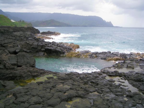
Queens Pool…Kauai
The trade winds will continue, moderately strong through this new work week…increasing some by the weekend. Glancing at this weather map, we find a high pressure system to the northeast of the islands. This high pressure area, along with its associated ridge of high pressure, will provide steady trade winds. The computer models don’t suggest much change through Friday…with perhaps some increase then for a while.
Our trade winds will remain active…the following numbers represent the strongest gusts (mph), along with directions Monday evening:
25 Port Allen, Kauai – ENE
22 Honolulu, Oahu – NE
23 Molokai – NE
23 Kahoolawe – ESE
31 Kapalua, Maui – NE
16 Lanai – NE
24 Upolu Point, Big Island – NE
We can use the following links to see what’s going on in our area of the north central Pacific Ocean Monday night. Looking at this NOAA satellite picture we find just scattered low level clouds in some directions…along with some middle level clouds to the east and southwest of the islands. We can use this looping satellite image to see lower level clouds approaching from the east. We can also find what's left of old Fernanda, the leftover spin to the southwest of Kauai…with still a little convection to the north and northeast of its faint center. Checking out this looping radar image we see a few showers falling, most of which are being carried over the windward sides in places, on the trade wind flow.
Sunset Commentary: High pressure to the northeast of the islands will keep our moderately strong trades going through this work week. There will be fairly minor fluctuations in wind speeds…picking up some this coming weekend.
The atmosphere over the islands is becoming more stable and dry. This is turn will limit shower activity to some extent. Nonetheless, with the trade winds blowing this week…we'll see off and on windward biased showers at times.
Here in Kihei, Maui at 530pm HST Monday evening, skies were clear to partly cloudy, with some cloudy areas around the mountains. The faint circulation of former tropical cyclone Fernanda is now located to the southwest of Kauai, and continues moving westward. Drier air has filled in behind this old weather feature, with mostly dry conditions now over the eastern islands. Looking ahead, we'll find typical summer weather conditions on tap, with nothing out of the ordinary on our horizon at this time. As noted by the brevity of this final paragraph, there really isn't much going on in our local weather to write about. Further afield of course, we have a big news maker in the from of category 2, soon to be category 3 major hurricane Irene in the Caribbean Islands. Then, in the opposite direction, we have newly formed tropical depression 14W in the Philippine Sea. Neither of these will come anywhere near our islands of course, and I should mention there's nothing going on in the eastern or central Pacific. ~~~ I'll be back early Tuesday morning with your next new weather narrative. I hope you have a great Monday night until then! Aloha for now…Glenn.
Interesting: 24 million American children ride school buses daily. On average, these students spend an hour and a half each day in a school bus. School buses drive more than 4 billion miles each year. School buses are the safest way for children to get to school. However, pollution from older diesel vehicles have health implications for everyone, especially children.
Clean School Bus USA (EPA based) brings together partners from business, education, transportation, and public-health organizations to work toward the goals of reducing the potential health impact on children. School districts, with the help of federal grants (and state grants in some cases) have been working to replace the oldest, most polluting buses, and to upgrade others with better pollution control equipment.
(The Diesel Reduction Act was reauthorized for five years in December 2010, but it's unclear how much money Congress will appropriate to continue the program.) The way drivers operate the buses can also have a big impact on the air quality for kids. School buses are a necessary evil despite some issues such as diesel pollution fumes.
Unnecessary school bus idling pollutes the air, wastes fuel, and causes excess engine wear. Fortunately, it's easy to implement practices that reduce school bus idling. This also applies to all of those people who drive their kids to school and let their cars idle in lines.
Idling school buses can pollute air in and around the bus. Exhaust from buses can also enter school buildings through air intakes, doors, and open windows. Diesel bus exhaust from excessive idling can be a health concern. Idling buses waste fuel and money.
When idling, a typical school bus engine burns approximately half a gallon of fuel per hour. School districts that eliminate unnecessary idling can save significant dollars in fuel costs each year. Any bus built before 1998 should be considered a prime candidate for replacement because older vehicles are designed with higher air emission standards in mind.
The ideal current goal is to have a fleet of buses built since 2007, when a new law went into effect requiring closed crankcases and advanced emissions controls to limit the emissions of soot and other harmful pollutants.
On older buses, having drivers close the crankcase reduces pollution inside buses significantly. Despite the air quality problems that persist in older buses, the bus is still the most efficient and least-polluting way to get most kids to school as well as the safest. If everybody drove to school there would be fifty vehicles for every bus spewing fumes and blocking traffic flow.