


Air Temperatures – The following maximum temperatures were recorded across the state of Hawaii Tuesday:
Lihue, Kauai – 85
Honolulu airport, Oahu – 88 (record for Tuesday – 91 in 1985, 1994, 1995, 2003)
Kaneohe, Oahu – 82
Molokai airport – 85
Kahului airport, Maui – 85
Kona airport 83
Hilo airport, Hawaii – 82
Air Temperatures ranged between these warmest and coolest spots near sea level – and on the highest mountain tops…as of 5pm Tuesday evening:
Barking Sands, Kauai – 85
Kailua-kona – 75
Haleakala Crater – 63 (near 10,000 feet on Maui)
Mauna Kea Summit – 48 (over 13,500 feet on the Big Island)
Here are the 24-hour precipitation totals (inches) for each of the islands as of Tuesday evening:
1.07 Mount Waialeale, Kauai
0.55 Punaluu Stream, Oahu
0.01 Molokai
0.00 Lanai
0.00 Kahoolawe
0.70 Puu Kukui, Maui
0.27 Saddle Quarry, Big Island
Marine Winds – Here’s the latest (automatically updated) weather map showing a 1027 millibar high pressure system to the northeast of our islands. Our local trade winds will remain active through Wednesday…increasingly strong.
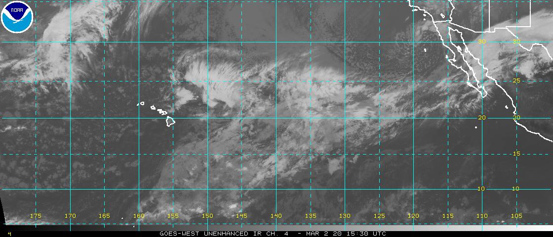
Satellite and Radar Images: To view the cloud conditions we have here in Hawaii, please use the following satellite links, starting off with this Infrared Satellite Image of the islands to see all the clouds around during the day and night. This next image is one that gives close images of the islands only during the daytime hours, and is referred to as a Close-up visible image. Finally, here's a Looping IR satellite image, making viewable the clouds around the islands 24 hours a day. To help you keep track of where any showers may be around the islands, here’s the latest animated radar image.
Hawaii’s Mountains – Here’s a link to the live web cam on the summit of near 13,500 foot Mauna Kea on the Big Island of Hawaii. The tallest peak on the island of Maui is the Haleakala Crater, which is near 10,000 feet in elevation. These two web cams are available during the daylight hours here in the islands…and when there’s a big moon shining down during the night at times. Plus, during the nights you will be able to see stars, and the sunrise and sunset too…depending upon weather conditions.
Tropical Cyclone activity in the eastern and central Pacific – Here’s the latest weather information coming out of the National Hurricane Center, covering the eastern north Pacific. You can find the latest tropical cyclone information for the central north Pacific (where Hawaii is located) by clicking on this link to the Central Pacific Hurricane Center. A satellite image, which shows the entire ocean area between Hawaii and the Mexican coast…can be found here. Here's a tropical cyclone tracking map for the eastern and central Pacific.
Aloha Paragraphs

Trade wind weather pattern prevails
The trade winds will continue to blow through this week and beyond. Glancing at this weather map, we find a 1027 millibar high pressure cell to the north-northeast of the islands. This high pressure cell and its associated ridge will provide a continuous flow of trade wind breezes. The computer models continue to strongly suggest that our local winds will accelerate starting Wednesday, and remain quite strong and gusty through the end of the week. There are no active small craft wind advisories now, although they will start up Wednesday morning around those windiest areas in Maui County and the Big Island.
Our trade winds will remain active…the following numbers represent the strongest gusts (mph), along with directions Tuesday evening:
25 Port Allen, Kauai – E
23 Honolulu, Oahu – NE
25 Molokai – NE
27 Kahoolawe – ESE
30 Kahului, Maui – NE
08 Lanai – SSW
28 Upolu Point – NE
We can use the following links to see what’s going on in our area of the north central Pacific Ocean Tuesday night. Looking at this NOAA satellite picture we find low level clouds impacting the windward sides of the Islands, along with larger chunks of lower level clouds to our southwest…all looking stable at the moment. We can use this looping satellite image to see lower level clouds being carried along in the low level wind flow. There are considerable high clouds not far offshore to our west and northwest, as well as south of the islands. Checking out this looping radar image we see a few showers being carried along in the wind flow…with showers impacting the windward sides locally.
Sunset Commentary: There’s been little change in the forecast outlook during the past 24 hours, with still the thought that our local trade winds will be strengthening, with generally light showers gravitating towards the windward sides for the most part. The increasing wind speeds will get top billing in terms of most notable weather feature through the end of this week.
These winds have triggered a small craft wind advisories, which begins Wednesday morning, specifically around those windiest coasts and channels between Molokai and the Big Island. This flow of air may be deep enough to cause a wind advisory over the summit of the Haleakala Crater on Maui with time too. It may take until Thursday or Friday before these small craft advisories become necessary across the other major channels in the state. There is no end in sight to these typical mid-summer trade winds, so that they will continue right on into next week.
Precipitation will continue this week a little on the drier side of normal. Moisture content measuring tools are sensing somewhat dry air over us now. As they probe the area further upstream of the islands, to the northeast and east…it’s a bit drier than normal up that way too. This suggests that showers will be somewhat limited, although not by any means totally dry. As the trade wind speeds pick up soon, we should see a normal corresponding increase in windward biased showers…and even a few leeward ones too.
Other than those fairly normal showers, there are no organized rainmakers on our horizon at this time. There’s always the chance that we might see some increase in showers arriving next week, from what will then be retired hurricane Eugene. This moisture source, if it holds together on the trade winds, could bring some tropical rainfall our way….that’s a long shot at this point however. Here's where major hurricane Eugene is now…and it won't be impacting our Hawaiian Islands, no worries. This track map shows where it is in relation to Hawaii…and a satellite image showing Hawaii and Eugene.
Here in Kihei, Maui at 545pm HST Tuesday evening, skies were partly cloudy, although I didn't see any rainfall in any direction. The trade winds are active, and will be strong enough by Wednesday morning to have triggered a small craft wind advisory…which should last through the rest of the week. As noted above, showers will be rather limited, and most of those will be falling along our windward sides during the night and early morning hours. I'm heading home now after a very long day of work. I didn't get my morning walk in, and I doubt whether I'll get my evening walk in either. This was because I had no internet connectivity this morning, and had to rush down to Kihei first thing this morning. It's been a big day in weather, with lots of hurricanes, typhoons and tropical storms active in the world now. So, hopefully Wednesday will be back to normal as far as my schedule goes. If you don't see my next narrative coming out on time, then you know that I'll be scrambling again. I hope you have a great Tuesday wherever you happen to be reading this! Aloha for now…Glenn.
Extra: The Hidden Beauty of Pollination – video
Interesting: Summer is anniversary time for many shark attack survivors, including myself. This time of year, we mark the terrifying moments of struggle in the jaws of the ocean's top predator. We recall the ordeals of surgery and rehabilitation. And some of us are lucky enough to reflect on how much worse it could have been. I am mostly healed from a severed Achilles tendon.
Many of my survivor friends also have recovered or learned to live without an arm or leg. But this year, our annual remembrances reach beyond our own experiences. My friends and I have become shark conservation advocates, and 2011 is the 10-year anniversary of a commitment by countries at the United Nations to develop plans to conserve these animals.
Unfortunately, little has been done. Eight of my survivor friends and I visited the U.N. in New York last fall to press for more help for sharks. As part of my work for the Pew Environment Group's Global Shark Conservation Campaign, I recruited the survivors who were forgiving enough to speak out for the creatures that changed our lives. We made some small headway during our visit.
But this year's anniversary underscores how much is left to be done. Few countries have developed the promised conservation plans. Of those that have plans, some are not fully implemented, and there's scant evidence the blueprints are as effective as everyone had hoped.
Time is running out. Nearly a third of all shark species are headed for extinction, and up to 73 million of the predators worldwide are killed each year largely for their lucrative fins, which are sold primarily to Asian markets for soup. These animals need stronger protections from the world's 20 top shark catchers, which account for nearly 80 percent of total reported harvest.
Indonesia, India, Spain and Taiwan make up more than 35 percent. In some areas of the world, there simply isn't the expertise, money, capacity or political will to develop sweeping conservation plans. But some first steps could go a long way.
Interesting2: More than a third of freshwater fish are threatened with extinction, according to interim results from an IUCN Red List assessment. The preliminary results, revealed by scientists at the annual conference of the Fisheries Society of the British Isles at Bournemouth University, suggest that along with amphibians, freshwater fish may now be considered one of the most threatened groups of species in the world.
Dr William Darwall, manager of the freshwater unit at the IUCN in Cambridge, says, "There are still some big gaps in our knowledge, but of the 5,685 species that have been assessed, 36 per cent of them are threatened." Several UK species are currently at risk of extinction, including the European eel.
Globally, species such as the Atlantic sturgeon and the Mekong giant catfish are Critically Endangered. The European eel has declined by 90 percent since the early 1980s, while the Atlantic sturgeon, which is the source of one of the most expensive forms of caviar and was once common in rivers around Europe, is now only found in a single river in France, where it has an estimated population of between 20 and 750 individuals.
The Mekong giant catfish may be down to just 250 individuals in the wild. Many little-known fish which become isolated in remote waterways are also among those with the greatest risk of dying out.
Interesting3: Builders of large solar array farms in Israel's Negev region and in places like California's Mojave Desert have had ongoing problems with nature lovers, environmentalists, and Native American Tribes. It now appears that the environmentalists in Israel may be winning out on efforts to build giant solar array farms in the Negev and Arava regions.
A recent study conducted by Israel's Nature and Parks Authority (NPA) indicates that building such projects could be fatal to thousands of wild animals that live in the fragile ecosystem of these desert regions. The idea of constructing large solar energy array farms has been in the works for several years now.
They will be similar to projects in the USA, where companies like Brightsource have been trying to build huge solar energy farms on supposedly vacant land in California's Mojave Desert and on "coyote land" in neighboring Nevada.
In the case of the Negev, the NPA now claims that constructing such solar farms will destroy the area’s already endangered eco-system which is home to wildlife species such as desert gazelles, Nubian Ibexes, spotted hyenas, desert cats; and several species of desert dwelling birds, including sand partridges, Huobara Bustards (large desert birds resembling turkeys), and several species of raptors.
Similar battles between solar energy advocates and environmentalists in California have caused problems for Brightsouce and other companies like Solar Millennium, which have also been accused of wanting to build these large solar farms on sacred Native American burial sites. In California, indigenous desert tortoises will be "relocated" to make room for the solar energy farms.
You might wonder how many of these slow moving desert dwellers we're talking about, and how the solar energy companies expect to round them up in order to move them elsewhere.
Interesting4: Three Himalaya glaciers have been shrinking over the last 40 years due to global warming and two of them, located in humid regions and on lower altitudes in central and east Nepal, may disappear in time to come, researchers in Japan said on Tuesday. Using global positioning system and simulation models, they found that the shrinkage of two of the glaciers — Yala in central and AX010 in eastern Nepal — had accelerated in the past 10 years compared with the 1970s and 1980s.
Yala's mass shrank by 0.8 (2.6 feet) and AX010 by 0.81 meters respectively per year in the 2000s, up from 0.68 and 0.72 meters per year between 1970 and 1990, said Koji Fujita at the Graduate School of Environmental Studies in Nagoya University in Japan. "For Yala and AX, these regions showed significant warming … that's why the rate of shrinking was accelerated," Fujita told Reuters by telephone.
"Yala and AX will disappear but we are not sure when. To know when, we have to calculate using another simulation (model) and take into account the glacial flow," Fujita said, but added that his team did not have the data to do so at the moment. Their findings were published in the journal Proceedings of the National Academy of Sciences on Tuesday.
The Himalayas is an enormous mountain range consisting of about 15,000 glaciers and some of the world's highest peaks, including the 8,848-meter-high Mount Everest and K2. Apart from climate change and humidity, elevation also appears to play a critical role in the lifespan of glaciers, which are large persistent bodies of ice.
The Rikha Samba glacier in the drier region of west Nepal has also been getting smaller since the 1970s, but its rate of shrinking slowed to 0.48 meters per year in the past 10 years compared to 0.57 meters per year in the 1970s and 1980s.