


Air Temperatures – The following maximum temperatures were recorded across the state of Hawaii Tuesday:
Lihue, Kauai – 81
Honolulu airport, Oahu – 83
Kaneohe, Oahu – 81
Molokai airport – 84
Kahului airport, Maui – 88 (record high temperature Tuesday – 92F…1953)
Kona airport – 83
Hilo airport, Hawaii – 81
Air Temperatures ranged between these warmest and coolest spots near sea level – and on the highest mountain tops…as of 5pm Tuesday evening:
Kailua-kona – 82
Lihue, Kauai – 73
Haleakala Crater – 50 (near 10,000 feet on Maui)
Mauna Kea summit – 32 (over 13,500 feet on the Big Island)
Here are the 24-hour precipitation totals (inches) for each of the islands as of Tuesday evening:
3.39 Mount Waialeale, Kauai
3.44 Punaluu Stream, Oahu
0.02 Molokai
0.60 Lanai
0.00 Kahoolawe
0.08 Kula, Maui
0.41 Kohala Ranch, Big Island
Marine Winds – Here’s the latest (automatically updated) weather map showing a 1028 millibar high pressure system far to the northeast of Hawaii, while a surface trough of low pressure is located west of the state. Our local winds will continue to come up from the southeast Wednesday…although gradually becoming more easterly trade winds Thursday.
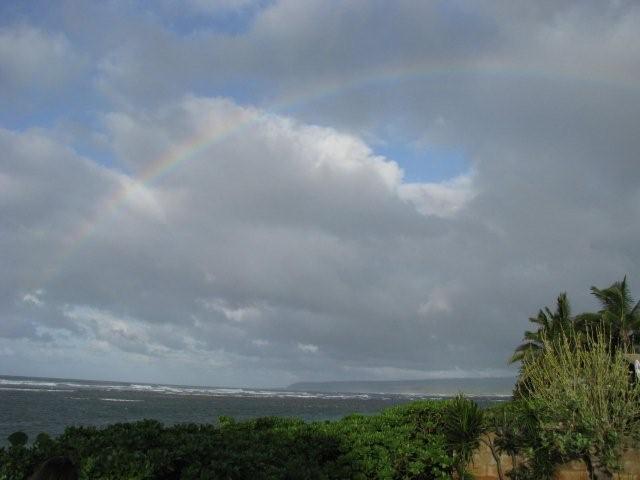
Satellite and Radar Images: To view the cloud conditions we have here in Hawaii, please use the following satellite links, starting off with this Infrared Satellite Image of the islands to see all the clouds around during the day and night. This next image is one that gives close images of the islands only during the daytime hours, and is referred to as a Close-up visible image. This next image shows a larger view of the Pacific…giving perspective to the wider ranging cloud patterns in the Pacific Ocean. Finally, here's a Looping IR satellite image, making viewable the clouds around the islands 24 hours a day. To help you keep track of where any showers may be around the islands, here’s the latest animated radar image.
Hawaii’s Mountains – Here’s a link to the live web cam on the summit of near 13,500 foot Mauna Kea on the Big Island of Hawaii. The tallest peak on the island of Maui is the Haleakala Crater, which is near 10,000 feet in elevation. These two web cams are available during the daylight hours here in the islands…and when there’s a big moon shining down during the night at times. Plus, during the nights you will be able to see stars, and the sunrise and sunset too…depending upon weather conditions.
Tropical Cyclone activity in the eastern and central Pacific – Here’s the latest weather information coming out of the National Hurricane Center, covering the eastern north Pacific. You can find the latest tropical cyclone information for the central north Pacific (where Hawaii is located) by clicking on this link to the Central Pacific Hurricane Center. Here’s a tracking map covering both the eastern and central Pacific Ocean. A satellite image, which shows the entire ocean area between Hawaii and the Mexican coast…can be found here. Of course, as we know, our hurricane season ended November 30th here in the central Pacific…and begins again June 1st.
Aloha Paragraphs
Unsettled weather with localized showers, some heavy.
Our local winds will be generally from the southeast.
Flash flood watch for Kauai and Oahu only
Our winds will be somewhat lighter Tuesday and Wednesday, although still locally gusty here and there…returning trade winds by Thursday through early next week at least. Glancing at this weather map, we find a 1028 millibar high pressure system located far to the northeast of Hawaii. A trough of low pressure, with its parent low pressure system remains to the west of the state, which is responsible for turning our wind directions to the south and southeast. The forecast continues to show variable wind speeds through Wednesday. It will take until Thursday before our trade winds finally rebound then into the weekend and beyond.
Our local winds will blow from the southeast for the most part…the following numbers represent the strongest gusts, along with directions early Tuesday evening:
20 Port Allen, Kauai – E
18 Kahuku, Oahu – ENE
10 Molokai – NW
31 Kahoolawe, Maui – ESE
22 Lipoa, Maui – SE
06 Lanai – SW
27 South Point, Big Island – NE
We can use the following links to see what’s going on in our area of the north central Pacific Ocean Tuesday night. Looking at this NOAA satellite picture we variable amount of clouds across all of the islands, although most of the heavy shower bearing clouds remain anchored near Kauai and Oahu. We can use this looping satellite image to see a stream of high cirrus clouds approaching from the southwest. At the same time we find locally heavy showers, associated with an upper level low pressure system to our northwest. Checking out this looping radar image shows areas of heavy showers over the ocean to the west of Kauai…and near Oahu at times too.
Sunset Commentary: It appears that all the low pressure that has kept us shower prone, and much cloudier than normal…is starting to shift away towards the north. It will take a little more time for all that cold air to get out of our area though, so that there’s still that chance of some locally heavy showers for the time being around Kauai mostly. It does seem like we’re finally leaning back towards a more normal trade wind weather pattern however. This means that most of the showers will migrate over to the windward coasts and slopes in a couple of days. This IR satellite picture shows that most of the heavy convection (the heaviest showers) are now located to the north of our islands. If we put this satellite image into motion, we can see that we may see another wave of high cirrus clouds approaching our islands from the southwest at some point soon too.
We can see that there are still quite a few showers around Kauai, some of which are fairly heavy, by viewing this looping radar image. Looking more closely it appears that Oahu is locally showery too. It may be premature to suggest, although it looks like we may have finally started to turn the corner here. The NWS forecast office in Honolulu is keeping the flash flood watch up over Kauai and Oahu however, so we have a little bit further to go it seems…before we see a normal spring weather pattern. I'll be back again early Wednesday morning with a new sunrise commentary, where I'll provide the latest changes…and a recap of what took place during the night. I hope you have a great Tuesday night until then! Aloha for now…Glenn.
Extra: It's been snowing atop the summit of Mauna Kea again…on the Big Island
Interesting: Cape Royds, home to the southernmost colony of penguins in the world, is a rocky promontory overlaid with dirty ice and the stench of pinkish guano. Beyond the croaking din of chicks pestering parents for regurgitated krill lies the Ross Sea, a southern extension of the Pacific Ocean that harbors more than one-third of the world’s Adélie penguin population and a quarter of all emperor penguins, and which may be the last remaining intact marine ecosystem on Earth.
The penguin colony is one of the longest-studied in the world. Data on its resident Adélie penguins was first acquired during the 1907-9 expedition of Ernest Shackleton, the eminent British explorer, whose wooden hut stands preserved nearby. “This is penguin nirvana,” David Ainley, an ecologist with the consulting firm H. T. Harvey and Associates who has been studying Ross Sea penguins for 40 years, said on a morning in January.
“This is where you want to be if you’re a pack ice penguin.” Of the species that stand to be most affected by global warming, the most obvious are the ones that rely on ice to live. Adélie penguins are a bellwether of climate change, and at the northern fringe of Antarctica, in the Antarctic Peninsula, their colonies have collapsed as an intrusion of warmer seawater shortens the annual winter sea ice season.
In the past three decades, the Adélie population on the peninsula, northeast of the Ross Sea, has fallen by almost 90 percent. The peninsula’s only emperor colony is now extinct. The mean winter air temperature of the Western Antarctic Peninsula, one of the most rapidly warming areas on the planet, has risen 10.8 degrees Fahrenheit in the past half-century, delivering more snowfall that buries the rocks the Adélie penguins return to each spring to nest — and favoring penguins that can survive without ice and breed later, like gentoos, whose numbers have surged by 14,000 percent.
The warmer climate on the Antarctic Peninsula has also upended the food chain, killing off the phytoplankton that grow under ice floes and the krill, a staple of the penguin diet, that eat them, by as much as 80 percent, according to a new study published this month in The Proceedings of the National Academy of Sciences. But in the Ross Sea a reverse trend is occurring: Winter sea ice cover is growing, and Adélie populations are actually thriving.
The Cape Royds colony grew more than 10 percent every year, until 2001, when an iceberg roughly the size of Jamaica calved off the Ross Sea ice shelf and forced residents to move 70 kilometers north to find open water. (The iceberg broke up in 2006, and the colony of 1,400 breeding pairs is now recovering robustly.) Across Ross Island, the Adélie colony at Cape Crozier — one of the largest known, with an estimated 230,000 breeding pairs — has increased by about 20 percent.
Climate change has created a paradise for some pack ice penguin colonies and a purgatory for others, but the long-term fate of all Adélie and emperor penguins seems sealed, as relentless warming eventually pulls their rug of sea ice out from under them.
Some scientists attribute the recent sea ice growth in the Ross Sea to the persistent ozone hole, a legacy of the human use of chlorofluorocarbons that cools the upper atmosphere over the continent, increasing the temperature difference with the lower atmosphere and equator, and over the last 30 years has delivered significantly brisker westerly winds in the summer and autumn.
The warming of Earth’s middle latitudes is having a similar effect, increasing that temperature difference and sending stronger winds that push sea ice off the coast and expose pockets of open water, called polynyas, that give nesting Adélie penguins easier access to food. Meanwhile, consumers’ appetite for Chilean sea bass (Antarctic and Patagonian toothfish) may also be benefiting Ross Sea penguins, as fishing fleets from southern nations converge on one of the last remaining refuges of the fish (Dissostichus mawsoni).
A fishery in the Ross Sea that opened in 1996 and was certified sustainable in December by the Marine Stewardship Council, could ultimately serve Adélie penguins by reducing competition for Antarctic silverfish (Pleuragramma antarcticum), a sardine-size fish that the penguins and toothfish enjoy. Dr. Ainley and colleagues have reported seeing fewer killer whales in the southern Ross Sea since 2002.
The whales feed on toothfish, and fewer sightings suggest that the fishery is already altering the ecosystem. Researchers witnessed Ross Sea penguin colonies thrive during the 1970s when commercial whaling removed 20,000 Antarctic minke whales, also a food competitor of Adélies, from the penguins’ wintering area. Adélie populations eventually leveled off after 1986, after an international moratorium on whaling began (and remained static until the more recent influences of climate change).
Japanese whaling of minkes resumed right after the moratorium was instituted, purportedly for science, a claim that conservation groups dispute and that has incited a confrontation in the Ross Sea between the Japanese fleet and the Sea Shepherd Conservation Society, an antiwhaling vigilante group. “It has become difficult to separate whether the increase is due to climate change or fewer toothfish,” Dr. Ainley said.
“Both factors seem to be working at the same time. On a chilly morning in January, the Cape Royds colony was clustered across the dark volcanic rock in crèches: month-old chicks, furry and pear-shaped with tummies full of krill, huddled near their parents as adolescent penguins, still too young to breed, acted “like teenagers trying to figure out the social scene,” in Dr. Ainley’s assessment.
Their cuddly appearance is misleading, it turns out, a projection of human sentiment. “They’re really nasty to one another,” Dr. Ainley said, “and if you try to pick one up you’ll have your hands full.” Climate models predict that the winds and sea ice will continue to increase in the Ross Sea for the next 30 to 40 years, at which time the region is expected to experience a tipping point, as rising temperatures and the waning effect of the ozone hole, now getting smaller, transform the climate into the kind now seen in the Antarctic Peninsula.
Already, that process is under way. The average summer temperature at McMurdo Station, the American research base on Ross Island, has inched up 2.7 degrees Fahrenheit in the past 30 years, records show, more than the global average. Scientists conducting long-term studies of lakes in the McMurdo Dry Valleys, Antarctica’s largest ice-free area, report that after a decade of cooling, some lakes in the Taylor Valley are now gaining heat.
During this past research season the scientists recorded unprecedented lake levels caused by higher glacial runoff. On Beaufort Island, north of Ross Island, glaciers have retreated over the rocky coastline farther than they have in 30,000 years, scientists estimate, a time before the last ice age. The receding ice has opened up more nesting habitat for the resident Adélie penguin colony, which has expanded to 55,000 breeding pairs from 40,000 in the last decade.
As the sea ice retreats, researchers expect that Adélie penguins living in the Ross Sea will be forced to shift their range farther south toward the pole. In a study between 2003 and 2005, Dr. Ainley and colleagues from PRBO Conservation Science, Stanford University, NASA and the British Antarctic Survey used geolocation sensor tags to track penguins from Cape Royds and Cape Crozier to better understand their migration patterns.
Published last year in the journal Ecology, the study revealed how the penguins depart their nesting grounds in February, at the end of the austral summer, and head north on foot and ice floes to flee the protracted darkness of the Antarctic winter. They appear to stop on the sea ice about 300 miles from the boundary with open water, where they stay to forage and fatten before doubling back south to their island breeding sites ahead of the creeping northern night — an 8,000-mile journey.
By carbon-dating mummified penguin remains, researchers have been able to construct a long-term history of the Adélie in Antarctica, indicating that throughout the last ice age penguins changed their migration routes and colony locations in response to advances and retreats of the sea ice. However, their range appears to have never extended farther south of where it is currently, for the simple reason that Adélie penguins appear to need light — if only twilight — to forage and navigate, and as comfort against predators.
“Emperor and Adélie penguins have an obligatory association with sea ice,” Dr. Ainley said. “As the sea ice goes, these species will go.” The Ross Sea is projected to be the last place on Earth where sea ice will endure. But as the annual winter sea ice boundary retreats farther south, pack ice penguins may ultimately find themselves trapped behind a curtain of polar night for which they have no hardwired strategy. Indeed, Dr. Ainley speculates, Adélie penguins face possible extinction not merely by a loss of habitat — but by an unshakable fear of darkness.
Interesting2: Scientists at Royal Holloway, University of London and the University of Leicester have discovered animals searching for food do not stick to a complicated pattern of movement as previously thought but tend to wander about randomly. It was previously believed that when searching for food, animals move in very peculiar way called a Lévy flight where they move small distances most of the time, but occasionally move a very long distance. This idea was based on studies in which many animals, like albatrosses or sharks, were tracked.
However scientists have been analyzing video records of aphids, small sap-sucking insects to find out how they move and have discovered that they wander about randomly, much like inanimate molecules move, and some tend to walk much more than others. The study is published in the Proceedings of the National Academy of Sciences.
Dr Alla Mashanova, from the School of Biological Sciences at Royal Holloway, said: "It was the large variation between individuals — with some moving very little and some moving a lot — that previously created the impression of the Lévy flight." The researchers recorded the length of movement by all the aphids and used this data to build two mathematical models to carry out a more detailed statistical analysis.
Dr Sergei Petrovskii, from the Department of Mathematics at Leicester says: "It is amazing how very simple mathematical models can sometimes be used to explain very complicated phenomena." The researchers say understanding how animals move is important, for instance, for hunting, to design nature reserves and to predict pest outbreaks and understand the spread of diseases.
Professor Vincent Jansen from the School of Biological Sciences at Royal Holloway said: "Understanding individual variation is crucial for interpreting the collective movement patterns of animals. This research will open the way to better understand animal search and behavior and work out how it has evolved."
susan felderman Says:
HI Glenn
Well since you asked. I just received this reply from the NOAA webnaster today,
I was wondering if 14 inches in 24 hours on Kauai in May is a record. Aloha Susan
Aloha Susan,
Yes, it is somewhat unusual to see this more "wet season-like" weather lingering into May. We are likely experiencing the lingering effects of the strong La Nina circulation that impacted us during the Winter, and led to a pretty busy season. Thank you for your inquiry, and have a great day!
HFO Webmaster~~~Hi Susan, thanks for asking the NWS, I trust their perspective…Aloha, Glenn
Eliza Says:
Aloha Glenn –
Have had weather chats with various people and we're all wondering why the late season rains from the equator are with us. Is this something to do with the shifts in the El Nino/La Nina cycle? Or …?
Sorry if you've posted on this before, as I missed it (so did others). Mahalo ~ Eliza~~~Hi Eliza, excellent question, I appreciate that you are curious. Without going into it with too much depth, its yet another case of an upper level trough to our west, which puts cold air overhead, which enhances all that tropical moisture being drawn up over us from the deeper tropics to our south. I would be able to necessarily attribute it to the El Nino or La Nina cycle, perhaps another of our readers could chime in here and give their thoughts. I won’t be long before our trade winds are back, with a high pressure ridge dictating our local weather…with more normal spring weather showing itself. Aloha, Glenn