


Air Temperatures – The following maximum temperatures were recorded across the state of Hawaii Wednesday:
Lihue, Kauai – 81
Honolulu airport, Oahu – 83
Kaneohe, Oahu – 81
Molokai airport – M
Kahului airport, Maui – 87
Kona airport – 85
Hilo airport, Hawaii – 82
Air Temperatures ranged between these warmest and coolest spots near sea level – and on the highest mountain tops…as of 5pm Wednesday evening:
Kahului, Maui – 84
Kaneohe, Oahu – 77
Haleakala Crater – 55 (near 10,000 feet on Maui)
Mauna Kea summit – 41 (over 13,500 feet on the Big Island)
Precipitation Totals – The following numbers represent the largest precipitation totals Wednesday evening:
0.09 Puu Opae, Kauai
0.06 Poamoho, Oahu
0.00 Molokai
0.00 Lanai
0.00 Kahoolawe
0.00 Maui
0.05 Glenwood, Big Island
Marine Winds – Here’s the latest (automatically updated) weather map showing high pressure systems to the east-northeast through the northwest of the Hawaiian Islands. Our trade winds will blow lightly Thursday through Friday…a bit stronger at times locally.
Satellite and Radar Images: To view the cloud conditions we have here in Hawaii, please use the following satellite links, starting off with this Infrared Satellite Image of the islands to see all the clouds around during the day and night. This next image is one that gives close images of the islands only during the daytime hours, and is referred to as a Close-up visible image. This next image shows a larger view of the Pacific…giving perspective to the wider ranging cloud patterns in the Pacific Ocean. Finally, here's a Looping IR satellite image, making viewable the clouds around the islands 24 hours a day. To help you keep track of where any showers may be around the islands, here’s the latest animated radar image.
Hawaii’s Mountains – Here’s a link to the live web cam on the summit of near 13,500 foot Mauna Kea on the Big Island of Hawaii. The tallest peak on the island of Maui is the Haleakala Crater, which is near 10,000 feet in elevation. These two web cams are available during the daylight hours here in the islands…and when there’s a big moon rising just after sunset for an hour or two! Plus, during the nights and early mornings you will be able to see stars, and the sunrise too…depending upon weather conditions.
Tropical Cyclone activity in the eastern and central Pacific – Here’s the latest weather information coming out of the National Hurricane Center, covering the eastern north Pacific. You can find the latest tropical cyclone information for the central north Pacific (where Hawaii is located) by clicking on this link to the Central Pacific Hurricane Center. Here’s a tracking map covering both the eastern and central Pacific Ocean. A satellite image, which shows the entire ocean area between Hawaii and the Mexican coast…can be found here. Of course, as we know, our hurricane season ended November 30th here in the central Pacific…and begins again June 1st.
Aloha Paragraphs
Trade wind weather pattern…substantial south swell
along our leeward beaches – be careful in the ocean.
Generally light trade winds through the upcoming holiday weekend into early next week…stronger at times locally. Glancing at this weather map, we find three high pressure systems, one to the northwest, one to the northeast, and the other to the east-northeast Wednesday afternoon. The latest forecast continues to suggest that our trade winds will gradually strengthen a bit into the upcoming holiday weekend, especially by Friday. The computer models show an increase in our local trade wind speeds beginning again next Tuesday onwards. If this pans out as projected, we’d see small craft wind advisories potentially going up by later in the day next Monday.
Our local trade winds will remain generally on the light side, a little more gusty here and there at times…the following numbers represent the strongest gusts, along with directions Wednesday evening:
06 mph Barking Sands, Kauai – NNW
16 Wheeler Field, Oahu – SW
07 Molokai – S
20 Kahoolawe – ESE
20 Hana, Maui – ENE
07 Lanai Airport
21 South Point, Big Island – NE
We can use the following links to see what’s going on in our area of the north central Pacific Ocean Wednesday night. This large University of Washington satellite image shows two large areas of high cirrus clouds, one just to the northwest, and the other to the south and southwest….with another departing to our east. Looking at this NOAA satellite picture we see generally clear skies over the islands, although with some lower level clouds over the islands in places. We can use this looping satellite image to see those cirrus clouds, which may intrude into our area from the northwest or southwest soon. Checking out this looping radar image shows just a bare minimum amount of showers falling over the ocean, with most island areas dry at the time of this writing as well.
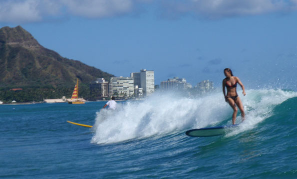
~~~ Here in Kihei, Maui at around 535pm Wednesday evening, skies are clear to partly cloudy. As usual the clouds were banked up against the slopes of the Haleakala Crater, and over the West Maui Mountains…although not a drop of rain was falling. The big thing now, which will continue into Thursday, is the larger than normal surf breaking along our leeward beaches, especially on the south facing shores. The high surf advisory for these beaches is effective through 6pm Thursday evening. I suggest that you folks who aren't familiar with these rough surf conditions remain out of the ocean, where the waves are too large for your comfort level. You surfers, and bodysurfer's, and others who love riding these waves, have at it! I'll be back early Thursday morning with your next new weather narrative, I hope you have a great Wednesday night until then! Aloha for now…Glenn.
Interesting: A big wildfire season may be on the way across the Top End and Red Center of Australia, according to authorities in the Northern Territory. The yearly rainy season, now ended, has left behind record rainfall, not only in the tropical "Top End" but also in the vast deserts of the "Red Center" deep in the middle of the continent.
Bushfires are pretty much a yearly occurrence in the "Top End", where heavy monsoon rain supports thick vegetation that dries to become fire-prone during the months-long dry season. The director of Bushfires NT, Steve Sutton, has warned that heavy fuel loads will lead to "hotter, more dangerous fires" during the coming dry season, which usually lasts until about October.
However, unusually lush growths of grass have followed exceptional summer rain on the deserts of central Australia, which take in much of Northern Territory. Fires are not typical in these deserts. Yet this year's growth of grass, described as "waist-high" "as far as the eye can see," could feed "quite intense fires," according to Mr. Sutton.
Dead, dried-out leftovers of the abundant growths of vegetation will become potential fuel during the coming dry season. Warning that the residents of the Territory should be prepared for the worst bushfire in years, the director stated that prescribed burns would be carried out. Prescribed burns, undertaken at a time of relatively low fire danger, can lessen the threat of a serious, uncontrolled blaze.
Interesting2: Gradually rising sea levels caused by global warming over the past 30 years have contributed to a growing number of disasters along China's coast, state news agency Xinhua said on Wednesday. Sea levels along China's coastline had risen 2.6 mm per year over the past three decades, Xinhua said, citing documents from the State Oceanic Administration. Average air and sea temperatures in coastal areas had risen about 0.4 and 0.2 degrees Celsius respectively over the past 10 years, the news agency added.
"As a 'gradual' marine disaster, the cumulative effect of rising sea levels could 'aggravate storm tides, coastal erosion, seawater invasion and other disasters'," Xinhua cited the oceanic administration as saying. An expert at the administration, Liu Kexiu, said the rising sea levels were a result of global warming.
"Other key factors are land subsidence caused by human activities, including over-exploitation of groundwater and massive construction of high buildings in coastal areas," Liu said. China's high and rapidly climbing output of carbon dioxide, the main greenhouse gas pollutant from burning coal, oil and gas, has put it at the center of negotiations for a new world pact to reduce the emissions responsible for global warming.
The government has vowed to cut the amount of carbon dioxide emitted from fossil fuels per unit of gross domestic product growth by 17 percent in the next five years. But China has repeatedly said it will not accept a more stringent, absolute cap on total emissions, calling it an unfair burden on developing nations that have much lower emissions per person than rich economies. It has also refused to say when its emissions could peak and begin to fall.
Interesting3: Haitian health officials on Wednesday said they have found new cases of cholera in rural areas of the country, but said the epidemic, which has killed thousands since last year, remains on the decline. "Residual outbreaks" have appeared in the north, the central plateau, and the southeast, "but they do not constitute a spike in the disease," the country's public health general director Gabriel Timothe told AFP late Tuesday.
He said authorities were addressing the outbreaks in the various regions, and insisted "the trend is decreasing." Haiti has suffered a devastating cholera epidemic since October, and authorities have reported 4,856 deaths since the onset of the disease, thought to have been eradicated from the country a century ago.
To mark six months of efforts to contain the epidemic, outgoing President Rene Preval received Haitian and international health experts, officials and aid workers on Tuesday to thank them for their work, and urged Haitians to continue safe hygiene guidelines.
The water-borne bacterial disease thrives in unhygienic conditions such as those throughout Haiti since a catastrophic earthquake early last year killed some 220,000 people and left 1.5 million homeless, many of whom have been living in squalid tent cities since the disaster.
Last month, a US team of experts warned that some 800,000 Haitians will contract cholera this year, double the estimates of United Nations agencies, and that a recent dip in reported cases was likely temporary.
Interesting4: Deforestation is on the rise in Peru's Madre de Dios region from illegal, small-scale, and dangerous gold mining. In some areas forest loss has increased up to six times. But the loss of forest is only the beginning; the unregulated mining is likely leaching mercury into the air, soil, and water, contaminating the region and imperiling its people. Using satellite imagery from NASA, researchers were able to follow rising deforestation due to artisanal gold mining in Peru.
According the study, published in PLoS ONE, Two large mining sites saw the loss of 7,000 hectares of forest (15,200 acres)—an area larger than Bermuda—between 2003 and 2009. "We present recent evidence of the global demand for a single commodity and the ecosystem destruction resulting from commodity extraction, recorded by satellites for one of the most biodiverse areas of the world," the researchers write. Jennifer Swenson, lead author from Duke University's Nicholas School of the Environment, says in a press release that such mining is "plainly visible from space."
There are also "man scattered, small but expanding areas of mining activity across Madre de Dios that are more difficult to monitor but could develop rapidly like the sites we've tracked over time," adds Swenson. Swenson and her colleagues clearly link the rise in unregulated mining to rising gold prices.
Interesting5: Earth has 657 more barrier islands than previously thought, according to a new global survey by researchers from Duke University and Meredith College. The researchers identified a total of 2,149 barrier islands worldwide using satellite images, topographical maps and navigational charts. The new total is significantly higher than the 1,492 islands identified in a 2001 survey conducted without the aid of publicly available satellite imagery.
All told, the 2,149 barrier islands measure 20,783 kilometers in length, are found along all continents except Antarctica and in all oceans, and make up roughly 10 percent of Earth's continental shorelines. Seventy-four percent of the islands are found in the northern hemisphere. Barrier islands help protect low-lying mainland coasts against erosion and storm damage, and can be important wildlife habitats.
The nation with the most barrier islands is the United States, with 405, including those along the Alaskan Arctic shoreline. The survey results appear in the current issue of the peer-reviewed Journal of Coastal Research. "This provides proof that barrier islands exist in every climate and in every tide-wave combination," says Orrin H. Pilkey, James B. Duke Professor Emeritus of Geology at Duke's Nicholas School of the Environment.
"We found that everywhere there is a flat piece of land next to the coast, a reasonable supply of sand, enough waves to move sand or sediment about, and a recent sea-level rise that caused a crooked shoreline, barrier islands exist." Barrier islands often form as chains of long, low, narrow offshore deposits of sand and sediment, running parallel to a coast but separated from it by bays, estuaries or lagoons.
Unlike stationary landforms, barrier islands build up, erode, migrate and rebuild over time in response to waves, tides, currents and other physical processes in the open ocean environment. The 657 newly identified barrier islands didn't miraculously appear in the last decade, explains Matthew L. Stutz, assistant professor of geosciences at Meredith, located in Raleigh, N.C.
They've long existed but were overlooked or misclassified in past surveys. Previously, for instance, scientists believed barrier islands couldn't exist in locations with seasonal tides of more than four meters. Yet Stutz and Pilkey's survey identifies the world's longest chain of barrier islands along a stretch of the equatorial coast of Brazil, where spring tides reach seven meters.
The 54-island chain extends 571 kilometers along the fringe of a mangrove forest south of the mouth of the Amazon River. Past surveys didn't recognize it as a barrier island coast partly because older, low-resolution satellite images didn't show a clear separation between the islands and mangrove, Stutz says, but also because the chain didn't match the wave-tide criteria used to classify barrier islands in the United States, where most studies have been conducted.
Scientists failed to consider that supplies of replenishing sand are so plentiful along the equatorial Brazilian coast that they can compensate for the erosion caused by higher spring tides. Stutz and Pilkey say the survey's findings — which formed part of Stutz's dissertation when he was a doctoral student at Duke — illustrate the need for a new way to classify and study barrier islands, one that takes into account the complex interplay of local, regional and global variables that shape where the islands form and how they evolve.
"Are there clues there to predict which of today's islands might be in danger of disappearing in the near future?" Stutz asks. The potential for significant climate and sea level change this century "underscores the need to improve our understanding of the fundamental roles these factors have played historically in island evolution, in order to help us better predict future impacts," Pilkey says.
"Barrier islands, especially in the temperate zone, are under tremendous development pressure, a rush to the oceanfront that ironically is timed to a period of rising sea levels and shoreline retreat," he says. A developed barrier island, held in place by seawalls, jetties or groins, can't migrate. "It essentially becomes a sitting duck unable to respond to the changes occurring around it."
Interesting6: Humans carry several pounds of microbes in our gastro-intestinal tracts. Recent research suggests that this microbial ecosystem plays a variety of critical roles in our health. Now, working in a mouse model, researchers from Canada describe many of the interactions between the intestinal microbiota and host, and show that antibiotics profoundly disrupt intestinal homeostasis.
The research is published in the April 2011 issue of the journal Antimicrobial Agents and Chemotherapy. "Intestinal microbes help us digest our food, provide us with vitamins that we cannot make on our own, and protect us from microbes that make us sick, amongst other things," says L Caetano M. Antunes of the University of British Columbia, a researcher on the study.
In this study, the investigators used powerful mass spectrometry techniques to detect, identify, and quantify more than two thousand molecules which they extracted from mouse feces. They then administered antibiotics to the mice, to kill off most of their gut microbiota, and analyzed the feces anew.
The second round of mass spectroscopy revealed a very different metabolic landscape. The levels of 87 percent of the molecules detected had been shifted up or down by factors ranging from 2-fold to 10,000-fold. The most profoundly altered pathways involved steroid hormones, eicosanoid hormones, sugar, fatty acid, and bile acid.
"These hormones have very important functions in our health," says Antunes. "They control our immune system, reproductive functions, mineral balance, sugar metabolism, and many other important aspects of human metabolism." The findings have two important implications, says Antunes.
"First, our work shows that the unnecessary use of antibiotics has deleterious effects on human health that were previously unappreciated. Also, the fact that our gut microbes control these important molecules raises the possibility that manipulating these microbes could be used to modulate diseases that have hormonal or metabolic origins (such as inmmunodeficiency, depression, diabetes and others).
However, further studies will be required to understand exactly how our microbial partners function to modulate human physiology, and to devise ways of using this information to improve human health."