


January 18-19, 2011
Air Temperatures – The following maximum temperatures were recorded across the state of Hawaii Tuesday afternoon:
Lihue airport, Kauai – 75
Honolulu airport, Oahu – 75
Kaneohe, Oahu – 74
Molokai airport – 74
Kahului airport, Maui – 80
Kona airport – 80
Hilo airport, Hawaii – 80
Air Temperatures ranged between these warmest and coolest spots near sea level – and on the highest mountain tops…as of 7pm Tuesday evening:
Kailua-kona – 76F
Molokai airport – 67
Haleakala Crater – missing (near 10,000 feet on Maui)
Mauna Kea summit – 21 (near 14,000 feet on the Big Island)
Precipitation Totals – The following numbers represent the largest precipitation totals (inches) during the last 24 hours on each of the major islands, as of Tuesday evening:
0.01 Lihue, Kauai
0.04 Mililani, Oahu
0.00 Molokai
0.00 Lanai
0.00 Kahoolawe
0.01 West Wailuaiki, Maui
0.68 Kealakomo, Big Island
Marine Winds – Here’s the latest (automatically updated) weather map showing a weak low pressure system to our northeast. At the same time we have a high pressure system far to our northeast…with a high pressure ridge in our area. Our winds will generally light…with returning trade winds late Wednesday into Thursday.
Satellite and Radar Images: To view the cloud conditions we have here in Hawaii, please use the following satellite links, starting off with this Infrared Satellite Image of the islands to see all the clouds around during the day and night. This next image is one that gives close images of the islands only during the daytime hours, and is referred to as a Close-up visible image. This next image shows a larger view of the Pacific…giving perspective to the wider ranging cloud patterns in the Pacific Ocean. Finally, here's a Looping IR satellite image, making viewable the clouds around the islands 24 hours a day. To help you keep track of where any showers may be around the islands, here’s the latest animated radar image.
Hawaii’s Mountains – Here’s a link to the live web cam on the summit of near 14,000 foot Mauna Kea on the Big Island of Hawaii. The tallest peak on the island of Maui is the Haleakala Crater, which is near 10,000 feet in elevation. These two web cams are available during the daylight hours here in the islands…and when there’s a big moon rising just after sunset for an hour or two! Plus, during the nights and early mornings you will be able to see stars, and the sunrise too…depending upon weather conditions.
Tropical Cyclone activity in the eastern and central Pacific – Here’s the latest weather information coming out of the National Hurricane Center, covering the eastern north Pacific. You can find the latest tropical cyclone information for the central north Pacific (where Hawaii is located) by clicking on this link to the Central Pacific Hurricane Center. Here’s a tracking map covering both the eastern and central Pacific Ocean. A satellite image, which shows the entire ocean area between Hawaii and the Mexican coast…can be found here. Of course, as we know, our hurricane season won't end until November 31st here in the central Pacific.
Aloha Paragraphs
Flash flood watch Maui/Big Island tonight into Wednesday
Full moon too!
Winds remained light Tuesday, and will stay that way until later Wednesday…when the trade winds will blow through the rest of the week. These trade winds winds will continue right on into early next week. This weather map shows a moderately strong 1030 millibar high pressure system far to our northeast, with its associated ridge of high pressure (orange zigzag line) extending southwest, near the islands. The deep 945 millibar low pressure system far to our northwest will remain in the general area, although its associated cold front, not too far to our northwest…will move northeast. This will allow the high pressure ridge to shift northward, with the trade winds returning later Wednesday onwards.
Winds were light Tuesday…the following numbers represent the strongest gusts, along with directions Tuesday evening:
13 mph Port Allen, Kauai – SE
12 Kahuku, Oahu – NE
07 Molokai – NNE
09 Kahoolawe – ESE
15 Kahului, Maui – NE
00 Lanai Airport
17 South Point, Big Island – NE
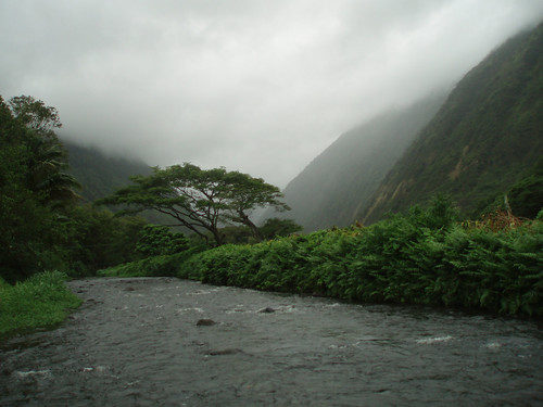
An area of low pressure aloft is located to the north of the state today, which will drop southward…crossing the eastern side of the island chain later tonight into Wednesday. This large University of Washington satellite image shows a large area of generally middle level clouds, extending southward. This is an offshoot of clouds from the cold front to our north and northwest, which looks rather stable. Looking at this NOAA satellite picture, shows a rather crisp, as far as clouds go that is, edge to this area of altocumulus and altostratus clouds. At the time of this writing, the islands from Kauai down through Oahu to parts of Maui County were covered. The Big Island has clouds coming in from the east, as part of the low pressure system to our north-northeast. This area of clouds near the Big Island, and to the east and north from there…have an unstable look to them…with some thunderstorms.
This instability is associated with an upper level trough of low pressure, which is forecast to move over the state from Maui County to the Big Island. This trough has unusually cold air aloft, which will spark the chance of thunderstorms over those eastern islands late tonight into Wednesday. The outlook calls for snowfall atop the Big Island summits, with even a few possible snow showers over the Haleakala Crater on Maui. We can see this trough digging southward, with already a few towering cumulus clouds, or thunderstorms forming to the east of the Big Island already Tuesday evening…using this looping satellite image. Checking out this looping radar image shows showers falling generally over the ocean – in the Kauai Channel, and to the south and west of Maui County to the Big Island at the time of this writing. We’re also starting to see a few small, moderately heavy showers over the ocean to the southeast of the Big Island.
The current higher than normal swell activity in the islands will gradually lower in size into Wednesday morning…with another very large, long lasting swell arriving later Wednesday into Thursday. This next west-northwest swell late Wednesday will bring dangerously large surf to our west and north shores again through Friday or Saturday. This weather map shows the huge storm low pressure system to the northwest of the islands…producing large swells, as it blows over an extensive area of the western and central Pacific Ocean. “Normal folks” should remain well away from the ocean in the areas where this extra large surf will be breaking. Only the most experienced water persons should be out in the water during this episode. There may be more of these abnormally large surf events cropping up over the next week or two.
The wild card remains the amount of moisture available in the area, with which the upper low pressure system will have to work with…having an important bearing on the eventual rainfall. Perhaps as a clarifying element, it should be remembered that the NWS forecast office has a flash flood watch up for both of our eastern islands. As evidence of this impending rainfall, we see precipitation already falling along the southeast flank of the taller mountains on the Big Island. ~~~ Don't forget to check out that big January full moon tonight. The actual fullest extent of this moon occurs Wednesday morning around 11am, so we can have tonight and Wednesday both be our full moon nights! I'll be back early Wednesday morning with your next weather narrative, and some results on what happened during the night. I hope you have a good Tuesday night until then. Aloha for now…Glenn.
Interesting: It holds the Guinness World Record for having the most names of any animal on the planet, with 40 in English alone. It's also the widest-ranging native land animal in the Americas, yet is declining throughout much of its range. Mongabay talks with big cat expert Dr. Howard Quigley about the status and research implications of the elusive, enigmatic, and unique cougar.
It is thought that the forebear of the cougar migrated from Asia into North America over the Bering land bridge approximately 8 million years ago, where it evolved into the different cat lineages present today. Cougars subsequently invaded South America three million years ago when the Isthmus of Panama formed to connect the two continents.
Genetic studies have shown that today's North American populations are all very similar, suggesting a population bottleneck contemporaneous with the megafauna extinction of approximately 10,000 years ago during which large North American mammals such as Smilodon went extinct.
Researchers believe that during this time cougars were largely or entirely extirpated from the whole of the continent, with today's populations refounded by cougars from South American. Although it can weigh up to 220 pounds, making it the second largest felid in the Americas (after the jaguar), the cougar is actually more related to smaller cat species such as ocelots and lynx than it is to lions and tigers.
Originally, it was even grouped in the same genus as the domestic cat (Felis), but in 1993 was given its own genus, Puma, which it shares with its closest living relative, the jaguarundi. Interestingly, even though they are in separate subfamilies, cougars and leopards are capable of hybridizing.
In the 1890s and early 1900s, an animal park in Germany bred a female cougar with a male leopard while a Berlin zoo bred a male puma to a female leopard. The resulting "pumapards" had the long body of a cougar with the rosettes of a leopard on a tawny or grey coat. Most died while young, and those that did reach adulthood grew to be only half the size of their parents due to genetic dwarfism.
Interesting2: Sakhalin Energy Investment Company — part owned by Shell — has announced plans to build a major oil platform near crucial feeding habitat of the Western North Pacific gray whale population. Only around 130 whales of the critically endangered Western population exist today, and their primary feeding habitat — off Sakhalin Island in the Russian Far East — is already besieged by multiple oil and gas exploration and development projects.
The construction and operation of an additional off-shore platform could have numerous negative impacts on the whales, potentially disrupting feeding behaviours and increasing the chance of fatal ship strikes. Also, a third platform heightens the risk of an environmentally catastrophic oil spill in this sensitive habitat.
"Just around 30 female western gray whales of breeding age remain — the population is already on the brink of disappearing forever," said Aleksey Knizhnikov, Oil & Gas Environmental Policy Officer for WWF-Russia. "The loss of even a few breeding females could mean the end for the population."
Gray whales occur on both sides of the Pacific Ocean. However IUCN classes the critically endangered Western population as separate from the Eastern population, as genetic studies indicate that the two populations probably do not mix.
Interesting3: More than a quarter of drinking wells in Vietnam's densely-populated Red River delta contain unsafe levels of arsenic that can cause cancer, neurological problems and hypertension, researchers warned on Tuesday. In a paper published in the journal Proceedings of the National Academy of Sciences, they also said 44 percent of the wells in the delta carried levels of manganese that exceed World Health Organization guidelines.
"About 7 million people are at a considerable risk of chronic arsenic poisoning. This is particularly worrying because groundwater is the main source of drinking water throughout the delta," lead author Michael Berg wrote in an email to Reuters. Arsenic contamination of groundwater occurs in many countries, like Argentina, Australia, Bangladesh, Chile, China, Hungary, India, Mexico, Peru, Thailand and the United States.
Manganese can disrupt the development of growing children. Home to 16.6 million people, the delta straddles eight provinces and two municipalities, the capital Hanoi and Hai Phong port. Eleven million people have no access to the public water supply and are dependent on other sources, such as tubewells.
Experts have long known that groundwater in parts of southeast Asia contain unsafe levels of arsenic, a naturally occurring chemical, but their locations have never been clear. Berg, a senior scientist at the Swiss Federal Institute of Aquatic Science and Technology, and colleagues collected samples from 512 private wells across the delta and analyzed them for arsenic, manganese and other toxins such as selenium and barium.
"Sixty-five percent of the groundwater wells in the Red River delta contain naturally occurring toxic elements, at levels which exceed the World Health Organization's (WHO) safety standards," Berg wrote. "The most health threatening … are arsenic, where 27 percent of the wells (are) above WHO guidelines and manganese, 44 percent."
Interesting4: Creating new well-paying jobs to spur the economic recovery remains a central concern globally and in the US. The Great Recession has left many professionals and their families struggling to make ends meet for over two years. This jobless recovery is likely to be the longest recovery since the Great Depression.
Furthermore, the convergence of automation and globalization have resulted in permanent changes in jobs across many industries. For instance, manufacturing and construction jobs are today more technical and requiring more education than 20 years ago.
Due to the same pressure of automation and globalization, middle management jobs are also disappearing. Most importantly, these lost jobs are likely not to come back as the economy recovers.
Larry Summers, who recently stepped down as the White House top economic adviser, made this point very clearly today during his interview on Fareed Zakaria's GPS on CNN: "Some of the jobs that were lost aren't going to come back, but some of the jobs are going to come in new places," Summers said.
Interesting5: Habitat alteration, simply put, is a change to a particular environment. What is unclear from its designation, however, is the adverse affect changes — big or small — have on the broader environment and related plant and animal life. According to The Nature Conservancy, habitat alteration, along with invasive species, are the two main causes of fish extinction.
The good news for responsible professionals and socio-eco innovators is that green jobs are likely to fuel the recovery both globally and in the US. Globally, research from the United Nations Environmental Program (UNEP) has shown that a shift to a a low-carbon and sustainable economy can create millions of green jobs across many sectors of the economy.
Similarly, the employment outlook from the US Department of Labor for job growth between 2008-2018 indicated a significant growth of green jobs this. Of course, this prediction is largely based on President Obama's pledge to invest $150 billion to create 5 million green jobs in the US over the next 10 years. The focus on green jobs is tremendously important not only to create jobs, but also to have a tremendous positive impact on our environment.
Rob Young Says:
Hi Glen, what a storm! That huge extra tropical low that bombed recently looks like it covered most of northern Pacific. What are the models saying about how big the waves will be?~~~big and bigger Rob, perhaps some of the biggest of the winter…although the models are suggesting that we more of these big bruisers to come. Thanks for your note! Aloha, Glenn
peter mac Says:
Glenn – your 'surfing' page photo is awesome, again. Do you know where that is?~~~Thanks Peter…Bali