


May 28-29, 2010
Air Temperatures – The following maximum temperatures were recorded across the state of Hawaii Friday afternoon:
Lihue, Kauai – 83
Honolulu, Oahu – 83
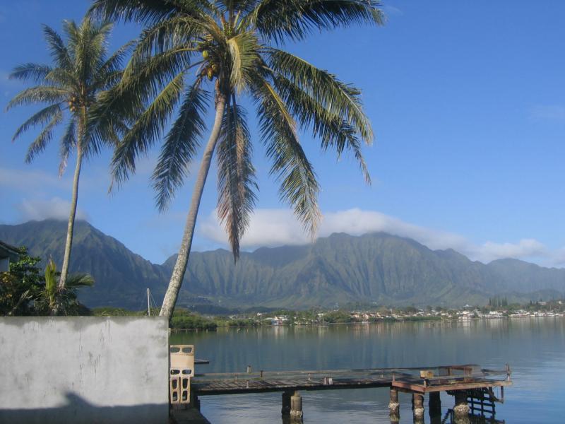
Kaneohe, Oahu – 82
Kaunakakai, Molokai – 83
Kahului, Maui – 87
Hilo, Hawaii – 78
Kailua-kona – 83
Air Temperatures ranged between these warmest and coolest spots near sea level around the state – and on the highest mountains…at 5pm Friday evening:
Kahului, Maui – 83F
Hilo, Hawaii – 70
Haleakala Crater – 48 (near 10,000 feet on Maui)
Mauna Kea summit – 32 (near 14,000 feet on the Big Island)
Precipitation Totals – The following numbers represent the largest precipitation totals (inches) during the last 24 hours on each of the major islands, as of Friday afternoon:
0.78 Puu Opae, Kauai
0.75 Moanalua RG, Oahu
0.00 Molokai
0.00 Lanai
0.00 Kahoolawe
0.03 Puu Kukui, Maui
0.30 Mountain View, Big Island
Marine Winds – Here’s the latest (automatically updated) weather map showing a 1030 millibar high pressure system far to our northeast…with an elongated ridge of high pressure extending from its center southwest from its center. The trade wind flow will be picking up Saturday into Sunday.
Satellite and Radar Images: To view the cloud conditions we have here in Hawaii, please use the following satellite links, starting off with this Infrared Satellite Image of the islands to see all the clouds around the state during the day and night. This next image is one that gives close images of the islands only during the daytime hours, and is referred to as a Close-up visible image. This next image shows a larger view of the Pacific…giving perspective to the wider ranging cloud patterns in the Pacific Ocean. Finally, here’s a Looping IR satellite image, making viewable the clouds around the islands 24 hours a day. To help you keep track of where any showers may be around the islands, here’s the latest animated radar image.
Hawaii’s Mountains – Here’s a link to the live webcam on the summit of near 14,000 foot Mauna Kea on the Big Island of Hawaii. The tallest peak on the island of Maui is the Haleakala Crater, which is near 10,000 feet in elevation. These two webcams are available during the daylight hours here in the islands…and when there’s a big moon rising just after sunset for an hour or two! Plus, during the nights and early mornings you will be able to see stars, and the sunrise too…depending upon weather conditions.
Tropical Cyclone activity in the eastern and central Pacific – Here’s the latest weather information coming out of the National Hurricane Center, covering the eastern north Pacific. You can find the latest tropical cyclone information for the central north Pacific (where Hawaii is located) by clicking on this link to the Central Pacific Hurricane Center. Here’s a tracking map covering both the eastern and central Pacific Ocean. A satellite image, which shows the entire ocean area between Hawaii and the Mexican coast…can be found here. Of course, as we know, our hurricane season won’t begin again until June 1st here in the central Pacific.
Aloha Paragraphs
Returning trades this weekend…pleasant weather
The trade winds will be picking up this weekend, remaining active through the upcoming Memorial Day holiday. The reason our winds are lighter than normal can be attributed to the relatively close proximity of the high pressure ridge to our northwest…pushed close there by a late season cold front. This weather map shows these features well, including the near 1030 millibar high pressure cell to our northeast. The expectation is for the trade winds to return to the islands during the day Saturday, then further increasing as we push through the remainder of the long holiday weekend. Once we get into the month of June, which starts Tuesday, it becomes more and more difficult to trip up the trade wind flow. Although, with that being said, the computer forecast models are suggesting that our winds might tumble once again…around the middle of the new week ahead.
Despite the generally dry and stable overhead atmosphere, we found a few locally heavy showers falling over the interior part of
It’s Friday evening as I begin writing this last section of today’s narrative.
As noted above, we’re at the tail-end of this light wind regime. As we move into Saturday, the trade winds will return, picking up speed Sunday into the holiday on Monday. These winds may become strong enough by Sunday, that small craft wind advisories will go up in those windiest areas around Maui and the Big Island. There may be a few showers over the windward coasts and slopes soon…once the trade winds start up again. All things considered, this weekend should be quite nice, setting the stage for most outdoor activities. ~~~ Since its Friday evening, I’ve decided to go see a new film in Kahului. I’m being drawn to the new Robin Hood film (2010), starring Russell Crowe and Cate Blanchett…among others. A synopsis: the famed 13th century expert archer leads an uprising against corruption in the village of Nottingham. The critics are giving this film a C+ grade, while the viewers are saying B. I’ll be sure to let you know what I think Saturday morning, when I return with your next new weather narrative from paradise. Here’s a trailer, just in case you’re interested. Aloha for now…Glenn.
Interesting: From the port of Sadarghat, the Bangladeshi capital Dhaka unfolds itself in an inclement palette of greys and browns. The Buriganga River, stretching out in each direction like a puddle of mercury, is dotted with hundreds of river craft, some dredging trash from the riverbed, others weighed down with passengers and piles of vegetables.
Moored nearby, bleeding rust, sits the country’s fleet of ‘rockets’—colonial-era paddle steamers fitted with belching diesel engines that ply Bangladesh’s extensive network of waterways. The road running along the riverbank, the old Buckman Bund of the British colonial era, is today a bottlenecked mass of overladen trucks and tinkling rickshaws.
A magnet for rural migrants, low-lying Dhaka—already one of the most densely populated megacities on earth—is likely to come under increasing strain as the country comes face-to-face with the effects of global climate change. The UN’s Intergovernmental Panel on Climate Change says Bangladesh is likely to face cyclones, drought and flood events of increasing frequency and intensity as global warming sets in.
In its 2005 report, the IPCC also estimated that a one meter rise in sea-levels could put 17 percent of the country underwater and cut its food production by 30 percent by 2050. Much of Dhaka, which lies in a flood plain protected only by giant embankments along the Buriganga could be engulfed by even a ‘slight rise’ in sea level, according to another report by UN Habitat.
It described the megacity—largely unplanned and lacking basic infrastructure—as a ‘recipe for disaster.’ In May last year, Cyclone Aila lashed the southern part of the country, breaching giant embankments and flooding large tracts of low-lying farmland with salt water. Of the 900,000 families affected by the storm, about 100,000 people are still living in makeshift camps on top of the flood embankments—the only place beyond the reach of the floodwaters.
Luigi Peter Ragno, a project manager at the International Organization for Migration who is working with communities affected by Aila, says an expected spike in extreme weather events due to global warming will likely accelerate the age-old flow of rural poor to the cities. ‘Looking at the future, you can see that environmental degradation can have a cascade effect into the cities and the urban areas,’ he says.
‘Everybody will be affected.’ As Munjurul Hannan Khan, deputy secretary of the Bangladeshi Ministry of Environment and Forests told a conference in Dhaka last month, ‘For the north, [climate change] will mean a compromise with lifestyle. For us, it’s about future survival.’ But the sight from Old Dhaka is not all as grim as these projections alone suggest.
While Western policymakers direct their focus toward mitigating carbon emissions, Bangladesh is one of the few countries to accept the inevitability of climate change and start tackling adaption head-on. Once the very symbol of backwardness—an ‘international basket case’ in Henry Kissinger’s infamous words—today’s Bangladesh may well soon be leading the way into a shared future of climate insecurity.
Saleemul Huq, a senior fellow at the International Institute for Environment and Development (IIED) in London, says Bangladesh, with its relatively high levels of education and a burgeoning awareness of climate change issues, was well placed to establish a ‘comparative advantage’ in adaptation research. ‘Over the course of the next ten years, this is where the world will learn how to deal with climate change,’ he says. ‘This is ground zero.’
Interesting2: Two volcanoes are wreaking havoc in Latin America. One in Guatemala and another in Ecuador. The Tungurahua volcano in central Ecuador erupted on Friday, sending a large cloud of ash into the air. No injuries or deaths have been reported, but authorities continue to monitor the event.
The volcano is located 90 miles south of Quito. Tungurahua had also erupted in 1999 and 2006. Meanwhile in Guatemala, the Pacaya volcano that erupted on Thursday, has killed at least three people, including a TV reporter, Aníbal Archila, who was hit by rocks and debris. Pacaya is only 17 miles south of Guatemala City — the country’s capital.
Guatemala emergency personnel say that four villages have been evacuated and at least 1700 people have taken shelter elsewhere. Dozens of people have suffered injuries and at least three children have been reported missing. On Friday, the Pacaya volcano seemed calmer after overnight rains hit the area, but geologist predict the volcano will spew lava in the next several hours.