


April 17-18, 2010
Air Temperatures – The following maximum temperatures were recorded across the state of Hawaii Saturday afternoon:
Lihue, Kauai – 76
Honolulu, Oahu – 78
Kaneohe, Oahu – 77
Kaunakakai, Molokai – 75
Kahului, Maui – 75
Hilo, Hawaii – 76
Kailua-kona – 82
Air Temperatures ranged between these warmest and coolest spots near sea level around the state – and on the highest mountains…at 4pm Saturday afternoon:
Kailua-kona – 78F
Kapalua, Maui – 73
Haleakala Crater – 57 (near 10,000 feet on Maui)
Mauna Kea summit – 46 (near 14,000 feet on the Big Island)
Precipitation Totals – The following numbers represent the largest precipitation totals (inches) during the last 24 hours on each of the major islands, as of Saturday afternoon:
0.15 Mount Waialaele, Kauai
0.03 Oahu Forest NWR, Oahu
0.00 Molokai
0.00 Lanai
0.00 Kahoolawe
0.20 West Wailuaiki, Maui
0.31 Kawainui Stream, Big Island
Marine Winds – Here’s the latest (automatically updated) weather map showing a 1030 millibar high pressure system located far to the northwest of the islands…with its ridge extending eastward. At the same time, we have a 1006 millibar low pressure cell positioned to our northeast. This pressure configuration will keep our winds northeast to east through Monday.
Satellite and Radar Images: To view the cloud conditions we have here in Hawaii, please use the following satellite links, starting off with this Infrared Satellite Image of the islands to see all the clouds around the state during the day and night. This next image is one that gives close images of the islands only during the daytime hours, and is referred to as a Close-up visible image. This next image shows a larger view of the Pacific…giving perspective to the wider ranging cloud patterns in the Pacific Ocean. Finally, here’s a Looping IR satellite image, making viewable the clouds around the islands 24 hours a day. To help you keep track of where any showers may be around the islands, here’s the latest animated radar image.
Hawaii’s Mountains – Here’s a link to the live webcam on the summit of near 14,000 foot Mauna Kea on the Big Island of Hawaii. The tallest peak on the island of Maui is the Haleakala Crater, which is near 10,000 feet in elevation. These two webcams are available during the daylight hours here in the islands…and when there’s a big moon rising just after sunset for an hour or two! Plus, during the nights and early mornings you will be able to see stars, and the sunrise too…depending upon weather conditions.
Tropical Cyclone activity in the eastern and central Pacific – Here’s the latest weather information coming out of the National Hurricane Center, covering the eastern north Pacific. You can find the latest tropical cyclone information for the central north Pacific (where Hawaii is located) by clicking on this link to the Central Pacific Hurricane Center. Here’s a tracking map covering both the eastern and central Pacific Ocean. A satellite image, which shows the entire ocean area between Hawaii and the Mexican coast…can be found here.
Aloha Paragraphs
Good looking Sunday coming up
Our weather is quite nice now, although still a little on the cool and breezy side. The latest weather map shows a high pressure system far to the northwest of the islands, with a gale low pressure system to the northeast. This is keeping us in a northeast wind flow, situated between these two weather features. Here’s a link to that weather map, so you can more easily visualize this pressure configuration. This north to northeast air flow dropped in strength some Saturday, although could easily be considered still breezy in many places. Air temperatures will remain cooler than normal this weekend, although those areas out from under the low cloud cover, will be able to warm up a bit more than elsewhere.
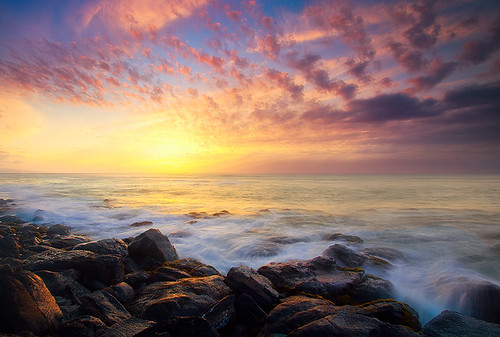
Saturday night and Sunday will be just fine, with just a few limited showers falling along our northeast to ENE sides of the islands…dry elsewhere. The rather thick swath of high cirrus clouds that we saw earlier in the day, and shifted southeast…and are breaking up now. Here’s a satellite image showing not only that cirrus, but the low clouds coming into the state from the northeast. If we look at this larger view, with this satellite image, we can get an even better idea of the cloudiness surrounding the islands, which will help to keep us cooler than normal for the time being. High temperatures Saturday remained several degrees cooler than normal, with perhaps a little warmer conditions expected by Sunday afternoon into Monday…as the trade winds return.
It’s Saturday evening as I begin writing this last section of today’s narrative. The overlying atmosphere remains quite dry and stable, so that the low clouds, called stratocumulus, evaporated nicely during the day. There may be a couple of very light showers tonight into early Sunday morning, but for the most part…look for dry weather to prevail through Sunday. The air mass over us, brought in by the recently retired cold front, is going to still feel a little chilly. We’re though the coolest part of this tropical cool snap, and Sunday should feel a little warmer, and pretty much back to normal by Monday. ~~~ Glancing further ahead, as the winds turn back to the normal easterly trade wind direction, it will bring a bit more moisture into our area, so that we’ll begin to see a few more windward showers falling. Moving further into the week, we could be looking at a wet period. This may begin to show its self around mid-week, but we could be looking at some potentially wetter weather by Friday into next weekend. It’s too early to know for sure, although the computer models have been suggesting this idea for several days now…stay tuned. ~~~ I went down to Paia this morning, and did some food shopping, and as I’m still trying to stay out of the sun, came right back upcountry to Kula thereafter. My neighbors and I just made a plan to take bikes down to Thompson Ranch Road in Keokea, and ride back and forth there before sunset. There aren’t any high clouds around now, so the sunset will be rather quick, rather than become colorful as it sometimes does. I’ll be back Sunday morning with your next new weather narrative, I hope you have a great Saturday night until then! Aloha for now…Glenn.
Extra: Excellent illustration of the volcanic ash cloud in Iceland – no scale given for the colors – and nothing to indicate what level in the atmosphere the ash & particulates are. Yet the time sequence to cover that much of northern Europe is quite stunning.
~~~ Thanks to Eliza, Haiku, Maui
Interesting: As an Icelandic volcano spewed more ash on Friday, disrupting air travel in Europe for a second day, the big question for scientists was how long the eruption might continue. The answer will go a long way toward determining any lasting impact on air travel, climate and health. But experts said that, for now, the question was essentially unanswerable.
“This may have been it,” said Colin Macpherson, a professor in the department of earth science at the University of Durham in England. “Alternatively it may be that we’re seeing the beginning of prolonged activity.” Jennie Gilbert, a professor at the University of Lancaster in England who has studied Icelandic volcanoes, said: “I don’t think there’s any general feeling for how this volcano will operate.
My best guess is that it will be explosive for a few days and then might continue at a reduced level.” Dr. Macpherson said that volcanologists in Iceland would be monitoring the volcano for indications that the eruption was continuing or starting to taper off. Small-scale seismic activity, for example, would be a sign that hot magma was still coming up through the volcano, cracking the ground as it moved through.
Slight changes in the slope of the volcano’s flanks, as measured by a device called a tilt-meter, would suggest that gases were continuing to build up below as they bubbled out of the magma, causing the surface to bulge, or were dissipating. “As long as the tilt is increasing, it’s still erupting,” Dr. Macpherson said. One complicating factor is that the eruption is occurring under an ice sheet, the Eyjafjallajokull glacier.
Melting of the underside of the ice has caused flooding, forcing evacuations of some communities near the volcano in southern Iceland. But of more concern for Europe is how the water being produced might be affecting the volcano and the ash it is generating. “Certainly the fact that the eruption is going on underneath the ice sheet is likely to have an effect on the explosivity of the volcano,” Dr. Macpherson said.
He likened the situation to putting a hot pan under the kitchen faucet — as the hot magma hits the cold water it rapidly creates steam. If the steam is contained by rock, the pressure can build up and a localized explosion can occur. Dr. Macpherson said that the magma also contained gases of its own that bubble out and build up. The explosivity of the volcano is a function of both these gases and the steam, he said, and the precise contribution of each is unknown.
But if the eruption continues at some point there will be no more ice to melt near the eruption site, which might reduce the explosivity. Dr. Gilbert said the presence of water can also affect the characteristics of the sand like ash that is produced. As the molten rock hits the cold water it is rapidly quenched, fusing into a glassy material. Then when the pressure builds up and the volcano explodes, this material breaks up into very fine particles. “It’s like this sort of shattering effect,” she said.
Interesting2: We’re not quite back to the pre-plane era, but air travel over and around the north Atlantic might get a lot more disrupted in the coming years. Volcanologists say the fireworks exploding from the Eyjafjallajökull volcano on Iceland, which is responsible for the ash cloud that is grounding all commercial flights across northern Europe, may become a familiar sight. Increased rumblings under Iceland over the past decade suggest that the area is entering a more active phase, with more eruptions and the potential for some very large bangs.
"Volcanic activity on Iceland appears to follow a periodicity of around 50 to 80 years. The increase in activity over the past 10 years suggests we might be entering a more active phase with more eruptions," says Thorvaldur Thordarson, an expert on Icelandic volcanoes at the University of Edinburgh, UK. By contrast, the latter half of the 20th century was unusually quiet. Along with increased volcanism, more seismic activity has been recorded around Iceland, including the magnitude-6.1 quake that rocked Reykjavik in May 2008.
In 1998 Gudrún Larsen from the University of Iceland in Reykjavik and colleagues used 800 years’ worth of data from lava layers, ice cores and historical records to show that Iceland’s volcanism goes through cycles of high and low activity. The peaks of these cycles seem to be strongly linked to bursts of earthquakes, which release the build-up of strain on tectonic faults near Iceland caused by the rifting of the Atlantic Ocean. In addition, the periodicity may be linked to pulses of magma coming from the mantle and pressure fluctuations at the surface caused by glaciers melting and geothermal activity.
Larsen and colleagues showed that the Vatnajökull ice cap region – which includes the highly active Grímsvötn and Bárdarbunga volcanoes – experienced between 6 and 11 eruptions every 40 years during phases of high activity, compared with no more than three eruptions per 40 years during low-activity phases. Other regions of Iceland appear to follow a similar pattern to Vatnajökull. As well as becoming more frequent, eruptions seem to get more intense during the high-activity phases.
A number of Iceland’s most devastating eruptions – including that of the volcano Laki in 1783 that killed over half of Iceland’s livestock and led to a famine that wiped out about a quarter of the human population – have occurred when the Atlantic rift system has been active. "If we are entering a more active phase, these bigger eruptions will become more likely," says Thordarson. Judging by recent volcanic and earthquake activity, Thordarson and his colleagues believe that Iceland is entering its next active phase and estimate it will last for 60 years or so, peaking between 2030 and 2040.
Lori Says:
Thank you Glenn! 🙂 ~~~ You’re very welcome Lori, Aloha,Glenn
sam mcfadden Says:
aloha glenn
Gratitude for your being on it. I have been surfing over 50 years and moved to hawaii in the 60’s, before coming here from southern california. I do body and mind work since I was 12years old. In being sensitive I always was able to read the weather and knew where the surf was going to be good and when within a week or two. both on the mainland and hawaii. So I do appreciate your using the technology of what we as humans have within us but is now shown in the toys we have to help others realize our magnificence as humans.
Aloha Sam Mc Fadden~~~Hi Sam, thanks for note! It sounds to me like your are quite magnificent yourself, thanks for sharing your story, or a little bit of it at least…with all of us! You and I have a similar story, at least in terms of being here in Hawaii for so long…and loving to ride all those waves we have under our belts. Aloha, Glenn
Lori Says:
Do you think any of this will affect mainland and Hawaii? I’m traveling to Maui in early May from the midwest- so hopefully NOT!~~~Not likely, as the winds aloft travel from west to east…although if there were more major eruptions, bigger ones than we’re seeing now…things could change. I wouldn’t worry about that Lori. Aloha, Glenn