


March 30-31, 2010
Air Temperatures – The following maximum temperatures were recorded across the state of Hawaii Tuesday afternoon:
Lihue, Kauai – 79
Honolulu, Oahu – 83
Kaneohe, Oahu – 79
Kaunakakai, Molokai – 78
Kahului, Maui – 82
Hilo, Hawaii – 80
Kailua-kona – 81
Air Temperatures ranged between these warmest and coolest spots near sea level around the state – and on the highest mountains…at 4pm Tuesday afternoon:
Kailua-kona – 82F
Princeville, Kauai – 75
Haleakala Crater – missing (near 10,000 feet on Maui)
Mauna Kea summit – 36 (near 14,000 feet on the Big Island)
Precipitation Totals – The following numbers represent the largest precipitation totals (inches) during the last 24 hours on each of the major islands, as of Tuesday afternoon:
0.48 Mount Waialaele, Kauai
0.20 Oahu Forest NWR, Oahu
0.00 Molokai
0.00 Lanai
0.00 Kahoolawe
0.03 Puu Kukui, Maui
0.37 Kawainui Stream, Big Island
Marine Winds – Here’s the latest (automatically updated) weather map showing a 1031 millibar high pressure system located to the north of the islands. This pressure configuration will keep strong to very strong trade winds blowing into mid-week…and beyond.
Satellite and Radar Images: To view the cloud conditions we have here in Hawaii, please use the following satellite links, starting off with this Infrared Satellite Image of the islands to see all the clouds around the state during the day and night. This next image is one that gives close images of the islands only during the daytime hours, and is referred to as a Close-up visible image. This next image shows a larger view of the Pacific…giving perspective to the wider ranging cloud patterns in the Pacific Ocean. Finally, here’s a Looping IR satellite image, making viewable the clouds around the islands 24 hours a day. To help you keep track of where any showers may be around the islands, here’s the latest animated radar image.
Hawaii’s Mountains – Here’s a link to the live webcam on the summit of near 14,000 foot Mauna Kea on the Big Island of Hawaii. The tallest peak on the island of Maui is the Haleakala Crater, which is near 10,000 feet in elevation. These two webcams are available during the daylight hours here in the islands…and when there’s a big moon rising just after sunset for an hour or two! Plus, during the nights and early mornings you will be able to see stars, and the sunrise too…depending upon weather conditions.
Tropical Cyclone activity in the eastern and central Pacific – Here’s the latest weather information coming out of the National Hurricane Center, covering the eastern north Pacific. You can find the latest tropical cyclone information for the central north Pacific (where Hawaii is located) by clicking on this link to the Central Pacific Hurricane Center. Here’s a tracking map covering both the eastern and central Pacific Ocean. A satellite image, which shows the entire ocean area between Hawaii and the Mexican coast…can be found here.
Aloha Paragraphs
Blustery weather continues into mid-week
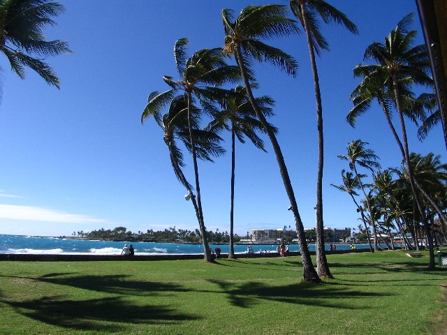
As expected, and pointed out by the computer models since late last week, our trade winds have escalated into the strong and gusty realms. The gust factor of this blustery trade wind event has been notable, topping out, at least so far, at 67 mph at Kaupo Gap…on the southeast side of east
The latest computer forecast models show this high pressure center wobbling around to our north through the next couple of days. This will ensure that our exceptionally strong and gusty trade winds will remain in force for the time being. The computer models show a low pressure system, and its associated cold front, migrating by to the north of our high pressure system around Thursday. This will likely weaken the pressure gradient as it goes by, with a corresponding softening of our local wind speeds…although minimally. This slightly lighter version of the trade winds won’t last long, as a new high pressure system moves into position to our northwest and north this weekend. This will crank the trade winds right back up across our area, before a second cold front moves by in the middle latitudes of the
Besides just the wind, there will be other considerations to contend with during this prolonged windy regime. We’ve already seen an unusual wind advisory in effect over all the islands. At sea, at least over the coastal zones, a small craft wind advisory covers the entire state. In deeper water, in those major channels between the islands of Maui and Molokai, Maui and the
So, what about precipitation, are we gonna get any? Very often we find wet clouds being carried into the windward sides of the islands…under such circumstances. This time it looks like a very limited rainfall regime, at least for the time being. There will of course be some showers arriving, although not all that many. The windward sides will get the most, although some light showers may get carried over into the leeward sides on the smaller islands…during the windiest aspects this ongoing windy episode. The models suggest that an upper level low pressure system will edge overhead later this weekend, into next week. This in turn could enhance our rainfall pattern, with more generous moisture getting into our area then. This is the time of year when we depend on, or at least hope…that the trade winds will bring us water, in order to get us through the often long dry summer months ahead. It’s still a bit too early to know for sure just how wet we may get beginning later Sunday, but we should all be looking forward to such an occurrence. As the information from the NWS shows below, we’re running short, very short of anything close to normal rainfall amounts thus far this year:
FOR JANUARY 2010 THROUGH THE END OF FEBRUARY – RAINFALL TOTAL ACCUMULATIONS WERE:
–
–
–
–
NCEP TOOLS PREDICT BELOW MEDIAN PRECIPITATION FOR
NCEP MODELS PREDICT BELOW NORMAL TEMPERATURE FOR
It’s Tuesday evening as I begin writing this last section of today’s narrative. Trade winds remain active across the islands now…to say the least. Looking at the strongest gusts around the state at near 5pm, these were the biggest numbers on each of the islands:
40 mph on Kauai
46 mph on Oahu
39 mph on Molokai
42 mph on Lanai
46 mph on Kahoolawe
50 mph on Maui
55 mph on the Big Island
As evidenced by the big numbers above, and after finding winds gusting up to 67 mph earlier Tuesday morning, the trade winds are still our headline weather news…as we head into Tuesday night and Wednesday. The flags are whipping straight out from their poles, dust is swirling around where there’s loose soil available, among numerous other wind sponsored happenings. It would be wise to drive carefully, not to mention take great care going out into the ocean now, what with the wind and seas so utterly rough in many places. ~~~ As I get ready to leave Kihei, on my way back upcountry to Kula, the whole west side of the Haleakala Crater is totally, absolutely cloud free! By the way, my neighbors mentioned it was near 80F degrees up at our property this afternoon, while down here near the ocean, my car thermometer was reading a very summery 89 degrees at lunch! I’ll be back with you early Wednesday morning, with what else – but more cutting edge information about this windy weather on the last day of March. I hope you have a great Tuesday night, made bright with the still large moon beaming down on us! Aloha for now…Glenn.
Interesting: In the Mediterranean Sea off the coast of Libya, there’s an area local fishermen call "Turtle Island." It’s real enough, but you’d be foolish to try to sail there. The island is never in precisely the same place, and it changes size from one minute to the next. In fact, you never know when its gleaming shore might disappear altogether, because it’s made up entirely of the half-exposed shells of basking loggerhead sea turtles.
The funny thing is, sea turtles, unlike the Mediterranean’s human denizens, aren’t supposed to like to float, says Sandra Hochscheid, a marine biologist at Stazione Zoologica Anton Dohrn in Naples, Italy. Scientists believe that loggerhead sea turtles (Caretta caretta), the dominant sea turtle in the Mediterranean, spend most of their lives underwater or on the sea floor, coming to the surface only for brief gasps of air.
"Everything we’d found out about turtles: feeding, mating, migrating, searching for good places, resting… has all taken place underwater," she says. Hochscheid knew about Turtle Island and had heard about basking turtles from tourists in Naples, but she’d never seen the behavior for herself. So she decided to figure out just what the loggerheads were doing spending so much time among the waves. "I’ve been looking 10 years into what they do under the water surface," Hochscheid says.
"But I’ve never looked at the time they spend at the surface." Hochscheid and colleagues collected 10 loggerheads from various locations in the Mediterranean and glued tracking devices—small black boxes with flexible antennas—to their shells. Over a year of observations, it became clear why the turtles had developed a reputation as bottom dwellers. The tagged loggerheads spent about 98% of their time underwater. And when they did come up, it was irregularly, sometimes twice in 2 days and sometimes not for a week.
Interesting2: The yearly ritual of severe heat and drought ahead of life-giving monsoon rains has kicked off earlier than usual over most of the Indian Subcontinent. As of Monday, average temperatures for the month thus far have been 5F to 10F above normal in a broad swath of eastern, central and northwestern India, as well as Pakistan and Bangladesh.
The upper end of this range has been reached along the thickly populated Indus River Valley between Karachi and Islamabad, Pakistan, and eastward into the desert of Rajasthan, the northwestern state of India. Highest temperature to about 110F have been reached this month from central Indian states of Chattisgarh, Maharashtra and Gujarat, west into Sindh, southern Pakistan.
An Indian rickshaw driver takes a nap in the afternoon heat in the Chandni Chowk neighborhood of New Delhi, India Friday, March 26, 2010. Coincident with the heat is serious drought over northwest India to much of Pakistan. This drought began last year with a rainfall dearth during the rain-giving summer monsoon. It has persisted through the present month on the back of deficient winter rains.
Heat and drought often work to perpetuate one another in a kind of reinforcing knock-on effect. In this light, and given that summer’s rains normally do not begin in earnest before July, sweltering heat and drought in Pakistan and northwest India are likely to persist indefinitely. Yields of winter crops have likely been trimmed by the ongoing drought. Looking forward, heat and drought will have continued impact in matters such as agriculture, water supply and personal comfort and health.
Interesting3: A new study involving scientists from 13 different organizations, universities and research institutions states that forest protection offers one of the most effective, practical, and immediate strategies to combat climate change. The study was published in PLoS Biology and makes specific recommendations for incorporating protected areas into overall strategies to reduce emissions of greenhouse gasses from deforestation and degradation (nicknamed REDD).
"Deforestation leads to about 15 percent of the world’s greenhouse gas emissions, more than all the cars, trucks, trains, ships, and planes on earth. If we fail to reduce it, we’ll fail to stabilize our climate," said Taylor Ricketts, director of World Wildlife Fund’s science program and lead author of the study.
"Our paper emphasizes that creating and strengthening indigenous lands and other protected areas can offer an effective means to cut emissions while garnering numerous additional benefits for local people and wildlife." The authors highlight analyses showing that since 2002, deforestation in the Brazilian Amazon has been 7 to 11 times lower inside of indigenous lands and other protected areas than elsewhere.
Simulation models suggest that protected areas established between 2003 and 2007 could prevent an estimated area of 100,000 square miles of deforestation through 2050. That is roughly the size of the state of Colorado, representing enough carbon to equal 1/3 of the world’s annual CO2 emissions. Within these efforts, location matters; protected areas in regions that face deforestation pressures would be most effective at truly reducing emissions.
"This study reinforces the wisdom behind global investments in protected areas," says Gustavo A.B. da Fonseca, co-author of the study and Team Leader Natural Resources of the Global Environment Facility (GEF). "In addition to protecting globally important species and ecosystems, the 2,302 protected areas supported by the GEF alone span over 634 million hectares and together store an impressive 30 billion tons of CO2"
Interesting4: Climate change might have helped bring about the fall of the ancient Khmer civilization in Angkor, Cambodia, nearly 600 years ago, new research suggests. Historians have given various explanations for the fall of the empire that stretched across much of Southeast Asia between the ninth and 14th centuries (801 to 1400), from land overexploitation to conflict with rival kingdoms.
But the new study offers strong evidence that two severe droughts, punctuated by bouts of heavy monsoon rain, could have weakened the empire by shrinking water supplies for drinking and agriculture, and damaging Angkor’s vast irrigation system, which was central to its economy. The kingdom, one of the greatest civilizations of all time, is thought to have collapsed in 1431 after a raid by the Siamese from present-day Thailand.
"Angkor at that time faced a number of problems — social, political and cultural. Environmental change pushed the ancient Khmers to the limit and they weren’t able to adapt," said study author Brendan Buckley, a climate scientist at Columbia University’s Lamont-Doherty Earth Observatory in New York. "I wouldn’t say climate caused the collapse, but a 30-year drought had to have had an impact."
The researchers were able to reconstruct 759 years of past climate in the region surrounding Angkor by studying the annual growth rings of cypress trees in a nearby national park. The tree rings revealed evidence of a mega-drought lasting three decades — from the 1330s to 1360s — followed by a more severe but shorter drought from the 1400s to 1420s, right before the empire collapse.
The droughts could have led to crop failure and a rise in infectious disease, and both problems would have been exacerbated by the density of the population, Buckley said. They also found evidence for intense rainy seasons that might have damaged Angkor’s hydraulic system. During a normal monsoon season, Angkor’s vast network of canals, embankments and reservoirs could have handled heavy downpours, but after extended droughts, the system may have been vulnerable to clogging.
The researchers suspect that El Niño, a cyclical warming of the tropical Pacific Ocean, might have played an important role in shutting down the monsoon rains in this region, leading to droughts. "The evidence from monsoon Asia should remind us that complex civilizations are still quite vulnerable to climate variability and change," said study researcher Kevin Anchukaitis, also of Columbia University.
Similar studies suggest that abrupt environmental changes may have pushed other ancient civilizations over the edge, including the Anasazi people of the southwestern United States; the Maya people of Central America; and the Akkadian people of Mesopotamia. The results were published this week in the journal Proceedings of the National Academy of Sciences.
Janet Says:
Glenn,
Wondering if you know of a site for cane burn schedule and locations? Been smelling smokey down here in Kihei in the mornings.
Thanks,
Janet~~~Hi Janet, I don’t have that information, although if you do a google search for Maui sugar cane burning schedule…I would imagine it would pretty easy to find. This is the time of year when it begins again. Aloha, Glenn
Gail Says:
Windy indeed. We even saw a water spout, though it did not rise too far above the surface of the water, in North Kihei this morning around 9am. It was moving north to south…..Gail~~~Hi Gail, waterspout, a small tornado over water, very interesting! Windy, yes was just out for lunch, and the winds are very strong over the ocean offshore from Kihei. Thanks for eye witness report! Aloha, Glenn