


February 27-28, 2010
Air Temperatures – The following maximum temperatures were recorded across the state of Hawaii Saturday afternoon:
Lihue, Kauai – 80
Honolulu, Oahu – 80
Kaneohe, Oahu – 80
Kaunakakai, Molokai – 79
Kahului, Maui – 85
Hilo, Hawaii – 85
Kailua-kona – 82
Air Temperatures ranged between these warmest and coolest spots near sea level around the state – and on the highest mountains…at 7pm Saturday evening:
Kokole Point, Kauai – 79F
Molokai airport – 72
Haleakala Crater – 62 (near 10,000 feet on Maui)
Mauna Kea summit – 37 (near 14,000 feet on the Big Island)
Precipitation Totals – The following numbers represent the largest precipitation totals (inches) during the last 24 hours on each of the major islands, as of Saturday afternoon:
0.01 Poipu, Kauai
0.08 Oahu Forest NWR, Oahu
0.00 Molokai
0.00 Lanai
0.00 Kahoolawe
0.02 Puu Kukui, Maui
0.13 Waiakea Uka, Big Island
Marine Winds – Here’s the latest (automatically updated) weather map showing a 1021 millibar high pressure system to the northeast of Hawaii…moving eastward. A cold front is moving in our direction, with cooler, stronger north to northeast winds into Monday, as a strong high pressure system moves into the area northwest of Hawaii.
Satellite and Radar Images: To view the cloud conditions we have here in Hawaii, please use the following satellite links, starting off with this Infrared Satellite Image of the islands to see all the clouds around the state during the day and night. This next image is one that gives close images of the islands only during the daytime hours, and is referred to as a Close-up visible image. This next image shows a larger view of the Pacific…giving perspective to the wider ranging cloud patterns in the Pacific Ocean. Finally, here’s a Looping IR satellite image, making viewable the clouds around the islands 24 hours a day. To help you keep track of where any showers may be around the islands, here’s the latest animated radar image.
Hawaii’s Mountains – Here’s a link to the live webcam on the summit of near 14,000 foot Mauna Kea on the Big Island of Hawaii. The tallest peak on the island of Maui is the Haleakala Crater, which is near 10,000 feet in elevation. These two webcams are available during the daylight hours here in the islands…and when there’s a big moon rising just after sunset for an hour or two! Plus, during the nights and early mornings you will be able to see stars, and the sunrise too…depending upon weather conditions.
Tropical Cyclone activity in the eastern and central Pacific – Here’s the latest weather information coming out of the National Hurricane Center, covering the eastern north Pacific. You can find the latest tropical cyclone information for the central north Pacific (where Hawaii is located) by clicking on this link to the Central Pacific Hurricane Center. Here’s a tracking map covering both the eastern and central Pacific Ocean. A satellite image, which shows the entire ocean area between Hawaii and the Mexican coast…can be found here.
Aloha Paragraphs
Cool windy weather…right around the corner
SUBJECT - TSUNAMI WARNING CANCELLATION THE TSUNAMI WARNING IS CANCELLED FOR THE STATE OF HAWAII EFFECTIVE AT 0138 PM HST. AN EARTHQUAKE HAS OCCURRED WITH THESE PRELIMINARY PARAMETERS ORIGIN TIME - 0834 PM HST 26 FEB 2010
COORDINATES - 36.1 SOUTH 72.6 WEST
LOCATION - NEAR COAST OF CENTRAL CHILE
MAGNITUDE - 8.8 MOMENT MEASUREMENTS OR REPORTS OF TSUNAMI WAVE ACTIVITY GAUGE LOCATION LAT LON TIME AMPL PER
------------------- ----- ------ ----- --------------- -----
KAWAIHAE HAWAII 20.0N 155.8W 2211Z 0.52M / 1.7FT 24MIN
BARBERS PT HI 21.3N 158.1W 2140Z 0.19M / 0.6FT 76MIN
KAUMALAPAU HAWAII 20.8N 156.9W 2136Z 0.18M / 0.6FT 56MIN
KAHULUI MAUI 20.9N 156.5W 2147Z 0.98M / 3.2FT 22MIN
NAWILIWILI KAUAI 22.0N 159.4W 2151Z 0.28M / 0.9FT 44MIN
PAGO PAGO AS 14.3S 170.7W 2132Z 0.66M / 2.2FT 12MIN LAT - LATITUDE (N-NORTH, S-SOUTH)
LON - LONGITUDE (E-EAST, W-WEST)
TIME - TIME OF THE MEASUREMENT (Z IS UTC IS GREENWICH TIME) AMPL - TSUNAMI AMPLITUDE MEASURED RELATIVE TO NORMAL SEA LEVEL.
IT IS ...NOT... CREST-TO-TROUGH WAVE HEIGHT.
VALUES ARE GIVEN IN BOTH METERS(M) AND FEET(FT).
PER - PERIOD OF TIME IN MINUTES(MIN) FROM ONE WAVE TO THE NEXT. EVALUATION: BASED ON ALL AVAILABLE DATA THERE IS NO LONGER A DESTRUCTIVE TSUNAMI THREAT TO THE STATE OF HAWAII. THEREFORE THE TSUNAMI WARNING FOR HAWAII IS CANCELLED. HOWEVER SOME COASTAL AREAS IN HAWAII MAY CONTINUE TO EXPERIENCE SMALL SEA LEVEL CHANGES AND STRONG OR UNUSUAL CURRENTS LASTING FOR SEVERAL MORE HOURS. THIS TSUNAMI WARNING CANCELLATION DOES NOT MEAN IT IS NOW SAFE TO RESUME NORMAL ACTIVITIES OR REENTER EVACUATED SHORELINE AREAS. YOUR COUNTY CIVIL DEFENSE AGENCY AND POLICE DEPARTMENT WILL MAKE THIS DETERMINATION. STAY TUNED TO YOUR LOCAL BROADCAST STATION FOR THE CIVIL DEFENSE -ALL CLEAR- ANNOUNCEMENT FOR YOUR AREA. REPEAT - DO NOT REENTER EVACUATED SHORELINE AREAS UNTIL ANNOUNCED BY YOUR COUNTY CIVIL DEFENSE AGENCY. STAY TUNED TO YOUR LOCAL BROADCAST STATION FOR THE -ALL CLEAR- ANNOUNCEMENT FOR YOUR AREA. PLEASE YIELD TO ROADBLOCKS AND UNIFORMED OFFICERS WHO ARE CONTROLLING REENTRY INTO EVACUATED SHORELINE AREAS. THIS WILL BE THE FINAL MESSAGE ISSUED FOR THIS EVENT UNLESS ADDITIONAL DATA ARE RECEIVED.
Interesting: An iceberg the size of Luxembourg has broken off from a glacier in Antarctica after being rammed by another giant iceberg, scientists said on Friday, in an event that could affect ocean circulation patterns. The 965 square mile iceberg broke off earlier this month from the Mertz Glacier's 100 miles floating tongue of ice that sticks out into the Southern Ocean. The collision has since halved the size of the tongue that drains ice from the vast East Antarctic ice sheet. "The calving itself hasn't been directly linked to climate change but it is related to the natural processes occurring on the ice sheet," said Rob Massom, a senior scientist at the Australian Antarctic Division and the Antarctic Climate and Ecosystems Cooperative Research Center in Hobart, Tasmania. Both organizations, along with French scientists, have been studying existing giant cracks in the ice tongue and monitored the bumper-car-like collision by the second iceberg, B-9B. Interesting2: China has no intention of capping its greenhouse gas emissions even as authorities are committed to realizing the nation's target to reduce carbon intensity through new policies and measures, the country's top climate change negotiators said yesterday. The negotiators also warned that rich and developing countries have little hope of overcoming key disagreements over how to fight global warming. China "could not and should not" set an upper limit on greenhouse gas emissions at the current phase, said Su Wei, the chief negotiator of China for climate change talks in Copenhagen, at a meeting in Beijing on China's climate change policies in the post-Copenhagen era. Su, who is also director of the department of combating climate change under the National Development and Reform Commission, said that China's greenhouse gas emissions have to grow correspondingly as the country still has a long way to go in improving people's livelihoods and eradicating poverty. The country's carbon dioxide emissions per capita is also relatively low compared to developed countries and China has not contributed much to climate change because of its short history as an industrial nation, he said. However, China will spare no effort to adopt proactive measures to fight the negative effects caused by global warming and achieve the country's ambitious goal of cutting carbon intensity per GDP unit by 40 to 45 percent by 2020, a voluntary target China pledged last November, he said. "The targets for carbon intensity reduction will be included in the 12th and 13th five-year plans (2011-15; 2016-20) as a binding index," he said. The targets remain a very challenging task for China, as its secondary industry comprises a large part of the country's industrial structure, said Ma Zhong, a professor at the Renmin University of China. Interesting3: The U.S. Fish and Wildlife Service is acting to remove Endangered Species Act protection from Arizona's desert nesting bald eagles. Almost two years after U.S. District Court Judge Mary Murguia’s March 5, 2008 rejection of the agency's last attempt in 2007, a similar decision by Fish and Wildlife has been released for publication in tomorrow's Federal Register. Today the agency also filed a request with the U.S. District Court to remove an injunction currently in place to protect the eagle. "We conclude that the best information available does not indicate that persistence in the ecosystem of the Sonoran Desert Area is important to the species as a whole," the new Fish and Wildlife decision states. But no recognized bald eagle expert agrees with that assertion, as no expert agreed with the Service’s earlier 2007 decision to remove protection. "The science and the law have not changed, but sadly, neither have the politics," says Dr. Robin Silver with the Center for Biological Diversity. "If the decision stands, it will be a death sentence for our desert nesting bald eagles. We're anxious to get back into court to save these magnificent birds." The desert nesting bald eagle is an icon of the Southwest's desert rivers, and only about 50 breeding pairs survive. The population is reproductively, geographically, biologically, and behaviorally distinct from all other bald eagle populations, since no other bald eagle population occupies habitat so hot and dry — an adaptation that’s critically important as global warming becomes increasingly problematic for species survival. No other population of bald eagles will move in if this population disappears, and that will result in a significant gap in the overall bald-eagle range. Interesting4: The personal care industry has long demanded stricter standards for products labeled "natural," and in February, the Natural Products Association (NPA), the group representing retailers and manufacturers including Whole Foods and Clorox Co., has released new standards for home-care products. These include household cleaners for bathrooms and kitchen countertops and laundry detergents. Up until now, there has been no definition of the term "natural" within the home-care products industry. Daniel Fabricant, NPA vice president of scientific and regulatory affairs, has been quoted as saying that many so-called natural cleaning products contain largely synthetic ingredients. And consumers are already confused about what makes products natural as well as organic. The Natural Certification Program and Seal of Approval was developed for products that meet the NPA’s new guidelines. In May 2008, the NPA created standards and a seal for natural personal care products such as shampoos, moisturizers, and lotions. More than 340 products have been reviewed and have been certified by the NPA. In order to display the Natural Home Care Seal, home-care product manufacturers must meet specific criteria, including making certain their products contain at least 95 percent truly natural ingredients derived from natural sources, with the exception of water. The products must not contain any ingredients that have any suspected health risks, such as residues of heavy metals or other ingredients not approved by the FDA or the EPA; or have any ingredients that adversely affect the natural ingredients. Interesting5: Bees communicate their floral findings in order to recruit other worker bees of the hive to forage in the same area. There are two main hypotheses to explain how foragers recruit other workers; the "waggle dance" theory and the "odor plume" theory. The dance language theory is far more widely accepted, and has far more empirical support. Honeybees do not only waggle dance to tell hive mates the whereabouts of good eats, they also bump and beep to warn others when big trouble awaits at some of those floral diners according to a recent study. In 1947, Karl von Frisch correlated the runs and turns of the dance to the distance and direction of the food source from the hive. The orientation of the dance correlates to the relative position of the sun to the food source, and the length of the waggle portion of the run is correlated to the distance from the hive. Also, the more vigorous the display is, the better the food. There seem to be two types of dances: the circle for food less than 100 meters distant and the figure 8 for longer distances. Now there is the discovery of the "stop" or warning signal as the first negative or "inhibitory" message ever found in bees. Previously the only recognized messages were all about how good and where the nectar was at various locations relative to hive. "Originally people called it a begging signal," said bee researcher James Nieh of the University of California at San Diego, regarding what was for 20 years considered a mysterious behavior. "It's usually produced by butting the head and giving a short beep" to another bee that is in the middle of providing information to the hive about a specific feeding site. Another researcher thought perhaps this had something to do with overcrowded feeding areas, said Nieh. But others saw the same behavior in un-crowded hives as well. "That got me thinking about what there could be in common. What if they were being attacked?" So Nieh and his assistants devised a series of experiments to simulate attacks by predatory crab spiders or by bees from competing colonies. "In all causes we found yes, they all significantly increased 'stop' signals," Nieh confirmed. His results are reported in the February 23 issue of the journal Current Biology. What's more, the bees delivering the stop signals are not wasting time: They target the message directly at those bees that are trying to recruit for the specific locations where the attacks are happening, said Nieh. They do this, as their experiments confirmed, by identifying odors that the bees got from those specific locations, he explained. Ants also have a similar "stop" signal. Pharaoh ant colonies can re-designate pheromone trails with a scent that says "Don't follow this trail!" when the way is no longer safe or worthwhile. The negative signals the bees and ants brings them that much closer to operating exactly like a multi-cellular organisms which use positive and negative feedback signals all the time between cells. Interesting6: The creation of marine protected areas can lead to the rapid recovery of depleted fish populations, according to several new studies presented at the annual meeting of the American Association for the Advancement of Science. One study, conducted in a network of 12 marine reserves covering 188 square miles near Los Angeles, showed that since the area was closed to fishing in 2003, heavily-fished species such as blue rockfish have increased by 50 percent. A study of the Great Barrier Reef in Australia showed that when the Australian government increased the portion of the park closed to commercial fishing from 5 percent to 32 percent in 2003, the biomass of numerous fish species, including coral trout, doubled within two years. In Mexico’s heavily-fished Gulf of California, the creation of the Cabo Pulmo protected area at the southern tip of the Baja peninsula has created a flourishing area of marine life, according to one study. Another study said that well-designed marine reserves can benefit fisheries outside of protected areas, since halting fishing in key spawning areas means that fertilized fish eggs can drift with sea currents and replenish populations far from reserves. The studies are published in a special issue of the Proceedings of the National Academy of Sciences.
Nancy Says:
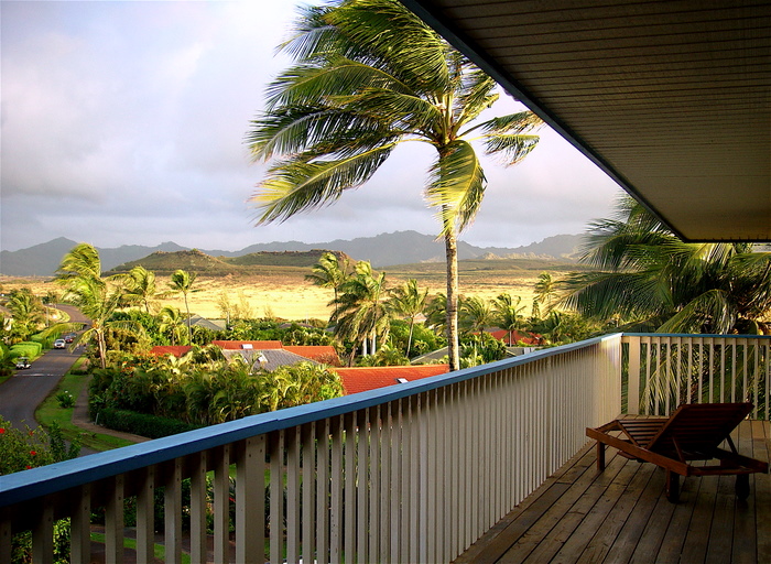
Glad you all dodged the bullet. A lot of us here in Sonoma Co. were following the events, concerned for our friends in Hawai`i. Is that your view from the weather tower? If so, lucky you!
Aloha,
Nancy~~~Hi Nancy, yes we were lucky indeed! No that is not my view, and actually my view is even better…bi-coastal view from up here on the Mountain. Take care there on the west coast my friend. Aloha, Glenn