


February 22-23, 2010
Air Temperatures – The following maximum temperatures were recorded across the state of Hawaii Monday afternoon:
Lihue, Kauai – 77
Honolulu, Oahu – 79
Kaneohe, Oahu – 79
Kaunakakai, Molokai – 79
Kahului, Maui – 83
Hilo, Hawaii – 82
Kailua-kona – 80
Air Temperatures ranged between these warmest and coolest spots near sea level around the state – and on the highest mountains…at 4pm Monday afternoon:
Kahului, Maui – 80F
Princeville, Kauai – 573
Haleakala Crater – 59 (near 10,000 feet on Maui)
Mauna Kea summit – 50 (near 14,000 feet on the Big Island)
Precipitation Totals – The following numbers represent the largest precipitation totals (inches) during the last 24 hours on each of the major islands, as of Monday afternoon:
0.11 Mana, Kauai
0.56 Oahu Forest NWR, Oahu
0.00 Molokai
0.00 Lanai
0.00 Kahoolawe
0.00 Maui
0.06 Saddle Quarry, Big Island
Marine Winds – Here’s the latest (automatically updated) weather map showing a 1025 millibar high pressure system far to the east-northeast of Hawaii. This high has an elongated ridge of high pressure extending westward, located near Kauai. This pressure configuration will keep our wind speeds light Monday and Tuesday.
Satellite and Radar Images: To view the cloud conditions we have here in Hawaii, please use the following satellite links, starting off with this Infrared Satellite Image of the islands to see all the clouds around the state during the day and night. This next image is one that gives close images of the islands only during the daytime hours, and is referred to as a Close-up visible image. This next image shows a larger view of the Pacific…giving perspective to the wider ranging cloud patterns in the Pacific Ocean. Finally, here’s a Looping IR satellite image, making viewable the clouds around the islands 24 hours a day. To help you keep track of where any showers may be around the islands, here’s the latest animated radar image.
Hawaii’s Mountains – Here’s a link to the live webcam on the summit of near 14,000 foot Mauna Kea on the Big Island of Hawaii. The tallest peak on the island of Maui is the Haleakala Crater, which is near 10,000 feet in elevation. These two webcams are available during the daylight hours here in the islands…and when there’s a big moon rising just after sunset for an hour or two! Plus, during the nights and early mornings you will be able to see stars, and the sunrise too…depending upon weather conditions.
Tropical Cyclone activity in the eastern and central Pacific – Here’s the latest weather information coming out of the National Hurricane Center, covering the eastern north Pacific. You can find the latest tropical cyclone information for the central north Pacific (where Hawaii is located) by clicking on this link to the Central Pacific Hurricane Center. Here’s a tracking map covering both the eastern and central Pacific Ocean. A satellite image, which shows the entire ocean area between Hawaii and the Mexican coast…can be found here.
Aloha Paragraphs
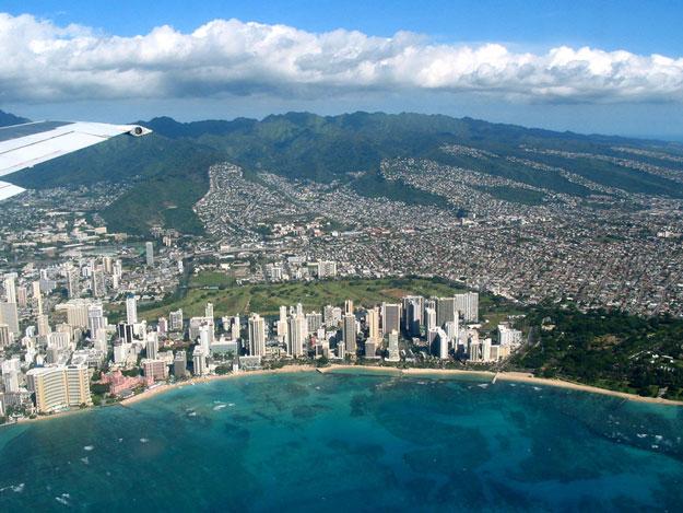
On my way from Maui to Honolulu…Monday evening
Our weather will remain quite nice into Tuesday…with a cold front arriving at mid-week. The leeward sides will find generally fine weather, with little if any rainfall through Tuesday…although there could be a few afternoon upcountry showers. The windward sides will generally dry weather too. This IR satellite image shows clear to partly cloudy skies over the state early Monday evening, with just a few high cirrus clouds stretching down over Kauai and
This even larger satellite image shows this massive area of cirrus to our north and northwest.
A high pressure ridge is located near
It’s Monday evening, as I begin writing the last section of today’s narrative. We still have another day or so before the next cold front arrives on Wednesday. The light winds will provide favorably inclined weather conditions for the most part. The front arriving at some point Wednesday won’t bring all that much rainfall, although will bring some showers with it locally…especially on the Kauai end of the state. ~~~ I worked as usual in Kihei today, and am about to fly over to Honolulu this evening for three days. I’ll be participating in a hurricane workshop sponsored by both FEMA, and the Central Pacific Hurricane Center. The meeting will be at the NWS forecast office, which happens to be located on the Manoa campus of the University of Hawaii. ~~~ Tuesday morning will be chilly, as the radiation cooling of the atmosphere will be happening all night, and especially when today’s clouds evaporate. The light winds too will promote cooler than normal temperatures as well. Tuesday will be a lot like today, which was a decent day, with those afternoon clouds brought on by the daytime heating of the islands. By the way, look for nice sunset colors this evening, as least from Kauai down through some parts of Maui. Oh yeah, one more thing, the surf will be rising along the north and west facing shores tonight, and the NWS forecast office has issued a high surf warning in response. ~~~ I’m on my way to the Kahului airport now, and will be back early Tuesday morning, writing from my hotel room in Waikiki. I hope you have a great Monday night until then! Aloha for now…
Glenn.
Interesting: Although global warming could cause the number of tropical cyclones to decrease around the world by the end of the century, the storms that do form probably will be more intense, a study in the journal Nature Geoscience finds. "Tropical cyclones" is an umbrella term that encompasses all tropical storms, hurricanes, typhoons and cyclones. The study’s authors, led by Thomas Knutson of the Geophysical Fluid Dynamics Laboratory in Princeton, N.J., base their findings on an analysis of past storm data as well as computer models that project future storm activity out to the year 2100.
Based on the analysis, Knutson says, the number of tropical cyclones around the world can be expected to decrease 6% to 34% by the end of the century. On average, about 87 tropical cyclones form each year globally. So by 2100, there could be as few as 57 storms each year. But just as the overall numbers decrease, the study finds that the intensity of the strongest storms is forecast to increase, from 2% to 11%, by the end of the century. Why the decrease in overall storms yet an increase in stronger storms?
Although the study does not address that, Knutson cites one of his studies in the journal Science in January that found that increased wind shear in a warmer world could tear apart developing Atlantic hurricanes, which would decrease the overall number that form. But the study theorized that those storms that do survive the wind-shear weeding-out process would gain in strength because of warmer sea-surface temperatures.
Nature Geoscience study co-author Christopher Landsea of the National Hurricane Center in Miami, who has been skeptical of a link between global warming and hurricane activity, calls the research "very useful. It brings together different folks with different beliefs." Landsea says the potential increase in strong hurricanes is "pretty tiny. We’re not looking at any drastic increase by 2100."
For example, he says, a 150-mph hurricane might increase only to a 157-mph hurricane. "In my perspective, that’s a little change, a long ways in the future." He says the focus should be more on societal effects of hurricanes. He notes that damage costs for each hurricane are doubling in the USA every 10 to 15 years: "Societal changes are much more important than the changes due to global warming.
Interesting2: As Mongolia cowers under the brutal thrall of its worst winter in decades, questions are being asked as to whether the country should end its reliance on nomadic herders and dig deeper into its mineral reserves instead. Some 800 years ago, Mongolia’s nomadic herdsmen were surging across the steppe under the leadership of Genghis Khan and conquering China, Tibet and much of central Asia.
Today, most of their descendents are at the mercy of the hostile Mongolian weather or crammed in the capital, Ulan Bator, where they struggle to make a living even though the country sits on some of the world’s richest mineral reserves. Mongolia has been extremely cautious about developing its huge but untapped reserves of coal, copper, gold and uranium, and it recently announced it would cancel an auction for the world’s biggest coking coal reserve at Tavan Tolgoi.
However, the government’s hand might be forced by massive fiscal debt, coupled with a crippling humanitarian problem as nomadic herders, fleeing a freezing winter that is killing their herds, overwhelm the capital. The ruling Mongolian People’s Revolutionary Party needs cash quickly to relieve the strain on Ulan Bator and provide jobs and an education for a million struggling nomads. The cash can only come from opening up its mining sector to foreign firms.
Interesting3: Fallout from a loss of public confidence in climate science is affecting other fields of research, a top US academic claimed. American opinion polls point to a general deterioration in people’s faith in science, according to Dr Ralph Cicerone, president of the National Academy of Sciences. It came after two major public relations setbacks for the global warming gurus. One was the "climategate" scandal involving leaked emails from the Climatic Research Unit at the University of East Anglia, which led to accusations that scientists manipulated and suppressed data.
The other was an admission by the United Nations’ influential climate change body that it issued flawed data about the rate at which Himalayan glaciers were melting. Two years ago the Intergovernmental Panel on Climate Change (IPCC) reported that the mountain range could lose all its glaciers by 2035.
In fact the claim had no valid scientific backing. Speaking about "transparency and integrity in science" today at the world’s biggest science conference in San Diego, California, Dr Cicerone said there had been a loss of public trust in climatology that appeared to be spreading.