


October 12-13, 2009
Air Temperatures – The following maximum temperatures were recorded across the state of Hawaii Monday afternoon:
Lihue, Kauai – 82
Honolulu, Oahu – 86
Kaneohe, Oahu – 80
Kaunakakai, Molokai – 83
Kahului, Maui – 85
Hilo, Hawaii – 79
Kailua-kona – 87
Air Temperatures ranged between these warmest and coolest spots near sea level around the state – and on the highest mountains…at 5 p.m. Monday evening:
Kailua-kona – 83F
Hilo, Hawaii – 74
Haleakala Crater – 57 (near 10,000 feet on Maui)
Mauna Kea summit – 45 (near 14,000 feet on the Big Island)
Precipitation Totals – The following numbers represent the largest precipitation totals (inches) during the last 24 hours on each of the major islands, as of Monday afternoon:
1.28 Mount Waialeale, Kauai
3.65 Oahu Forest NWR, Oahu
0.06 Molokai
0.00 Lanai
0.00 Kahoolawe
1.84 West Wailuaiki, Maui
2.40 Hilo airport, Big Island
Marine Winds – Here’s the latest (automatically updated) weather map showing a 1023 millibar high pressure system to the northwest of the islands. Light to moderately strong trade winds giving way to lighter winds Tuesday and Wednesday.
Satellite and Radar Images: To view the cloud conditions we have here in Hawaii, please use the following satellite links, starting off with this Infrared Satellite Image of the islands to see all the clouds around the state during the day and night. This next image is one that gives close images of the islands only during the daytime hours, and is referred to as a Close-up visible image. This next image shows a larger view of the Pacific…giving perspective to the wider ranging cloud patterns in the Pacific Ocean. Finally, here’s a Looping IR satellite image, making viewable the clouds around the islands 24 hours a day. To help you keep track of where any showers may be around the islands, here’s the latest animated radar image.
Hawaii’s Mountains – Here’s a link to the live webcam on the summit of near 14,000 foot Mauna Kea on the Big Island of Hawaii. The tallest peak on the island of Maui is the Haleakala Crater, which is near 10,000 feet in elevation. These two webcams are available during the daylight hours here in the islands…and when there’s a big moon rising just after sunset for an hour or two! Plus, during the nights and early mornings you will be able to see stars, and the sunrise too…depending upon weather conditions.
Tropical Cyclone activity in the eastern and central Pacific – Here’s the latest weather information coming out of the National Hurricane Center, covering the eastern north Pacific. You can find the latest tropical cyclone information for the central north Pacific (where Hawaii is located) by clicking on this link to the Central Pacific Hurricane Center. Here’s a tracking map covering both the eastern and central Pacific Ocean. A satellite image, which shows the entire ocean area between Hawaii and the Mexican coast…can be found here.
Aloha Paragraphs
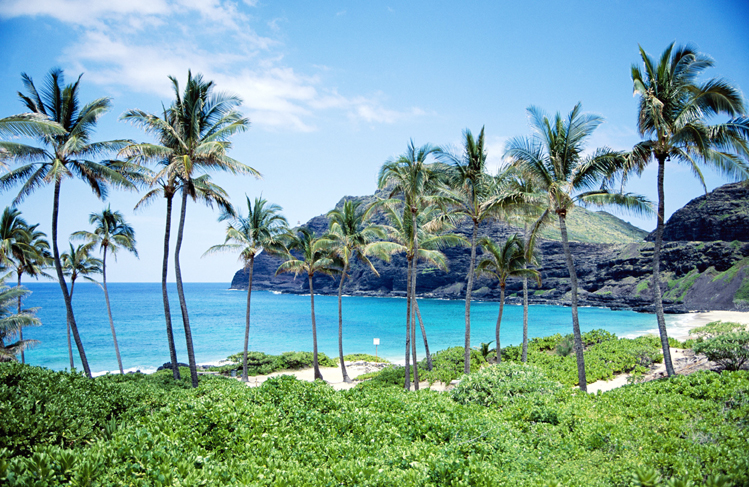
Lovely beach…Kauai
It looks very likely that we’re heading into a weather pattern…which looks remarkably similar to the one we saw last week. The trade winds are blowing at the moment, which will begin a weakening process Tuesday…for several days. What is causing this faltering of the trade winds, will be an approaching cold front…just like last week. Using this weather map, we can see the parent low pressure system, for this cold front, moving towards the west coast of the mainland. By the way, this storm is going to be a wet and windy storm all along the WA, OR, and CA seaboard over the next couple of days! Monday we still have that 1023 millibar high pressure system positioned northwest of
Here in the tropics, when the trade winds stop blowing, or are reduced significantly in strength…we lose our cooling and refreshing atmospherics. They are replaced by often hot and muggy conditions, associated with what we call a convective weather pattern. The sun is never all that far from being pretty much straight overhead, so that the daytime heating of the islands, causes onshore flowing sea breezes. This carries moisture inland over the islands, which cools and condenses on the upcountry slopes during the afternoon hours. Depending upon what kind of air temperatures reside in the middle and upper air mass over the state…determines if we see any enhancement to whatever showers that happen to fall from these interior cumulus clouds. This time around, it appears that there won’t be all that many showers, and likely nothing overly heavy is anticipated either.
Meanwhile, the first major storm to hit the west coast, generated a swell train of waves in our direction, which are expected to arrive during the day tomorrow. This swell, coming in from the west-northwest direction, will put larger than normal waves on some of our west facing beaches. The north shores will see large surf too. It looks like another new swell will arrive this weekend along those same north and west facing beaches. All of this points strongly to the fact that summer is over, even though it often feels like the summer heat is still around now. The south shores too will see a good rise in surf this weekend, another sign that a spring storm has sent us a new swell from the southern hemisphere…perhaps one of the last largish south swells until next spring here in Hawaii?
Looking a bit further ahead, after the sultry light wind episode that we have coming up soon, again last week…the trade winds will return for the weekend. This will ventilate our stagnant air mass, which by the way, might be rather hazy (some of which may be volcanic in origin) after several days lacking the trade winds. The showers during the light winds will fall over and around the slopes, as stated above. The showers will migrate back over towards the windward coasts and slopes, concentrating their efforts there while the trade winds hang on. I wonder if we should just go ahead and say…before the next cold front bears down on us? Considering climatology, it’s still a bit early for an overly wet and windy cold front to push down over us just yet. I guess we could say that it’s just a matter of time before we see strong and gusty Kona winds preceding a cold front, which brings to bear heavy rainfall.
It’s that time of the year again, when I’ll be taking my annual vacation to the mainland…once again to California. I’ll be leaving in a week from today, and be gone for about three weeks. I’ll be visiting my good friends, and also spending some quality time with my family in Long Beach as well. This will be a time when I renew my batteries, and spend time away from my weather schedule here in the islands. I’ll have more to say about this going forward, but just wanted to give you a heads up ahead of time. I’ll probably leave this paragraph here, so that those who drop by every few days, will know of my plans, and won’t be surprised.
It’s early Monday evening here in Kihei, Maui, as I begin writing this last section of today’s narrative update. Monday saw the trade winds blowing, which remained somewhat gusty in places. At 5pm Monday, the two windiest spots around the state included a 28 mph gust at Port Allen on Kauai, and 30 mph at Maalaea Bay, on Maui. There were still some clouds that hung on along the windward sides, but less than the last couple of days…with the showers tapering off. Glancing out the window here in Kihei, before I take the drive back upcountry, I see generally clear skies, with some clouds around the edges. ~~~ I’ll be back early Tuesday morning again, with your next new weather narrative from paradise. I hope you have a great Monday night wherever you’re spending it! Aloha for now…Glenn.
Interesting: Food production will have to increase by 70% over the next 40 years to feed the world’s growing population, the United Nations food agency predicts. The Food and Agricultural Organization says if more land is not used for food production now, 370 million people could be facing famine by 2050. The world population is expected to increase from the current 6.7 billion to 9.1 billion by mid-century.
Climate change, involving floods and droughts, will affect food production. The FAO said net investments of $83bn a year – an increase of 50% – had to be made in agriculture in developing countries if there was to be enough food by 2050.
"The combined effect of population growth, strong income growth and urbanization… is expected to result in almost the doubling of demand for food, feed and fiber," FAO Director-General Jacques Diouf told delegates at a forum entitled How to Feed the World 2050.
The FAO said that even if governments increased agricultural investments, there could still be 370 million people suffering from famine in 2050. Difficulties ahead included a scarcity of natural resources such as land, water and biodiversity.
Food production would also have to deal with "the effects of climate change, notably higher temperatures, greater rainfall variability and more frequent extreme weather events such as floods and droughts," Mr Diouf warned.
Climate change would reduce water availability and lead to an increase in plant and animal pests and diseases, he said. Mr Diouf said it was important to increase food production in areas where it was most needed, as climate change could reduce potential output by up to 30% in Africa and up to 21% in Asia.
"There should be a special focus on smallholder farmers, women and rural households and their access to land, water and high quality seeds… and other modern inputs," he said. He added that the biofuel market also presented competition to food production. Biofuel production is set to increase by nearly 90% over the next 10 years to reach 192 billion liters by 2018, the FAO said.
Interesting2: The red dust storm that dumped thousands of tons of soil across eastern Australia two weeks ago has caused an explosion in microscopic life in Sydney Harbor and beyond. Researchers analyzing the impact say the finding validates plans to increase fish stocks to feed some of the world’s poorest people using ocean fertilization.
Ian Jones, director of the Ocean Technology Group at University of Sydney, said enriching oceans with nitrogen will also aid the fight against climate change. Jones’ comments follow an analysis of the impact on the sea of the 23 September dust storm that swept across New South Wales and southeast Queensland.
At its peak the storm carried about 140,000 tons of soil an hour from central Australia. An estimated 4000 tons of dust settled on Sydney, while Jones and his colleagues calculate about three million tons landed in the Tasman Sea between Australia and New Zealand.
Measurements taken at the Sydney Institute of Marine Science on the harbor’s north shore show a tripling of microscopic plant life, or phytoplankton, at the Chowder Bay site and in samples taken 10 kilometers off shore.
Interesting3: Indian Kashmir’s biggest glacier, which feeds the region’s main river, is melting faster than other Himalayas glaciers, threatening the water supply of tens of thousands of people, a new report warned on Monday. Experts say rising temperatures are rapidly shrinking Himalayan glaciers, underscoring the effects of climate change that has caused temperatures in the mountainous region to rise by about 1.1 degrees Celsius in the past 100 years.
The biggest glacier in Indian Kashmir, the Kolahoi glacier spread over just a little above 4.25 sq mile, has shrunk 2.63 sq km in the past three decades, a new study said. "Kolahoi glacier is shrinking 0.08 square kilometers a year, which is an alarming speed," said the study, presented at a workshop on "Climate Change, Glacial Retreat and Livelihoods," in Srinagar, Indian Kashmir’s summer capital.
Interesting4: After several strong storms in the Philippines, the recovery continues; however, the solution maybe the removal of more than 400,000 people. According to government officials in Manila, at least 400,000 squatters are blocking major drainage channels of a giant lake which lies on the edge of the Philippine capital.
There are more than one million people living around the Laguna de Bay, which will stay flooded unless dramatic action is taken. It may stay flooded for five months or more under its current conditions. The people who live there have been strongly advised to move on and find a new location to avoid the danger of the wetlands.
In this area shantytowns and illegal settlements far outweigh farms and housing developments. But the decision to move these people will have to be decided by the politicians. This solution comes after days of heavy rain from several storms, the first being Typhoon Ketsana, bringing devastation, taking hundreds of lives and causing millions of dollars worth of damage.
Around 300,000 are living around an illegal garbage dump on the wetlands which connects two rivers. It’s these rivers that are meant to drain away the excess water from the lake into Manila Bay. But the buildup of garbage and make-shift homes is stopping this from happening. Clearing the garbage and the squatters who are responsible for the garbage would clear the channels for the water to flow.
Many squatters have built their homes on stilts to the south side of the lake, but garbage is still a major issue. Other districts also remain under water, so the affects of this area affects over a million people.
Aside from trying to solve these problems over 300,000 people remain homeless due to the recent storms, so it seems the government have their hands full. Infrastructure seems to be a good starting point for this problem, but as with many governments around the world, the prevention never arrives before the cure.
Dick Huddleston Says:
Hi Glenn, It was good to look at your report today, our Canadian Thanksgiving,where it has been unseasonably cold. It was -15C here this morning and the large cold front has been here for a week. It has been exceptionally dry this fall, and appears to be that way along the eastern slopes of the Rocky Mountains here and in the US.
We are looking forward to returning to Maui on Nov 8 for 4 weeks.
Best wishes. Dick~~~ Hi Dick, very nice to hear from you there in Canada, hope you enjoy your Thanksgiving holiday! Brrrr, that sounds cold, rather enticing for a change of pace, although I suppose it would get a little old if it stuck around more than several days. Here in Hawaii, it will still be nice and warm, and very pleasant for your upcoming extended vacation here on Maui…no doubt about it! I’ll be getting back from my vacation the day after you arrive. Enjoy!! Aloha, Glenn