


September 30-October 1, 2009
Air Temperatures – The following maximum temperatures were recorded across the state of Hawaii Wednesday afternoon:
Lihue, Kauai – 85
Honolulu, Oahu – 88
Kaneohe, Oahu – 84
Kahului, Maui – 87
Hilo, Hawaii – 83
Kailua-kona – 86
Air Temperatures ranged between these warmest and coolest spots near sea level around the state – and on the highest mountains…at 5 p.m. Wednesday evening:
Kailua-kona – 87F
Hilo, Hawaii – 79
Haleakala Crater – 54 (near 10,000 feet on Maui)
Mauna Kea summit – 41 (near 14,000 feet on the Big Island)
Precipitation Totals – The following numbers represent the largest precipitation totals (inches) during the last 24 hours on each of the major islands, as of Wednesday afternoon:
0.28 Mount Waialaele, Kauai
0.02 Kahuku, Oahu
0.01 Molokai
0.00 Lanai
0.00 Kahoolawe
0.28 Puu Kukui, Maui
0.54 Piihonua, Big Island
Marine Winds – Here’s the latest (automatically updated) weather map showing a 1037 millibar strong high pressure system far to the northeast. Our trade wind speeds will maintain moderate to fresh levels Thursday and Friday.
Satellite and Radar Images: To view the cloud conditions we have here in Hawaii, please use the following satellite links, starting off with this Infrared Satellite Image of the islands to see all the clouds around the state during the day and night. This next image is one that gives close images of the islands only during the daytime hours, and is referred to as a Close-up visible image. This next image shows a larger view of the Pacific…giving perspective to the wider ranging cloud patterns in the Pacific Ocean. Finally, here’s a Looping IR satellite image, making viewable the clouds around the islands 24 hours a day. To help you keep track of where any showers may be around the islands, here’s the latest animated radar image.
Hawaii’s Mountains – Here’s a link to the live webcam on the summit of near 14,000 foot Mauna Kea on the Big Island of Hawaii. The tallest peak on the island of Maui is the Haleakala Crater, which is near 10,000 feet in elevation. These two webcams are available during the daylight hours here in the islands…and when there’s a big moon rising just after sunset for an hour or two! Plus, during the nights and early mornings you will be able to see stars, and the sunrise too…depending upon weather conditions.
Tropical Cyclone activity in the eastern and central Pacific – Here’s the latest weather information coming out of the National Hurricane Center, covering the eastern north Pacific. You can find the latest tropical cyclone information for the central north Pacific (where Hawaii is located) by clicking on this link to the Central Pacific Hurricane Center. Here’s a tracking map covering both the eastern and central Pacific Ocean. A satellite image, which shows the entire ocean area between Hawaii and the Mexican coast…can be found here.
Aloha Paragraphs
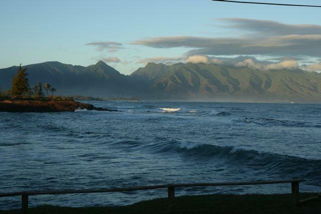
West Maui Mountains…looking from Hookipa Beach Park
The trade winds will remain active through the rest of this week, easing up some in strength later this weekend…into early next week. These trade winds are blowing generally in the moderately strong realms Wednesday evening, although as usual…locally lighter and stronger, depending upon where we’re referring to. As this weather map shows, we still have a strong and wide ranging 1037 millibar high system positioned far to the northeast of
Looking into the future, in terms of trade winds, they’re expected to diminish in strength later this coming weekend…remaining on the lighter side into the first part of next week. This down-winding of the trade winds are expected to happen, as an early season cold front approaches the islands from the northwest. Looking at the latest GFS model output actually shows two different cold fronts heading our way then, neither of which is expected to reach the north
The latest thought remains in place that we could see some increase in showers Sunday into early next week. These showers won’t fall from the clouds identified with the cold front, but rather from clouds pulled up over the islands from the east or southeast. The direction that these clouds eventually arrive from will have a bearing upon where they fall. If the trade winds remain intact as expected, the majority of this precipitation would land on the windward sides. If on the other hand, the breezes are south of east, they could reach into some of the leeward areas as well. The question remains about this, and it may take another day or so before the computer forecast models sort this out. There’s still a question about the second cold front as well, although considering this early date in the autumn season, it would seem reasonable…that it would skid to a stop, before arriving as well. Back to the present, the rainfall will remain limited at best through Saturday. As this satellite image shows, we have a streak of high cirrus clouds moving over the island chain this evening.
Extra: Post-human Earth – How the planet will recover from us
Interesting: U.S. seismologists have found evidence that the massive 2004 earthquake that triggered killer tsunamis throughout the Indian Ocean weakened at least a portion of California’s famed San Andreas Fault. The results, which appear this week in the journal Nature, suggest that the Earth’s largest earthquakes can weaken fault zones worldwide and may trigger periods of increased global seismic activity.
"An unusually high number of magnitude 8 earthquakes occurred worldwide in 2005 and 2006," said study co-author Fenglin Niu, associate professor of Earth science at Rice University. "There has been speculation that these were somehow triggered by the Sumatran-Andaman earthquake that occurred on Dec. 26, 2004, but this is the first direct evidence that the quake could change fault strength of a fault remotely."
Earthquakes are caused when a fault fails, either because of the buildup of stress or because of the weakening of the fault. The latter is more difficult to measure. The magnitude 9 earthquake in 2004 occurred beneath the ocean west of Sumatra and was the second-largest quake ever measured by seismograph. The temblor spawned tsunamis as large as 100 feet that killed an estimated 230,000, mostly in Indonesia, Sri Lanka, India and Thailand.
Interesting2: One day after a powerful earthquake triggered a devastating tsunami, another earthquake rumbled in Indonesia, leaving dozens dead and injured, and RSOE reports that thousands are buried under debris. The earthquake, which hit this morning EDT (around 5 p.m. local time), had a preliminary magnitude of 7.6, and its epicenter was recorded about 30 miles west-northwest of Padang, which is on the Indonesian Island of Sumatra.
This morning’s earthquake struck south of where the devastating Sumatra Quake from Christmas Day 2004 was centered. No tsunami has been detected, but the fact that an earthquake of this intensity could generate one has prompted a Tsunami Watch for Indonesia, India, Thailand and Malaysia. A 7.6-magnitude earthquake has the potential to produce a destructive tsunami along coasts up to 650 miles from its epicenter.
Smaller sea level changes and strong currents may be felt much farther away, similar to what occurred along the West Coast from Tuesday’s earthquake. Nothing more than spotty showers through Friday will interfere with rescue and cleanup efforts across the islands of Samoa and American Samoa in the wake of Tuesday’s deadly tsunami. CNN reports at least 111 dead as of 2 p.m. EDT. but that could rise as rescuers reach other devastated areas.
Tuesday’s tsunami was generated by a powerful 8.0-magnitude earthquake that violently shook the ground about 125 miles south-southwest of Apia, Samoa. The quake struck just before 2 p.m. EDT, and had a focal depth of 11 miles, which was recalculated from the earlier 22 mile depth. Several gauges detected the tsunami, which measured 5.1 feet high at Pago Pago, American Samoa.
A wave at Apia Upolu, Samoa, registered 2.3-feet high. In the wake of the earthquake and tsunami, the streets and fields of Pago Pago were littered with ocean debris, mud, overturned cars and boats. Several buildings in the city have been flattened. The weather should cooperate for those participating in rescue and cleanup efforts through Friday. There will be a threat of isolated showers each day with highs in the mid-80s, which is seasonable for the islands.
Showers will likely become more numerous over the weekend, but heavy rainfall is not expected. As the tsunami battered these islands, tsunami watches, warnings and advisories were posted for other parts of the Pacific Ocean. This included Hawaii and the coasts of California, Oregon and Washington. Arena Cove, Calif., recorded a 1.1-foot wave earlier today.
Interesting3: The U.S. and the European Union recently settled one of their longest-running trade disputes: over beef. Under the deal, the EU agreed to quadruple import quotas for hormone-free U.S. beef, but it still won’t import hormone-treated American beef, because many Europeans consider it unhealthy. Farmer Michel Baudot, who raises cattle in France’s Burgundy region, says the two cattle industries are run differently: One focuses on profit and the other on quality.
For seven generations, his family has bread the stocky white Charolais cows indigenous to the area. In the summer, his herd of 600 cattle grazes freely on his 1,500-acre farm. In winter, the animals are sheltered in his barn, where they eat hay and grain. They live on Baudot’s farm until they are slaughtered. Every aspect of each cow’s life is meticulously followed. Baudot says European consumers demand this.
Interesting4: Farmers in central Kenya are cutting down water-hungry eucalyptus tree species growing near water sources as a government directive aiming to save water takes effect. Environment minister, John Michuki, issued the directive three months ago in an attempt to lessen the impact of the drought that is ravaging the country.
Eucalyptus has been popular with farmers because it grows fast and provides ample stocks of timber and firewood. But it is also a danger to water supplies (see Strategic tree planting could save water in dry areas). Wangari Maathai, Kenyan Nobel Peace Prize winner and environmentalist, has recently spoken out about the threat, saying that the trees have been "over-promoted for commercial reasons" and threaten biodiversity.
Now, eucalyptus trees growing less than 30 meters from rivers, streams, wells and other water sources are being cut down. Already, farmers in central Kenya have felled virtually all trees growing near water sources. "We agree that eucalyptus growing near water sources has contributed to water sources drying up and that is why we are removing the trees," says Joseck Gatitu, a farmer in the Kamune area of central Kenya, who has cut down 15 trees near a stream that has nearly dried up.
James Gitonga, a senior officer at the Kenya Forest Service, says that although eucalyptus trees were a source of income to farmers, the recent rapid planting of Eucalyptus grandis and Eucalyptus camaldulensis, two fast growing species introduced to Kenya from South Africa seven years ago, was a threat to the environment.
"The trees have been planted in great numbers, including near rivers, swamps and other catchments, and being huge water consumers they have greatly contributed to depletion of water, particularly during the current drought," he says. James Gathage, a forestry consultant trees farmers can cultivate without putting water supplies at risk.
He adds: "Farmers should be encouraged to plant more Grevillea instead, which is an agro-forestry tree with many commercial benefits, including timber, firewood and fodder." Interesting5: There has been good and bad news this week on the world’s food prospects. At a major food summit in Rome, Italy, on 12 October, the UN’s Food and Agriculture Organization will show that farming output in sub-Saharan Africa grew by 3.5 per cent last year.
Following decades of decline, this promises the rosiest outlook for many years. The FAO estimates that the region has 700 million hectares of unoccupied land fit for farming. For example, the Guinea Savannah region, an area twice as large as that currently planted with wheat worldwide, offers "a huge production potential", it says. At present, only 10 per cent of it is farmed.
But further ahead, child malnutrition worldwide will increase by 20 per cent by 2050 as crop yields fall through climate change, warns a report from the International Food Policy Research Institute in Washington DC. Sub-Saharan Africa and south-east Asia will be worst hit, as rising temperatures and dwindling water supplies drive down wheat and rice yields by 30 and 15 per cent respectively.
"There will be 25 million more malnourished children in 2050 than if climate change hadn’t happened," says study author Gerald Nelson. Keith Wiebe, who led the FAO study, accepts that the two reports "differ in tone", but says they agree on the investments needed to improve agriculture in Africa and make it more resilient to climate change.
Interesting5: There has been good and bad news this week on the world’s food prospects. At a major food summit in Rome, Italy, on 12 October, the UN’s Food and Agriculture Organization will show that farming output in sub-Saharan Africa grew by 3.5 per cent last year. Following decades of decline, this promises the rosiest outlook for many years. The FAO estimates that the region has 700 million hectares of unoccupied land fit for farming.
For example, the Guinea Savannah region, an area twice as large as that currently planted with wheat worldwide, offers "a huge production potential", it says. At present, only 10 per cent of it is farmed. But further ahead, child malnutrition worldwide will increase by 20 per cent by 2050 as crop yields fall through climate change, warns a report from the International Food Policy Research Institute in Washington DC.
Sub-Saharan Africa and south-east Asia will be worst hit, as rising temperatures and dwindling water supplies drive down wheat and rice yields by 30 and 15 per cent respectively. "There will be 25 million more malnourished children in 2050 than if climate change hadn’t happened," says study author Gerald Nelson. Keith Wiebe, who led the FAO study, accepts that the two reports "differ in tone", but says they agree on the investments needed to improve agriculture in Africa and make it more resilient to climate change.
Ted Grupenhoff Says:
Hi Glenn, Just wanted to give a first hand account of tidal surges in Maalaea harbor Tues. afternoon from the samoan earthquake. I witnessed 8-10 tidal surges in the 2ft range, and one at least 3ft inside the harbor between 3:30 – 5:00 pm. The resulting current through the channel was significant, breaking one of the channel markers, and pulling the other underwater with the force of the current. Quite a sight, glad it was not the “big one” as they experienced in Samoa.
Thanks for all your great work, Ted Grupenhoff ~~~ Hi Ted, very good reports, I really appreciate your observations, as I’m sure all the other readers will! Thank you very much! Aloha, Glenn