


September 1-2, 2009
Air Temperatures – The following maximum temperatures were recorded across the state of Hawaii Tuesday afternoon:
Lihue, Kauai – 83
Honolulu, Oahu – 89
Kaneohe, Oahu – 83
Kahului, Maui – 87
Hilo, Hawaii – 82
Kailua-kona – 87
Air Temperatures ranged between these warmest and coolest spots near sea level – and on the highest mountains…at 5 p.m. Tuesday evening:
Barking Sands, Kauai – 88F
Hilo, Hawaii – 79
Haleakala Crater – 59 (near 10,000 feet on Maui)
Mauna Kea summit – 61 (near 14,000 feet on the Big Island)
Precipitation Totals – The following numbers represent the largest precipitation totals (inches) during the last 24 hours on each of the major islands, as of Tuesday afternoon:
0.28 Mount Waialaele, Kauai
0.54 Poamoho 2, Oahu
0.02 Molokai
0.00 Lanai
0.08 Kahoolawe
0.89 West Wailuaiki, Maui
0.84 Kealakekua, Big Island
Marine Winds – Here’s the latest (automatically updated) weather map showing a high pressure system far to the north of the islands. Trade winds will be active through Thursday.
Satellite and Radar Images: To view the cloud conditions we have here in Hawaii, please use the following satellite links, starting off with this Infrared Satellite Image of the islands to see all the clouds around the state during the day and night. This next image is one that gives close images of the islands only during the daytime hours, and is referred to as a Close-up visible image. This next image shows a larger view of the Pacific…giving perspective to the wider ranging cloud patterns in the Pacific Ocean. Finally, here’s a Looping IR satellite image, making viewable the clouds around the islands 24 hours a day. To help you keep track of where any showers may be around the islands, here’s the latest animated radar image.
Hawaii’s Mountains – Here’s a link to the live webcam on the summit of near 14,000 foot Mauna Kea on the Big Island of Hawaii. The tallest peak on the island of Maui is the Haleakala Crater, which is near 10,000 feet in elevation. These two webcams are available during the daylight hours here in the islands…and when there’s a big moon rising just after sunset for an hour or two! Plus, during the nights and early mornings you will be able to see stars, and the sunrise too…depending upon weather conditions.
Tropical Cyclone activity in the eastern and central Pacific – Here’s the latest weather information coming out of the National Hurricane Center, covering the eastern north Pacific. You can find the latest tropical cyclone information for the central north Pacific (where Hawaii is located) by clicking on this link to the Central Pacific Hurricane Center. Here’s a tracking map covering both the eastern and central Pacific Ocean. A satellite image, which shows the entire ocean area between Hawaii and the Mexican coast…can be found here.
Aloha Paragraphs
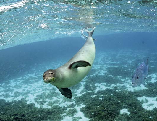
Hawaiian Monk Seal…and friend
The moderately strong trade winds will be increasing a notch or two over the next several days. As a high pressure system to our north moves closer on Wednesday into Thursday, our local trade wind speeds should surge a little, with stronger trade winds occurring into the weekend. These trade winds will likely soften going into the Labor Day holiday, into next week. Small craft wind advisories have been stretched up across all the major channels between the Big island and Oahu…including those windiest coastal waters as well.
The windward sides will find cloudy periods, with showers falling at times…while the leeward sides remain generally dry. There’s an increase in windward showers expected later in the work week, which will occur due to the arrival of an upper level low pressure system. The computer models then show another ridge overhead this coming holiday weekend…which should bring us back around to drier weather then. A tropical disturbance moving by to our south, may bring a few showers to the windward sides Thursday into Friday…especially around the Big Island.
It’s Tuesday evening here in Kihei, Maui, as I begin writing this last section of today’s narrative update. As noted above, the trade winds will be on the rise soon. As a precaution, the NWS office in Honolulu has issued a fire weather watch, which remains in effect from Wednesday morning through Wednesday afternoon. We could see these critical fire weather conditions extend into Thursday. The island of Molokai has had a large fire burning the last couple of days. Speaking of fires, California sure is having some difficult times with forest fires as well.
~~~ Looking out the window here in Kihei before I take the drive back upcountry to Kula, it’s almost completely clear! Blue skies galore is the name of the game for sure. The trade winds are blowing nicely, with the strongest winds as of 5pm, being reported at Maalaea Bay, Maui…with a gust of 38 mph. I would imagine that as the trade winds pick up over the next few days, we’ll see some of those windier locations easily gusting up over the 40 mph mark at times. I’ll be back with you again early Wednesday morning, I hope you have a great Tuesday night until then! Aloha for now…Glenn.
Extra: The great month of September…celebrated by the music group Earth, Wind & Fire!
Interesting: Earth’s oceans are vast reservoirs of carbon dioxide (CO2) with the potential to control the pace of global warming. It all hinges on the fate of marine "snow" — a constant sprinkle of carbon-rich bits that flutter down from the sea surface to the cold depths below.
And according to a new study, the flurries could suck much more of the greenhouse gas out of the atmosphere than previously thought. Each year, phytoplankton floating in the seas’ big blue expanse drink in 10 billion tons of carbon from the air (humans emit about 8 billion tons).
Their shells and excretions rain down from the surface, providing a feast for creatures that recycle up to 90 percent of the carbon back into the water as CO2. Only a light dusting lands on the ocean floor. But small changes in this carbon system have big implications for climate.
Interesting2: China is taking advantage of the green technology revolution that the challenge of climate change provides, according to a new report launched recently by former British Prime Minister Tony Blair in Beijing. The report from The Climate Group shows that China is leading the development and commercialization of a range of low carbon technologies.
With a new breed of entrepreneurs and ambitious government policies, Chinese businesses are amongst the top producers of electric vehicles, wind turbines, solar panels and energy efficient appliances.
Tony Blair, speaking at the launch event in Beijing, said: "China is already playing an important role in producing and consuming those technologies needed to solve the climate change challenge."
"A new global climate agreement will set a route map for this to happen and for our journey to a prosperous low carbon 21st century. As one of the world’s major economic powers, China will have to be at the forefront of this journey. This report shows that it can be."
Interesting3: A wolf hunt is set to begin in Idaho on Tuesday if a federal judge does not stop it. It would be the first time in decades that hunters have been allowed to pursue the gray wolf, an animal that has come to symbolize tensions over how people interact with wilderness in the West.
On Monday, the judge, Donald W. Molloy of Federal District Court, will hold a hearing to determine whether to issue an injunction sought by wildlife advocates against the hunt and reopen the question of returning the wolf to the endangered list.
Gray wolves were taken off the list five months ago, after being protected under federal law for more than 30 years. More than 6,000 hunters in Idaho have bought licenses for the chance to participate in the hunt, in which wildlife officials will allow 220 wolves to be killed. In 2008, the population stood at about 850. Montana will allow 75 animals to be killed, starting Sept. 15.
Interesting4: Carbon dioxide will soon be declared a dangerous pollutant – a move that could help propel slow-moving climate-change legislation on Capitol Hill, the head of the Environmental Protection Agency said Monday. EPA Administrator Lisa Jackson told reporters that a formal "endangerment finding," which would trigger federal regulations on greenhouse gas emissions, probably would "happen in the next months."
Jackson announced her timeline even as top senators said they were delaying plans to introduce legislation that would set new limits on carbon dioxide emissions. Senators had been scheduled to unveil legislation next Tuesday, but the date has now been pushed back to later in September.
The EPA kick-started the regulatory process in April when it proposed declaring carbon dioxide and five other greenhouse gases as pollutants that jeopardize the public health and welfare. EPA scientists believe the greenhouse gases contribute to global warming by trapping heat in the Earth’s atmosphere.
Interesting5: Official rainfall figures have confirmed that south west Scotland has just had its wettest August on record. Statistics recorded at the Met Office’s Eskdalemuir observatory in Dumfries and Galloway also show it was the third wettest month ever. Assistant manager Billy Jagger said one day alone – 20 August – saw 3.25” of rainfall.
He said the total for the month had been 15in – about three times the average for August in the region. "It has been quite bad," said Mr Jagger. "It is the wettest August ever recorded." He added that it was close to beating the Dumfries and Galloway record for monthly rainfall.
"The wettest month ever recorded is February 1997 with 16 inches," said Mr Jagger. "And in January 1928 we had 15.5” so it’s not that far behind the all-time record." The rain has had an impact on many people – none more so than the region’s farmers.
Robin Spence at Roberthill, near Lockerbie, has had to save animals from drowning twice in the past month. "We had a situation 10 days ago where we were swimming cattle out from next to the River Annan because of flooding," he said. "We have never seen that degree of flooding in August before.”
Two or three days later we were doing the same again." He said that as well as the risk to animals, the rain had also flattened crops. "We are just in harvest season just now and the crops that are still to cut are getting very much damaged by the wind and rain."
And, of course, the bad weather has meant that the harvest is way behind." Early prospects for September do not appear much better. The Met Office is advising of a risk of more heavy rain in the region on Wednesday into Thursday with up to 2” possible in places.
Interesting6: The future of the Earth could rest on potentially dangerous and unproven geo-engineering technologies unless emissions of carbon dioxide can be greatly reduced, the latest Royal Society report has found. The report (published September 1, 2009 by the Royal Society, the UK’s national academy of science) found that unless future efforts to reduce greenhouse gas emissions are much more successful than they have been so far, additional action in the form of geo-engineering will be necessary if we are to cool the planet.
Geo-engineering technologies were found to be very likely to be technically possible and some were considered to be potentially useful to augment the continuing efforts to mitigate climate change by reducing emissions. However, the report identified major uncertainties regarding their effectiveness, costs and environmental impacts.
Professor John Shepherd, who chaired the Royal Society’s geo-engineering study, said, “It is an unpalatable truth that unless we can succeed in greatly reducing CO2 emissions we are headed for a very uncomfortable and challenging climate future, and geo-engineering will be the only option left to limit further temperature increases.
Our research found that some geo-engineering techniques could have serious unintended and detrimental effects on many people and ecosystems – yet we are still failing to take the only action that will prevent us from having to rely on them. Geo-engineering and its consequences are the price we may have to pay for failure to act on climate change.”