2008
Yearly Archive
Posted by Glenn
No Comments
May 17-18 2008
Air Temperatures – The following maximum temperatures were recorded across the state of Hawaii Saturday:
Lihue, Kauai – 83
Honolulu, Oahu – 86
Kaneohe, Oahu – 83
Kahului, Maui – 89
Hilo, Hawaii – 83
Kailua-Kona, Hawaii – 80
Air Temperatures ranged between these warmest and coolest spots near sea level at 5 p.m. Saturday evening:
Kapalua, Maui – 84F
Hilo, Hawaii – 78
Precipitation Totals – The following numbers represent the largest precipitation totals (inches) during the last 24 hours on each of the major islands, as of Saturday afternoon:
0.31 Mount Waialeale, Kauai
0.01 Waianae Valley, Oahu
0.00 Molokai
0.01 Lanai
0.00 Kahoolawe
0.10 Oheo Gulch, Maui
0.11 Pahala, Big Island
Weather Chart – Here’s the latest (automatically updated) weather map showing a high pressure ridge just north of the state of Hawaii now. This has brought back light to moderately strong easterly trade winds…which will last through Monday.
Satellite and Radar Images: To view the cloud conditions we have here in Hawaii, please use the following satellite links, starting off with the Infrared Satellite Image of the islands to see all the clouds around the state during the day and night. This next image is one that gives close images of the islands only during the daytime hours, and is referred to as a Close-up visible image. This next image shows a larger view of the Pacific…giving perspective to the wider ranging cloud patterns in the Pacific Ocean…out from the islands. To help you keep track of where any showers may be around the islands, here’s the latest animated radar image.
Hawaii’s Mountains – Here’s a link to the live webcam on the summit of near 14,000 foot Mauna Kea on the Big Island of Hawaii. The tallest peak on the island of Maui is the Haleakala Crater, which is near 10,000 feet in elevation. These two webcams are available during the daylight hours here in the islands…and when there’s a big moon rising just after sunset for an hour or two! Plus, during the nights and early mornings you will be able to see stars, and the sunrise too…depending upon cloud conditions.
Aloha Paragraphs
 After the volcanic haze is gone
Photo Credit: flickr.com
The trade winds are back! A trade wind producing ridge of high pressure is now north of Kauai Saturday evening. Light trade winds have slipped into the state to its south, blowing light to moderately strong from the Big Island up through the island of Oahu…still light on Kauai. These cooling and refreshing trade breezes are helping to clear out our local skies, which will be much improved Sunday.
The trade winds usually bring back some showers to the windward sides, although not many for the time being. The atmosphere remains dry and stable, which will remain the case through the weekend into early in the upcoming new week. The leeward sides will be generally dry, with lots of sunshine beaming down during the days. Nice weather will prevail through the next several days…at least.
The models were showing a dynamic upper level low pressure system digging down towards the islands around the middle of the upcoming week. A surface reflection, in the form of a very late season cold front, was also shown approaching the state from the northwest at the same time. The unfortunate part of this impending weather situation would have been the fact that our local trade winds would stop again, as the ridge would be pushed down over Hawaii again by Wednesday or Thursday. We would have likely seen our winds turn southeast again…ushering in thick volcanic haze over the state again then! The fortunate thing is that the latest model runs have backed off on this, lets hope that they stick with this through the next couple of days!
~~~ I went to see a new film Friday evening after work. I saw Iron Man (2008), starring Robert Downey, Jeff Bridges, Terrence Howard, Shaun Toub, and Gwyneth Paltrow. Robert Downey Jr. stars as Tony Stark, a billionaire playboy and genius who puts as much effort into chasing skirts as he puts into chasing his next big idea. A trip to Afghanistan to sell weapons quickly devolves into chaos, and Stark finds himself at the mercy of a warlord who wants him to build a missile. Instead, Stark creates a powerful suit of armor, turning him into Iron Man and allowing him to escape. When he returns to America, his assistant Pepper Pots (Gwyneth Paltrow), friend Rhodey (Terrence Howard), and right-hand man Obadiah Stane (Jeff Bridges) all marvel at the change in the man they knew…who is ready to save the world.
Everyone has been raving about this film, and I for one had been looking forward to seeing it for a long time! I was thoroughly entertained, and found the film to be very engaging. It had plenty of special effects, and no lack of high action either. There were aspects of it that reminded me of Batman, or even Superman, it was that kind of big film. If you are a fan of those kinds of tall tales, you would do well to see this highly rated movie. I enjoyed all of the actors, and I must admit got a fairly major crush on Ms. Paltrow…its fun to look at her beauty on the big screen! Here’s a trailer for your enjoyment.
~~~ The trade winds are back, which is a good thing! It’s still before sunset here in Kula, Maui, as I begin this last paragraph…and still quite hazy in the lee of the Haleakala Crater. Stepping out on my weather deck, I still can’t quite see the West Maui Mountains. I was downtown in Kahului today though, and found that the trade winds were clearing the haze from the windward sides already. I’m sure that during the day Sunday, the haze will be ventilated away even more, and by this time on Sunday, there will be substantially better air visibilities. I’ll be back Sunday morning with a new weather narrative, with the latest status on the hazy conditions of late. I hope you have a great Saturday night wherever you happen to be spending it! Aloha for now…Glenn.
Posted by Glenn
No Comments
May 16-17 2008
Air Temperatures – The following maximum temperatures were recorded across the state of Hawaii Friday:
Lihue, Kauai – 83
Honolulu, Oahu – 83
Kaneohe, Oahu – 84
Kahului, Maui – 84
Hilo, Hawaii – 83
Kailua-Kona, Hawaii – 82
Air Temperatures ranged between these warmest and coolest spots near sea level at 4 p.m. Friday afternoon:
Barking Sands, Kauai – 82F
Molokai airport – 78
Precipitation Totals – The following numbers represent the largest precipitation totals (inches) during the last 24 hours on each of the major islands, as of Friday afternoon:
0.22 Hanapepe, Kauai
0.01 Makua Ridge, Oahu
0.00 Molokai
0.00 Lanai
0.00 Kahoolawe
0.05 Pukalani, Maui
0.67 Laupahoehoe, Big Island
Weather Chart – Here’s the latest (automatically updated) weather map showing a dissipating cold front near Kauai. This weather feature is keeping our trade wind producing high pressure ridge near the Islands…although it will be migrating northward slowly. Light easterly trade winds will begin blow across the state through the weekend.
Satellite and Radar Images: To view the cloud conditions we have here in Hawaii, please use the following satellite links, starting off with the Infrared Satellite Image of the islands to see all the clouds around the state during the day and night. This next image is one that gives close images of the islands only during the daytime hours, and is referred to as a Close-up visible image. This next image shows a larger view of the Pacific…giving perspective to the wider ranging cloud patterns in the Pacific Ocean…out from the islands. To help you keep track of where any showers may be around the islands, here’s the latest animated radar image.
Hawaii’s Mountains – Here’s a link to the live webcam on the summit of near 14,000 foot Mauna Kea on the Big Island of Hawaii. The tallest peak on the island of Maui is the Haleakala Crater, which is near 10,000 feet in elevation. These two webcams are available during the daylight hours here in the islands…and when there’s a big moon rising just after sunset for an hour or two! Plus, during the nights and early mornings you will be able to see stars, and the sunrise too…depending upon cloud conditions.
Aloha Paragraphs
 Volcanic haze gives pink sunsets in Hawaii
Photo Credit: flickr.com
A dissipating cold front is located just to the north of Kauai Friday evening, which will keep our winds light into the weekend. As the cold front washes out over the next 24 hours, a trade wind producing ridge of high pressure will migrate to a position just north of the islands again…returning light trades to our islands…gradually. The thick volcanic haze will take some time to clear out our local skies, although slowly improving air visibilities are on the way.
The overlying atmosphere remains dry and stable, limiting showers just about everywhere here in Hawaii. There will be a few possible showers here and there, but our weather will remain quite dry going into the weekend. As the trade winds filter back into the state over the next several days, into early in the new week ahead, we’ll see a few showers falling along the windward sides.
The late season cold front isn’t dissipating quick as fast as expected, keeping the trade winds at bay for a while longer yet. This IR satellite image shows what’s left of the gradually weakening frontal boundary. This cloud band will disappear from our Hawaiian Island weather picture at some point this weekend, paving the way for the return of light trade winds.
The main weather related concern continues to be the volcanic haze hanging over the Hawaiian Islands Friday night. The haze will be most thick and troublesome right around the volcanic vents, plaguing the local population on the Big Island. The rest of the islands will have thick vog as well, with poor visibilites common. We will have to wait until this weekend, when the trade winds start to blow lightly, to see the gradual ventilation of the haze…although it will be slow going at first.
The latest computer forecast models are showing another round of unusual weather beginning later next week. It’s too early in the game to get all worked-up over this prospect, as what the models are pointing out would be very unusual for this time of year! Nonetheless, the models are showing a very dynamic upper level low pressure system digging down over the islands around the middle of next week. A surface reflection, in the form of a very late season cold front, would be approaching the state from the northwest towards the weekend. This is very similar to what we’re involved in now, almost a mirror image in some ways. The negative part of this potential weather situation would be the fact that our local winds would turn southeast again…ushering in thick volcanic haze over the state again late next week! We have plenty of time to make major revisions along the way, so let’s just hang loose about this for the time being.
~~~ It’s Friday evening here in the islands as I begin this last section of today’s narrative. As is my habit, I’ll be taking in a new film tonight. I’ll see Iron Man (2008), starring Robert Downey, Jeff Bridges, Terrence Howard, Shaun Toub, and Gwyneth Paltrow. Robert Downey Jr. stars as Tony Stark, a billionaire playboy and genius who puts as much effort into chasing skirts as he puts into chasing his next big idea. A trip to Afghanistan to sell weapons quickly devolves into chaos, and Stark finds himself at the mercy of a warlord who wants him to build a missile. Instead, Stark creates a powerful suit of armor, turning him into Iron Man and allowing him to escape. When he returns to America, his assistant Pepper Pots (Gwyneth Paltrow), friend Rhodey (Terrence Howard), and right-hand man Obadiah Stane (Jeff Bridges) all marvel at the change in the man they knew…who is ready to save the world. Everyone is raving about this film, and I for one have been looking forward to seeing it for a long time! Here’s a trailer for your enjoyment.
~~~ I’ll be back early Saturday morning with your next new weather narrative. This will include more reports about the persistent voggy weather, and when exactly the trade winds will finally clear our local skies from this thick haze. I’ll have more up-to-date information about the next round of increasing vog on tap for later next week…at least maybe it will come back on us. I’ll have a movie review for you in the morning as well. I hope you have a great Friday night wherever you happen to be spending it! Aloha for now…Glenn.
Interesting: The world’s species are declining at a rate "unprecedented since the extinction of the dinosaurs", a census of the animal kingdom has revealed. The Living Planet Index out today shows the devastating impact of humanity as biodiversity has plummeted by almost a third in the 35 years to 2005. The report, produced by WWF, the Zoological Society of London (ZSL) and the Global Footprint Network, says land species have declined by 25 per cent, marine life by 28 per cent, and freshwater species by 29 per cent. Jonathan Loh, editor of the report, said that such a sharp fall was "completely unprecedented in terms of human history". "You’d have to go back to the extinction of the dinosaurs to see a decline as rapid as this," he added. "In terms of human lifespan we may be seeing things change relatively slowly, but in terms of the world’s history this is very rapid." And "rapid" is putting it mildly. Scientists say the current extinction rate now up to 10,000 times faster than what has historically been recorded as normal.
Interesting2: Greenhouse gases are at higher levels in the atmosphere than at any time in at least 800,000 years, according to a study of Antarctic ice on Wednesday that extends evidence that mankind is disrupting the climate. Carbon dioxide and methane trapped in tiny bubbles of air in ancient ice down to 3,200 meters (10,500 ft) below the surface of Antarctica add 150,000 years of data to climate records stretching back 650,000 years from shallower ice drilling. "We can firmly say that today’s concentrations of carbon dioxide and methane are 28 and 124 percent higher respectively than at any time during the last 800,000 years," said Thomas Stocker, an author of the report at the University of Berne. Before the Industrial Revolution, levels of greenhouse gases were guided mainly by long-term shifts in the earth’s orbit around the sun that have plunged the planet into ice ages and back again eight times in the past 800,000 years. The U.N. Climate Panel last year blamed human activities, led by burning of fossil fuels that release heat-trapping gases, for modern global warming that may disrupt water and food supplies with ever more droughts, floods and heat waves. "The driving forces now are very much different from the driving forces in the past when there was only natural variation," Stocker told Reuters of the study in the journal Nature by scientists in Switzerland, France and Germany.
Interesting3: The universe is twice as bright as it appears, astronomers now suggest. The light bulb went on when they calculated that dust blocks about the half the light emitted from stars and galaxies. Astronomers have known about interstellar dust for a while, but they haven’t been able to quantify just how much light it blocks. Now a team of researchers has studied a catalogue of galaxies and found that dust shields roughly 50 percent of their light. "I was shocked by the sheer scale of the effect," said Simon Driver, an astronomer from the University of St. Andrews in Scotland who led the study. "Most people just kind of said, ‘We suspect dust is a minor problem.’ I spent much of my career working on deep images from Hubble and I’ve always ignored dust almost entirely." The result will likely cause many astronomers to revise their calculations of the intrinsic brightness of many celestial objects, Driver said. Until now, many astronomers thought stars and galaxies were really about 10 percent brighter in optical light than they appeared because of dust. If the new findings are true, it turns out that objects in the sky are about twice as bright than they appear. "This is a strong, clear-cut result," Driver told SPACE.com. "We’ve really got to take dust seriously and we’ve got to make large adjustments to our magnitude calculations." (A magnitude scale is used to define brightness of celestial objects.) The astronomers detailed their findings in the May 10 issue of the Astrophysical Journal Letters.
Interesting4: Peering beneath the ice at the north pole of Mars has now revealed the red planet may be surprisingly colder than was thought. Any liquid water that might exist on Mars therefore might be hidden deeper than once suspected, closer to that world’s warm heart, researchers suggested. An international team of scientists used the Mars Reconnaissance Orbiter to probe the north pole of the red planet with radar. The ice cap there goes about 1.2 miles deep (2 km) and is roughly the size of Pakistan at 310,000 square miles large (800,000 square km). These scans revealed the polar cap has up to four layers of ice rich in sand and dust, each separated by clearer sheets of nearly pure ice. Each dirty and clean layer is some 1,000 feet thick (300 meters). These dirty and clean layers were created by ages of intense dust storms followed by icy eras.
This five-million-year-long cycle was likely driven by wobbles in Mars’ tilt and fluctuations in the shape of its orbit around the sun. The more sunlight the red planet saw because of these changes, the more the polar icecaps retreated and the more dust storms Mars saw. "All this layering is key evidence for theoretical models that predict that changes in Mars’ climate are coupled with orbital changes," said researcher Roger Phillips, a geophysicist at Southwest Research Institute in Boulder. Unexpectedly, the radar scans also revealed the massive weight of the ice cap does not deform any underlying sediment. This implies the crust beneath the cap is strong — more than 180 miles thick (300 km). To have such a thick crust, "Mars might be colder than we thought," Phillips told SPACE.com. As a result, any liquid water that might be underground has to be buried even deeper than once speculated. "If one thought that liquid water was 5 kilometers deep (3 miles), it’s now at least 30 percent deeper than that," he said. Philips and his colleagues detailed their findings online May 15 in the journal Science.
Posted by Glenn
No Comments
May 15-16 2008
Air Temperatures – The following maximum temperatures were recorded across the state of Hawaii Thursday:
Lihue, Kauai – 83
Honolulu, Oahu – 84
Kaneohe, Oahu – 87
Kahului, Maui – 85
Hilo, Hawaii – 84
Kailua-Kona, Hawaii – 82
Air Temperatures ranged between these warmest and coolest spots near sea level at 4 p.m. Thursday afternoon:
Honolulu, Oahu – 82F
Hilo, Hawaii – 78
Precipitation Totals – The following numbers represent the largest precipitation totals (inches) during the last 24 hours on each of the major islands, as of Thursday afternoon:
0.01 Mount Waialeale, Kauai
0.01 Palolo Fire Station, Oahu
0.00 Molokai
0.00 Lanai
0.00 Kahoolawe
0.21 Kaupo Gap, Maui
0.29 Kealakekua, Big Island
Weather Chart – Here’s the latest (automatically updated) weather map showing a dissipating cold front near Kauai and Oahu. This weather feature is keeping our trade wind producing high pressure ridge near the Islands now…and our local winds light and variable in direction. Light easterly trade winds will begin to appear Saturday.
Satellite and Radar Images: To view the cloud conditions we have here in Hawaii, please use the following satellite links, starting off with the Infrared Satellite Image of the islands to see all the clouds around the state during the day and night. This next image is one that gives close images of the islands only during the daytime hours, and is referred to as a Close-up visible image. This next image shows a larger view of the Pacific…giving perspective to the wider ranging cloud patterns in the Pacific Ocean…out from the islands. To help you keep track of where any showers may be around the islands, here’s the latest animated radar image.
Hawaii’s Mountains – Here’s a link to the live webcam on the summit of near 14,000 foot Mauna Kea on the Big Island of Hawaii. The tallest peak on the island of Maui is the Haleakala Crater, which is near 10,000 feet in elevation. These two webcams are available during the daylight hours here in the islands…and when there’s a big moon rising just after sunset for an hour or two! Plus, during the nights and early mornings you will be able to see stars, and the sunrise too…depending upon cloud conditions.
Aloha Paragraphs
 Volcanic haze over Waikiki
Photo Credit: flickr.com
A high pressure ridge has been pushed down near the Big Island, by a weakening cold front near Kauai. The ridges position close to the Big Island will keep light and variable winds over the Big Island. The islands from Maui up through Kauai will remain in a light Kona wind condition Thursday. As the cold front dissipates Friday, the ridge will migrate northward over the islands again, returning light and variable winds to the entire state. The hazy conditions will remain in place until the trade winds return this weekend.
Despite the presence of the late season cold front, there won’t be much precipitation around…although Kauai and Oahu may see a few showers. The atmosphere will remain rather muggy, as the air flow is coming up from the deeper tropics to our south. There will be a few showers, but overall, our weather will remain quite dry and stable. As the ridge comes back up over the state Friday, we will move back into a light wind convective weather pattern, with a few afternoon interior showers falling locally.
An unusually late season cold front was located between Kauai and Oahu Thursday evening. This IR satellite image shows the ragged leading edge of this frontal boundary. If this were happening during the winter months, or even earlier this spring, we might expect wetter conditions. Since we’re just a month or so away from the summer solstice, its too late in the spring…to wring much moisture out of this last cold front of the season.
The main concern remains the volcanic haze that is being carried up over the state of Hawaii, from the two volcanic vents on the Big Island. The haze will be most thick and troublesome right around the vents, plaguing the local population on the Big Island. The rest of the islands will have varying amounts of vog. We will have to wait until this weekend, when the trade winds start to blow, to see the gradual ventilation of the haze, or at least the beginning of that process.
~~~ Thursday was a voggy day there in the Aloha state, no doubt about it. This volcanic haze has enveloped the entire state, from the northernmost island of Kauai, right down the chain, to the Big Island in the south. Looking out the window here in Kihei, Maui, we’re pretty much soaked in with vog, with what I would consider very poor air visibilities! The sunset this evening will be muted at best, probably just a red ball sinking into the Pacific Ocean to our west. Unfortunately, we seem to be having more and more of this hazy weather lately. One of my friends recently asked me, "Is this perma-vog Glenn"…I reassured her, at least the best that I could, that that was not going to be the case. The folks on the Big Island will have to contend with this stuff more than the rest of the state though, especially the Kau District, and then at times wrapping around into the Kona area as well.
~~~ We’ll see yet another day or even two, with rather thick vog hanging around. There is light at the end of the tunnel however, or in this case, clearer skies ahead. As the trade winds pick up this weekend, there will begin to be some increased detail to our local mountains and valleys. It may take most of the upcoming weekend before the trade winds are fully able to bring back our more normal better quality air visibilities. I’ll be back very early Friday morning with your next new weather narrative from paradise, yes, it is still paradise…despite the hazy conditions! I hope you have a great Thursday night wherever you happen to be reading from! Aloha for now…Glenn.
Interesting: Greenhouse gases are at higher levels in the atmosphere than at any time in at least 800,000 years, according to a study of Antarctic ice on Wednesday that extends evidence that mankind is disrupting the climate. Carbon dioxide and methane trapped in tiny bubbles of air in ancient ice down to 3,200 meters (10,500 ft) below the surface of Antarctica add 150,000 years of data to climate records stretching back 650,000 years from shallower ice drilling. "We can firmly say that today’s concentrations of carbon dioxide and methane are 28 and 124 percent higher respectively than at any time during the last 800,000 years," said Thomas Stocker, an author of the report at the University of Berne. Before the Industrial Revolution, levels of greenhouse gases were guided mainly by long-term shifts in the earth’s orbit around the sun that have plunged the planet into ice ages and back again eight times in the past 800,000 years. The U.N. Climate Panel last year blamed human activities, led by burning of fossil fuels that release heat-trapping gases, for modern global warming that may disrupt water and food supplies with ever more droughts, floods and heat waves. "The driving forces now are very much different from the driving forces in the past when there was only natural variation," Stocker told Reuters of the study in the journal Nature by scientists in Switzerland, France and Germany.
Interesting2: A new NASA-led study shows human-caused climate change has made an impact on a wide range of Earth’s natural systems, including permafrost thawing, plants blooming earlier across Europe, and lakes declining in productivity in Africa. Cynthia Rosenzweig of NASA’s Goddard Institute for Space Science in New York and scientists at 10 other institutions have linked physical and biological impacts since 1970 with rises in temperatures during that period. The study, to be published May 15 in the journal Nature, concludes human-caused warming is resulting in a broad range of impacts across the globe. "This is the first study to link global temperature data sets, climate model results, and observed changes in a broad range of physical and biological systems to show the link between humans, climate, and impacts," said Rosenzweig, lead author of the study. Rosenzweig and colleagues also found the link between human-caused climate change and observed impacts on Earth holds true at the scale of individual continents, particularly in North America, Europe, and Asia. To arrive at the link, the authors built and analyzed a database of more than 29,000 data series pertaining to observed impacts on Earth’s natural systems. The data were collected from about 80 studies, each with at least 20 years of records between 1970 and 2004.
Interesting3: The universe is twice as bright as it appears, astronomers now suggest. The light bulb went on when they calculated that dust blocks about the half the light emitted from stars and galaxies. Astronomers have known about interstellar dust for a while, but they haven’t been able to quantify just how much light it blocks. Now a team of researchers has studied a catalogue of galaxies and found that dust shields roughly 50 percent of their light. "I was shocked by the sheer scale of the effect," said Simon Driver, an astronomer from the University of St. Andrews in Scotland who led the study. "Most people just kind of said, ‘We suspect dust is a minor problem.’ I spent much of my career working on deep images from Hubble and I’ve always ignored dust almost entirely." The result will likely cause many astronomers to revise their calculations of the intrinsic brightness of many celestial objects, Driver said. Until now, many astronomers thought stars and galaxies were really about 10 percent brighter in optical light than they appeared because of dust. If the new findings are true, it turns out that objects in the sky are about twice as bright than they appear. "This is a strong, clear-cut result," Driver told SPACE.com. "We’ve really got to take dust seriously and we’ve got to make large adjustments to our magnitude calculations." (A magnitude scale is used to define brightness of celestial objects.) The astronomers detailed their findings in the May 10 issue of the Astrophysical Journal Letters.
Posted by Glenn
No Comments
May 14-15 2008
Air Temperatures – The following maximum temperatures were recorded across the state of Hawaii Wednesday:
Lihue, Kauai – 85
Honolulu, Oahu – 84
Kaneohe, Oahu – 83
Kahului, Maui – 83
Hilo, Hawaii – 83
Kailua-Kona, Hawaii – 81
Air Temperatures ranged between these warmest and coolest spots near sea level at 4 p.m. Wednesday afternoon:
Honolulu, Oahu – 82F
Hilo, Hawaii – 76
Precipitation Totals – The following numbers represent the largest precipitation totals (inches) during the last 24 hours on each of the major islands, as of Wednesday afternoon:
0.09 Mount Waialeale, Kauai
0.85 Punuluu Pump, Oahu
1.35 Molokai
0.15 Lanai
0.54 Kahoolawe
1.07 Oheo Gulch, Maui
0.68 Waikii, Big Island
Weather Chart – Here’s the latest (automatically updated) weather map showing a deep low pressure system in the Gulf of Alaska, with its associated cold front approaching from the NW. These weather features have forced our trade wind producing high pressure ridge southward over the islands now…weakening our local winds in the process. There will be south to SW kona winds blowing to the north of the high pressure ridge.
Satellite and Radar Images: To view the cloud conditions we have here in Hawaii, please use the following satellite links, starting off with the Infrared Satellite Image of the islands to see all the clouds around the state during the day and night. This next image is one that gives close images of the islands only during the daytime hours, and is referred to as a Close-up visible image. This next image shows a larger view of the Pacific…giving perspective to the wider ranging cloud patterns in the Pacific Ocean…out from the islands. To help you keep track of where any showers may be around the islands, here’s the latest animated radar image.
Hawaii’s Mountains – Here’s a link to the live webcam on the summit of near 14,000 foot Mauna Kea on the Big Island of Hawaii. The tallest peak on the island of Maui is the Haleakala Crater, which is near 10,000 feet in elevation. These two webcams are available during the daylight hours here in the islands…and when there’s a big moon rising just after sunset for an hour or two! Plus, during the nights and early mornings you will be able to see stars, and the sunrise too…depending upon cloud conditions.
Aloha Paragraphs
 Volcanic haze
Photo Credit: flickr.com
A high pressure ridge is now located over the Big Island, with light to locally moderate south to southwest kona winds blowing from Maui to Kauai. An active Pacific cold front has pushed our ridge southward over the islands. Areas over the Big Island will have light and variable winds, while the Kona breezes will remain in the 5-20+ mph range through the remainder of the work week over the rest of the state.
These Kona winds will bring tropical showers to some parts of the state. Clouds will begin stacking-up over the leeward sides of islands…where the greatest likelihood of showers exists at this time. These clouds, aided by the daytime heating will thicken during the later mornings through afternoon hours. Showers will fall from these cumulus clouds locally, with a couple of them potentially rather heavy.
It’s Wednesday evening as I begin writing this last section of today’s narrative. A deep low pressure system, now spinning in a counterclockwise fashion in the Gulf of Alaska, with its associated late season cold front, have effectively stopped our trade winds from blowing here in Hawaii. More specifically, this low and front have teamed-up to force a ridge of high pressure down over the southern part of the island chain. The location of this ridge will help determine our local weather conditions through the rest of this work week.
The locally breezy south breezes will bring variable amounts of volcanic haze to the state. These kona breezes will give a rather muggy feel to our air at times too. Meanwhile, the aforementioned cold front, which is still to our northwest, will be moving closer now. The computer forecast models have had varying solutions as to exactly where it will finally stall in its journey into the tropics. The latest iteration shows it skidding to a stop somewhere around Kauai. The close proximity of that northernmost island will make it a candidate for showers as the frontal cloud band gets close. There’s a chance that some of the front’s moisture may sneak down as far as Oahu, with an outside chance of them reaching Maui as well.
Here’s a looping satellite image so you can keep an eye on this cold front’s progress towards the state of Hawaii.
A concern that crops up now too, is just how hazy it will become. The haze will contain, at least in some places, varying amounts of volcanic emission, of course called vog. The Big Island, being closest to the Puu OO and Halemaumau vents, will have the most serious problems. The SE through SW winds, will help to spread it into the populated area of Hilo town. This volcanic haze is working its way up the island chain Wednesday, where it had become thick across most of the state by late afternoon. It will take getting to the weekend, with the return of our fair weather trade winds, to see the haze lifting some, although it will take until early next week to see significant clearing.
~~~ Wednesday was an interesting day here in the islands. The most notable features included the increasing voggy conditions, in addition to the unusual Kona wind flow across the state. This air flow from the deeper tropics carried some showers into our leeward areas, a couple of which were briefly heavy. I spent the day in Kihei, as usual at my day job, where in the late morning hours there was a rather short lived downpour. Looking out the window early this evening, it has become very voggy, with thick haze masking all but the closest physical terrain features. We will have to get used to this murky reality, as they will be upon us through the next several days. Aloha for now…Glenn.
Interesting: If you’ve ever been on a road trip, you’ve probably seen this sight at a rest stop: one, or many big rig trucks, just…idling. Not going anywhere. What is this, like a computer on "sleep," ready to go? No. The answer may surprise you. At least in the US, truck drivers are required to rest 10 hours for every 11 driven. A reasonable thing, but this often necessitates them sleeping in their cabins. And that requires power for the heating or cooling, and other comforts of "home" on the road. Power that comes from a running truck. But that has consequences. On the environment, on the driver, and on the vehicle. Multiply that by the number of truckers on the road at any given time, and the potential impact is enormous. And it doesn’t have to be that way. IdleAire has created a device that alleviates the need for idling, while retaining all that truckers are accustomed to having while at rest. And it doesn’t require retrofitting the vehicle, beyond a $10 window adapter, a price point apparently unique for the industry.
Interesting2: Recipe for energy saving unravelled in migratory birds, pointed wings together with carrying less weight per wing area and avoidance of high winds and atmospheric turbulence save a bird loads of energy during migration. This has been shown for the first time in free-flying wild birds by researchers at Princeton University, the University of Montana, and the German Max Planck Institute for Ornithology. They state in PLoS ONE’s May 14th edition that climate change might have a critical impact on small migrants’ energy budgets if it causes higher winds and atmospheric instability as predicted. The costs of migration are enormous: in small songbirds, flight increases energy expenditure by approximately 50 % during the migratory period.
Biologists Melissa Bowlin and Martin Wikelski examined the energetics of Swainson’s thrushes, which are often used to study migration. Some of these small songbirds of only 30 grams travel an amazing distance of about 4800 km from their winter site in Panama to breed in Canada, and back again. In total, a one-way trip takes 3.2 million wing beats and about 1300 kJ of extra energy.
As they can not take much fuel ”˜on board’ and can only afford short stops, the thrushes have to fly very efficiently. Birds with rounder wingtips and a higher ”˜wingloading’ — a high body mass compared to the wing area — were found to have a higher heart rate, and therefore a higher rate of energy expenditure. Also, heart rates increased with wind speed, but surprisingly it did not matter whether it was a tailwind or a headwind. Heart rates also went up with increasing atmospheric instability. Avoidance of high winds and turbulence may therefore reduce flight costs for small birds during their migration.
Interesting3: Overconfidence ensures failure in business. New research reveals big-headed business people are more likely to jump into new ventures with little regard for competition and market size. The results, detailed in the recent issue of the journal Experimental Psychology, shed light on why many ventures fail in the first few years. In 2006, nearly 650,000 new businesses with employees opened their doors in the United States, while nearly 565,000 firms closed, according to the U.S. Small Business Administration. More than 99 percent of the nearly 27 million businesses in the U.S. in 2006 were small firms with fewer than 500 employees. "Market entry decisions tend to be overoptimistic," said lead researcher Briony Pulford, a psychologist at the University of Leicester in England, "with the inevitable result that new business startups tend to exceed market capacity, and many new businesses fail within a few years."
Interesting3: Potentially toxic computer waste could instead wind up fueling your car one day. A simple and efficient technique can recycle discarded circuit boards into environmentally friendly raw materials for use in fuel, plastic and other useful consumer products. As electronics make their way everywhere around the world, heaps of outdated, unwanted devices are piling up in junkyards. This is creating one of the world’s biggest environmental headaches. Computers and other electronics are more hazardous than normal household trash, loaded as they are with toxic materials such as arsenic, mercury and lead or certain flame retardants. In 2005, the United States generated some 2.63 million tons of such garbage, and this amount is only expected to increase — "electronic waste" is the fastest growing part of our waste stream. Now scientists in Romania and Turkey are seeking ways to remove toxic materials from electronics so these scrap materials can be safely recycled.
Posted by Glenn
No Comments
May 13-14 2008
Air Temperatures – The following maximum temperatures were recorded across the state of Hawaii Tuesday:
Lihue, Kauai – 80
Honolulu, Oahu – 80
Kaneohe, Oahu – 81
Kahului, Maui – 86
Hilo, Hawaii – 81
Kailua-Kona, Hawaii – 81
Air Temperatures ranged between these warmest and coolest spots near sea level at 4 p.m. Tuesday afternoon:
Kapalua, Maui – 82F
Kaneohe, Oahu – 74
Precipitation Totals – The following numbers represent the largest precipitation totals (inches) during the last 24 hours on each of the major islands, as of Tuesday afternoon:
0.17 Moloaa Dairy, Kauai
0.58 Koolau rain gauge, Oahu
0.18 Molokai
0.02 Lanai
0.00 Kahoolawe
0.48 Hana airport, Maui
0.75 Kealakekua, Big Island
Weather Chart – Here’s the latest (automatically updated) weather map showing a rapidly deepening low pressure system to the north, with its associated cold front approaching from the NW. These weather features have forced our trade wind producing high pressure ridge southward over the islands now…weakening our local winds in the process.
Satellite and Radar Images: To view the cloud conditions we have here in Hawaii, please use the following satellite links, starting off with the Infrared Satellite Image of the islands to see all the clouds around the state during the day and night. This next image is one that gives close images of the islands only during the daytime hours, and is referred to as a Close-up visible image. This next image shows a larger view of the Pacific…giving perspective to the wider ranging cloud patterns in the Pacific Ocean…out from the islands. To help you keep track of where any showers may be around the islands, here’s the latest animated radar image.
Hawaii’s Mountains – Here’s a link to the live webcam on the summit of near 14,000 foot Mauna Kea on the Big Island of Hawaii. The tallest peak on the island of Maui is the Haleakala Crater, which is near 10,000 feet in elevation. These two webcams are available during the daylight hours here in the islands…and when there’s a big moon rising just after sunset for an hour or two! Plus, during the nights and early mornings you will be able to see stars, and the sunrise too…depending upon cloud conditions.
Aloha Paragraphs


Nene…Hawaii’s state bird
Photo Credit: flickr.com
Light daytime onshore sea breezes, will give way to light offshore flowing land breezes at night through the remainder of this work week. We can refer to these light wind conditions as part of a convective weather pattern…with light and variable breezes blowing. The weather models show the trade winds returning again by the weekend…continuing into the following week.
The bias for showers will be over and around the mountains during the afternoon and early evening hours now. The beaches will be generally quite dry, as showers concentrate their efforts best in the upcountry areas. There may be times when those showers turn into brief downpours here and there. As the trade winds return by the weekend, showers will move back to the windward sides.
It’s Tuesday evening as I begin writing this last section of today’s narrative. As noted in the two paragraphs above, we’re now into a fairly well established convective weather pattern. A rapidly developing low pressure system, sometimes referred to in the meteorology community as an exploding low, or a bomb, with its associated cold front approaching the state from the NW…are causing this change in our weather conditions. This rather vigorous frontal boundary, at least for this time of year, will stall around the island of Kauai by Thursday.
This cold front will push our trade wind producing high pressure ridge down over the islands Tuesday night. This will prompt clear skies, along with slightly cooler than normal early morning air temperatures…giving way to rather sultry conditions as the sun gets higher in the sky during the days. The daytime heating will cause clouds to build up over and around the mountains during the afternoons, with precipitation falling in the upcountry areas. Clouds typically evaporate again after dark, leading to a clear sky start to the next day.
Here’s a looping satellite image so you can keep an eye on this cold front’s progress towards the state of Hawaii. It appears that there are high cirrus clouds associated with the frontal cloud band.
As the ridge moves southward over us, we’ll end up under a stagnant air mass. Adding to this sultry environment will be the addition of volcanic haze, carried from the two volcanic vents on the Big Island…up over the other islands. The thickest part of this hazy episode will reside down over the Big Island, where there may be some health issues with the local population. There should be a slight drift of air coming up from the SE, south, and even SW direction. This will carry some of the vog up over the other islands as well. The returning trade winds by the weekend, will help to carry most of this haze away.
~~~ Tuesday turned out to be a rather unusual day for this Maui Weatherman! Everything was going well, as I got this website all updated early in the morning, and then went down and did my TV weather show. The interesting part came as I was driving from Kahului, here on Maui, to the Pacific Disaster Center in Kihei, my day job. I happened to look down at the temperature gauge on my car on the way over, and it began to rise. I stopped, and checked the water, and it seemed to be fine. Still though, the needle on the gauge rose, so I pulled off the road, as I didn’t want my car to over heat. I had to call a tow truck, who pulled me back to a mechanic in Wailuku. My neighbor here in Kula came down and picked me up, and brought me home. I fortunately have the ability to log into my office computer from home, and do my regular work. I don’t know about you, but when my car breaks down on the side of the road, I sort of break down too! I was lucky to have a cell phone, and a free towing contract with one of the automobile clubs…otherwise, I would have been up the creek, without a paddle as the saying goes.
~~~ Anyway, everything worked out, despite all those weird feelings that come to play when this kind of thing happens. I still have to wait to find out what is wrong with my car though, wish me luck! I’ll be back here with your next new weather narrative from hazy Hawaii, very early Wednesday morning. I hope you have a great Tuesday night wherever you happen to be spending it! Aloha for now…Glenn.
Interesting: The sun bounces up and down as it roams the Milky Way, and such wavering might have hurled showers of comets Earth’s way that caused mass extinctions, including the one that killed the dinosaurs, a new study claims. Such cosmic impacts might also have spread life to alien worlds, scientists speculate. However, doubts have been raised about these suggestions. To arrive at the comet showers idea, astronomers calculated the path of our solar system across the Milky Way as it circles the galactic core. As we pass through the densest part of the galactic disk, the gravitational pull of the surrounding gas and dust clouds dislodges comets in the Oort Cloud in the outer solar system, causing these icy goliaths to plunge toward the sun, the researchers said. The sun passes through this galactic zone every 35 million to 40 million years, raising the chances of comets hurtling inward tenfold, according to calculations. This cycle seems to coincide with evidence of craters and mass extinctions on Earth, which suggest we suffer more collisions roughly every 36 million years.
"It’s a beautiful match between what we see on the ground and what is expected from the galactic record," said researcher William Napier, an astronomer at the CardiffCenter for Astrobiology in Wales. He and his colleague Janaki Wickramasinghe will detail their findings in a forthcoming issue of the Monthly Notices of the Royal Astronomical Society. Although the solar bounce cycle may have been killer news for non-avian dinosaurs, pterosaurs, plesiosaurs, mosasaurs, and the many plant and invertebrate species that went extinct 65 million years ago, it may also have helped life spread to other planets. The comets may have blasted microbes off Earth that can withstand the interstellar void. "Microorganisms thrown into space from this barrage can pass straight into star- and planet-forming regions within the nebula, without being sterilized en route by cosmic rays," Napier told SPACE.com. "This opens the door to the exciting idea that life may spread not just within the solar system, but may be pan-galactic."
Interesting2: The deadly earthquake in China this week was devastating and felt across a vast area. The epicenter struck central China‘s SichuanProvince, yet it was felt as far away as Taiwan, Thailand and Vietnam. And its origin was shallow. In short, it is exactly what seismologists fear could happen in Southern California some day. Scientists think the Sichuan earthquake was caused by seismic activity associated with the Indian land-mass colliding with the Asian continent (this same force has slowly built up the Himalaya mountain range). Because this week’s temblor was relatively shallow — 11.8 miles (19 km) below the ground — it caused especially violent quaking on the surface, which led to extensive damage. "Some of our worst-case scenarios would involve an earthquake somewhat like this on one of the faults that run through the L.A. region," said Thomas Heaton, a professor of engineering seismology at Caltech. "If we had one like this, it would be a tremendous natural disaster. We would expect to have extensive damage in the several hundred-billion dollar range."
While this event was horrific, it is not the worst experienced in China‘s shaky past. A number of Earth’s deadliest earthquakes have occurred in China, including what is thought to be the deadliest in history, the 1556 quake in Shaanxi, China. Thought to be about a magnitude-8 event, this disaster caused an estimated 830,000 deaths. China‘s last major quake struck the city of Tangshan, near Beijing, in 1976. Though this temblor rated a 7.8 magnitude, less geologically severe than Monday’s earthquake (a 7.9 according to the U.S. Geological Survey), it caused far greater damage. "Tangshan was a horrendous disaster," Heaton said today. "Basically every building in the city was leveled." Official figures put the death toll around 250,000 people, but it was likely closer to 500,000 to 750,000, Heaton said. So far, the Sichuan earthquake has claimed at least 12,000 lives, and this figure is likely to rise.
Interesting3: Enthusiastic response to an international tree- planting plan begun in 2006 prompted the UN Development Programme on Tuesday to set a new target of 7 billion trees planted by 2009. The programme had already exceeded its initial target of 1 billion trees, planting twice that many. The billion-tree campaign was launched by UNEP and the World Agroforestry Centre in Nairobi in November 2006 to counter the threats of global warming and help meet the challenge of water shortages and bio-diversity loss. The campaign went beyond the expectations of UNEP and its supporters, and has spread to 155 countries. "No one could have imagined it could have flowered so fast and so far," UNEP executive director Achim Steiner said at UN headquarters.
"Having exceeded every target that has been set for the campaign, we are now calling on individuals, communities, business and industry, civil society organizations and governments to evolve this initiative onto a new and even higher level" by the time the Climate Change Conference meets in Copenhagen in late 2009, Steiner said. If the new target is be reached by the end of next year, there would be a tree planted for each person on earth. The world population now stands at 6.6 billion. UNEP said the billion-tree campaign has become a "practical expression of private and public concern over global warming," which results from the trapping of carbon dioxide and greenhouse gases in the atmosphere. Over half of all trees planted since 2006 were in Africa, with Ethiopia leading with 700 million trees, UNEP said. Other significant tree planting took place in Turkey (400 million), Mexico (100 million) and Kenya (100 million).
Posted by Glenn
No Comments
May 12-13 2008
Air Temperatures – The following maximum temperatures were recorded across the state of Hawaii Monday:
Lihue, Kauai – 81
Honolulu, Oahu – 86
Kaneohe, Oahu – 80
Kahului, Maui – 87
Hilo, Hawaii – 79
Kailua-Kona, Hawaii – 83
Air Temperatures ranged between these warmest and coolest spots near sea level at 4 p.m. Monday afternoon:
Honolulu, Oahu – 84F
Kahului, Maui – 78
Precipitation Totals – The following numbers represent the largest precipitation totals (inches) during the last 24 hours on each of the major islands, as of Monday afternoon:
0.37 MOUNT WAIALEALE, KAUAI
0.06 KOOLAU RAIN GAUGE, OAHU
0.00 MOLOKAI
0.01 LANAI
0.05 KAHOOLAWE
0.08 OHEO GULCH, MAUI
0.56 GLENWOOD, BIG ISLAND
Weather Chart – Here’s the latest (automatically updated) weather map showing a rapidly deepening low pressure system to the north, with its associated cold front to the NW. These weather features are forcing our trade wind producing high pressure ridge southward closer to the islands…weakening our local winds in the process.
Satellite and Radar Images: To view the cloud conditions we have here in Hawaii, please use the following satellite links, starting off with the Infrared Satellite Image of the islands to see all the clouds around the state during the day and night. This next image is one that gives close images of the islands only during the daytime hours, and is referred to as a Close-up visible image. This next image shows a larger view of the Pacific…giving perspective to the wider ranging cloud patterns in the Pacific Ocean…out from the islands. To help you keep track of where any showers may be around the islands, here’s the latest animated radar image.
Hawaii’s Mountains – Here’s a link to the live webcam on the summit of near 14,000 foot Mauna Kea on the Big Island of Hawaii. The tallest peak on the island of Maui is the Haleakala Crater, which is near 10,000 feet in elevation. These two webcams are available during the daylight hours here in the islands…and when there’s a big moon rising just after sunset for an hour or two! Plus, during the nights and early mornings you will be able to see stars, and the sunrise too…depending upon cloud conditions.
Aloha Paragraphs

Common bird of Hawaii…Japanese white-eye
Photo Credit: flickr.com
The trade winds will be breaking down, with light and variable winds taking over through the remainder of the work week. The long lasting small craft wind advisory, across all or parts of Hawaiian waters, has now been cancelled altogether…due to the diminishing wind speeds. During the Tuesday through Friday period, they will be in the very light and variable realms. The weather models show them picking up again by the weekend…then continuing into the following week.
Whatever showers that are around through the rest of this work week, will be switching over to the interior sections during the afternoons soon. The leeward beaches will be generally quite dry, although showers could fall along the Kona slopes of the Big Island, and perhaps Maui during the late afternoons beginning Tuesday. The atmosphere will remain quite dry and stable, limiting those convective showers quite a bit in most cases. As the trade winds return by the weekend, showers will return to the windward sides then.
It’s Monday evening as I begin writing this last section of today’s narrative. As noted in the two paragraphs above, we will be slipping out of our normal trade wind weather pattern soon. A late season cold front approaching the state from the NW, will prompt this change in our weather conditions. This rather vigorous frontal boundary, at least for this time of year, will stall around the island of Kauai by Thursday. It may get close enough to that northernmost island, that they may receive a few showers.
This cold front will push our trade wind producing high pressure ridge down over the islands Wednesday. The arrival of this ridge will prompt light and variable wind conditions. As we get into the heart of this light wind episode, our days will start off with clear skies, along with slightly cooler than normal early morning air temperatures…giving way to rather warm and sultry conditions as the sun gets higher in the sky during the days. The daytime heating will cause clouds to build up over and around the mountains during the afternoons, with precipitation falling in the upcountry areas. Clouds typically evaporate again after dark, with the process beginning again the next day.
The problem that we’re going to run into during this convective weather episode, will be the rather muggy conditions during the days. Adding to this sultry environment may be the addition of volcanic haze, carried up from the volcanic vents on the Big Island…up over the other islands. It’s still too early to know for sure just how thick this vog will become, although it seems quite likely that there will be some. The wind direction, even though it will be light, will make all the difference on where these volcanic emissions end up. We will have to wait and see exactly which way the wind is drifting, to know where the vog will be most concentrated. The returning trade winds by the weekend, will help to carry most of this haze away, thank goodness!
~~~ The trade winds held on Monday, and have been quite breezy in those windiest areas around the state. We will soon be saying goodbye to those cooling and refreshing breezes however, as they go on vacation until the weekend. Late Monday afternoon, the strongest wind gust around the state was noted at Kahoolawe, where the winds were topping-out at just above 30 mph. Clouds have been rather sparse during the day, even in those usually cloudiest spots around the state. Whatever showers that fell from those generally fair weather clouds, were quite light however…with the largest rainfall figure during the last 24 hours falling along the windward side of the Big Island, where Glenwood registered .56".
~~~ I will be back very early Tuesday morning with your next new weather narrative. I hope you have a great Monday night wherever you happen to be spending it! Aloha for now…Glenn.
Funny cat treadmill video
Interesting: The Korean village Donggwang gets 100% of its power from the sun. The village is located on the semi-tropical island of Jeju-do. Near the village, HallaMountain, a volcano and the tallest mountain in South Korea, rises from the island’s center amidst a patchwork of small farms. The village’s forty houses and the school all have large solar panels covering their roofs. A typical roof will have a two kilowatt solar installation. In 2004, the government subsidized the solar systems in Donggwang, paying 70% of the installation fees. Jeju-du island also has a large wind farm. Last year, the local government announced its plan to raise the island’s wind power generation capacity to 500 megawatts (MW) by 2020, in order to replace 20 percent of conventionally generated electricity. It also had said it will replace 26 percent of existing fuel used in transportation to environmentally friendly fuel.
Interesting2: Arctic ice is melting fast and the area covered by ice sheets in ocean could shrink this summer to the smallest since 1978 when satellite observation first started, Japanese scientists warned in a report. Ice sheets in the Arctic Ocean shrank to the smallest area on record in late summer in 2007, researchers at the Japan Aerospace Exploration Agency said in a report on the website. "The sea ice in the Arctic Ocean has continued to shrink since the beginning of April in such momentum to approach last year’s levels," they said in the report based on an analysis of satellite images. The area covered with perennial ice in the Arctic Ocean has receded "drastically" in recent years, falling to nearly half the area observed in 2005, they said. "The reduction of areas covered with perennial ice means the overall ice in the Arctic Ocean is thinner and thinner year after year," the report added. The researchers made no mention of human-fueled climate change that could be blamed for thinner Arctic ice. The conservation group WWF said last month that Arctic ice may be melting faster than most climate change science has concluded. WWF said that climate change has already affected all aspects of ecology in the Arctic, including the region’s oceans, sea ice, ice sheets, snow and permafrost.
Interesting3: The pesticide DDT, banned decades ago in much of the world, still shows up in penguins in Antarctica, probably due to the chemical’s accumulation in melting glaciers. Adelie penguins, known for their waddling gait and a habit of nesting on stones, have long shown evidence of DDT in their fatty tissues, although not in enough concentration to hurt the birds, according to Heidi Geisz of the Virginia Institute of Marine Science. But researchers were surprised to see that the level of the pesticide in Adelies’ fat had not declined, even after DDT was banned for exterior use in the 1970s in the United States and elsewhere. First noted in 1964, while the chemical was still widely used, the amount of DDT found in Adelie penguins rose in the 1970s and has stayed stable since then, Geisz said in a telephone interview. In findings published in the journal Environmental Science & Technology, Geisz and her colleagues noted that persistent organic pollutants like DDT accumulate and become concentrated in the Antarctic ecosystem. "DDT, along with a lot of other of these organic contaminants, actually travel through the atmosphere … toward the polar regions by a process of evaporation and then condensation in cooler climates," Geisz said, explaining this is how the pesticide got deposited in Antarctic glaciers.
Interesting4: The wealthier a country is and the more greenhouse gases it spews into the atmosphere, the less worried its citizens are about the effects of global warming. Residents of the low-lying Netherlands, ironically, are the least worried of all. The findings are the result of a study that started when Hanno Sandvik, a biology postdoctoral researcher at the NorwegianUniversity of Science and Technology, came across on online survey conducted by ACNielsen that polled people in 46 countries asking about their attitudes toward global warming. Sandvik had been "a little depressed" about what he perceived as the poor state of understanding of climate change and the lack of public concern over its effects in Norway, he said. When he saw the survey results, his suspicions were confirmed: Norway was in the top 10 of the least concerned countries. More surprisingly, The Netherlands, which stands to be one of the first nations to feel the effects of climate change through sea level rise, topped the list. The flood-prone country with a lot of coastline was followed by Russia and the United States (in a tie), with Latvia, Estonia, Denmark, Belgium, New Zealand, and Finland rounding out the top 10.
Posted by Glenn
No Comments
May 11-12 2008
Air Temperatures – The following maximum temperatures were recorded across the state of Hawaii Sunday:
Lihue, Kauai – 81
Honolulu, Oahu – 87
Kaneohe, Oahu – 79
Kahului, Maui – 86
Hilo, Hawaii – 80
Kailua-Kona, Hawaii – 82
Air Temperatures ranged between these warmest and coolest spots near sea level at 5 p.m. Sunday evening:
Honolulu, Oahu – 82F
Hilo, Hawaii – 76
Precipitation Totals – The following numbers represent the largest precipitation totals (inches) during the last 24 hours on each of the major islands, as of Sunday afternoon:
0.48 MOUNT WAIALEALE, KAUAI
0.47 POAMOHO 2, OAHU
0.00 MOLOKAI
0.00 LANAI
0.05 KAHOOLAWE
1.34 PUU KUKUI, MAUI
0.79 WAIAKEA UKA, BIG ISLAND
Weather Chart – Here’s the latest (automatically updated) weather map showing high pressure centers far to the NE of the state. This large area of high pressure will keep trade winds blowing across our islands Monday…gradually getting lighter into Tuesday.
Satellite and Radar Images: To view the cloud conditions we have here in Hawaii, please use the following satellite links, starting off with the Infrared Satellite Image of the islands to see all the clouds around the state during the day and night. This next image is one that gives close images of the islands only during the daytime hours, and is referred to as a Close-up visible image. This next image shows a larger view of the Pacific…giving perspective to the wider ranging cloud patterns in the Pacific Ocean…out from the islands. To help you keep track of where any showers may be around the islands, here’s the latest animated radar image.
Hawaii’s Mountains – Here’s a link to the live webcam on the summit of near 14,000 foot Mauna Kea on the Big Island of Hawaii. The tallest peak on the island of Maui is the Haleakala Crater, which is near 10,000 feet in elevation. These two webcams are available during the daylight hours here in the islands…and when there’s a big moon rising just after sunset for an hour or two! Plus, during the nights and early mornings you will be able to see stars, and the sunrise too…depending upon cloud conditions.
Aloha Paragraphs

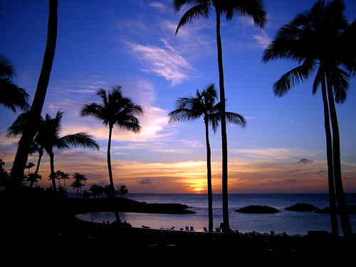
Happy Mothers Day!
Moderately strong trade winds will give way to lighter trade breezes Monday. A small craft wind advisory was trimmed down Saturday, which on Sunday includes only the major channels around Maui and the Big Island, plus Maalaea Bay…which should be canceled altogether Monday. Our local winds will be getting even lighter by Tuesday, and for several days thereafter. During the Tuesday through Friday period, they will in the very light and variable realms. The weather models show them picking up again by the weekend…then continuing into the following week.
As the trade winds are still blowing, the focus for showers will remain anchored along the windward sides through Monday. The leeward beaches will be generally quite dry, although showers could fall along the Kona slopes of the Big Island during the late afternoons. The bias for showers will shift over to the interior areas starting Tuesday afternoon, with afternoon showers occurring each day through Friday. The generosity of these convective showers will be somewhat limited, so that no flooding problems are anticipated at this time.
It’s Sunday evening as I begin writing this last section of today’s narrative. As described above, a fairly routine trade wind weather pattern will prevail here in the islands through Monday. As Tuesday arrives, our trade winds will be pretty much completely gone, with whatever light breezes that will be around then…drifting up from a southeast direction. This means that we’ll see voggy weather in many parts of the state for several days thereafter.
~~~ A cold front approaching the state from the NW will prompt this change in our weather circumstances. As we get into the heart of this convective weather pattern, our days will start off with clear skies, along with slightly cooler than normal early morning air temperatures…giving way to rather sultry conditions as the sun gets higher in the sky during the days. The daytime heating will cause clouds to build up over and around the mountains during the afternoons, with precipitation falling in the upcountry areas. Clouds typically evaporate again after dark, with the process beginning again the next day.
~~~ It’s Mother’s Day…one of the most special holiday’s of the year! My Mom, whose name is Dorothy James, lives in Long Beach, California. It’s pretty much a given, that we all love our Mom’s, no doubt about that fact! I’d like to wish each and every Mom that happens to be reading these words, the very best day. I was just talking to my Mom yesterday, and she reminded me that it only happens once a year…giving us just this one special Sunday to tell our Mothers just how much they mean to us. I sent my Mom two orchid plants, from Haiku, Maui. I know that everyone sends a card, and tries to get together with this special lady in our lives, or at least sends a nice card. You can’t say it too often: Happy Mothers Day!
~~~ I was able to connect with my Mother today through a software program called Skype. My neighbor connected with my Mom and Dad via her portable computer, which had a built in camera. I was able to see my Mom and Dad, and others in my family, while they could see me on their computer…talking live to each other at the same time, via microphones in our computers. We walked around this property, showing my parents our garden, and where I lived, including my weather tower here in Kula, Maui. It was pretty amazing, and especially for my parents! My Mom was able to show me the orchids that I had sent her for a Mothers Day present.
~~~ It’s quite clear here on Maui this evening, with not many clouds around at all, much less rainfall. I understand that the Big Island’s windward sides are where the most showers were falling. I hope everyone had a chance to communicate with their Mom in person, or at least on the telephone on this special day. If not, I trust spirits were touched in such a way that an intimate Mother son and daughter connection was continued through yet another year. I’ll be back again with your next new weather narrative from paradise very early Monday morning. I hope you have a great Sunday night until then! Aloha for now…Glenn.
Posted by Glenn
No Comments
May 10-11 2008
Air Temperatures – The following maximum temperatures were recorded across the state of Hawaii Saturday:
Lihue, Kauai – 81
Honolulu, Oahu – 86
Kaneohe, Oahu – 81
Kahului, Maui – 84
Hilo, Hawaii – 79
Kailua-Kona, Hawaii – 83
Air Temperatures ranged between these warmest and coolest spots near sea level at 3 p.m. Saturday afternoon:
Honolulu, Oahu – 85F
Hilo, Hawaii – 75
Precipitation Totals – The following numbers represent the largest precipitation totals (inches) during the last 24 hours on each of the major islands, as of Saturday afternoon:
0.40 MOUNT WAIALEALE, KAUAI
0.30 SOUTH FORK KAUKONAHUA, OAHU
0.02 MOLOKAI
0.00 LANAI
0.00 KAHOOLAWE
0.54 WEST WAILUAIKI, MAUI
0.88 GLENWOOD, BIG ISLAND
Weather Chart – Here’s the latest (automatically updated) weather map showing high pressure centers far to the NE of the state. This large area of high pressure will keep moderately strong trade winds blowing across our islands Saturday…gradually getting lighter into Sunday into Monday.
Satellite and Radar Images: To view the cloud conditions we have here in Hawaii, please use the following satellite links, starting off with the Infrared Satellite Image of the islands to see all the clouds around the state during the day and night. This next image is one that gives close images of the islands only during the daytime hours, and is referred to as a Close-up visible image. This next image shows a larger view of the Pacific…giving perspective to the wider ranging cloud patterns in the Pacific Ocean…out from the islands. To help you keep track of where any showers may be around the islands, here’s the latest animated radar image.
Hawaii’s Mountains – Here’s a link to the live webcam on the summit of near 14,000 foot Mauna Kea on the Big Island of Hawaii. The tallest peak on the island of Maui is the Haleakala Crater, which is near 10,000 feet in elevation. These two webcams are available during the daylight hours here in the islands…and when there’s a big moon rising just after sunset for an hour or two! Plus, during the nights and early mornings you will be able to see stars, and the sunrise too…depending upon cloud conditions.
Aloha Paragraphs

A magical spot on Kauai
The trade winds will still be rather gusty Saturday…stepping down in strength Sunday into the new week ahead. A small craft wind advisory was trimmed down Saturday, now including just the major channels from Oahu southward to the Big Island for the most part. These trades will slow down Sunday, getting even lighter during the new week ahead. During the Tuesday through Thursday period, they will in the very light and variable realms. The latest models show them picking up again around next Friday…then continuing through the rest of the week into the following week.
Showers will concentrate around the mountains and along the windward coasts and slopes for the time being. Those windward areas will find the most generous rainfall as usual, which will be the case through Monday. The leeward beaches will be generally quite dry, although showers could fall along the Kona slopes of the Big Island during the late afternoons. The bias for showers will shift over to the interior areas starting Tuesday afternoon.
It’s Saturday evening as I begin writing this last section of today’s narrative. As described above, a fairly routine trade wind weather pattern prevails here in the islands for the moment. These conditions will hold through the weekend, and start us off into our new week ahead. The current rather strong and gusty trade wind flow will begin to soften later this weekend into Monday…onward.
~~~ As Tuesday rolls around, our trade winds will diminish further in strength, and will likely veer around to a southeast direction. A cold front approaching the state from the NW will prompt this change in our weather circumstances. A light wind convective weather pattern will begin Tuesday, and remain in place through Thursday. This means that we’ll see voggy weather in many parts of the state.
~~~ A convective weather pattern typically manifests with days starting off in a clear way, with slightly cooler than normal temperatures giving way to rather hot and muggy afternoons. At the same time we can see clouds stacking-up over and around the mountains during the afternoons, with precipitation falling in the upcountry areas. Clouds typically evaporate again after dark, with the process beginning again the next day.
~~~ I went down to the beach on the north shore here on Maui early this morning. It was a delight to take that long walk down to Spreckelsville, or what is often referred to as baby beach. Baby beach is a long lagoon, with shallow water, which is perfect for kids, and for people who don’t want to deal with waves. I walked back to Baldwin Beach, and had a nice swim. It was breakfast time when I got back to Paia, so I had a crepe at a little eatery on Baldwin Ave. I did a little shopping at Mana Food, and stopped in at the Pukalani Superette for a couple pieces of fresh Ahi tuna on the way home.
~~~ When I got back home to Kula, my neighbor and I cut down a stock of bananas, which turned out to be quite a job. I had a chance to rest a little, although now I’m on my way to meet a friend for a walk out along Thompson Ranch Rd, down in Keokea. It’s a wonderful place to stretch your legs, and look down the mountain towards Makena, Wailea and Kihei. We will have dinner together, and sip on a nice glass of red wine…in this case a great 1997 Napa Valley, California Cabernet. I’ll catch up with you early Sunday morning again, when I’ll have your next new weather narrative from paradise ready for the reading here. I’m planning on an early trip down to the Pukalani country club for some putting…more about that then. I hope you have a great Saturday night wherever you happen to be spending it. It may mean you are reading from here in Hawaii, or perhaps in Vancouver, Canada, or Duluth, or Tampa, maybe Butte, Montana…whatever. Aloha for now…Glenn.
Bye the way, here’s wishing all you Mom’s…a very Happy Mothers Day!
Posted by Glenn
No Comments
May 9-10 2008
Air Temperatures – The following maximum temperatures were recorded across the state of Hawaii Friday:
Lihue, Kauai – 81
Honolulu, Oahu – 86
Kaneohe, Oahu – 80
Kahului, Maui – 84
Hilo, Hawaii – 80
Kailua-Kona, Hawaii – 82
Air Temperatures ranged between these warmest and coolest spots near sea level at 4 p.m. Friday afternoon:
Barking Sands, Kauai – 84F
Hilo, Hawaii – 77
Precipitation Totals – The following numbers represent the largest precipitation totals (inches) during the last 24 hours on each of the major islands, as of Friday afternoon:
0.34 MOUNT WAIALEALE, KAUAI
1.13 SOUTH FORK KAUKONAHUA, OAHU
0.00 MOLOKAI
0.00 LANAI
0.00 KAHOOLAWE
0.22 KAUPO GAP, MAUI
2.26 KEALAKEKUA, BIG ISLAND
Weather Chart – Here’s the latest (automatically updated) weather map showing high pressure centers far to the NE of the state. This large area of high pressure will keep moderately strong trade winds blowing across our islands Saturday…gradually getting lighter into Sunday.
Satellite and Radar Images: To view the cloud conditions we have here in Hawaii, please use the following satellite links, starting off with the Infrared Satellite Image of the islands to see all the clouds around the state during the day and night. This next image is one that gives close images of the islands only during the daytime hours, and is referred to as a Close-up visible image. This next image shows a larger view of the Pacific…giving perspective to the wider ranging cloud patterns in the Pacific Ocean…out from the islands. To help you keep track of where any showers may be around the islands, here’s the latest animated radar image.
Hawaii’s Mountains – Here’s a link to the live webcam on the summit of near 14,000 foot Mauna Kea on the Big Island of Hawaii. The tallest peak on the island of Maui is the Haleakala Crater, which is near 10,000 feet in elevation. These two webcams are available during the daylight hours here in the islands…and when there’s a big moon rising just after sunset for an hour or two! Plus, during the nights and early mornings you will be able to see stars, and the sunrise too…depending upon cloud conditions.
Aloha Paragraphs

Deep colors of a beautiful flower lei
The gusty trade winds of the last several days will be gradually mellowing out this weekend. A small craft wind advisory remains active in all coastal and channel waters from the north shore of Kauai down through South Point, on the Big Island Friday evening. These trades will slow down this weekend, becoming much lighter by the middle of next week. The latest models show them picking up again around next Friday…then continuing through the rest of the week into the following week.
There will still be the usual showers falling here in the islands. The windward areas as usual will find the most generous rainfall. The leeward beaches will be generally quite dry, although showers could fall along the Kona slopes of the Big Island during the late afternoons. As the winds are so strong now, a few stray showers may make it over into the leeward areas at times on the smaller islands. Weather in general will continue to be pretty normal in most regards otherwise.
It’s Friday evening as I begin writing this last section of today’s narrative. As described above, a fairly routine trade wind weather pattern prevails here in the islands at the moment. These conditions will hold through the weekend, and start us off into our new week ahead. The current rather strong and gusty trade wind flow will however, begin to soften a little this weekend into Monday.
~~~ As next Tuesday rolls around, our trade winds will diminish in strength, and may very well veer around to the southeast direction. A trough, or a cold front approaching the state from the NW will be the culprit in this change in our weather circumstances. A light wind convective weather pattern will kick in Tuesday, and remain in place through Thursday. This means that we’ll see the likelihood of voggy weather in some parts of the state.
~~~ A convective weather pattern usually has the days starting off in a clear way, with slightly cooler than normal temperatures giving way to rather hot and muggy afternoons. At the same time we can see clouds stacking-up over and around the mountains during the afternoons, with precipitation falling in the upcountry areas. Clouds typically evaporate again after dark, with the process beginning again the next day.
~~~ It’s after work on Friday, I’m still in Kihei, Maui, leaving soon for the drive to Kahului. I really want to see the new film called Iron Man, but I’m afraid it’s still going to be too crowded, so I’ll give it one more week. As a second choice, I’ll see the new film called Redbelt (2008)…starring Chjwetel Ejiofor, Tim Allen, Rodrigo Santoro, among others. Redbelt is set in the west-side of Los Angeles fight world, a world inhabited by bouncers, cage- fighters, cops and special forces types, Redbelt, is the story of Mike Terry (Chiwetel Ejiofor), a Jiu-Jitsu teacher who has avoided the prize fighting circuit, choosing instead to pursue an honorable life by operating a self-defense studio with a samurai’s code. The Yahoo critics give it a solid B rating, while the rottentomatoes movie review website gives it 70 out of 100 points. Here’s a trailer if you feel like checking it out. It’s another one of those heavy duty action packed films!
~~~ I’ll be back early Saturday morning, not only with your next new weather narrative, but with my impression of the film. I plan on leaving the house early for a trip to the north shore right after breakfast, more about that in the morning. I hope you have a great Friday night wherever you happen to be spending it, whether in Laramie, Palm Springs, Albany, Austin…or perhaps Portland, Santa Rosa or even Key West, Florida! Aloha for now…Glenn.
Shark Surfer!
Interesting: A new company hopes drivers will kick the oil habit by brewing ethanol at home that won’t spike food prices. E-Fuel Corp unveiled on Thursday the "MicroFueler" touting it as the world’s first machine that allows homeowners to make their own ethanol and pump the brew directly into their cars. The portable unit that sells for $10,000 resembles a gasoline station pump and nozzle — minus the slot for a credit card, or the digital "SALE" numbers that whir ever faster at retail pumps as global demand pushes fuel prices to record levels. Instead of tapping gasoline from an underground tank, the pump’s back end plugs into home power and water supplies to make ethanol for as little as $1 a gallon (3.8 liters), according to E-Fuel. The company says one of the machine’s top selling points is its sweet tooth. It ferments fuel from sugar, the price of which is historically cheap as global supplies are glutted. That means it avoids the Achilles heel of today’s U.S. ethanol system — reliance on corn — which has been blamed for helping to spike global food prices.
Interesting2: It’s a happy Mother’s Day for an Arkansas woman — she’s pregnant with her 18th child. Michelle Duggar, 41, is due on New Year’s Day, and the latest addition will join seven sisters and 10 brothers. There are two sets of twins. "We’ve had three in January, three in December. Those two months are a busy time for us,” she said, laughing. The Duggars’ oldest child, Josh, is 20, and the youngest, Jennifer, is nine months old. The fast-growing family lives in Tontitown in northwest Arkansas in a 7,000-square-foot home. All the children — whose names start with the letter J — are home-schooled. Duggar has been pregnant for more than 11 years of her life, and the family is in the process of filming another series for Discovery Health. The new show looks at life inside the Duggar home, where chores — or "jurisdictions” — are assigned to each child. One episode of the new show involves a "jurisdiction swap,” where the boys do chores traditionally assigned to the girls, and vice versa, Duggar said. "The girls swapped jurisdictions, changing tires, working in the garages, mowing the grass,” she said. "The boys got to cook supper from start to finish, clean the bathrooms,” among other chores.
Interesting3: It’s hard for anyone to say what music looks like, but a new mathematical approach sees classical music as cone-shaped and jazz as pyramid-like. The connections between math and music are many, from the unproven Mozart effect (the idea that playing Mozart’s music to children might improve their mathematical abilities) to the music of the spheres (the ancient belief that proportions in the movements of the planets could be viewed as a form of music). Now scientists have created a mathematical system for understanding music. Clifton Callender of Florida State University, Ian Quinn of YaleUniversity and Dmitri Tymoczko of PrincetonUniversity outlined their "geometrical music theory" in the April 18 issue of the journal Science. The team designed a geometrical technique for mapping out music in coordinate space. For music made of chords containing two notes, all musical possibilities take the shape of a Möbius strip, which basically looks like a twisted rubber band (this was first described by Tymoczko in a 2006 Science paper). The team found that the shape of possibilities using three-note chords is a three-dimensional ice cream cone, where types of chords, such as major chords and minor chords, are unique points on the cone. The space of four-note chords is what mathematicians would call a "cone over the real projective plane," which resembles a pyramid in our 3-D universe. Any piece of music can be mapped in these spaces.
Posted by Glenn
No Comments
May 8-9 2008
Air Temperatures – The following maximum temperatures were recorded across the state of Hawaii Thursday:
Lihue, Kauai – 80
Honolulu, Oahu – 85
Kaneohe, Oahu – 80
Kahului, Maui – 84
Hilo, Hawaii – 79
Kailua-Kona, Hawaii – 83
Air Temperatures ranged between these warmest and coolest spots near sea level at 4 a.m. Thursday afternoon:
Honolulu, Oahu – 83F
Lihue, Kauai – 75
Precipitation Totals – The following numbers represent the largest precipitation totals (inches) during the last 24 hours on each of the major islands, as of Thursday afternoon:
0.51 MOUNT WAIALEALE, KAUAI
0.73 SOUTH FORK KAUKONAHUA, OAHU
0.15 MOLOKAI
0.00 LANAI
0.00 KAHOOLAWE
1.15 PUU KUKUI, MAUI
0.92 GLENWOOD, BIG ISLAND
Weather Chart – Here’s the latest (automatically updated) weather map showing high pressure centers far to the NE of the state. This large area of high pressure will keep moderately strong to fresh trade winds blowing across our islands Friday into Saturday…locally strong and gusty.
Satellite and Radar Images: To view the cloud conditions we have here in Hawaii, please use the following satellite links, starting off with the Infrared Satellite Image of the islands to see all the clouds around the state during the day and night. This next image is one that gives close images of the islands only during the daytime hours, and is referred to as a Close-up visible image. This next image shows a larger view of the Pacific…giving perspective to the wider ranging cloud patterns in the Pacific Ocean…out from the islands. To help you keep track of where any showers may be around the islands, here’s the latest animated radar image.
Hawaii’s Mountains – Here’s a link to the live webcam on the summit of near 14,000 foot Mauna Kea on the Big Island of Hawaii. The tallest peak on the island of Maui is the Haleakala Crater, which is near 10,000 feet in elevation. These two webcams are available during the daylight hours here in the islands…and when there’s a big moon rising just after sunset for an hour or two! Plus, during the nights and early mornings you will be able to see stars, and the sunrise too…depending upon cloud conditions.
Aloha Paragraphs


The art of flower lei making
The trade winds are blowing in the locally strong and gusty realms now. We’ve seen the trade winds increase a notch now, and will remain that way into the first half of the weekend. A small craft wind advisory is now active in all coastal and channel waters from the north shore of Kauai down through South Point, on the Big Island. These trades will slow down starting Sunday, becoming much lighter by the middle of next week. The latest models show them picking up again around next Thursday or Friday…then continuing through the rest of the week.
There will be the usual showers being carried in our direction on the fresh trade winds…slightly more numerous than normal. The windward areas as usual will find the most generous rainfall. The leeward beaches will be generally quite dry, although a few showers could fall along the Kona slopes of the Big Island during the afternoon or early evening hours. As the winds are so strong now, a few stray showers may make it into the leeward areas at times on the smaller islands.
It’s Thursday evening as I begin writing this last section of today’s narrative. Just when we thought we were going to see the trade winds blowing through the remainder of spring, right on into the beginning of summer…we now see a stop sign up ahead! As I’ve been mentioning the last several days, the computer models want to have our winds getting much lighter for a day or two next week. Those models point out a rather deep trough of low pressure, with a cold front, approaching the Hawaiian Islands after the weekend. This storminess would push our trade wind producing high pressure ridge down closer to the state, and perhaps right down over us. This is the reason our winds will take a nose dive in strength…around next Tuesday and Wednesday.
~~~ If this happens as described, we would see our trade wind weather pattern giving way to a light wind convective weather pattern. We would see the haze levels around the state increasing, and if there was a drift of air coming up from the southeast, we could see thick volcanic haze, the infamous vog, settling in over many parts of the state. Often with this kind of weather pattern in force, we see clear, slightly cooler than normal mornings giving way to rather hot and muggy afternoons. At the same time we could see clouds stacking up over and around the mountains during the afternoons, with precipitation falling in the upcountry areas. Clouds typically evaporate again after dark, with the process beginning again the next day.
~~~ Thursday was another nice day here in the islands, although the trade winds were rushing around locally. The strongest winds that I saw during the aftrernoon hours, was the 44 mph gust here on Maui, at Maalaea Bay. They were still gusting to 42 mph at that windy Bay late in the afternoon. Kahoolawe saw gusts at the same time to 37 mph, while even normally light winded Lanai had 35 mph gusts. Other than all this "air in a hurry", skies were generally quite sunny during the day. As this looping satellite image shows, a strong stream of high cirrus clouds are remaining just to the south of Hawaii…riding along in the jet stream level winds. It wouldn’t take much of a nudge northward, to bring that high altitude cloudiness up over the Aloha state.
~~~ Friday will find the trade winds still on the rowdy side of the wind speed spectrum. Sunshine will be abundant, especially along the leeward sides of the islands. The windward sides will see a few showers falling, and there could be a couple of loud showers falling, particularly if you live under a tin roof! I’ll be back very early Friday morning with your next new weather narrative from paradise. I hope you have a great Thursday night until then! Aloha for now…Glenn.
Interesting: High gasoline prices could lead to a dramatic saving in US greenhouse-gas emissions. That’s the conclusion of economists in the US, who suggest high fuel prices are turning consumers off SUVs and onto smaller, more fuel-efficient vehicles. What’s more, car owners are predicted to cut back on driving in order to save money. Together, these changes in consumer behaviour could make an important dent in the US contribution to global warming, reducing annual carbon dioxide emissions by tens of millions of tons per year. The impact will be dramatic, says Chris Knittel, an economist at the University of California, Davis, who was involved in one of the studies. The changes are being driven by record fuel prices in the US, where, at the end of April, the average price of gasoline stood at $3.65 per gallon, 20 per cent more than in January and treble the price of a decade ago. Until recently, these increases did not seem to be having a consistent effect on the car market and fuel use. Though sales of SUVs in the US have been falling over the past few years, this decline has come on the back of years of rapid growth, and overall gasoline consumption has been increasing every year since 1991.
Interesting2: Wyoming Air Pollution Rivals Big Cities. There isn’t anything metropolitan about this tiny unincorporated town in southwest Wyoming, where a few single-family homes and a volunteer fire station stand against a skyline of snowcapped mountains. But Boulder, with a population of just 75 people, has one thing in common with major metropolitan areas: air pollution thick enough to pose health risks. "Used to be you could see horizon to horizon, crystal clear. Now you got this,” said Craig Jensen as he gestured to a pale blue sky that he says is not as deeply colored as it used to be. "Makes you wonder what it’s going to do to the grass, the trees and the birds.” The pollution, largely from the region’s booming natural gas industry, came in the form of ground-level ozone, which has exceeded healthy levels 11 times since January and caused Wyoming to issue its first ozone alerts. Now the ozone threatens to cost the industry and taxpayers millions of dollars to stay within federal clean-air laws. Sublette County is home to one of the largest natural gas reserves in North America, and it is dotted with hundreds of gas wells to supply the growing U.S. demand for cleaner-burning fuel. Thousands more wells are planned for the future.
Interesting3: Turn greenhouse gases to stone? Transform them into a treacle-like liquid deep under the seabed? The ideas may sound like far-fetched schemes from an alchemist’s notebook but scientists are pursuing them as many countries prepare to bury captured greenhouse gases in coming years as part of the fight against global warming. Analysts say the search for a suitable technology could become a $150 billion-plus market. But a big worry is that gases may leak from badly chosen underground sites, perhaps jolted open by an earthquake. Such leaks could be deadly and would stoke climate change. Part of the answer could be to petrify or liquefy gases like carbon dioxide — emitted for example from power plants and factories run on coal, oil or natural gas — if technical hurdles can be overcome and costs are not too high. "If you can convert (the gases) to stone, and it’s environmentally benign and permanent, then that’s better," said Juerg Matter, a German scientist at ColumbiaUniversity in New York who is working on a project in Iceland to turn carbon dioxide, the main greenhouse gas, to rock. In theory, carbon dioxide reacts with porous basalt and turns into a mineral, but no one knows how long that takes. Matter and U.S., French and Icelandic experts plan to inject 50,000 tonnes of the gas into basalt in a test starting in 2009.
Interesting4: Remains of meals that included seaweed are helping confirm the date of a settlement in southern Chile that may offer the earliest evidence of humans in the Americas. Researchers date the seaweed found at Monte Verde to more than 14,000 years ago, 1,000 years earlier than the well-studied Clovis culture. And the report comes just a month after other scientists announced they had found coprolites — fossilized human feces — dating to about 14,000 years ago in a cave in Oregon. Taken together, the finds move back evidence of people in the Americas by a millennium or more, with settlements in northern and southern coastal areas. The prevailing theory has been that people followed herds of migrating animals across an ancient land bridge between Siberia and Alaska, and then moved southward along the West coast. Proof has been hard to come by, however. The sea was about 200 feet lower at the time and as it rose it would have inundated the remains of coastal settlements. A team led by anthropologist Tom Dillehay of Vanderbilt University reports on the new seaweed study from Monte Verde, Chile, in Friday’s edition of the journal Science.
« Previous Page — Next Page »


