2008
Yearly Archive
Posted by Glenn
No Comments
June 6-7 2008
Air Temperatures – The following maximum temperatures were recorded across the state of Hawaii Friday:
Lihue, Kauai – 83
Honolulu, Oahu – 87
Kaneohe, Oahu – 81
Kahului, Maui – 90
Hilo, Hawaii – 84
Kailua-kona – 84
Air Temperatures ranged between these warmest and coolest spots near sea level at 4 p.m. Friday afternoon:
Kahului, Maui – 86F
Barking Sands, Kauai – 79
Precipitation Totals – The following numbers represent the largest precipitation totals (inches) during the last 24 hours on each of the major islands, as of Friday afternoon:
0.55 Mount Waialeale, Kauai
0.16 Oahu Forest NWR, Oahu
0.02 Molokai
0.00 Lanai
0.00 Kahoolawe
0.07 West Wailuaiki, Maui
0.06 Puu Waawaa, Big Island
Weather Chart – Here’s the latest (automatically updated) weather map showing a 1032 millibar high pressure system to the northeast of the islands. This high pressure cell, along with its associated ridge, will keep moderately strong trade winds blowing across our area through Saturday…locally stronger and gusty in those windiest areas around Maui and the Big Island.
Satellite and Radar Images: To view the cloud conditions we have here in Hawaii, please use the following satellite links, starting off with the Infrared Satellite Image of the islands to see all the clouds around the state during the day and night. This next image is one that gives close images of the islands only during the daytime hours, and is referred to as a Close-up visible image. This next image shows a larger view of the Pacific…giving perspective to the wider ranging cloud patterns in the Pacific Ocean…out from the islands. To help you keep track of where any showers may be around the islands, here’s the latest animated radar image.
Hawaii’s Mountains – Here’s a link to the live webcam on the summit of near 14,000 foot Mauna Kea on the Big Island of Hawaii. The tallest peak on the island of Maui is the Haleakala Crater, which is near 10,000 feet in elevation. These two webcams are available during the daylight hours here in the islands…and when there’s a big moon rising just after sunset for an hour or two! Plus, during the nights and early mornings you will be able to see stars, and the sunrise too…depending upon cloud conditions.
Aloha Paragraphs

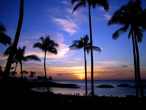
The end of another nice day in the islands
Photo Credit: flickr.com
Late spring trade winds will continue to grace the Hawaiian Islands, moderating our very warm afternoon temperatures at sea level. The computer forecast models suggest that this trade wind flow will prevail through the rest of this week, right on into next week. A moderately strong 1032 millibar high pressure system, to the northeast of the islands is the source of our trade wind flow now. Nothing out of the ordinary is expected, although the winds may increase just enough this weekend, in which case we would see small craft wind advisory flags going up over the windier areas around Maui and the Big Island.
The upper level trough of low pressure is now to the north of Kauai, and will soon lose whatever little bit of influence it has left here in Hawaii. This trough of low pressure has been moving by just to the north of the islands, with its associated cold pool of air aloft, and has been the source of some instability. This water vapor satellite image shows this feature to our north, spinning in a counterclockwise fashion as is moves generally westward. There was hope that it would help to bring us some much needed showers, but most of those didn’t fall in the places that needed the moisture most. We will fall back into a fairly normal trade wind weather pattern now.
~~~ We didn’t have very good luck in terms of attracting much rainfall here in the islands. It’s very clear that we needed the precipitation, to take the edge off the very dry conditions that prevail here in Hawaii now. There have been a couple of heavier showers, although, besides fall over the islands in a few places, ended up being most active over the ocean to the south of the state. There’s still a slim chance that some areas will end up with water on the ground, before this rainfall enhancing upper trough moves away soon.
~~~ Another weather related feature of note, will be the increasing surf along our leeward coasts. Late autumn storms in the southern hemisphere, down near New Zealand last week, generated a swell train of waves in our direction. This swell began arriving Friday, and will bring relatively large breaking waves to our south and west facing beaches this weekend. These breakers will be large enough that the general public may need to use caution when entering the ocean, so please be careful out there this weekend. The NWS office in Honolulu issued a high surf advisory for the south facing shores during the day Friday.
~~~ It’s after work Friday evening, as I’m about ready to leave Kihei. I just got an email from my neighbors, asking if I wanted to meet them at the putting green in Pukalani on the way home to Kula. There weren’t any new films that I was interested in seeing, so I agreed to meet them. It’s nice to putt around sunset, as the Pukalani Country Club has great views down the mountain to the ocean…and also uphill to the summit of the Haleakala Crater. I plan on going surfing early Saturday morning, taking the drive over to the Lahaina side. I have a haircut later in the morning in Haiku, which will put me in close proximity to take a nice beach walk and swim in Paia aftwerwards. This all sounds great to me, as I look forward to having a couple of days off work. I’ll be back online early Saturday, with your next new weather narrative from paradise. I hope you have a great Friday night until then! Aloha for now…Glenn.
Interesting: A team of physicists has claimed that our view of the early Universe may contain the signature of a time before the Big Bang. The discovery comes from studying the cosmic microwave background (CMB), light emitted when the Universe was just 400,000 years old. Their model may help explain why we experience time moving in a straight line from yesterday into tomorrow. Details of the work have been submitted to the journal Physical Review Letters. The CMB is relic radiation that fills the entire Universe and is regarded as the most conclusive evidence for the Big Bang. Although this microwave background is mostly smooth, the Cobe satellite in 1992 discovered small fluctuations that were believed to be the seeds from which the galaxy clusters we see in today’s Universe grew. Dr Adrienne Erickcek, and colleagues from the California Institute for Technology (Caltech), now believes these fluctuations contain hints that our Universe "bubbled off" from a previous one.
Interesting2: The numbers of Northeastern offshore spotted and eastern spinner dolphins in the eastern tropical Pacific Ocean are increasing after being severely depleted because of accidental death in the tuna purse-seine fishery between 1960 and 1990, according to biologists from NOAA’s Fisheries Service. "These estimates are encouraging because they are consistent with what we would expect to see if these stocks are recovering, now that reported fishery mortality has been dramatically reduced," said Dr. Lisa Ballance, director of NOAA’s Southwest Fisheries Science Center protected resources division. "However, we have to be careful not to jump to final conclusions. We need to resolve the uncertainties around these estimates before we can definitively say these stocks are recovering." Between 1960 and 1990, the northeastern offshore spotted and eastern spinner dolphin populations dropped to 20 percent and 30 percent, respectively, of their pre-fishery levels when dolphins were caught and died in tuna purse-seine nets. Since the early 1990s, however, the number of reported dolphin deaths has been very low because of severe restrictions on the fishery.
Posted by Glenn
No Comments
June 5-6 2008
Air Temperatures – The following maximum temperatures were recorded across the state of Hawaii Thursday:
Lihue, Kauai – 83
Honolulu, Oahu – 87
Kaneohe, Oahu – 82
Kahului, Maui – 88
Hilo, Hawaii – 84
Kailua-kona – 84
Air Temperatures ranged between these warmest and coolest spots near sea level at 4 p.m. Thursday afternoon:
Honolulu, Oahu – 85F
Barking Sands, Kauai – 77
Precipitation Totals – The following numbers represent the largest precipitation totals (inches) during the last 24 hours on each of the major islands, as of Thursday afternoon:
2.80 Mount Waialeale, Kauai
0.55 Poamoho 2, Oahu
0.03 Molokai
0.31 Lanai
0.00 Kahoolawe
0.53 Puu Kukui, Maui
0.15 Puu Waawaa, Big Island
Weather Chart – Here’s the latest (automatically updated) weather map showing a 1031 millibar high pressure system to the northeast of the islands. This high pressure cell, along with its associated ridge, will keep moderately strong trade winds blowing across our area through Saturday…locally stronger and gusty in those windiest areas around Maui and the Big Island.
Satellite and Radar Images: To view the cloud conditions we have here in Hawaii, please use the following satellite links, starting off with the Infrared Satellite Image of the islands to see all the clouds around the state during the day and night. This next image is one that gives close images of the islands only during the daytime hours, and is referred to as a Close-up visible image. This next image shows a larger view of the Pacific…giving perspective to the wider ranging cloud patterns in the Pacific Ocean…out from the islands. To help you keep track of where any showers may be around the islands, here’s the latest animated radar image.
Hawaii’s Mountains – Here’s a link to the live webcam on the summit of near 14,000 foot Mauna Kea on the Big Island of Hawaii. The tallest peak on the island of Maui is the Haleakala Crater, which is near 10,000 feet in elevation. These two webcams are available during the daylight hours here in the islands…and when there’s a big moon rising just after sunset for an hour or two! Plus, during the nights and early mornings you will be able to see stars, and the sunrise too…depending upon cloud conditions.
Aloha Paragraphs

The beach at Wailea, Maui
Photo Credit: flickr.com
The trade winds may ease up a touch Friday, as an upper level low pressure trough moves by overhead. The computer forecast models suggest that this trade wind flow will prevail through the rest of this week, right on into next week. This is the time of year the trade winds blow very steadily, really hitting their stride. The month of June, on average, find the trade winds blowing 91% of the time here in Hawaii.
The upper level trough, referred to above, will increase windward showers over the next several days. This trough, with its associated cold pool of air aloft, will destabilize our atmosphere enough…that we could find more generous rainfall arriving along our windward coasts and slopes into the weekend. There may be a few nice showers along the leeward slopes on Maui and the Big Island during the afternoon hours too. This won’t however be a widespread rain event, rather of the hit and miss variety for the most part.
~~~ We have a golden opportunity here, in regards to wringing-out some showers from the clouds that will be passing through our area now. The well advertised trough of low pressure, which will be moving over us now, should trigger some localized heavy windward biased showers. This hasn’t happened yet, but we’ll know soon, whether this will unfold as expected. All the ingredients for this to happen are in place now, and all we need at this point is to hear those raindrops falling on our roofs!
~~~ The cold air associated with the trough is moving over us, which will help to thicken-up our local cumulus clouds. This cold air won’t reach down to the surface of course, so we will find warm temperatures down here where we live. The cold air aloft however will cause what we call instability in our atmosphere. This simply means that those clouds will become more shower prone. How much rain will the windward sides receive, I don’t know, although I’d like to say a lot! As we’re definitely flirting with drought conditions on the islands from Oahu down to the Big Island.
~~~ As I’ve been mentioning the last several days, there’s a second chance for additional precipitation next week, as another trough moves near our islands. It would be so great to have ample rainfall from this first occurrence, and then a follow-up second wet event around the middle of next week! Just about everyone here in the islands should have their fingers crossed, or you wild and crazy folks should be out there doing a rain dance! 
~~~ Conditions are becoming more ripe for localized showers now, with even some fairly generous ones at that in the offing. This looping satellite image shows the high clouds associated with this trough of low pressure, as it spins in a counterclockwise fashion across the state now. This trough will end up to the west of Hawaii by Saturday, although a lobe of the trough will remain back over the islands, keeping localized showers in the forecast into Sunday. Here’s an animated radar image as well, so you can keep an eye on where the showers are falling. Looking out the window here from Kihei, Maui, before I leave on the drive upcountry to Kula, there are lots of high clouds around, and some fairly showery looking cumulus clouds around the edges as well. Those icy cirrus clouds up high, could very easily make for a colorful sunset this evening…keep an eye out. I’ll be back very early Friday morning with your next new weather narrative from paradise. I hope to have news about some nice rains that hopefully fell during the night. The wild card seems to be whether there will be ample moisture being carried our way on the somewhat weaker trade winds that are around now. Aloha for now…Glenn.
Interesting: Chronic pollution in Mexico City, which stains the sky yellow and can trigger government warnings to stay indoors, could be killing off residents’ sense of smell, scientists say. Tests showed people in Mexico City — a sprawling metropolis crammed with around 20 million people and 4 million cars — struggled to sniff out everyday odors like coffee and orange juice compared to residents of a nearby town. Their noses are so badly damaged from a life inhaling toxic particles that they also find it harder to detect the scent of rotten food, said researcher Robyn Hudson who ran the study. "We added a substance (to powdered milk) that is a common contaminant of food, something that smells disgusting basically — like a sour, rotting cabbage," said Hudson. "We were able to see at what point … they would start to reject the contaminated sample, say ‘ew yuck! no! take it away please,’" said Hudson, an Australian and a senior research scientist at Mexico‘s National Autonomous University (UNAM). Mexico City is one of the world’s most polluted capitals, along with Beijing, blighted by its thin high-altitude air and a ring of surrounding mountains that trap exhaust fumes belched from smoky buses and factories on the city outskirts. Contamination levels are better now than two decades ago, but from a high-story window it’s still hard most days to make out the snow-capped peaks that surround the city through the murky shroud of brownish smog. Mexico City‘s ozone levels exceed World Health Organization standards on approximately 300 days of the year.
Interesting2: Mexico City, one of the world’s most polluted capitals, is planting rooftop gardens on public buildings as part of a program launched on Thursday to combat global warming. The smog-choked metropolis plans to replace gas tanks, clothes lines and heat-reflecting asphalt on 100,000 square feet (9,300 square metres) of publicly owned roof space each year with grass and bushes that will absorb carbon dioxide. The city also plans to offer tax breaks for businesses or individuals who put gardens on top of their offices and apartment buildings. Left-wing Mayor Marcelo Ebrard has pledged $5.5 billion over five years to reduce greenhouse gases in Mexico City, home to some 20 million people and 4 million cars. "These are not generic objectives or wishes — we have a clear goal," Ebrard said at an event to inaugurate the environmental plan. The aim is to cut carbon emissions by 4.4 million tonnes a year, still a fraction of the 643 million tonnes of gas Mexico produces nationwide each year, ranking it among the world’s top polluters. The mayor has encouraged cycling by providing bicycle paths and some car-free roads on weekends. His program also aims to capture gas that bubbles up from overflowing landfills and calls for a new subway line and more express bus routes. Putting plants on roofs soaks up some of the carbon dioxide belched out by cars and factories, one of the main causes of climate change, the U.S. Environmental Protection Agency says.
Interesting3: Better insulation at home, less use of the car and even giving up an electric toothbrush can help people in rich nations halve emissions of greenhouse gases, a U.N. report said on Thursday. "Adopting a climate-friendly lifestyle needn’t require drastic changes or major sacrifices," according to the 202-page U.N. Environment Program (UNEP) book entitled "Kick the CO2 Habit: the U.N. Guide to Climate Neutrality". Issued to mark the U.N.’s annual World Environment Day on June 5, it outlines ways for people to combat global warming with measures such as packing lighter suitcases when flying or going jogging in a park rather than on an electric treadmill. World emissions of greenhouse gases, is blamed by the U.N. Climate Panel, for heating the globe total about 4.5 tonnes per person for all of the world’s 6.7 billion population. Most efforts to slow climate change focus on the role of governments — such as in rules for emissions from cars or power plants or building codes to help avert projected impacts such as droughts, heat waves, more powerful storms or rising seas. Fewer look at how individuals can do it themselves. "Multiplied across the world and acted upon by 6.7 billion people, the public have the power to change the future, have the power to personally and collectively influence economies to ‘Kick the CO2 Habit’," said Achim Steiner, head of UNEP.
Posted by Glenn
[2] Comments
June 4-5 2008
Air Temperatures – The following maximum temperatures were recorded across the state of Hawaii Wednesday:
Lihue, Kauai – 83
Honolulu, Oahu – 86
Kaneohe, Oahu – 82
Kahului, Maui – 84
Hilo, Hawaii – 84
Kailua-kona – 82
Air Temperatures ranged between these warmest and coolest spots near sea level at 4 p.m. Wednesday afternoon:
Kahului, Maui – 85F
Hilo, Hawaii – 79
Precipitation Totals – The following numbers represent the largest precipitation totals (inches) during the last 24 hours on each of the major islands, as of Wednesday afternoon:
1.17 Mount Waialeale, Kauai
1.17 Poamoho 2, Oahu
0.03 Molokai
0.29 Lanai
0.00 Kahoolawe
0.72 Puu Kukui, Maui
0.24 Keahole airport, Big Island
Weather Chart – Here’s the latest (automatically updated) weather map showing a 1030 millibar high pressure system to the northeast of the islands. This high pressure cell, along with its associated ridge, will keep light to moderately strong trade winds blowing across our area through Friday…locally stronger and gusty in those windiest areas around Maui and the Big Island. An upper level trough of low pressure, moving by during the next several days, may tamp our surface winds down a bit more than expected, we’ll have to wait and see.
Satellite and Radar Images: To view the cloud conditions we have here in Hawaii, please use the following satellite links, starting off with the Infrared Satellite Image of the islands to see all the clouds around the state during the day and night. This next image is one that gives close images of the islands only during the daytime hours, and is referred to as a Close-up visible image. This next image shows a larger view of the Pacific…giving perspective to the wider ranging cloud patterns in the Pacific Ocean…out from the islands. To help you keep track of where any showers may be around the islands, here’s the latest animated radar image.
Hawaii’s Mountains – Here’s a link to the live webcam on the summit of near 14,000 foot Mauna Kea on the Big Island of Hawaii. The tallest peak on the island of Maui is the Haleakala Crater, which is near 10,000 feet in elevation. These two webcams are available during the daylight hours here in the islands…and when there’s a big moon rising just after sunset for an hour or two! Plus, during the nights and early mornings you will be able to see stars, and the sunrise too…depending upon cloud conditions.
Aloha Paragraphs

Lanikai, Oahu…could this be my
favorite beach in all of the Islands?

The colors of windward Oahu…oh my!
Photo Credit: flickr.com
The trade winds will continue to be the primary weather feature here in the Hawaiian Islands. A moderately strong 1031 millibar high pressure system, located to the northeast of Hawaii Wednesday evening…is the source of our moderately strong trade winds. The computer forecast models suggest that this late spring trade wind flow will prevail through the rest of this week, right on into next week. There will be some minor variations in wind speeds, although 10-25 mph will catch the outer limits in most areas, with those localized 30+ mph gusts here and there.
We will see some increase in windward showers over the next several days. The computer forecast models continue to bring an upper level trough over the state from the east over the next couple of days. This upper trough, with its associated cold pool of air, will destabilize our atmosphere enough…that we would find heavier rainfall arriving along our windward coasts and slopes Thursday into the weekend. There may be a few heavier showers along the leeward slopes on Maui and the Big Island too.
~~~ Despite the fact that this is the driest month of the year, and it would be somewhat unusual, we’re still looking for an increase in showers. The computer models have been very consistent in their forecast of increasing showers associated with an upper low pressure migrating in over the islands. These showers won’t envelop the entire island chain, but be generally restricted to the windward sides. The upcountry areas in Kona, and perhaps the Kula through Ulupalakua slopes on Maui…may see some afternoon showers as well.
~~~ The original thought was that these showers would be around Thursday into Friday, and then move away over the weekend. It now appears that this trough of low pressure will linger in our area right into the weekend. This would give it more of a chance to enhance our local showers into Saturday, and possibly Sunday. This is one of those times when we really need the rain, so we’re hoping that these windward showers manifest as forecast, and perhaps be more generous than expected too.
~~~ The models continue to show a second upper level trough of low pressure coming our way next week. This would be doubly unusual, although given the dry weather conditions we’re dealing with now…twice as nice! The leeward beaches won’t likely see any of this moisture, and may remain quite sunny during the days, so that those folks living on the windward sides, want to escape the showers, they can take their beach towels and plop down on the leeward beaches. Speaking of the leeward beaches, there will be lots of south swell waves breaking there this weekend.
~~~ I just finished work in Kihei, Maui, and will leave soon for the 40 minute drive upcountry to Kula. Glancing out the window, I see some high cirrus clouds streaming overhead from the east this evening. These icy clouds should provide a colorful sunset! During the day, the two most noticeable things that caught my eye, where the locally strong and gusty winds, and the thicker clouds that were around too. Those gusty trade winds reached over 40 mph at Kahoolawe, offshore from the south coast here on Maui. The cumulus clouds today had a different nature than we’ve seen recently, and were more hefty than the fairly wimpy, and rather shallow clouds of late. These more well developed clouds are the first signal of the approaching upper level trough of low pressure. This looping satellite image shows, to the east of the Big Island, the advancing cold air, with its high clouds, moving over the islands. I’ll be back very early Thursday morning with more news about this developing wet trade wind episode, which again, will deposit the bulk of the incoming showers along the windward coasts and slopes. I hope you have a great Wednesday night until then! Aloha for now…Glenn.
Interesting: A team of astronomers has cooked up an out-of-this-world recipe for lunar concrete that could be used to build homes on the moon. The innovative recipe of carbon, glue and moon dust, which produces what looks like a hockey puck, could also be helpful in building other structures on the moon, including giant telescopes and solar power arrays. Lunar living aside, many astrophysicists think that large telescopes on the moon have their advantages: The moon lacks the clouds and blurring atmosphere that can distort images taken from ground-based observatories. In addition, the moon offers a permanent and stable platform — the lunar surface.
One limiting factor for making the concrete could be the amount of material a rocket can reasonably haul up to the moon. But if the bulk of the material was already on the moon, that would lighten the Earth-to-moon payload. And that is the case, Chen says. "We could make huge telescopes on the moon relatively easily, and avoid the large expense of transporting a large mirror from Earth," said Peter Chen of NASA Goddard Spaceflight Center in Greenbelt, Md., and the Catholic University of America in Washington, D.C.
"Since most of the materials are already there in the form of dust, you don’t have to bring very much stuff with you, and that saves a ton of money." Chen also notes that like concrete on Earth, the lunar type could have many uses. "We could build structures on the moon, perhaps habitats for astronauts on the moon, maybe igloos," Chen said during a press briefing here today at a meeting of the American Astronomical Society (AAS).
Interesting2: A little strategically placed makeup quickly turns the wimpiest of male barn swallows into chick magnets, amping up their testosterone and even trimming their weight, new research shows. It’s a "clothes make the man" lesson that — with some caveats — also applies to human males, researchers say. Using a $5.99 marker, scientists darkened the rust-colored breast feathers of male New Jersey barn swallows, turning lighter birds to the level of those naturally darkest. They had already found, in a test three years ago, that the marked-up males were more attractive to females and mated more often. This time they found out that the more attractive appearance, at least in the bird world, triggered changes to the animals’ body chemistry, increasing testosterone. "Other females might be looking at them as being a little more sexy, and the birds might be feeling better about themselves in response to that," said study co-author Kevin McGraw, an evolutionary biology professor at ArizonaStateUniversity. McGraw said the findings are surprising, in part because the hormonal changes occurred after only one week. The study was published in Tuesday’s edition of the journal Current Biology.
Interesting3: New research led by Dr Melanie Massaro and Dr Jim Briskie at the University of Canterbury, which found that the New Zealand bellbird is capable of changing its nesting behaviour to protect itself from predators, could be good news for island birds around the world at risk of extinction. The introduction of predatory mammals such as rats, cats and stoats to oceanic islands has led to the extinction of many endemic island birds, and exotic predators continue to threaten the survival of 25 percent of all endangered bird species worldwide. Dr Massaro says the impact of exotic predators on the native birds of oceanic islands is particularly profound as they evolved over millions of years largely in the absence of these predators and appear naive towards newly introduced mammals. But their study on the bellbird, an endemic New Zealand bird, has identified the ability of a previously naive island bird to change its nesting behaviour in response to the introduction of a large suite of exotic mammalian predators by humans.
Posted by Glenn
No Comments
June 3-4 2008
Air Temperatures – The following maximum temperatures were recorded across the state of Hawaii Tuesday:
Lihue, Kauai – 82
Honolulu, Oahu – 87
Kaneohe, Oahu – 78
Kahului, Maui – 88
Hilo, Hawaii – 83
Kailua-kona – 82
Air Temperatures ranged between these warmest and coolest spots near sea level at 4 p.m. Tuesday afternoon:
Honolulu, Oahu – 86F
Hilo, Hawaii – 76
Precipitation Totals – The following numbers represent the largest precipitation totals (inches) during the last 24 hours on each of the major islands, as of Tuesday afternoon:
0.90 Mount Waialeale, Kauai
0.24 Oahu Forest NWR, Oahu
0.03 Molokai
0.00 Lanai
0.00 Kahoolawe
0.19 West Wailuaiki, Maui
0.10 Mountain View, Big Island
Weather Chart – Here’s the latest (automatically updated) weather map showing a 1029 millibar high pressure system to the northeast of the islands. This high pressure cell, along with its associated ridge, will keep moderately strong trade winds blowing across our area through Thursday…locally stronger and gusty in those windiest areas around Maui and the Big Island.
Satellite and Radar Images: To view the cloud conditions we have here in Hawaii, please use the following satellite links, starting off with the Infrared Satellite Image of the islands to see all the clouds around the state during the day and night. This next image is one that gives close images of the islands only during the daytime hours, and is referred to as a Close-up visible image. This next image shows a larger view of the Pacific…giving perspective to the wider ranging cloud patterns in the Pacific Ocean…out from the islands. To help you keep track of where any showers may be around the islands, here’s the latest animated radar image.
Hawaii’s Mountains – Here’s a link to the live webcam on the summit of near 14,000 foot Mauna Kea on the Big Island of Hawaii. The tallest peak on the island of Maui is the Haleakala Crater, which is near 10,000 feet in elevation. These two webcams are available during the daylight hours here in the islands…and when there’s a big moon rising just after sunset for an hour or two! Plus, during the nights and early mornings you will be able to see stars, and the sunrise too…depending upon cloud conditions.
Aloha Paragraphs

The beautiful island of Kauai
Photo Credit: flickr.com
The trade winds slipped a little in strength Tuesday, although are expected to increase a notch already Wednesday. A moderately strong 1030 millibar high pressure system, located to the northeast of Hawaii…is the source of our moderately strong trade winds now. The recent small craft wind advisory around Maui and the Big Island, has been brought down, although will likely be initiated again Wednesday. The computer forecast models suggest that this late spring trade wind flow will prevail through the rest of this week, right on into next week.
Satellite imagery shows no lack of clouds upwind of the islands, some of which will bring a few showers to the windward sides…although not many. We should have a better shot of moisture later in the week, as an upper level trough moves over, or close to the state then. This upper trough, with its associated cold air aloft, may destabilize our atmosphere enough…that we could find heavier rainfall arriving along our windward coasts and slopes, which would be a very good thing.
~~~ Not all of the forecast models are showing such a good chance of those heavier showers arriving Thursday into Friday. Although, there seems to be enough model agreement, that the chance at least seems quite likely from this vantage point. This is just the kind of weather that we need now, which would help in replenishing our underground aquifers, and our upcountry water reservoirs. This time of year it gets more and more difficult to have generous rainfall, but it’s not out of the question…despite the fact that June is climatologically the driest month of the year.
~~~ The models go on to show the upper level low pressure system, giving way to a rainfall inhibiting upper level high pressure ridge during the weekend. This would bring our dry weather back, although if we can get some good soaking rainfall, again most notably along the windward sides, it will be fine to have a pleasant weekend. The interesting thing now, is that the latest model runs are now showing a second upper level low pressure trough arriving early next week, which could bring the chance of more enhanced shower activity then…that would be a fantastic turn of events!
~~~ Tuesday was another very nice day here in the Hawaiian Islands, with more than enough sunshine beaming down…at least in most places. The next several days should remain favorably inclined as well, with more warm days, and seasonably warm nights continue…at least at sea level locations. The upcountry areas, what with the added elevations, are cooler as would be expected. We could expect a pretty status quo weather reality for the time being, with no major changes expected through at least Wednesday. As noted above, we may see an interesting change of pace Thursday and Friday, before a beautiful weekend unfolds thereafter. I’ll be back very early Wednesday morning with your next new weather narrative. I hope you have a great Tuesday night until then! Aloha, Glenn
Interesting: Lush fields of lettuce and hothouses of tomatoes line the roads. Verdant new developments of plush pastel vacation homes beckon buyers from Britain and Germany. Golf courses – 54 of them, all built in the past decade and most in the past three years – give way to the beach. At last, this hardscrabble corner of southeast Spain is thriving. There is only one problem with this picture of bounty: This province, Murcia, is running out of water. Spurred on by global warming and poorly planned development, swaths of southeast Spain are steadily turning into desert. This year in Murcia farmers are fighting developers over water rights. They are fighting each other over who gets to water their crops. And in a sign of their mounting desperation, they are buying and selling water like gold on a burgeoning black market. "Water will be the environmental issue this year," said Barbara Helferrich, spokeswoman for the European Union’s Environment Directorate. "The problem is urgent and immediate." "If you’re already having water shortages in spring, you know it’s going to be a really bad summer."
Interesting2: Global climate change will not only impact plants and animals but will also affect bacteria, fungi and other microbial populations that perform a myriad of functions important to life on earth. It is not entirely certain what those effects will be, but they could be significant and will probably not be good, say researchers today at a scientific meeting in Boston. “Microbes perform a number of critical functions for ecosystems around the world and we are only starting to understand the impact that global change is having on them,” says Kathleen Treseder of the University of California, Irvine, at the 108th General Meeting of the American Society for Microbiology. Treseder studied the effect of rising temperatures and fungi on carbon stores in Alaskan boreal forests, one area of the globe that is experiencing greater warming than others. “There is a lot of frozen dead material under the snow pack. There is as much carbon trapped in the soil of northern ecosystems as there is carbon in the atmosphere. It is a big unknown what is going to happen if these environments heat up,” says Treseder. She started her research with the hypothesis that an increase in temperatures would lead to increased decomposition by fungi. Since one by-product of decomposition is carbon dioxide, rising temperatures should result in greater carbon dioxide release from the soil. What she found was that nitrogen levels in the soil increased as temperatures rose, and nitrogen tends to suppress fungal decomposition rates.
Interesting3: Speedier family baths could help Japanese cut their burgeoning energy consumption and reduce greenhouse gas emissions, a government report said on Tuesday. Japanese households consume less energy than their U.S. and European counterparts, but consumption has been sharply increasing –jumping 44 percent between 1990 and 2005 — a big reason the environment white paper zeroed in on ways for people to save energy. Families should not only shorten their daily showers by a minute — a common recommendation in the West — but should try to take baths in quick succession, the report said. Japanese usually wash outside the tub and then soak in hot water, which is then reused by the next family member. That means the water must be reheated each time if the next person in line dawdles. Hot water use in bathrooms and kitchens accounted for 39 percent of energy consumed in Japanese homes, a stark contrast to European households, where energy is mainly used for air-conditioning and heating, the report said. Japan is one of the world’s most energy-efficient countries, but greenhouse gas emissions from companies and households have been on the rise in recent years, prompting the government to raise public awareness for global warming. Climate change will be a major agenda on at the G8 summit Japan will be hosting in early July.
Interesting4: Being tiny has its advantages, and a newly discovered microbe in Greenland has exploited this fully. The bacterium survived more than 120,000 years beneath the ice where inhospitable conditions reach new lows. Most organisms constantly deal with trade-offs, such as some hot-desert residents that take advantage of sunshine yet must endure dehydration. The new microbe makes dehydration seem like a walk in the park. Called Chryseobacterium greenlandensis, the tiny bacterium was found 2 miles (3.2 km) beneath a Greenland glacier. There, conditions are extreme, with temperatures below 16 degrees F (-9 degrees C), high pressure, very little oxygen and meager food. The ultra-small size of the new species — about 10 to 100 times smaller than E. coli bacteria — could explain why it was able to gain a foothold in such harsh conditions and survive for so long, scientists say. Tiny microbes like this one likely can more efficiently absorb nutrients due to a larger surface-to-volume ratio. They also may be able to hide more easily from predators and take up residence in microenvironments, such as microscopic veins or cracks in the ice.
Interesting5: Another swimmer was killed by a shark off the Pacific coast of Mexico on May 24, the second tragic shark encounter in two months in that area, thus officially launching another summer of shark hysteria. The Mexican Navy immediately took to seas to search for the sharks, perhaps with the intent to punish them or at least send a stern warning to the shark community. Shark reports are now a regular feature of the news as far away as the New England coast; the sharks are tracked as if they are as deadly as a tornado or summer storm. What would be the reaction to the death of a kid in Iowa killed by a bee sting? Imagine the drama unfold as angry and nervous denizens take to the fields with insect repellent. Never mind pollination: The bees must die. And why not? Worldwide bees are nearly a hundred times deadlier than sharks, killing about 500 people annually, including about 50 in the United States, according to the Centers for Disease Control and Prevention. Yes, sharks are deadly. It has something to do with their gazillion or so razor-sharp teeth. But while it is prudent to avoid waters populated with sharks, shark encounters are rare and fatalities from attacks are even rarer.
Posted by Glenn
No Comments
June 2-3 2008
Air Temperatures – The following maximum temperatures were recorded across the state of Hawaii Monday:
Lihue, Kauai – 83
Honolulu, Oahu – 88
Kaneohe, Oahu – 82
Kahului, Maui – 88
Hilo, Hawaii – 84
Kailua-kona – 85
Air Temperatures ranged between these warmest and coolest spots near sea level at 4 p.m. Monday afternoon:
Honolulu, Oahu – 85F
Lihue, Kauai – 79
Precipitation Totals – The following numbers represent the largest precipitation totals (inches) during the last 24 hours on each of the major islands, as of Monday afternoon:
0.34 Mount Waialeale, Kauai
0.00 Oahu
0.00 Molokai
0.00 Lanai
0.00 Kahoolawe
0.19 Puu Kukui, Maui
0.05 Kealakekua, Big Island
Weather Chart – Here’s the latest (automatically updated) weather map showing a 1028 millibar high pressure system to the northeast of the islands. As the same time, we find a surface trough between that high and Hawaii. The placement of this trough has weakened our local trade winds a touch, but they should strengthen again by mid-week.
Satellite and Radar Images: To view the cloud conditions we have here in Hawaii, please use the following satellite links, starting off with the Infrared Satellite Image of the islands to see all the clouds around the state during the day and night. This next image is one that gives close images of the islands only during the daytime hours, and is referred to as a Close-up visible image. This next image shows a larger view of the Pacific…giving perspective to the wider ranging cloud patterns in the Pacific Ocean…out from the islands. To help you keep track of where any showers may be around the islands, here’s the latest animated radar image.
Hawaii’s Mountains – Here’s a link to the live webcam on the summit of near 14,000 foot Mauna Kea on the Big Island of Hawaii. The tallest peak on the island of Maui is the Haleakala Crater, which is near 10,000 feet in elevation. These two webcams are available during the daylight hours here in the islands…and when there’s a big moon rising just after sunset for an hour or two! Plus, during the nights and early mornings you will be able to see stars, and the sunrise too…depending upon cloud conditions.
Aloha Paragraphs

The Big Island across the channel from Maui
Photo Credit: flickr.com
Trade winds will remain active through the next week here in the Hawaiian Islands. High pressure centers to the north-northeast through northeast, will be the source of our moderately strong trade wind flow. Those windiest areas, especially around Maui and the Big Island, will find somewhat stronger gusts. The recent small craft wind advisory was cancelled Monday for all areas.
There will be some showers arriving this week, focusing their efforts best along the windward sides. The first possible increase in those windward biased showers will arrive Monday night. The source of these showers can be tracked back to an old cold front that pushed into the area north of the state last week. It now appears that only Kauai and perhaps Oahu will see these showers. The second chance we have will occur later in the week, when an upper level trough of low pressure approaches around Thursday.
~~~ We’re looking forward to seeing an increase in clouds and showers along our north and east facing windward coasts and slopes Monday night. The bulk (and that doesn’t mean a lot by the way) of these showers will arrive on Kauai and maybe Oahu, as this first chance of showers arrives. These showers may turn out to be disappointingly light down over Maui and the Big Island. Later in the week, with that upper trough arriving from the east, there’s a better chance of localized heavier showers. Unfortunately, both of these showery events, and calling them events is actually going too far, won’t be nearly enough, on their own, to solve the dry weather problems that we have going on now.
~~~ June 1st marked the first day of our 2008 hurricane season here in the north central Pacific Ocean. There are no tropical cyclones forecast through the next two days…at least. We will have to wait until later in July, at least according to hurricane climatology, before expectations arise in that regard. The eastern Pacific, where the season began May 15th, has already seen two tropical systems, with a third potentially forming over the next couple of days. All the action over there has stuck very close to the coasts in Central America thus far.
~~~ It’s early Monday evening here in Kihei, Maui, as I just finished work. Looking out the window, I see abundantly clear blue skies, with fairly minor small patches of white cotton ball cumulus floating along in the brisk trade wind breezes. I noticed that at lunch, when I was out driving, I could see large areas of dust being picked up in the central valley, between Kahului and Kihei. I looked to see how fast the winds were blowing through the Maalaea Bay, and was impressed with the 44 mph proportions! Looking at the latest satellite image, that old cold front is very difficult to pick out, so I don’t have much hope left in it bringing much in the way of our much needed showers. I’m about ready to take the 40 or so minute drive upcountry, where there are much less than the usual later afternoon clouds stacked-up along the slopes of the Haleakala Crater. I look forward to bringing your next new weather narrative to you, which will be available here in the islands at about 530am, or 830am on the west coast, and 1130am on the east coast Tuesday. I hope you have a great Monday night until then! Aloha for now…Glenn.
Interesting: During the Sichuan earthquake earlier this month, the ground suddenly shifted a gaping five feet, or about shoulder height of an adult. That huge displacement and the rapid ground motions that followed could explain the extensive and tragic damage in China, an engineer said today. "Even though the findings are preliminary, they can be used. It’s better to have this information than no information," said Mario Chavez, professor of seismological engineering at the National Autonomous University of Mexico in Mexico City.
His results also showed the ground motions reached velocities of at least 2.1 feet per second (65 cm per second, or about 1.4 mph – that might seem slow, but consider if a heavy object struck at that speed). In size and speed, the motions are similar to those that were recorded at the epicenter of an 8.1-magnitude earthquake that killed 30,000 people in Mexico City
in 1985, Chavez said.
He added the results provide "an explanation of why we observed so much damage in the region." (Recent reports put the confirmed death toll at 68,858, with another 18,000-plus still missing.)
Chavez used a computer model along with ground-motion data collected during the 7.9-magnitude earthquake at Chinese seismological stations to put together a detailed picture of the ground-shaking that ensued on May 12. He discovered that the ground suddenly jumped, shifted or sank by at least five feet (1.5 meters) in a matter of seconds.
Interesting2: A new super-absorbing material shows promise of sopping up oil leaks and toxic spills in five years, sparing coastlines devastating effects, a published report said on Monday. The paper-like substance made up of a mesh of fine wires, is the work of an international team of scientists including National University of Singapore assistant professor Liu Xiao Gang. The make-up of the strands, known as nanowires, enables them to separate water from oil or other poisonous chemicals containing carbon, The Straits Times said. Joined into fabric-like layers, they could be floated on the surface of the sea in tanks, absorbing oil and leaving clean water behind. "We used the same principle as the lotus leaf," Liu was quoted as saying. "Its texture allows water to roll off like marbles, without ever getting wet." Liu began research two years ago with three experts at the Massachusetts Institute of Technology. The new material is expected to cost slightly more than conventional fabrics. Recyclable and more absorbent, it is expected to save money in the long run. The nanowires absorb up to 20 times the material’s weight purely of oil and no water. On a smaller scale, the material could also be used to absorb oil leaks in car engines and modified to heal wounds, the report said.
Posted by Glenn
[2] Comments
June 1-2 2008
Air Temperatures – The following maximum temperatures were recorded across the state of Hawaii Sunday:
Lihue, Kauai – 85
Honolulu, Oahu – 87
Kaneohe, Oahu – 82
Kahului, Maui – 85
Hilo, Hawaii – 84
Kailua-kona – 85
Air Temperatures ranged between these warmest and coolest spots near sea level at 4 p.m. Sunday afternoon:
Honolulu, Oahu – 85F
Hilo, Hawaii – 77
Precipitation Totals – The following numbers represent the largest precipitation totals (inches) during the last 24 hours on each of the major islands, as of Sunday afternoon:
0.12 Mount Waialeale, Kauai
0.00 Oahu
0.00 Molokai
0.00 Lanai
0.00 Kahoolawe
0.01 West Wailuaiki, Maui
0.07 Pahoa, Big Island
Weather Chart – Here’s the latest (automatically updated) weather map showing high pressure systems strung out to the north-northeast through northeast of the state of Hawaii now. These high pressure cells, along with their associated ridges, will keep moderately strong trade winds blowing across the state Monday and Tuesday…locally strong and gusty in those windiest areas.
Satellite and Radar Images: To view the cloud conditions we have here in Hawaii, please use the following satellite links, starting off with the Infrared Satellite Image of the islands to see all the clouds around the state during the day and night. This next image is one that gives close images of the islands only during the daytime hours, and is referred to as a Close-up visible image. This next image shows a larger view of the Pacific…giving perspective to the wider ranging cloud patterns in the Pacific Ocean…out from the islands. To help you keep track of where any showers may be around the islands, here’s the latest animated radar image.
Hawaii’s Mountains – Here’s a link to the live webcam on the summit of near 14,000 foot Mauna Kea on the Big Island of Hawaii. The tallest peak on the island of Maui is the Haleakala Crater, which is near 10,000 feet in elevation. These two webcams are available during the daylight hours here in the islands…and when there’s a big moon rising just after sunset for an hour or two! Plus, during the nights and early mornings you will be able to see stars, and the sunrise too…depending upon cloud conditions.
Aloha Paragraphs

A good place to hang out…on the island of Kauai
Photo Credit: flickr.com
The trade winds continue to be the dominant weather feature here in Hawaii for the time being. These trades are strong enough, that small craft wind advisory flags remain up in the windiest places around Maui and the Big Island. The latest forecast calls for these stronger than normal trades to drop back down into the more normal moderately strong realms in a couple of days. There continues to be no end in sight to these late spring trade winds.
There will be little change in the dry weather we’ve seen all week. The windward sides will pick up whatever few showers that are around. The leeward sides will find dry weather, with plenty of sunshine…although Kona may see a few afternoon showers. We still expect to see a modest increase in showers later Monday evening into Tuesday, as the moisture associated with an old cold front gets carried onto the windward sides.
~~~ As mentioned in the paragraph above, there’s a retired cold front that’s been hanging out to the north and northeast of the islands most of this week. The computer forecast models continue showing that the remnant moisture will get carried our way on the trade winds starting later Monday. This isn’t going to be a gully washer by any means, but due to the dry weather conditions that prevail here in the islands…we have our hopes up for at least some showers arriving.
~~~ It’s been an unusally warm afternoon up here in Kula, Maui. Skies have been partly cloudy, while down near the beaches, its been mostly sunny. There hasn’t been very many showers, as a matter of fact, almost all rain gauges remained dry during the day. Glancing at my thermometer, the outside air temperature is 71F degrees later Sunday afternoon here at my place. The temperature inside my weather tower, with all the windows open, is an even warmer 79 degrees, which is a little warmer than usual at this elevation. There are many indicators that summer is upon us, or will be in about three weeks at least. This being the first day of June, one would expect summer-like weather conditions to prevail down here in the tropics.
~~~ The weather models are still showing that later in the upcoming week, we will see an area of low pressure approaching from the east. This would act to rise our trade wind inversion layer, with thicker clouds the result. This could provide a second increase in trade wind showers, along the windward sides, for the new week ahead. Counter-balancing this somewhat wetter outlook, is the fact that June is the driest month of the year here in Hawaii. We’ll just have to wait and see how much moisture we can wring-out of the skies starting Monday night, and then again right after mid-week…lets hope at least some! I’ll be back very early Monday morning with your next new edition of the weather narrative from paradise. I hope you have a great Sunday night until. Aloha for now…Glenn.
Posted by Glenn
1 Comment
May 31 – June 1 2008
Air Temperatures – The following maximum temperatures were recorded across the state of Hawaii Saturday:
Lihue, Kauai – 83
Honolulu, Oahu – 87
Kaneohe, Oahu – 78
Kahului, Maui – 87
Hilo, Hawaii – 82
Kailua-kona – 84
Air Temperatures ranged between these warmest and coolest spots near sea level at 4 p.m. Saturday afternoon:
Barking Sands, Kauai – 85F
Kailua-kona – 79
Precipitation Totals – The following numbers represent the largest precipitation totals (inches) during the last 24 hours on each of the major islands, as of Saturday afternoon:
0.11 Mount Waialeale, Kauai
0.02 Poamoho 2, Oahu
0.00 Molokai
0.00 Lanai
0.00 Kahoolawe
0.17 Oheo Gulch, Maui
0.17 Kamuela Upper, Big Island
Weather Chart – Here’s the latest (automatically updated) weather map showing high pressure systems strung out from the northwest through northeast of the state of Hawaii. These high pressure cells, along with their associated ridges, will keep moderately strong trade winds blowing across the state through Sunday…locally stronger and gusty in those windiest areas.
Satellite and Radar Images: To view the cloud conditions we have here in Hawaii, please use the following satellite links, starting off with the Infrared Satellite Image of the islands to see all the clouds around the state during the day and night. This next image is one that gives close images of the islands only during the daytime hours, and is referred to as a Close-up visible image. This next image shows a larger view of the Pacific…giving perspective to the wider ranging cloud patterns in the Pacific Ocean…out from the islands. To help you keep track of where any showers may be around the islands, here’s the latest animated radar image.
Hawaii’s Mountains – Here’s a link to the live webcam on the summit of near 14,000 foot Mauna Kea on the Big Island of Hawaii. The tallest peak on the island of Maui is the Haleakala Crater, which is near 10,000 feet in elevation. These two webcams are available during the daylight hours here in the islands…and when there’s a big moon rising just after sunset for an hour or two! Plus, during the nights and early mornings you will be able to see stars, and the sunrise too…depending upon cloud conditions.
Aloha Paragraphs
The end of another perfect day here in Hawaii
Photo Credit: flickr.com
The trade winds will be quite blustery Sunday into Monday. These trades are strong enough now, that small craft wind advisory flags remain up in the windiest places around Maui and the Big Island. The latest forecast calls for these stronger than normal trades to drop back down into the more normal light to moderately strong realms after the weekend.
The dry weather we’ve seen lately will continue through Sunday. The windward sides will pick up whatever few showers that are around. The leeward sides will find dry weather, with plenty of sunshine. We still expect to see some increase in showers right after the weekend, as the moisture associated with an old cold front gets carried onto the windward sides Monday…last for a day or two.
~~~ As mentioned in the paragraph above, there’s a retired cold front that’s been hanging out to the north of the islands most of this week. The computer forecast models continue showing that the remnant moisture will get carried our way on the trade winds starting Monday. As a matter of fact, there’s a second chance for showers, later in the week, when an upper level trough of low pressure moves into our area…which could bring another surge of wet trade winds into our area.
~~~ I have my fingers crossed, that at least one…and hopefully both of those potential showery episodes manifest as the models suggest. The Hawaiian Islands are dry, too dry as we head into our summer dry season. The spring rains that we usually get, didn’t give us nearly enough water this year. I wouldn’t go so far as to call it bone dry, but there’s no doubt that we need some rainy weather. The bulk of the showers that I spoke of in the two paragraphs above, will arrive along the windward sides.
~~~ I had a great time surfing over on the Lahaina side this morning! The waves were small as I expected, although that kept the crowds down. The winds were very light while I was there, which made for very smooth ocean conditions. This smooth water is referred to as glassy in the surfing community. I got lots of rides, several of which made me happy. I decided to drive to the north shore afterwards, and took a nice walk on the sandy beach near Paia…dipping into the warm ocean again there. My feeling is you can’t get into the ocean too much! I couldn’t resist swinging by the Maui Country Club in Spreckelsville again, to try my hand at putting…although I didn’t do all that well. My concentration was off a bit, but it felt good being on the green there anyway.
~~~ I’ve been home for the rest of the day, enjoying the tranquility of Kula, Maui. I’m celebrating a little, don’t ask me why though. I just popped a bottle of 1995 Champagne Henriot, Brut Millesime, from Reims, France. It’s tasty, and I believe it’s the first bubbly that I’ve ever had that wasn’t non-vintage. I’ve had a glass, and those bubbles are going straight to my head. The sun is still shining brightly, with just a few rather shallow clouds banked up against the slopes of the Haleakala Crater. Looking over towards the beaches, both towards the north and south shores, it looks near totally clear. This Maui weatherman is on to the next thing, whatever that may be. I’ll meet you here again Sunday morning however, and before I sign off, would like to wish you a great Saturday night wherever you’re reading from! Aloha for now…Glenn.
An unknown fact: the two songs below have been a couple of my favorites through the years:
Tears for Fears – Head over heels
Simply Red – Stars
Posted by Glenn
No Comments
May 30-31 2008
Air Temperatures – The following maximum temperatures were recorded across the state of Hawaii Friday:
Lihue, Kauai – 83
Honolulu, Oahu – 86
Kaneohe, Oahu – 81
Kahului, Maui – 85
Hilo, Hawaii – 82
Kailua-kona – 83
Air Temperatures ranged between these warmest and coolest spots near sea level at 4 p.m. Friday afternoon:
Kahului, Maui – 85F
Hilo, Hawaii – 78
Precipitation Totals – The following numbers represent the largest precipitation totals (inches) during the last 24 hours on each of the major islands, as of Friday afternoon:
0.10 Mount Waialeale, Kauai
0.01 Waimanalo, Oahu
0.00 Molokai
0.00 Lanai
0.00 Kahoolawe
0.05 Puu Kukui, Maui
0.33 Hilo airport, Big Island
Weather Chart – Here’s the latest (automatically updated) weather map showing high pressure systems strung out to the northwest through northeast of the state of Hawaii now. These high pressure cells, along with their associated ridges, will keep moderately strong trade winds blowing across the state through Sunday…becoming locally stronger and gusty, topping 30 knots in those windiest areas.
Satellite and Radar Images: To view the cloud conditions we have here in Hawaii, please use the following satellite links, starting off with the Infrared Satellite Image of the islands to see all the clouds around the state during the day and night. This next image is one that gives close images of the islands only during the daytime hours, and is referred to as a Close-up visible image. This next image shows a larger view of the Pacific…giving perspective to the wider ranging cloud patterns in the Pacific Ocean…out from the islands. To help you keep track of where any showers may be around the islands, here’s the latest animated radar image.
Hawaii’s Mountains – Here’s a link to the live webcam on the summit of near 14,000 foot Mauna Kea on the Big Island of Hawaii. The tallest peak on the island of Maui is the Haleakala Crater, which is near 10,000 feet in elevation. These two webcams are available during the daylight hours here in the islands…and when there’s a big moon rising just after sunset for an hour or two! Plus, during the nights and early mornings you will be able to see stars, and the sunrise too…depending upon cloud conditions.
Aloha Paragraphs


Magnificent dolphin jumps here in Hawaii
Photo Credit: flickr.com
The trade winds will become fairly blustery over the next couple of days. Wind speeds ramped-up into the moderately strong category Friday, and then even more so as we move into the weekend. Wind speeds will become strong enough by Saturday, that we’ll likely see small craft wind advisory flags being raised in the windiest places around Maui and the Big Island. The computer forecast models show no end to these late spring trade winds from this vantage point.
Despite the solid trade wind flow, there won’t be many showers falling here in the islands. The windward sides would be where those few showers would fall generally. The leeward sides will find dry weather, although on the Kona slopes, the usual afternoon cloudiness will develop, where there may be a few light showers. There is a hope that we will see some increase in showers right after the weekend, as a retired cold front gets carried onto the windward sides by Monday into Tuesday…and then again later in the week.
~~~ As is often the case, there’s one weather feature that captures our attention over most of the others. Here in the Hawaiian Islands, I’m afraid that that feature may turn out to be dry weather conditions this summer. We generally count on having springtime showers, especially along the windward sides, which bring enough water to aquifers and upcountry reservoirs…to carry us through our summer dry period. The month of April in particular, is usually a good one in regards to receiving lots of incoming trade wind showers. April was not a good rain producer however, and May hasn’t been very impressive either. This leaves us lacking in the precipitation department!
~~~ Looking ahead, our next best chance for showers may be coming up right after the weekend. As I mentioned in one of the paragraphs above, there’s an old cold front hanging out to the north of the islands, and has been most of this week. It has been blocked from progressing southward so far. The computer forecast models however continue showing that the fronts moisture may eventually get carried our way on the trade winds after the weekend. This could bring us some much needed showers, although by themselves, won’t be nearly enough to bring us back up to a normal amount of rainfall for this time of year. I should add however, that at this point any moisture would be helpful! Let’s hope that we might see some showers during the new week ahead, although working against us…is the fact that June is the driest month of the year in most places in Hawaii!
~~~ I just finished work here in Kihei, Maui, and am ready to start my weekend. I just looked out the window, and found a near cloud free sky! It’s really very clear out there, with tons of sunshine beaming down over the south coast. The winds look pretty frisky, with the palm trees bending over nicely under their influence. Looking at the wind reports around the state at the 5pm hour, the two strongest gusts that I see are both here on Maui. The Kahului airport was showing 31 mph, with Maalaea Bay topping out at 36 mph. Just for comparison’s sake, the lightest wind speed at the same time, were being reported at the Kona airport…at just 6 mph.
~~~ Nothing’s really catching my eye at the movies this evening, so I’ll have to turn my attention to something else. I may just head to the shopping center, as I need to pick up something, and then from there, it’s anyones guess. I have a thought to go into Wailuku town, maybe have a glass of wine. Then again, there’s always a putting green waiting at one of the local Country Clubs as well. I honestly don’t know exactly what I’ll end up doing. I have a strong idea to get over to the Lahaina side early Saturday morning for a surfing session, which sounds very enticing at the moment. At any rate, I’ll be back here early to very early Saturday morning with your next new weather narrative from paradise. I hope you have a great Friday night whatever you’re doing! Aloha for now…Glenn.
Interesting: All but one of the top 10 U.S. metropolitan areas that release the most greenhouse gases on a per capita basis lie east of the Mississippi River, a study released on Thursday showed. "A north-south divide is also apparent," as seven of the highest emitters of greenhouse gases are located in the south, including two from each of three states, Tennessee, Ohio and Kentucky, according to the report by the Regional Plan Association, a New York-based think tank. Honolulu was the greenest U.S. metro area, with a carbon footprint of only 1.356 metric tons per resident in 2005. he analysis only counted greenhouse gases from buildings and transportation, excluding utilities, for example. The second greenest on the list of the top 100 metropolitan areas was Los Angeles-Long Beach-Santa Ana, followed by Portland-Vancouver-Beaverton, Oregon–Washington. Coming in fourth was New York-Northern New Jersey-Long Island, New York-New Jersey–Pennsylvania. Fifth-ranked was Boise City-Nampa, Idaho. The worst polluter was the metropolitan area of Lexington-Fayette, Kentucky, which ranked last at 100. Indianapolis, Indiana, was 99th, Cincinnati-Middletown, Ohio-Kentucky-Indiana was 98th, and Toledo, Ohio was 97th. Louisville, Kentucky-Indiana came in 96th, with Nashville-Davidson-Murfreesboro, Tennessee ranking 95th. The West was the only part of the nation that cut its carbon footprint from 2000 to 2005, according to the report.
Interesting2: A new way to make greener asphalt for U.S. highways and byways isn’t new at all. They’ve been doing it for decades in Africa and India. Asphalt is the sticky byproduct left after fuel and lubricating oil are extracted from crude petroleum. It’s too thick to be laid on roads as is, so in the United States it’s heated to as much as 300 degrees Fahrenheit to make it easy to pump and apply. A new national research program called the Asphalt Research Consortium (ARC) aims to make asphalt cheaper and more environmentally friendly to produce. That means it might, for example, last longer, or use recycled material, or be manufactured using less energy. There’s good reason for the effort: America has more than 4 million miles of roads. The only place you can be 22 miles away from a road in the contiguous states is a spot in the southeast corner of YellowstoneNational Park in Wyoming. In other countries, so-called cold-mix asphalts save up to seven times the energy of the hot-mix counterparts, according to University of Wisconsin-Madison civil engineering professor Hussain Bahia.
Interesting3: Mankind is causing 50 billion euros ($78 billion) of damage to the planet’s land areas every year, making it imperative governments act to save plants and animals, a Deutsche Bank official told a U.N. conference. A study, presented to delegates from 191 countries in the U.N.’s Convention on Biological Diversity on Thursday, said recent pressure on commodity and food prices highlighted the effects of the loss of biodiversity to society. "Urgent remedial action is essential because species loss and ecosystem degradation are inextricably linked to human well-being," said Pavan Sukhdev, a banker at Deutsche Bank and the main author of the report. On top of the current 50 billion euros annual loss from land-based ecosystems caused by factors including pollution and deforestation, the cumulative loss could amount to at least 7 percent of annual consumption by 2050, said the report. Deforestation, if continued at current levels, would cost some 6 percent of world gross domestic product by 2050, he said. The idea of the report is to spur action to safeguard wildlife in the way Britain‘s Stern report sparked action to fight climate change after the economic costs were outlined, German Environment Minister Sigmar Gabriel said. European Environment Commissioner Stavros Dimas said the study proved biodiversity was not just about saving pandas and tigers but underscored the need to preserve natural wealth. "The report shows we are eating away at our natural capital and making ourselves vulnerable to climate change," he said.
Posted by Glenn
No Comments
May 29-30 2008
Air Temperatures – The following maximum temperatures were recorded across the state of Hawaii Thursday:
Lihue, Kauai – 83
Honolulu, Oahu – 88
Kaneohe, Oahu – 82
Kahului, Maui – 86
Hilo, Hawaii – 84
Kailua-kona – 85
Air Temperatures ranged between these warmest and coolest spots near sea level at 5 p.m. Thursday evening:
Barking Sands, Kauai – 84F
Kaneohe, Oahu – 79
Precipitation Totals – The following numbers represent the largest precipitation totals (inches) during the last 24 hours on each of the major islands, as of Thursday morning:
0.49 Mount Waialeale, Kauai
0.68 Poamoho 2, Oahu
0.01 Molokai
0.00 Lanai
0.00 Kahoolawe
0.03 Oheo Gulch, Maui
0.35 Glenwood, Big Island
Weather Chart – Here’s the latest (automatically updated) weather map showing high pressure systems strung out to the northwest through northeast of the state of Hawaii now. This high pressure cells, along with their associated ridges, will keep moderately strong trade winds blowing across the state Friday…becoming locally stronger and gusty, topping 30 knots in those windiest areas into Saturday.
Satellite and Radar Images: To view the cloud conditions we have here in Hawaii, please use the following satellite links, starting off with the Infrared Satellite Image of the islands to see all the clouds around the state during the day and night. This next image is one that gives close images of the islands only during the daytime hours, and is referred to as a Close-up visible image. This next image shows a larger view of the Pacific…giving perspective to the wider ranging cloud patterns in the Pacific Ocean…out from the islands. To help you keep track of where any showers may be around the islands, here’s the latest animated radar image.
Hawaii’s Mountains – Here’s a link to the live webcam on the summit of near 14,000 foot Mauna Kea on the Big Island of Hawaii. The tallest peak on the island of Maui is the Haleakala Crater, which is near 10,000 feet in elevation. These two webcams are available during the daylight hours here in the islands…and when there’s a big moon rising just after sunset for an hour or two! Plus, during the nights and early mornings you will be able to see stars, and the sunrise too…depending upon cloud conditions.
Aloha Paragraphs
 Black and white…Oheo Gulch, east Maui

Closer view…in color
Photo Credit: flickr.com
The brisk trade winds will be around for the long haul here in the Hawaiian Islands. Wind speeds have increased into the moderately strong category Thursday evening, gradually increasing further in strength later Friday into the weekend. Wind speeds will become strong enough by Saturday, that we’ll likely see small craft wind advisory flags being hoisted in the windiest places around Maui and the Big Island. The computer forecast models show no end to these late spring trade winds at this point.
There will be a few showers around, although nothing heavy or widespread is indicated for the time being. The leeward sides will find dry weather, with the Kona slopes being the one standout, where the usual afternoon cloudiness may drop some generally light showers. As the trade winds increase a notch this weekend, we will likely see some increase in showers right after the weekend, as a retired cold front gets carried onto the windward sides by Monday into Tuesday.
~~~ Despite the fact that we’re seeing a few showers falling locally, it’s dry here in the islands. Dry enough in fact, that water usage is being restricted in some locales…although at this point, it’s still voluntary. If we continue to remain as dry as we are presently, mandatory water restrictions are a definite possibility during our normally dry summer months. Our next best chance for picking up some moisture would be right after this weekend, when an old cold front arrives at about the same time an upper level trough of low pressure gets here. Otherwise, we may have to wait until some tropical system moves close to the islands this summer.
~~~ Speaking of tropical systems, we find the first tropical cyclone of the 2008 hurricane season now having flared-up in the eastern Pacific. Tropical storm Alma is spinning just off the coast of Nicaragua. Here’s a National Hurricane Center storm track map, showing it getting ready to move overland, where it will lose steam quickly. Here in the central Pacific our 2008 hurricane season doesn’t begin until June 1st, two weeks after the eastern Pacific’s start date. We are expecting slightly less than the normal number of storms here in the central Pacific this year…which is a good thing.
~~~ Thursday was yet another nice day, they just keep coming our way, which of course is a good thing! The winds were up today, while rainfall was down. This pattern will continue through the rest of this week, with increasingly strong trade winds, which will be carrying very little in the way of showers. The overlying atmosphere is very dry and stable, which will keep island skies quite sunny during the days, along with seasonably warm to very warm days…especially along the sun drenched leeward coasts. Looking out the window here in Kihei, before I leave for the drive upcountry to Kula, it is sunny, sunny, and more sunny out there! I’ll be back again very early Friday morning, when I’ll be talking about just how dry it is, and what that means for us as we head into summer. I hope you have a great Thursday night wherever you happen to be spending it! Aloha for now…Glenn.
Interesting: All but one of the top 10 U.S. metropolitan areas that release the most greenhouse gases on a per capita basis lie east of the Mississippi River, a study released on Thursday showed. "A north-south divide is also apparent," as seven of the highest emitters of greenhouse gases are located in the south, including two from each of three states, Tennessee, Ohio and Kentucky, according to the report by the Regional Plan Association, a New York-based think tank. Honolulu was the greenest U.S. metro area, with a carbon footprint of only 1.356 metric tons per resident in 2005. he analysis only counted greenhouse gases from buildings and transportation, excluding utilities, for example. The second greenest on the list of the top 100 metropolitan areas was Los Angeles-Long Beach-Santa Ana, followed by Portland-Vancouver-Beaverton, Oregon–Washington. Coming in fourth was New York-Northern New Jersey-Long Island, New York-New Jersey–Pennsylvania. Fifth-ranked was Boise City-Nampa, Idaho. The worst polluter was the metropolitan area of Lexington-Fayette, Kentucky, which ranked last at 100. Indianapolis, Indiana, was 99th, Cincinnati-Middletown, Ohio-Kentucky-Indiana was 98th, and Toledo, Ohio was 97th. Louisville, Kentucky-Indiana came in 96th, with Nashville-Davidson-Murfreesboro, Tennessee ranking 95th. The West was the only part of the nation that cut its carbon footprint from 2000 to 2005, according to the report.
Interesting2: A new way to make greener asphalt for U.S. highways and byways isn’t new at all. They’ve been doing it for decades in Africa and India. Asphalt is the sticky byproduct left after fuel and lubricating oil are extracted from crude petroleum. It’s too thick to be laid on roads as is, so in the United States it’s heated to as much as 300 degrees Fahrenheit to make it easy to pump and apply. A new national research program called the Asphalt Research Consortium (ARC) aims to make asphalt cheaper and more environmentally friendly to produce. That means it might, for example, last longer, or use recycled material, or be manufactured using less energy. There’s good reason for the effort: America has more than 4 million miles of roads. The only place you can be 22 miles away from a road in the contiguous states is a spot in the southeast corner of Yellowstone National Park in Wyoming. In other countries, so-called cold-mix asphalts save up to seven times the energy of the hot-mix counterparts, according to University of Wisconsin-Madison civil engineering professor Hussain Bahia.
Posted by Glenn
No Comments
May 28-29 2008
Air Temperatures – The following maximum temperatures were recorded across the state of Hawaii Wednesday:
Lihue, Kauai – 83
Honolulu, Oahu – 88
Kaneohe, Oahu – 82
Kahului, Maui – 88
Hilo, Hawaii – 84
Kailua-kona – 85
Air Temperatures ranged between these warmest and coolest spots near sea level at 4 p.m. Wednesday afternoon:
Honolulu, Oahu – 86F
Hilo, Hawaii – 78
Precipitation Totals – The following numbers represent the largest precipitation totals (inches) during the last 24 hours on each of the major islands, as of Wednesday afternoon:
0.88 Mount Waialeale, Kauai
0.70 Manoa Valley, Oahu
0.00 Molokai
0.00 Lanai
0.00 Kahoolawe
0.04 Oheo Gulch, Maui
0.34 Glenwood, Big Island
Weather Chart – Here’s the latest (automatically updated) weather map showing a 1026 millibar high pressure system far to the north-northeast of the state of Hawaii now. This high pressure cell, with its associated ridges, will keep light to moderately strong trade winds blowing across the state into Friday…locally gusty in those windiest areas.
Satellite and Radar Images: To view the cloud conditions we have here in Hawaii, please use the following satellite links, starting off with the Infrared Satellite Image of the islands to see all the clouds around the state during the day and night. This next image is one that gives close images of the islands only during the daytime hours, and is referred to as a Close-up visible image. This next image shows a larger view of the Pacific…giving perspective to the wider ranging cloud patterns in the Pacific Ocean…out from the islands. To help you keep track of where any showers may be around the islands, here’s the latest animated radar image.
Hawaii’s Mountains – Here’s a link to the live webcam on the summit of near 14,000 foot Mauna Kea on the Big Island of Hawaii. The tallest peak on the island of Maui is the Haleakala Crater, which is near 10,000 feet in elevation. These two webcams are available during the daylight hours here in the islands…and when there’s a big moon rising just after sunset for an hour or two! Plus, during the nights and early mornings you will be able to see stars, and the sunrise too…depending upon cloud conditions.
Aloha Paragraphs
 Out along the Hana, Maui coastline
Photo Credit: flickr.com
There’s no end in sight for the trade winds, although they will be slightly lighter now through Thursday into Friday. Wind speeds will remain in the light to moderately strong range. High pressure will remain anchored in the area north through northeast of Hawaii, which will be the source of our long lasting trade wind weather pattern. As the weekend rolls around, the trade winds are expected to boost up into the moderately strong category…continuing into next week.
A few showers will fall along the windward sides, although generally quite light precipitation totals are expected through Friday. The leeward sides will find dry weather, with the only exception being Kona slopes, where the usual afternoon cloudiness may drop a couple of light showers. As the trade winds increase a notch this weekend, we will likely see some increase in showers right after the weekend, although once again…the bias will remain focused along the windward sides.
~~~ The calender may tell us that we’re still in the spring season, although the weather here in the islands…sure has the look and feel of summer now! The days are getting warmer and warmer, which in turn is prompting the surrounding ocean to gain warmth as well. These two, working in tandem, make it seem like we should have already reached the summer solstice, which is of course June 21st or so. It won’t be long before we see our maximum temperatures, at those warmest sea level locations, topping out at 90F degrees…as we’re just short of that now.
~~~ The trade winds, another sign of summer weather conditions, have faltered several times this spring. This has lead to light and variable wind episodes, more than I remember as being normal. We have probably put the last light winded event behind us now, with a pretty solid period of steady trade winds, like through most of the summer into the early autumn…coming up. As we move deeper into spring, and then into summer, the trade winds will be hard to stop.
~~~ Wednesday was another fine day, in a long string of pleasant late spring days. The day started off, at least here on Maui, with excellent air visibilities. As I was driving down the Haleakala Highway, from Kula to Kahului, early this morning…the West Maui Mountains were totally clear. The valleys and ridges had exceptional clarity, for a change! My Kona weather reporter this morning told me that the voggy weather is sticking like glue to that part of the Big Island. The trade winds held up, despite their getting a little lighter, making for a great day for our local beaches. I don’t see any weather problems in our immediate future, with the next wetter period perhaps arriving late this coming weekend or by early next week. This turn will occur as the clouds from an cold front arrives over the islands from the north and northeast, at about the same time an upper level trough of low pressure moves up over us from the south. The hope is that these two weather features may team up to bring us some much needed precipitation. I’ll have more information about that soon, along with some news about the eastern Pacific’s first tropical cyclone of the 2008 hurricane season. As always, I’ll be back very early Thursday morning with your next new weather narrative from paradise. I hope you have a great Wednesday night until then! Aloha for now…Glenn.
Interesting: Wind energy can supply 20 percent of U.S. electricity needs by 2030 at a "modest" cost difference, a new U.S. Department of Energy (DOE) report says. The analysis predicts that the 20 percent wind scenario would cost about 2 percent more than sticking with the current energy mix, which relies more heavily on traditional fossil fuels. "The 20 percent wind scenario entails higher initial capital costs (to install wind capacity and associated transmission infrastructure) in many areas, yet offers lower ongoing energy costs than conventional power plants for operations, maintenance, and fuel," said the report, which was written in conjunction with industry and environmental analysts. Under the scenario, 500,000 new jobs would be created. To reach their goal by 2030, the department said wind energy installation would need to triple from the current rate of 5.2 gigawatts (GW) added in 2007 to more than 16 GW per year by 2018, with that pace continuing through 2030. The total wind energy growth, 290 GW, would displace the projected use of coal for power generation by 18 percent and the use of natural gas by about 50 percent
Interesting2: Warmer temperatures brought on by climate change could trim output of some U.S. crops like corn in coming decades, but increase yields from other crops like soybeans, government scientists said on Tuesday. U.S. corn output dips and rises from year-to-year but has risen overall as farmers use new seeds and fertilizers to maximize growth. But output of the corn crops grown today could fall as much as much as 5 percent in coming decades as expected higher temperatures brought on by greenhouse gas emissions cause droughts and weaken plants, scientists said in a U.S. Department of Agriculture report released on Tuesday. The report synthesized peer-reviewed studies on how climate change would affect agriculture, most of which assumed U.S. temperatures would rise about 1.2 degrees Celsius (2.2 degrees Fahrenheit) over the next 30 to 50 years, as indicated by the U.N.’s Intergovernmental Panel on Climate Change report last year.
Interesting3: Getting away from it all doesn’t have to mean leaving your frosty cold-ones behind. These SunDanzer energy efficient DC refrigerators can keep your vitals cold while maintaining the off-the-grid status of your mountaintop yoga studio. The fridge will cost somewhere around $1,000 with ancillary electrical stuff and solar array estimated costing another $900 to $1,000.
Interesting4: Much of the seafloor long thought to be barren is instead teeming with microbes, researchers said today. Scientists now have found "thousands of times more bacteria on the seafloor than in the water above," according to a statement. The findings were made at two sites, suggesting that rich microbial life extends across the ocean floor, said University of Southern California geomicrobiologist Katrina J. Edwards. These results, along with a separate discovery announced last week of life a mile below the seafloor, have scientists wondering if life on Earth began along shorelines or perhaps originated in the planet’s marine belly. They plan to dig deeper into the question soon. Using genetic analysis, Edwards and colleagues found higher microbial diversity on common, basalt rocks compared with other marine locations, such as those found at hydrothermal vents. The diversity on the seafloor rocks was as rich as that in common farm soil. "We now know that there are many more such microbes than anyone had guessed," said David L. Garrison, director of the National Science Foundation’s biological oceanography program. The findings are detailed in the May 29 issue of the journal Nature. The big question now is where all these newfound bacteria get the energy they need to survive.
« Previous Page — Next Page »


