


Weather Details & Aloha Paragraphs
Posted by GlennNovember 1-2 2007
Air Temperatures – The following maximum temperatures were recorded across the state of Hawaii Thursday:
Lihue, Kauai – 84
Honolulu, Oahu – 85
Kaneohe, Oahu – 81
Kahului, Maui – 85
Hilo, Hawaii – 84
Kailua-Kona, Hawaii – 84
Temperatures ranged between these warmest and coolest spots near sea level at 4 a.m. Friday:
Lihue, Kauai – 76F
Kahului, Maui – 66
Precipitation Totals – The following numbers represent the largest precipitation totals (inches) during the last 24 hours on each of the major islands, as of Friday morning:
0.64 WAINIHA, KAUAI
3.00 POAMOHO 2, OAHU
0.17 MOLOKAI
3.26 LANAI
0.00 KAHOOLAWE
2.09 PUU KUKUI, MAUI
2.30 HILO AIRPORT, BIG ISLAND
Weather Chart – A strong high pressure system is still evident far to the NE of Hawaii, although its associated ridge to our north is being weakened rapidly by low pressure to our NW. This pressure configuration will turn our winds lighter and from the SE to south over the next several days. Here’s the latest (automatically updated) weather map. Here’s a Weather Map Symbol page for clarification about what all those weather symbols mean on the map.
Hawaii’s Mountains – Here’s a link to the live webcam on the summit of near 14,000 foot Mauna Kea on the Big Island of Hawaii. The tallest peak on the island of Maui is the Haleakala Crater, which is near 10,000 feet in elevation. These two webcams are available during the daylight hours here in the islands…and when there’s a big moon rising just after sunset for an hour or two! Plus, during the nights and early mornings you will be able to see stars, and the sunrise too…depending upon cloud conditions.
Tropical Cyclone activity in the eastern and central Pacific – Here’s the latest information coming out of the National Hurricane Center, covering the eastern north Pacific. You can find the latest tropical cyclone information for the central north Pacific (where Hawaii is located) by clicking on this link to the Central Pacific Hurricane Center. Here’s a tracking map covering both the eastern and central Pacific Ocean.
Satellite and Radar Images: To view the cloud conditions we have here in Hawaii, please use the following satellite links, starting off with the Infrared Satellite Image of the islands to see all the clouds around the state during the day and night. This next image is one that gives close images of the islands only during the daytime hours, and is referred to as a Close-up visible image. This next image shows a larger view of the Pacific…giving perspective to the wider ranging cloud patterns in the Pacific Ocean…out from the islands. To help you keep track of where any showers may be around the islands, here’s the latest animated radar image.
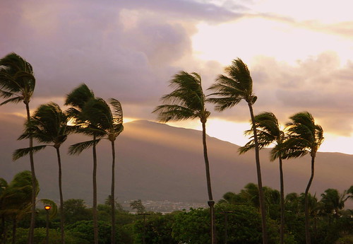
Another nice sunset here in the islands
photo credit: flickr.com
As the trade winds fade away, our weather will remain pretty good for the time being. Although with the relatively close proximity of an upper level low pressure to the east-northeast of the
After nearly a week’s worth of flip flops in the computer forecast models, they seem to be in fair agreement that we will see a wet weekend coming up. The upper level low to our ENE now is expected to fill and move away soon. This doesn’t help us much, as a new long wave trough of low pressure is expected to swing down from the middle latitudes, depositing a cutoff low pressure center to the NW of Kauai by Saturday. These cutoff lows are called Kona lows when they form within range of the
Back to the winds, as they become lighter and from the southeast, there will be several influences in our local
There seems to still be enough uncertainty, that this may or may not manifest completely as drawn out in the paragraphs above. However, most of the computer forecast models are now suggesting that some form of trough or Kona low will come close to, or over the islands over the next 4-5 days. There are still some wild cards in the mix, but in sum…unsettled weather coming our way, with the best prospect for the heaviest showers between Saturday and Sunday or Monday. Between now and then, there seems to be a distinct lack of clouds over us, and upstream, which will limit the shower outbreaks temporarily. Later Friday things should become more interesting, and hopefully put an end to whatever drought prone pockets that still remain in place across the
It’s Thursday evening here in Hawaii as I begin updating this last paragraph of today’s narrative. As you can see from the information in the paragraphs above, we have a good chance of a wet weekend coming up. There’s still a part of me that wants to hedge my bet on this unfolding as the computer models indicate. All this week I’ve been asking for just one or two more days to fully make up my mind in regards to this rain event. It’s finally the judgement day though, and the models are all just too lined up together in their forecast, in lock step if you will…to overlook their weather solution. So, with just a little leftover reluctance, I’ll finally submit to the good chance of increasing showers Saturday through next Monday or Tuesday! I think folks should be ready for the chance of some good soaking rains during that time frame, with the possibility of flooding rainfall not out of the question. The cold air associated with the upper low may onof both Mauna Kea and Mauna Loa on the Big Island! ~~~ I’ll be back very early Friday morning, well before dawn, with your next new weather narrative, I hope you have a great Thursday night wherever you happen to be spending it! Aloha for now…Glenn.