


Weather Details & Aloha Paragraphs
Posted by GlennJune 19-20 2007
Air Temperatures – The following maximum temperatures were recorded across the state of Hawaii Tuesday:
Lihue, Kauai – 84F
Honolulu, Oahu – 89
Kaneohe, Oahu – 83
Kahului, Maui – 87
Hilo, Hawaii – 81
Kailua-Kona, Hawaii – 85
Temperatures early Wednesday morning ranged between these warmest and coolest spots near sea level at the 4 a.m. hour:
Kailua-kona – 77F
Hilo, Hawaii – 70
Precipitation Totals – The following numbers represent the largest precipitation totals (inches) during the last 24 hours on each of the major islands, as of Wednesday morning:
1.12 MOUNT WAIALEALE, KAUAI
0.18 POAMOHO 2, OAHU
0.03 MOLOKAI
0.00 LANAI
0.00 KAHOOLAWE
0.29 WEST WAILUAIKI, MAUI
0.55 WAIAKEA UKA, BIG ISLAND
Weather Chart – Here’s the latest (automatically updated) weather map…showing high pressure systems to the NE and far NNW of the islands. The trade winds will be moderately strong Wednesday, becoming stronger and gusty Thursday…especially in those windiest areas in the southern part of the state. Here’s a Weather Map Symbol page for clarification about what all those weather symbols mean on the map.
Hawaii’s Mountains – Here’s a link to the live webcam on the summit of near 14,000 foot Mauna Kea on the Big Island of Hawaii. The tallest peak on the island of Maui is the Haleakala Crater, which is near 10,000 feet in elevation. These two webcams are available during the daylight hours here in the islands…and when there’s a big moon rising just after sunset for an hour or two! Plus, during the nights and early mornings you will be able to see stars, and the sunrise too…depending upon cloud conditions.
Tropical Cyclone activity in the eastern and central Pacific – Here’s the latest information coming out of the National Hurricane Center, covering the eastern north Pacific. You can find the latest tropical cyclone information for the central north Pacific (where Hawaii is located) by clicking on this link to the Central Pacific Hurricane Center.
Satellite Images – To view the cloud conditions we have here in Hawaii, please use the following satellite links, starting off with the Infrared Satellite Image of the islands to see all the clouds around the state during the day and night. This next image is one that gives close images of the islands only during the daytime hours, and is referred to as a Close-up visible image. This next image shows a larger view of the Pacific…giving perspective to the wider ranging cloud patterns in the Pacific Ocean…out from the islands. To help you keep track of where any showers may be around the islands, here’s the latest animated radar image.
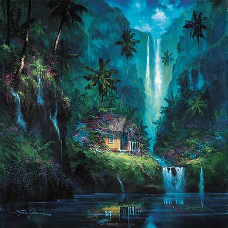
Secret tropical hideaway
The trade winds are here to stay in the Hawaiian Islands. They will remain at about the same strength as they have been for the last week, getting only slightly lighter today and Wednesday. The computer forecast models show a stronger than normal high pressure system, now far to our NNW…moving closer to Hawaii over the next several days. As this high pressure cell gets into closer range, our local trade winds will increase a notch after mid-week. We’ve temporarily lost our small craft wind advisory around Maui and the Big Island, although we might see it reappear a little later in the work week. The trade winds will remain active through the rest of this week into next week at least.
There will be just the usual few showers arriving along the windward sides of the islands. The overlying atmosphere doesn’t have a whole lot of moisture to work with, which has limited the amount of rain in most areas. As the trade winds increase in strength a little bit by about Thursday…we may see a modest increase in windward showers then. Without any upper level troughs of low pressure in our vicinity however, there won’t be any significant change in our local precipitation characteristics for the time being. The leeward sides will see plentiful morning sunshine, with the usual afternoon clouds developing…with a few random showers in the upcountry areas here and there.
It’s Tuesday here in Kula, Maui, as I begin writing this last paragraph of today’s narrative. We’ll soon be entering into the beginning of summer 2007. The summer solstice this year, at least here in the Hawaiian Islands, begins Thursday morning at a little after 8am. Thus, we are breathing the air of very, very late spring! This summer looks like it will be quite a dry one, and is certainly starting off in that direction…especially in the upcountry areas on Maui and the Big Island. It isn’t so much that we’ve been all that dry, although we have been quite dry, during this late spring season…as much as we didn’t get enough rainfall during our winter rainy season. There aren’t that many chances to get any regular rains now, as this time of year is always dry. ~~~ I’ve mentioned in the past how I enjoy seeing the Hawaiian Owls that fly around this upcountry area. Often folks think in terms of having it be good luck, or a good omen to see them. Well, I saw three of these birds yesterday, or perhaps the same one three times. So perhaps I may be in for some good luck soon, which is always a good thing I reckon! I look forward to getting out there for my early morning walk, and see if it glides by silently overhead again today. ~~~ The weather is going to be just fine for the next few days, and for that matter, through the rest of the week at least. I hope you have a great Tuesday night wherever you happen to be reading from. I’ll be back very early in the day on Wednesday with your next tropical weather narrative. Aloha for now…Glenn.